Tomyhoi Peak, Mount Baker Wilderness, Glacier, Washington
Disclaimer: This hike involves glacier travel and/or rock climbing, which are inherently dangerous. This blog post does not include formal instruction of any kind. Please make sure you have the appropriate skills and knowledge before attempting this hike.
After summiting Ruth Mountain, Mike and I were looking to do another hike in the area. Tomyhoi Peak caught our eye as an interesting peak with a spicy looking Class 3 scramble. On some of the websites I looked at while researching this peak, I came across multiple claims that this was the most fun scramble in the state. I haven’t climbed enough peaks in Washington to give my own opinion on that, but it certainly made a good case to go check the peak out!
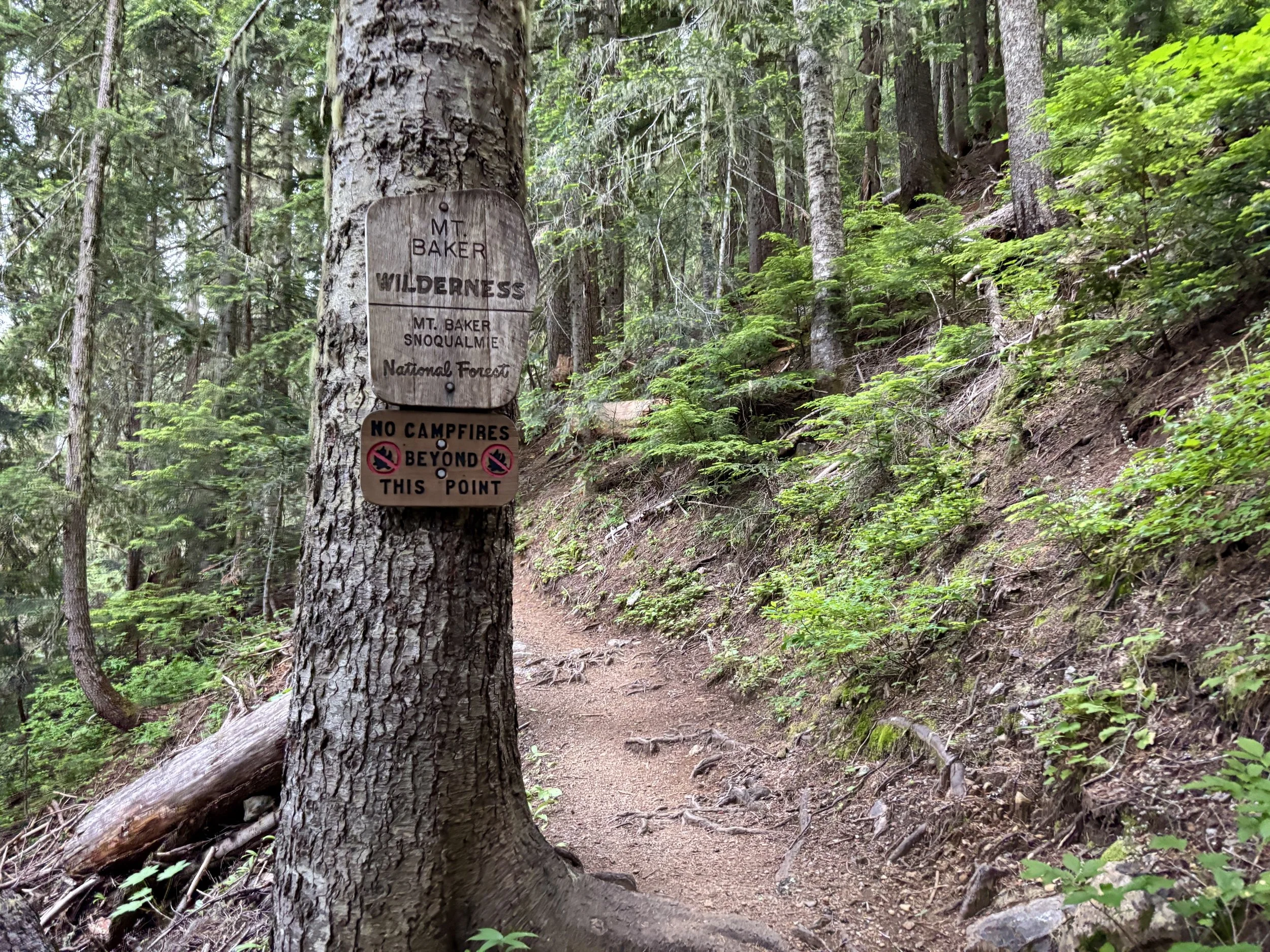
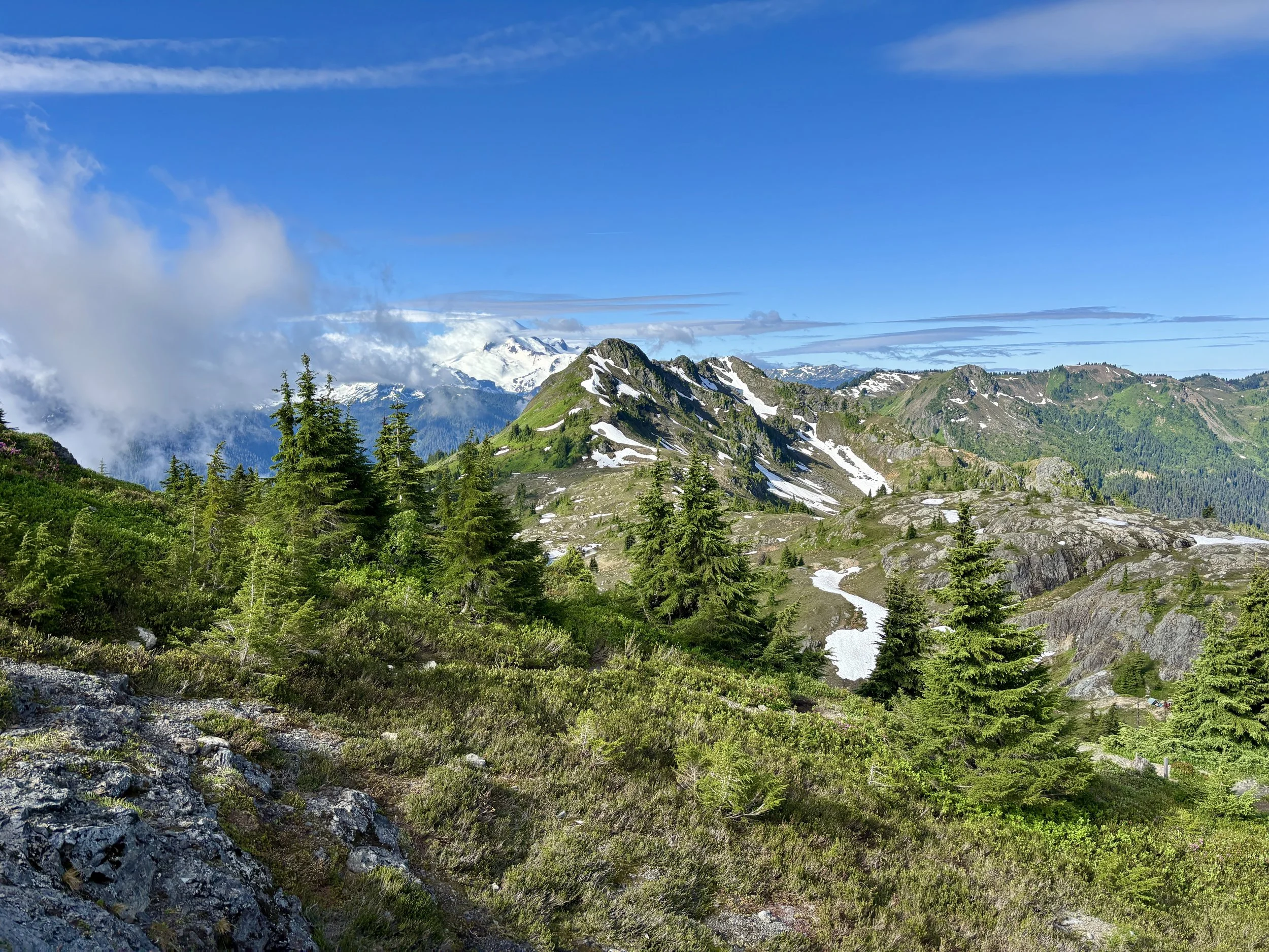
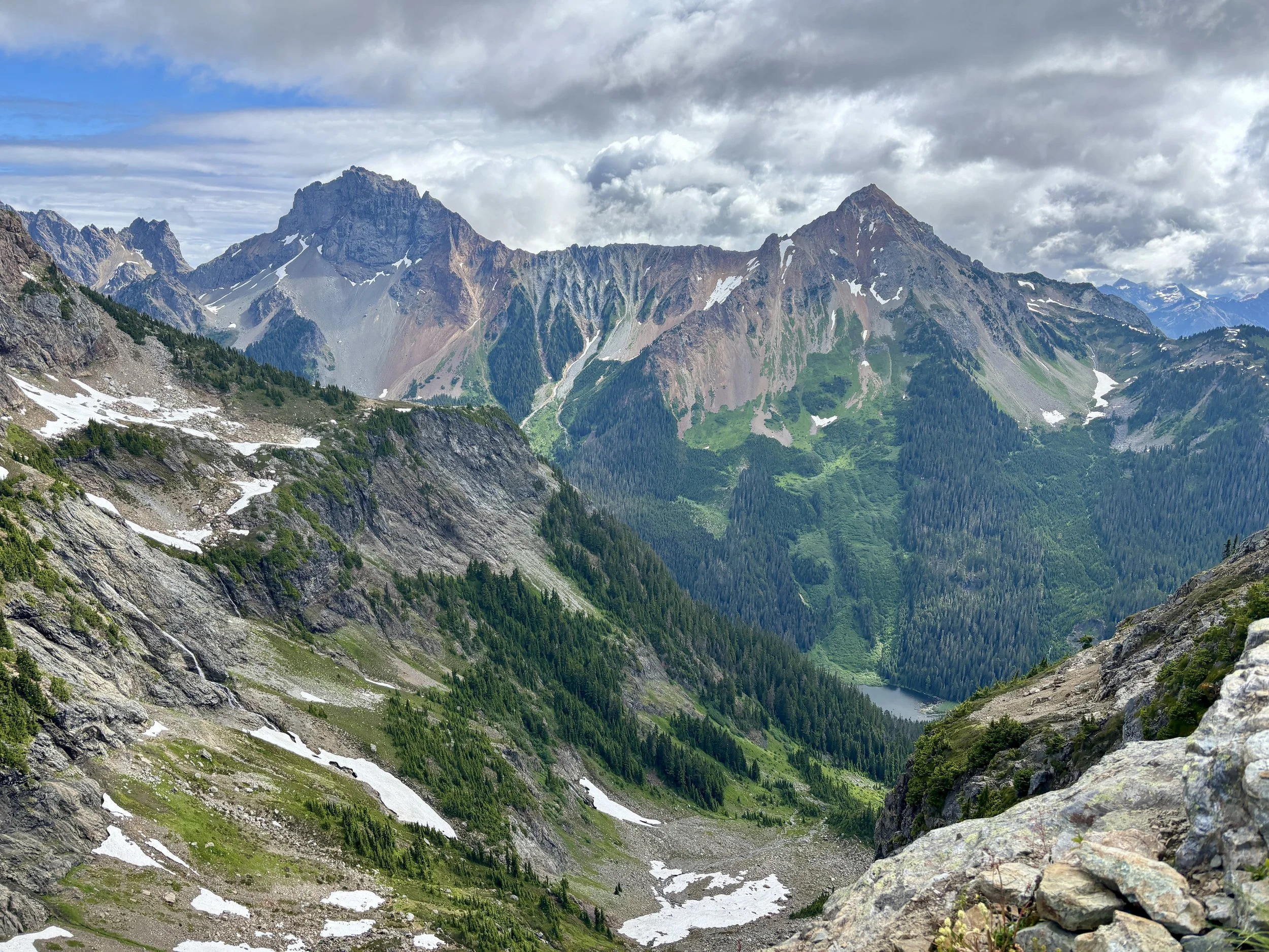
We parked at the trailhead around 6:30am on a Monday morning and there were only a few other cars parked at that time. We signed in with the Wilderness register and were on our way. The first few miles of trail are mostly in the trees and gain elevation fairly quickly. We finally popped out into this basin where we realized we would contour around the whole basin on a trail above us. It was somewhat cloudy that morning, but views of Goat Mountain would occasionally pop through the clouds. We could also see the bottom half of Mount Baker, with the top half in a cloud for most of the day.
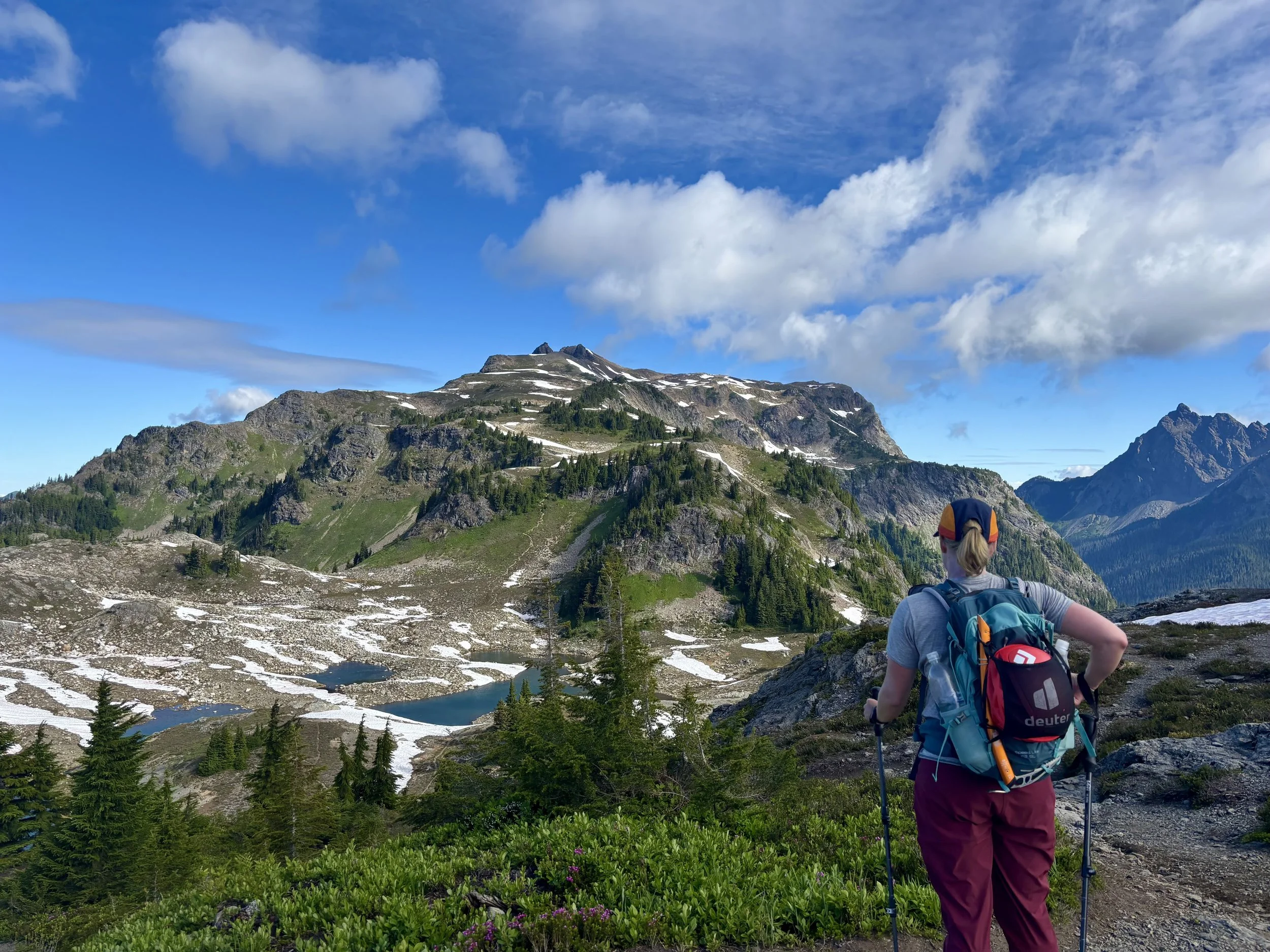
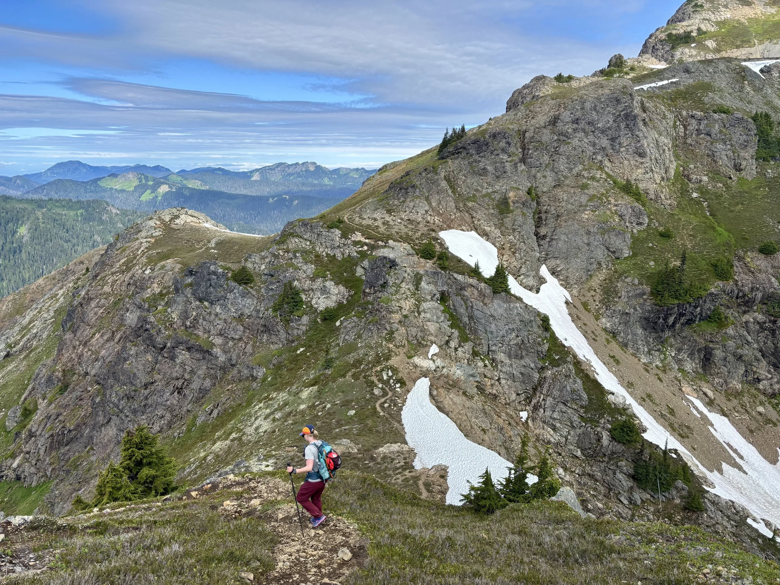
After 3.5 miles, we came to a nice viewpoint of a chain of small lakes (perhaps they should be called tarns) where we discovered a handful of tents camping. It looked like a nice spot to camp, however it was pretty obvious from the number of social trails and tent sites that it was a very popular area. Across the basin, we could see the climber’s trail we needed to reach. We stopped for a snack and to filter some water in the basin and then continued to the climber’s trail. This trail ascended steeply out of the basin, but thankfully leveled out after several hundred feet of elevation gain. It was hard to tell how far we were from the summit as the trail seemed to follow this wide ridge for some time. The social trail remained well defined and easy to follow for most of the hike. At the last stand of trees, we hung our trail running shoes and put on our approach shoes as those seemed more appropriate for the summit block.
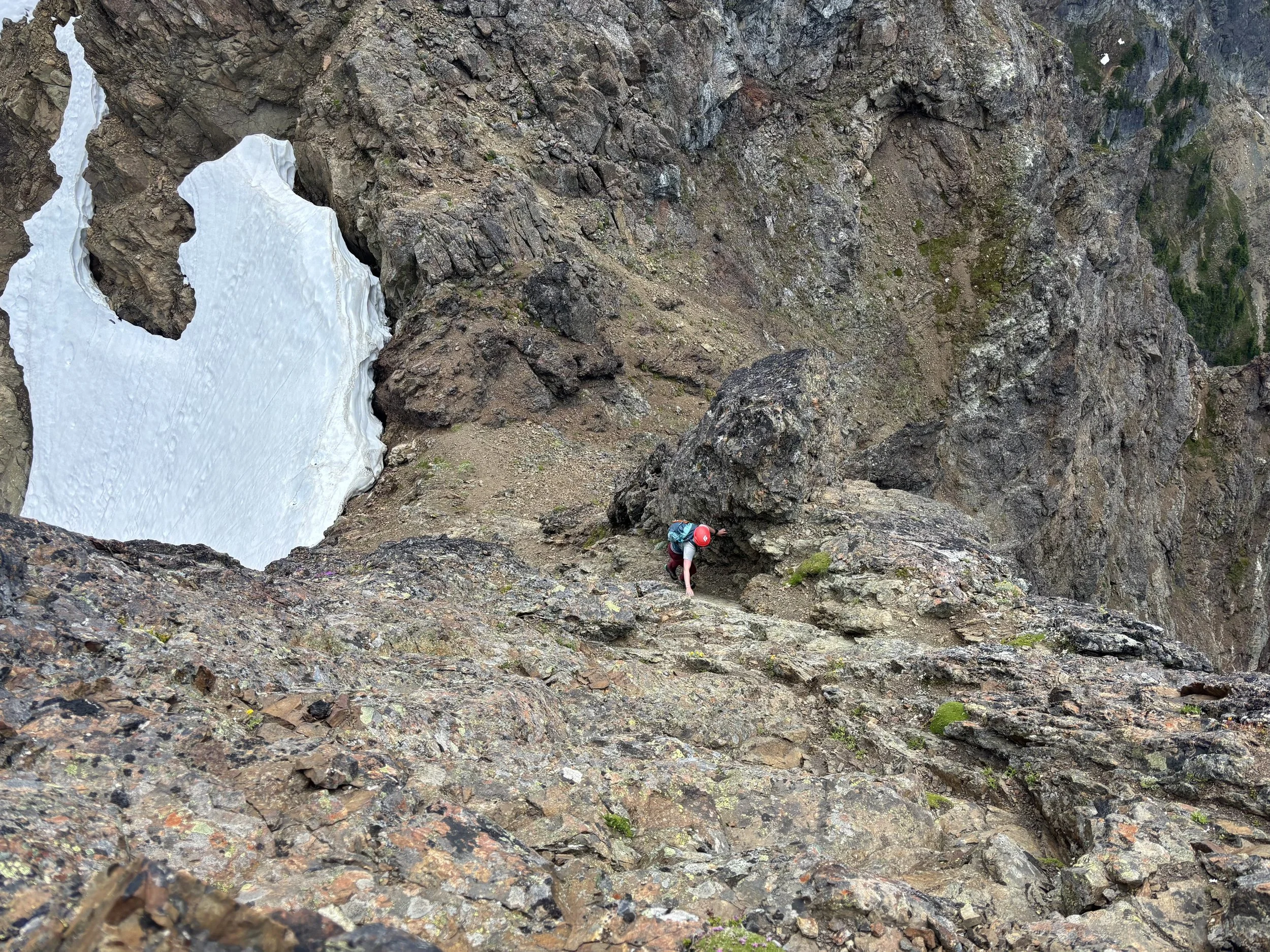
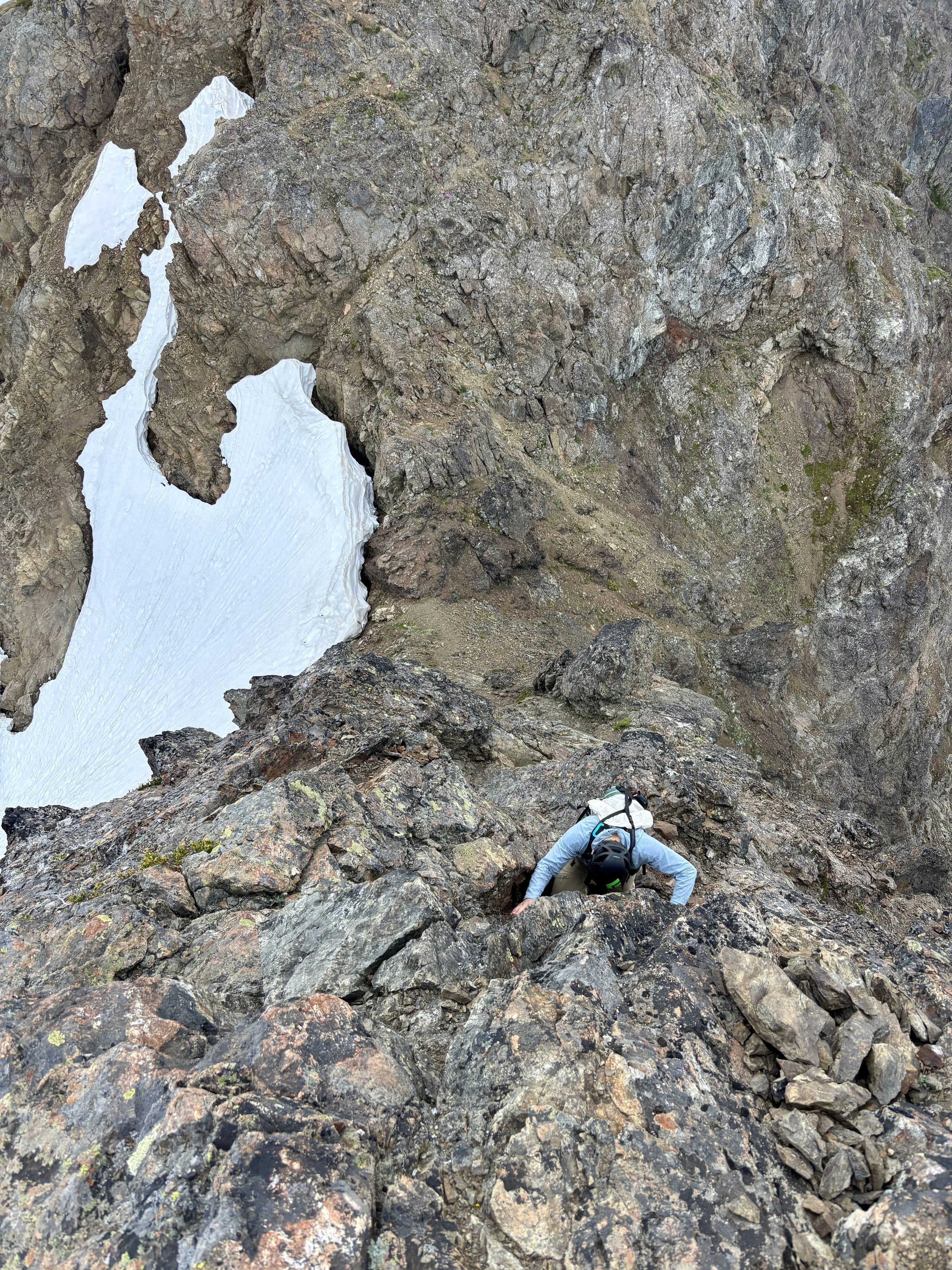
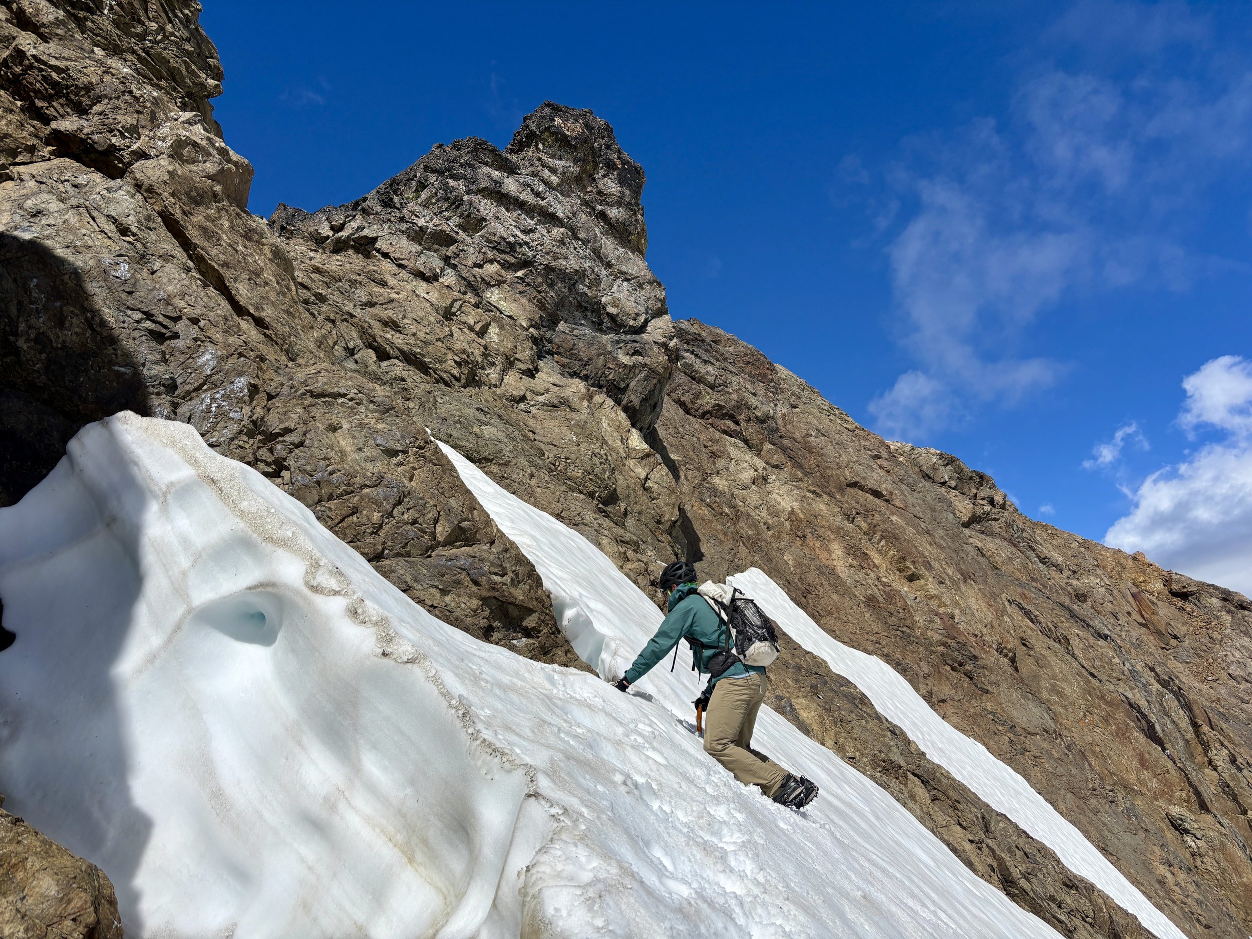
While researching this hike, I spent most of my time focusing on the summit pyramid and understanding the route to take for that section of the hike. I had seen there was a snowfield we needed to cross, but it looked short and with a lot of snow travel experience under our belts, it didn’t seem to be a section to be worried about. When we got to the snowfield, we had a much more difficult time than anticipated getting across it. I was expecting there to be more of a boot path for us to be able to follow, but we found a very faint one that didn’t aid us at all. We found the snow to be very soft for the top inch and then was so firm underneath, we were unable to kick steps into it. With Mike in the lead, he did his best to cut us some steps to traverse the snowfield. Thankfully we did have our ice axes as without those, I don’t think we would have been able to get across the snowfield safely with the conditions we found. If we had mountaineering boots and real crampons on, this snowfield would have been no problem, but with approach shoes, it was more of an adventure than expected. We finally made it to the other side where we believed we should head up.

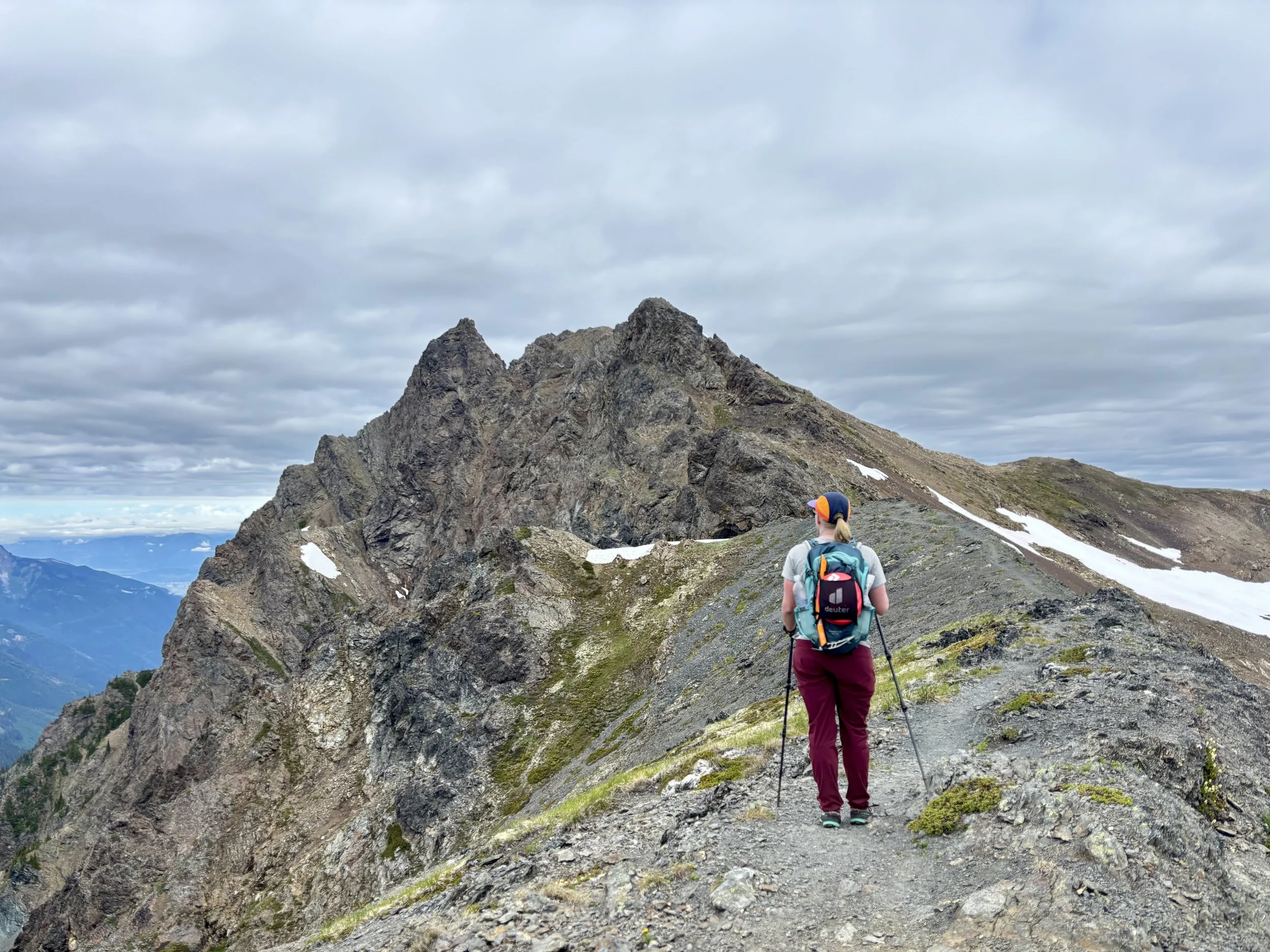
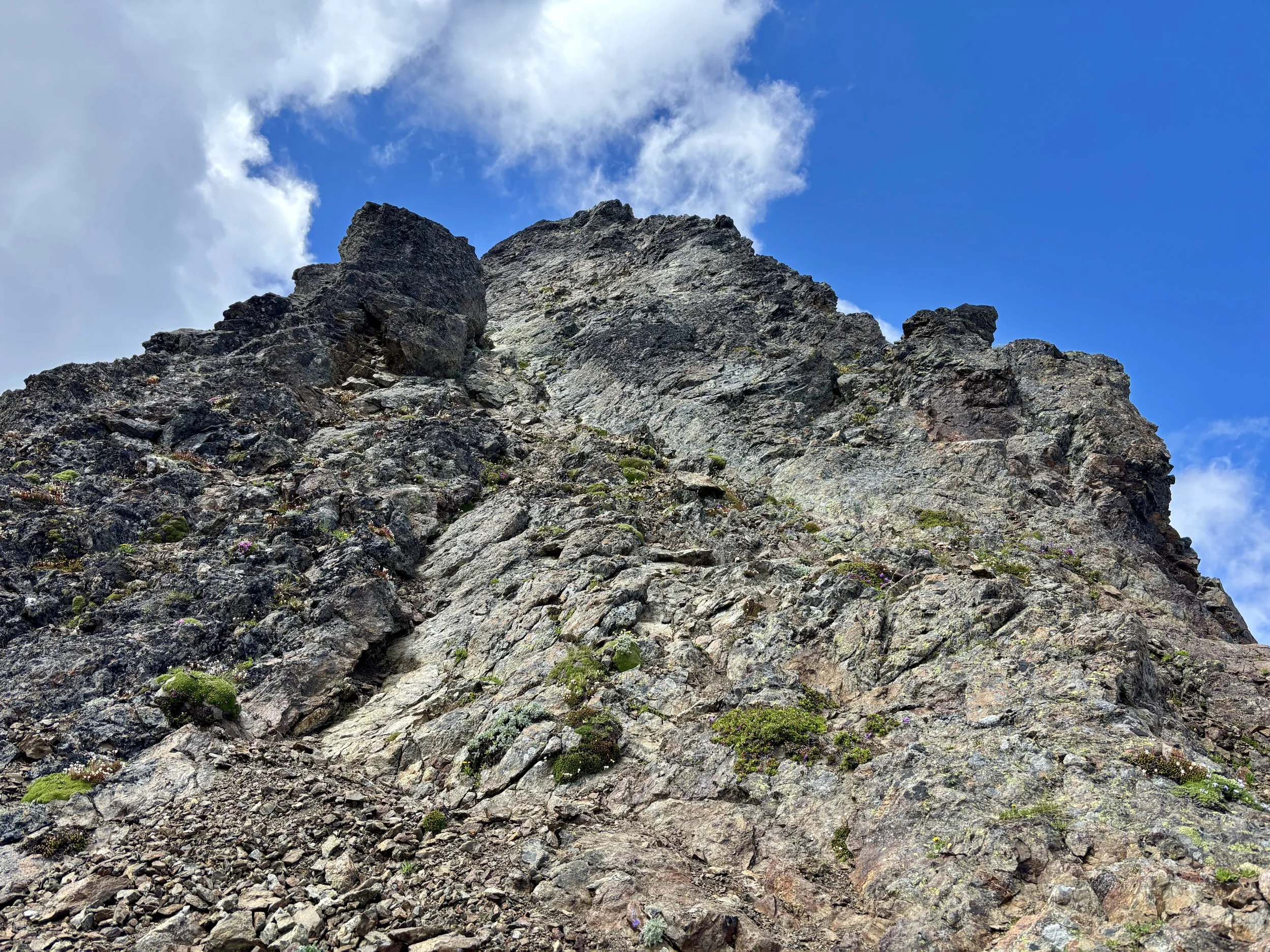
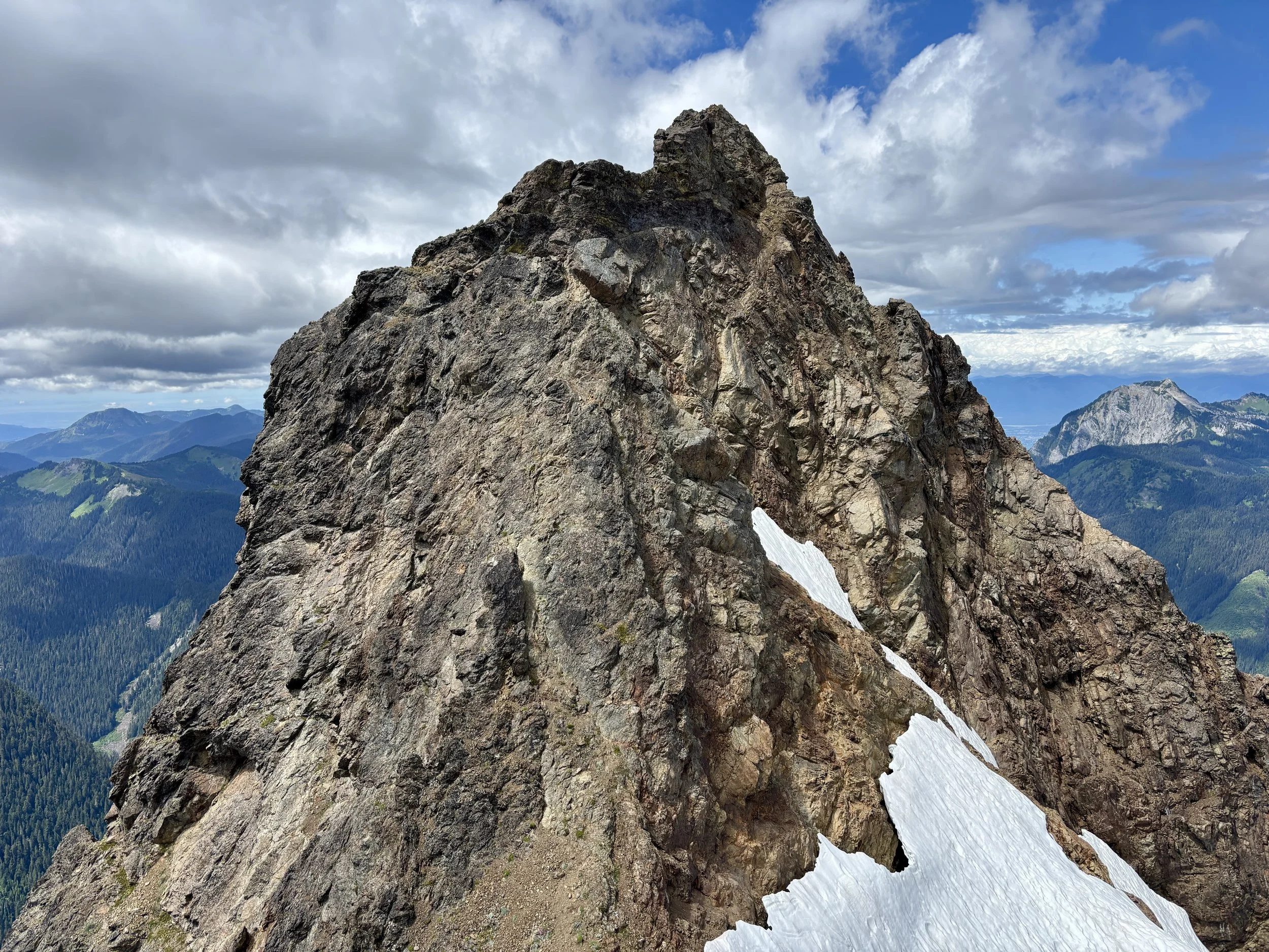
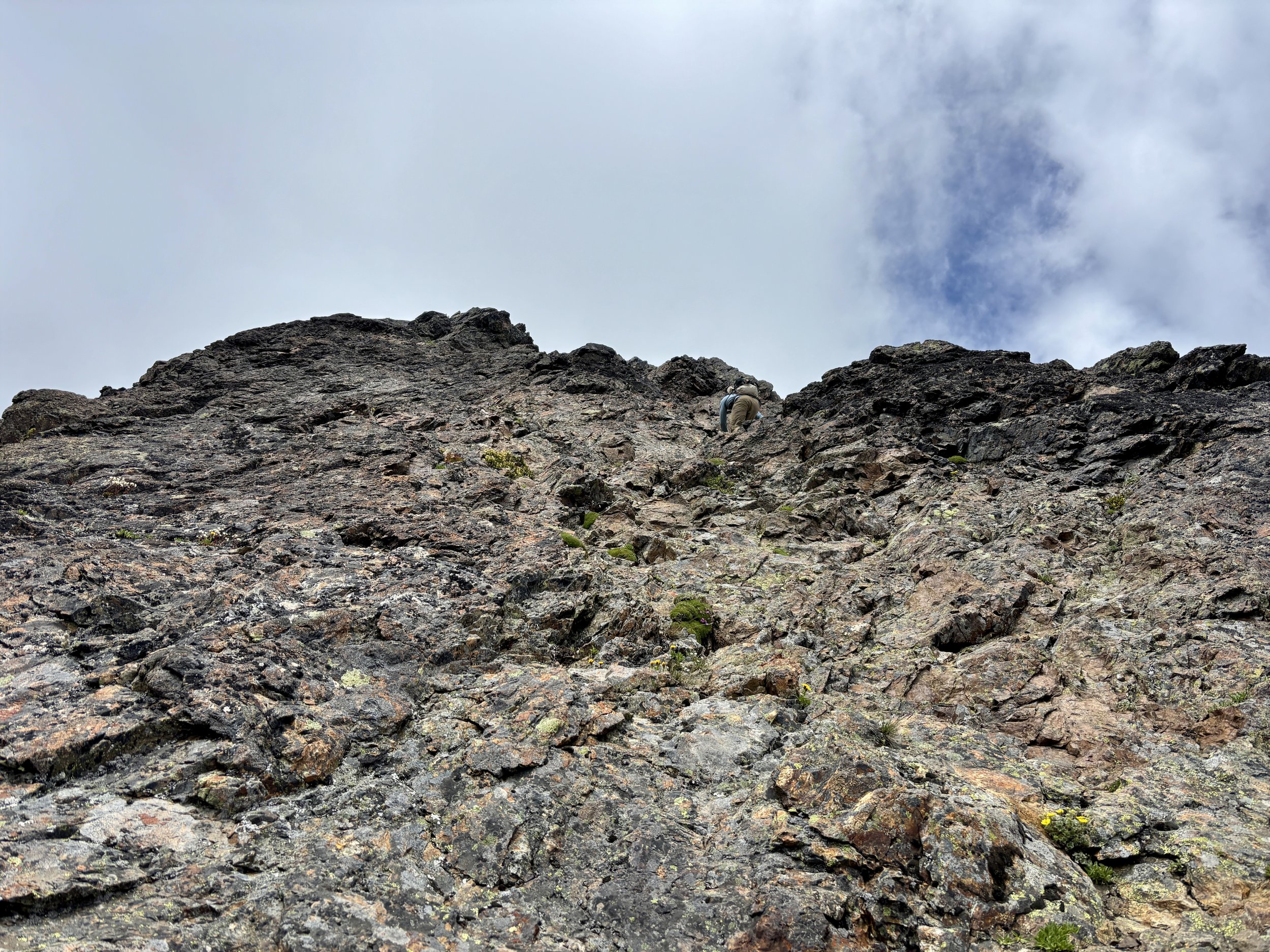
When we got to the ridge, there were a handful of trails that traversed just below the left hand side (west) of the ridge. We finally came to the final viewpoint of the summit pyramid. It looked very intimidating and nearly vertical. Most sources online suggested this would be our reaction in this spot so we knew to continue on and see if it looked different at the bottom of the saddle. We descended an easy class 3 section and found ourselves at the bottom of the summit pyramid. It still looked pretty darn intimidating, but it at least looked a little more do-able from this angle.
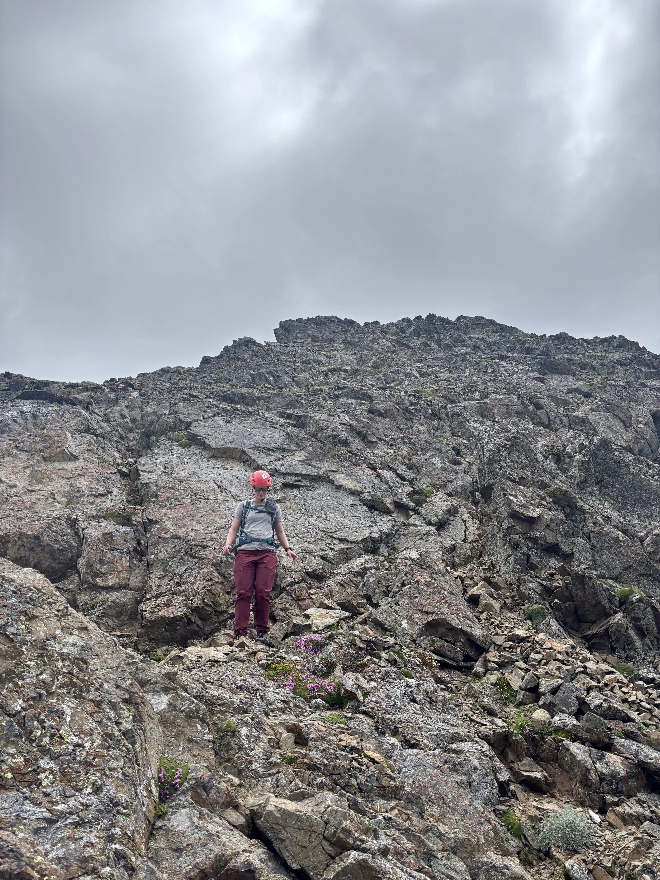
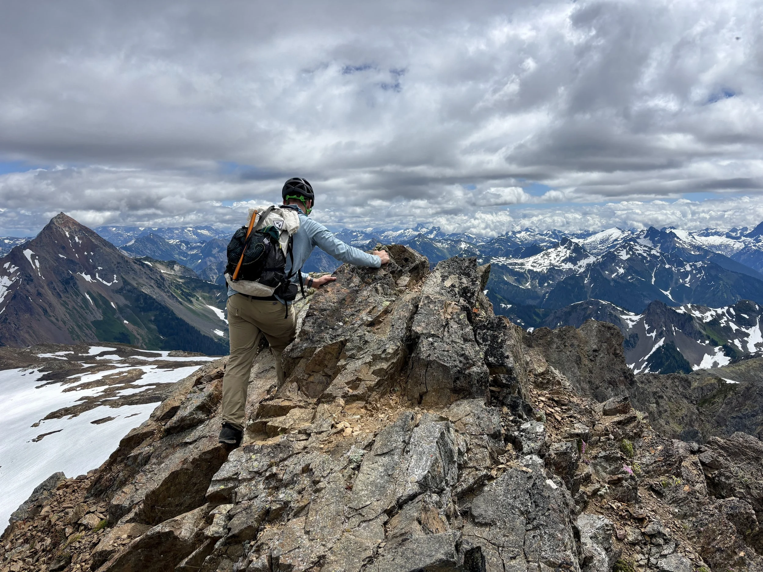
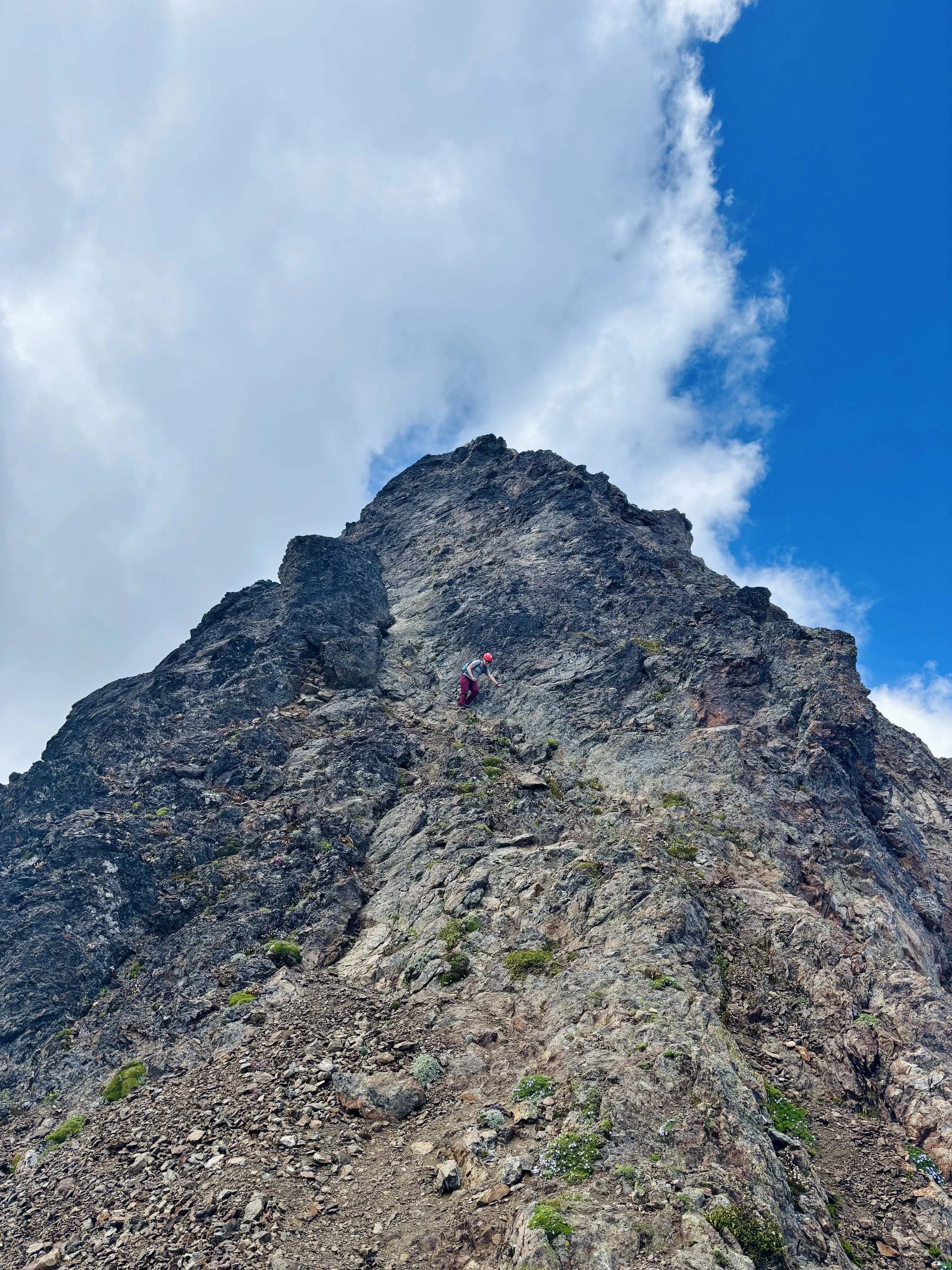
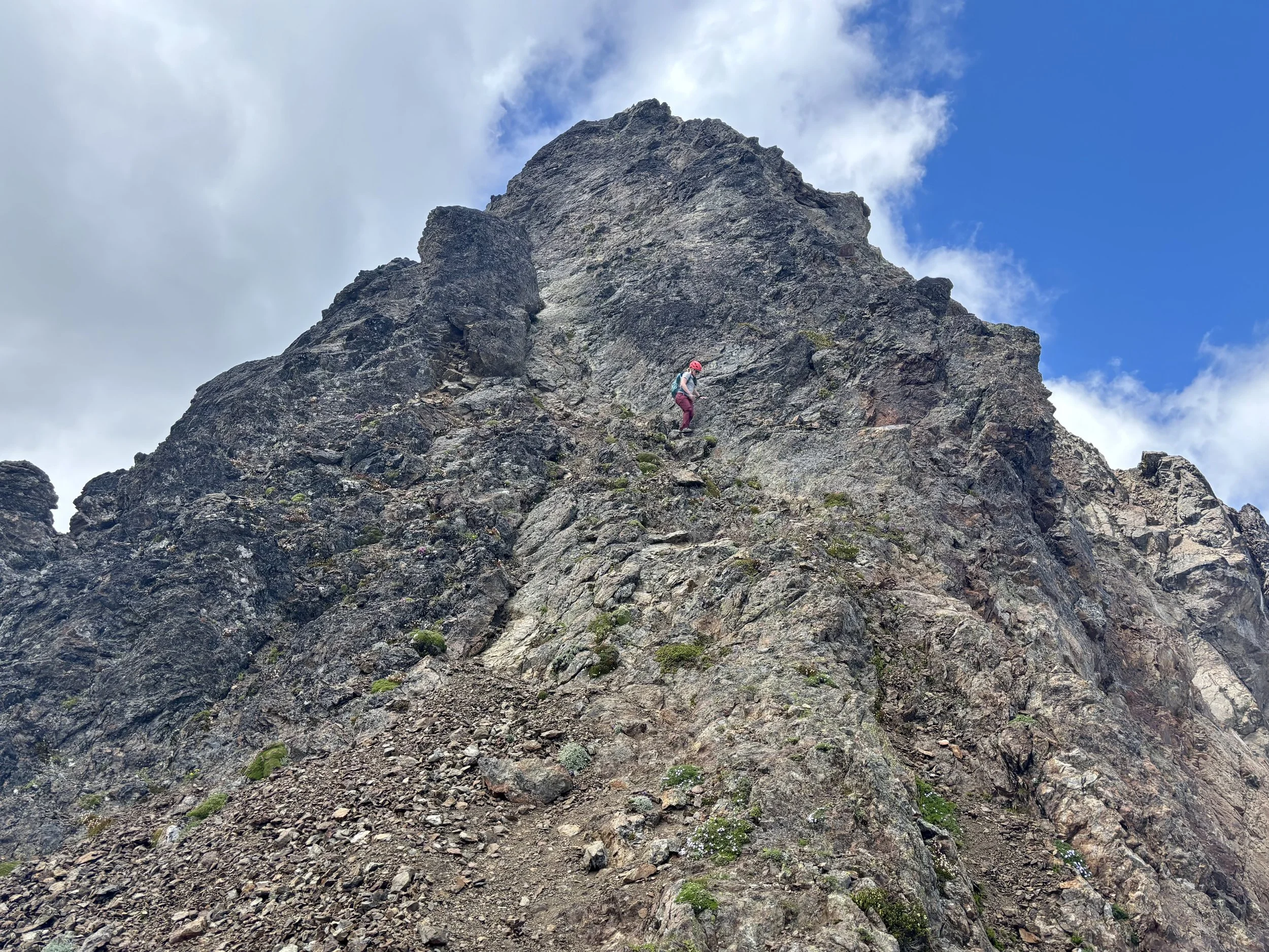
Mike set out and started up the obvious path at the bottom. He then moved right as the hand and foot holds got better in that direction. I followed and was surprised at how there always seemed to be a handhold in a spot where you wanted to find a solid hold. The the route we took on the bottom face contoured out onto the arete and was quite airy and definitely a no-fall zone. We then came to what Summit Post called the “gabled ridge” and found traversing it on the right side was straightforward, but definitely had some exposure. We joked that a fall here would land you on a steep glacier that would send you all the way to Canada. Once through this section, we came to a fairly large, flat spot that was a nice spot to take a minute to catch our breath.
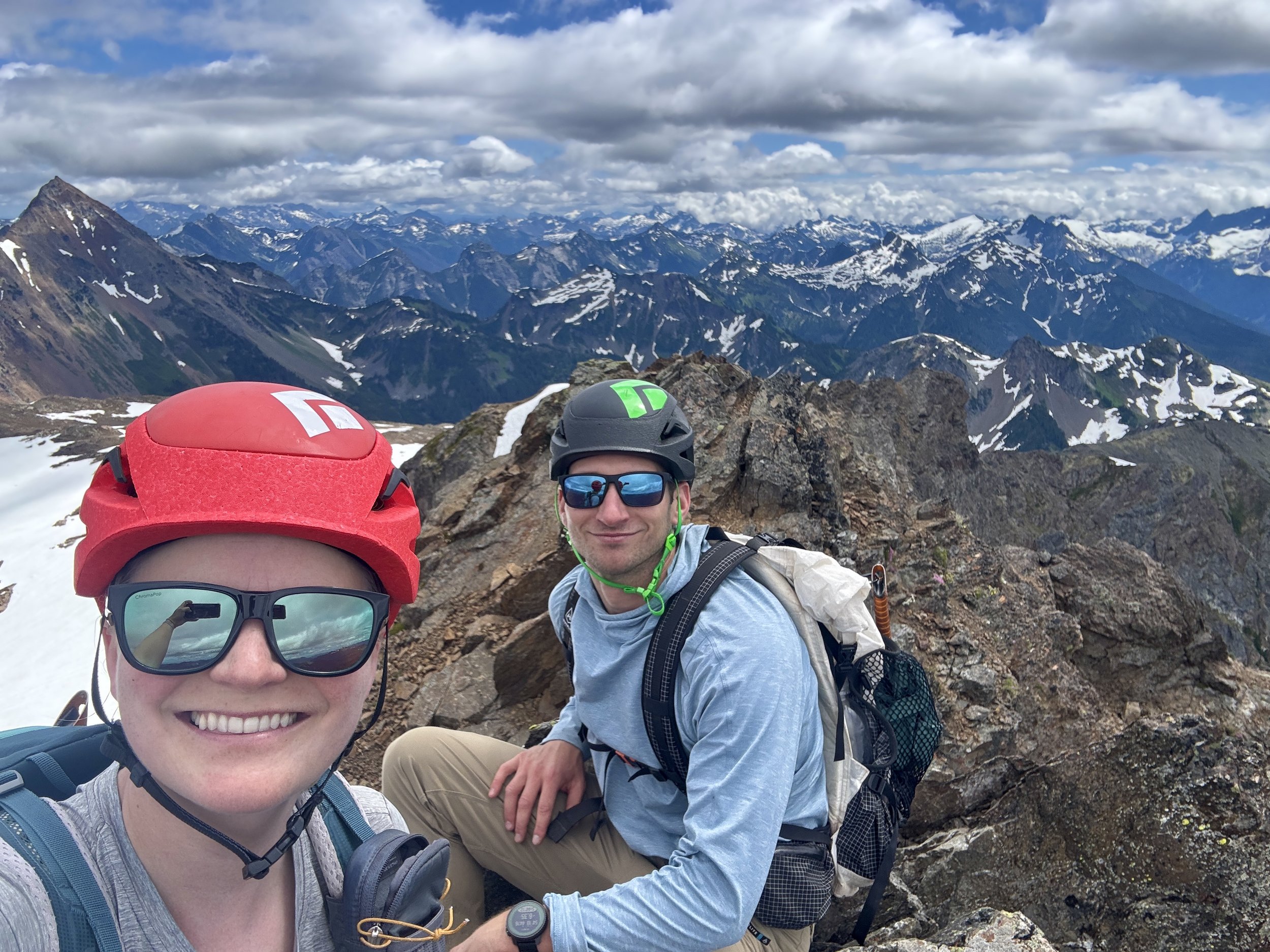
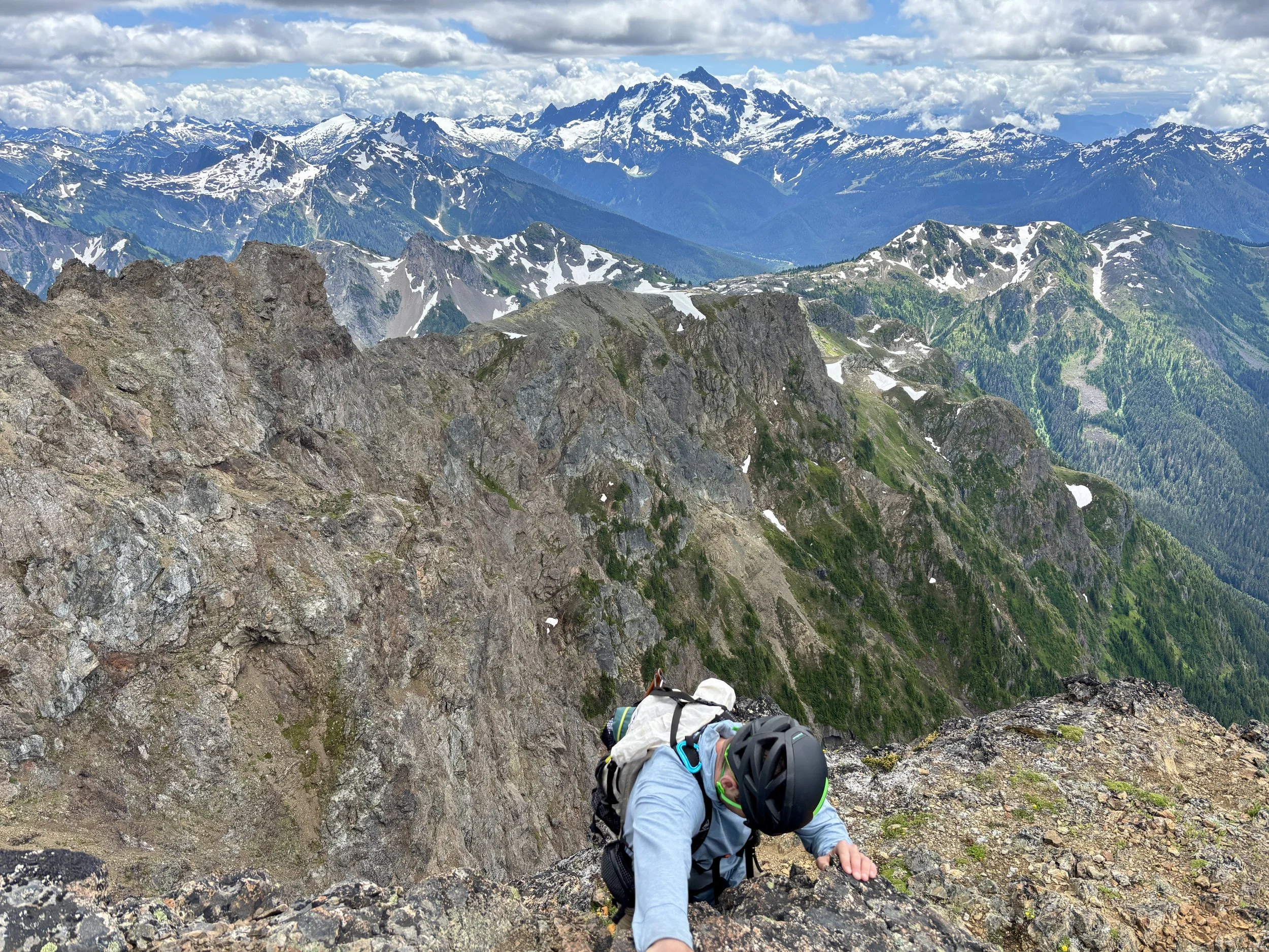
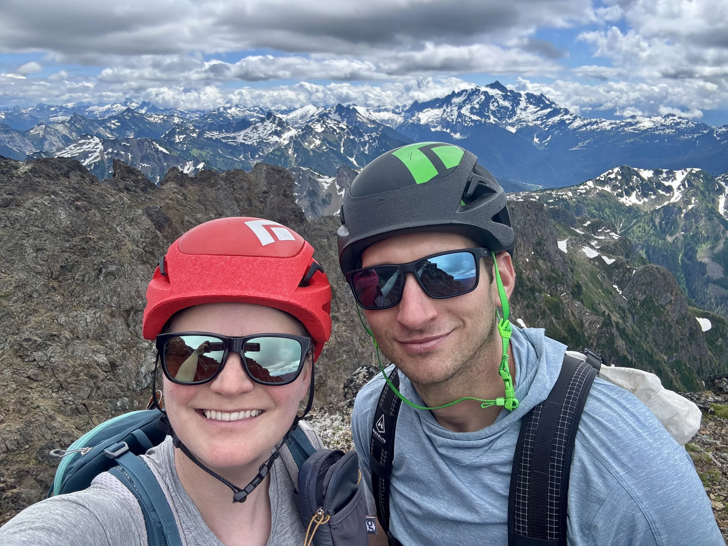
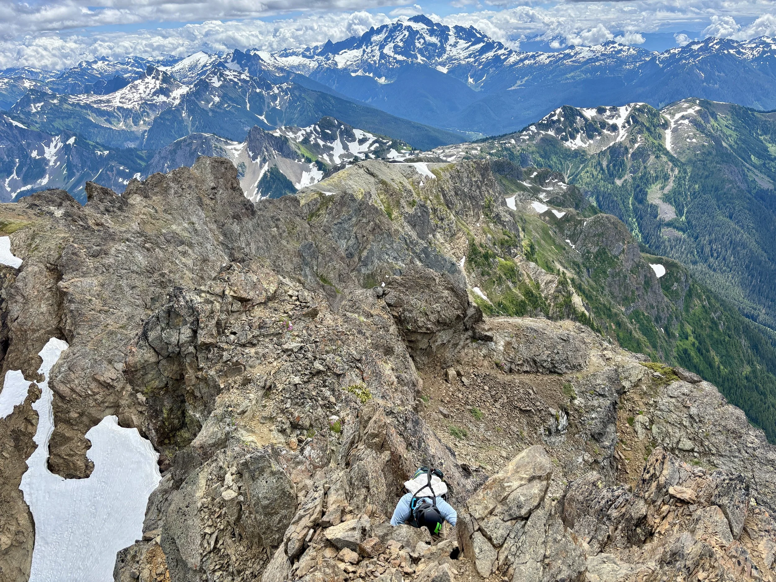
To get to the next section, we had to climb a 5 ft vertical-ish wall that had great hand and footholds and also no real exposure, which was nice. We then traversed for ~50 ft and then found ourselves scrambling on class 3 terrain again. We shortly popped out on the ridge and were ~20 ft away from the true summit. With a few very airy class 3 moves, we found ourselves on the summit, where there is only room for 2 people to sit. It was straight down in almost every direction from this spot. However, the views were breathtaking. We could see Ruth Mountain, the peak we had summited a two days earlier, Mount Shuksan, which we had summited the summer before, Mount Baker, which we planned to summit in a few days, and countless other peaks in the North Cascades and Canada. What a beautiful spot to take it all in, and we had it all to ourselves as we hadn’t seen any other people since leaving the busy lakes. We didn’t linger for too long as clouds were moving around us, and we didn’t want to get caught in a white out for the climb down the summit pyramid or the snow traverse. So we turned around and headed back down the way we came. The snowfield was no more fun on the way back than it was on the way in, but at least we knew what to expect. Once we reached the other side, within 2 minutes the whole summit and snowfield were socked in. We sure got lucky on our timing! With no views, it was time to keep moving. We made good time back to the lake, but were completely out of water and took a nice long break there before the final ~4 miles back to the car.
Overall, this was an extremely fun day. Tomyhoi’s summit pyramid was an exciting, airy, class 3 scramble that rewards you with 360 degree views. I also appreciated that there was absolutely no bushwhacking required to get to the summit. I can’t wait to do some more scrambles in the area!
Total stats: 12.4 miles, 4350 ft of elevation gain.