Ruth Mountain, Mount Baker Wilderness, Glacier, Washington
Disclaimer: This hike involves glacier travel and/or rock climbing, which are inherently dangerous. This blog post does not include formal instruction of any kind. Please make sure you have the appropriate skills and knowledge before attempting this hike.
Mike and I had such a great time climbing Mount Shuksan last summer and also really enjoyed the time we spent in Mazama, so we decided we would head to Washington again this summer for some adventures. We packed up the van and headed up towards Glacier, WA with our eyes on some peaks around there. We decided Ruth Mountain looked like a good warm up for the trip as it would get us on some glaciated terrain and also wake up our legs for the bigger days that were to come. Ruth Mountain is technically in the North Cascades National Park so if you plan on camping at the top, please be mindful of National Park policies (as well as Leave No Trace!).
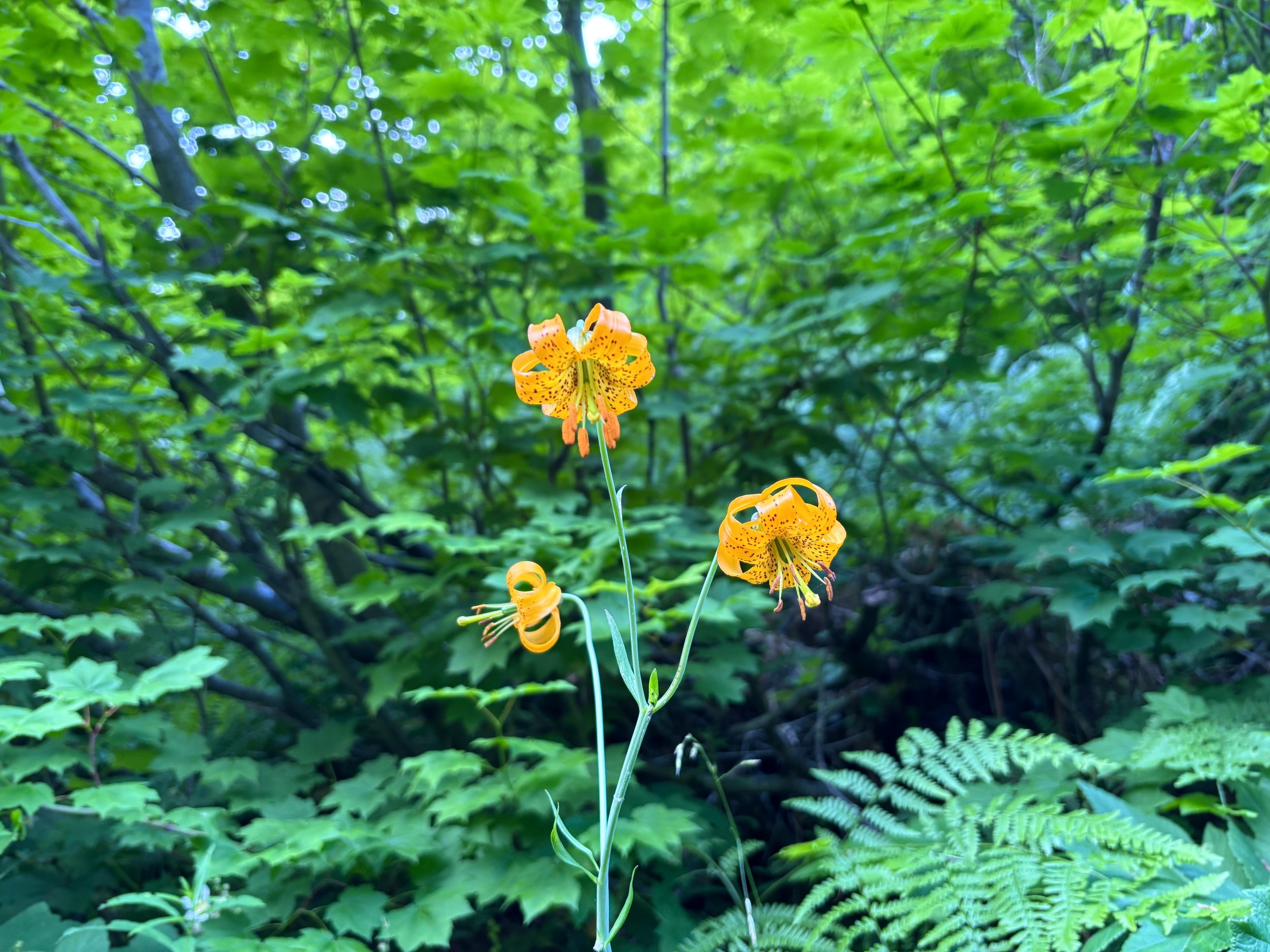
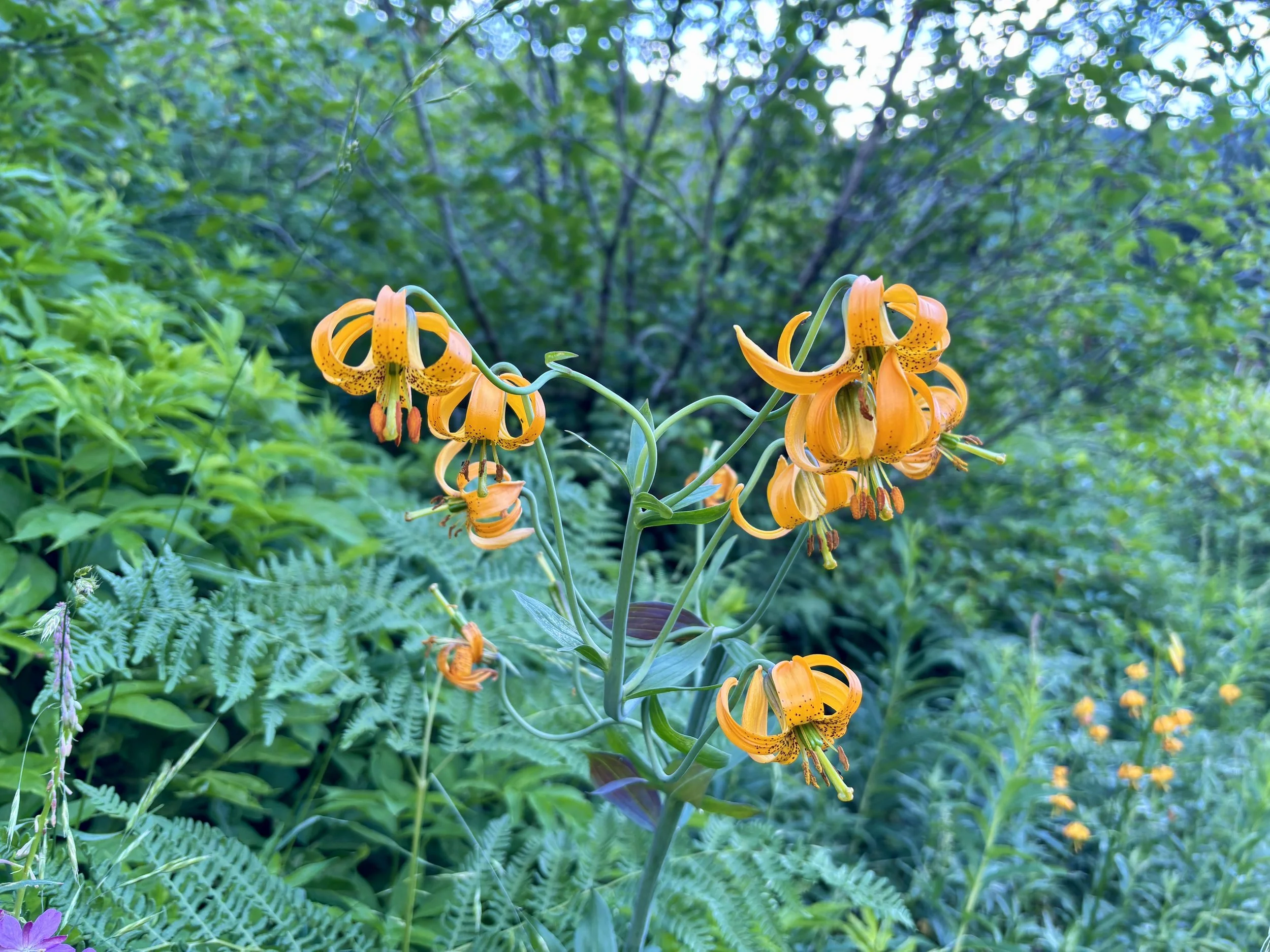
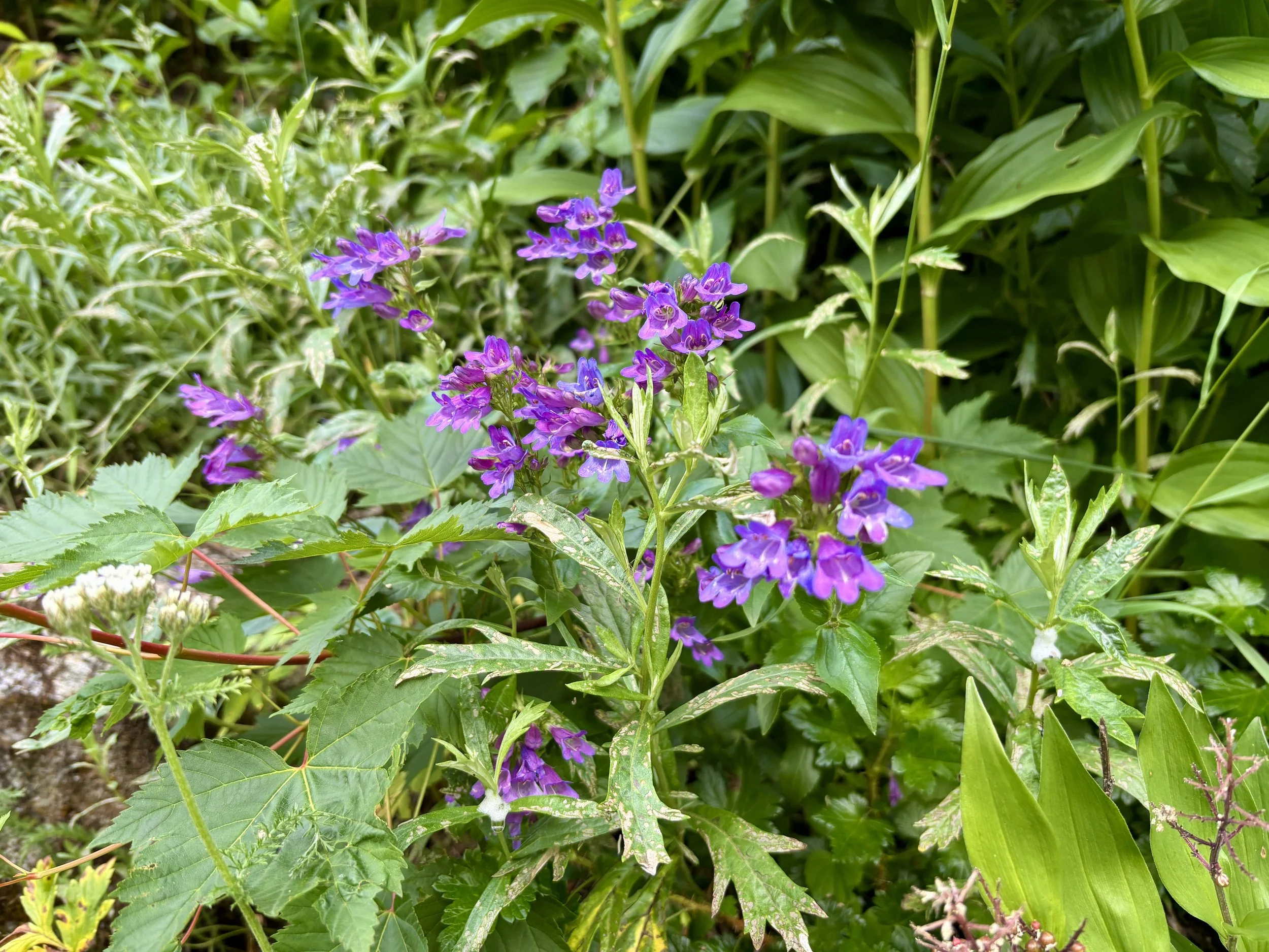
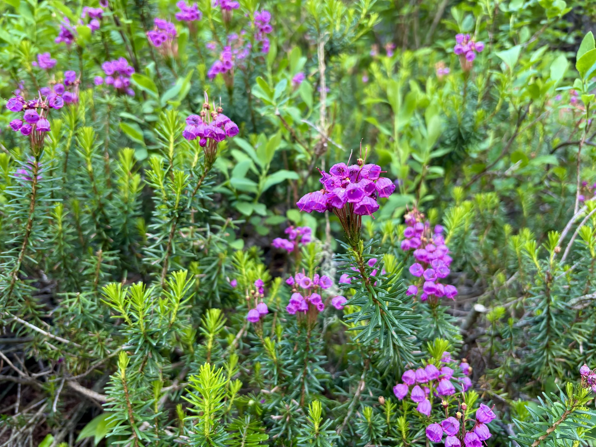
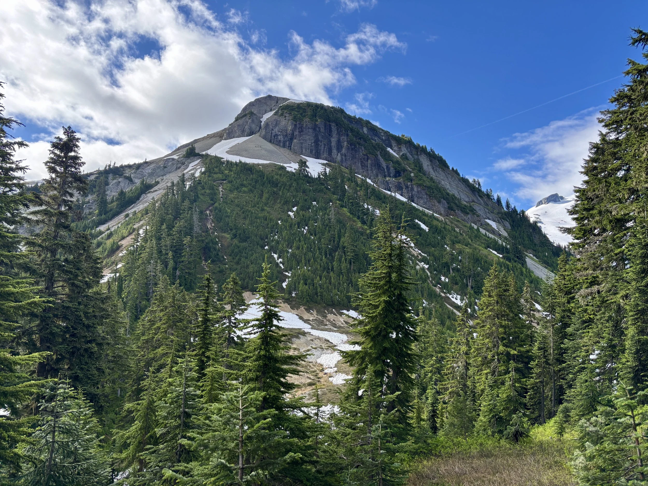
We decided to get an early start to beat the crowds and the heat. We parked at the Hannegan Trailhead around 6am on a Saturday morning and found the trailhead to be about half full. We started down Hannegan Pass Trail. Immediately, all of the wildflowers caught my eye and slowed down our pace as I found myself stopping to take pictures of them. After hiking for only a little bit, the views of Mount Sefrit and Nooksack Ridge opened up before us and had us saying how glad we were to drive up here from Colorado. Countless waterfalls were cascading down the steep walls across the valley and listening to them was a lovely way to start the day.
The trail gains elevation fairly moderately for the first 3.6 miles. We made good time to the Hannegan Camp area where we saw a handful of tents. We continued up to the pass. We then turned right and started up the climbers trail to Ruth. We went up a small knob and descended the other side. It was apparent that our hike was about to get a lot steeper. The trail up the next knob was my least favorite section of trail of the day (especially on the way down). The “trail” was essentially a 40 degree slope up an eroded trail that had turned into a stream bed. The trail was 4-5 ft deep in spots.
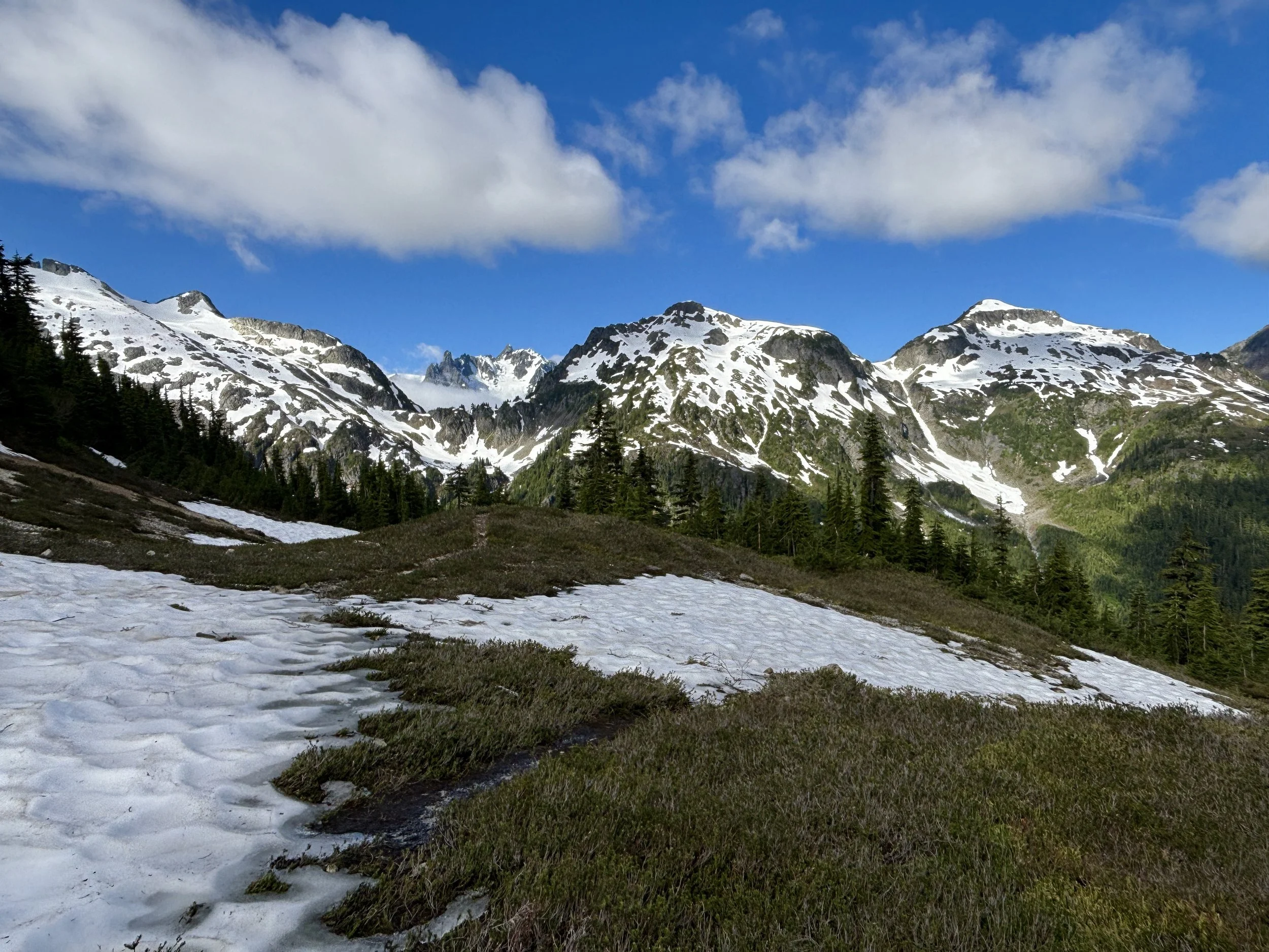
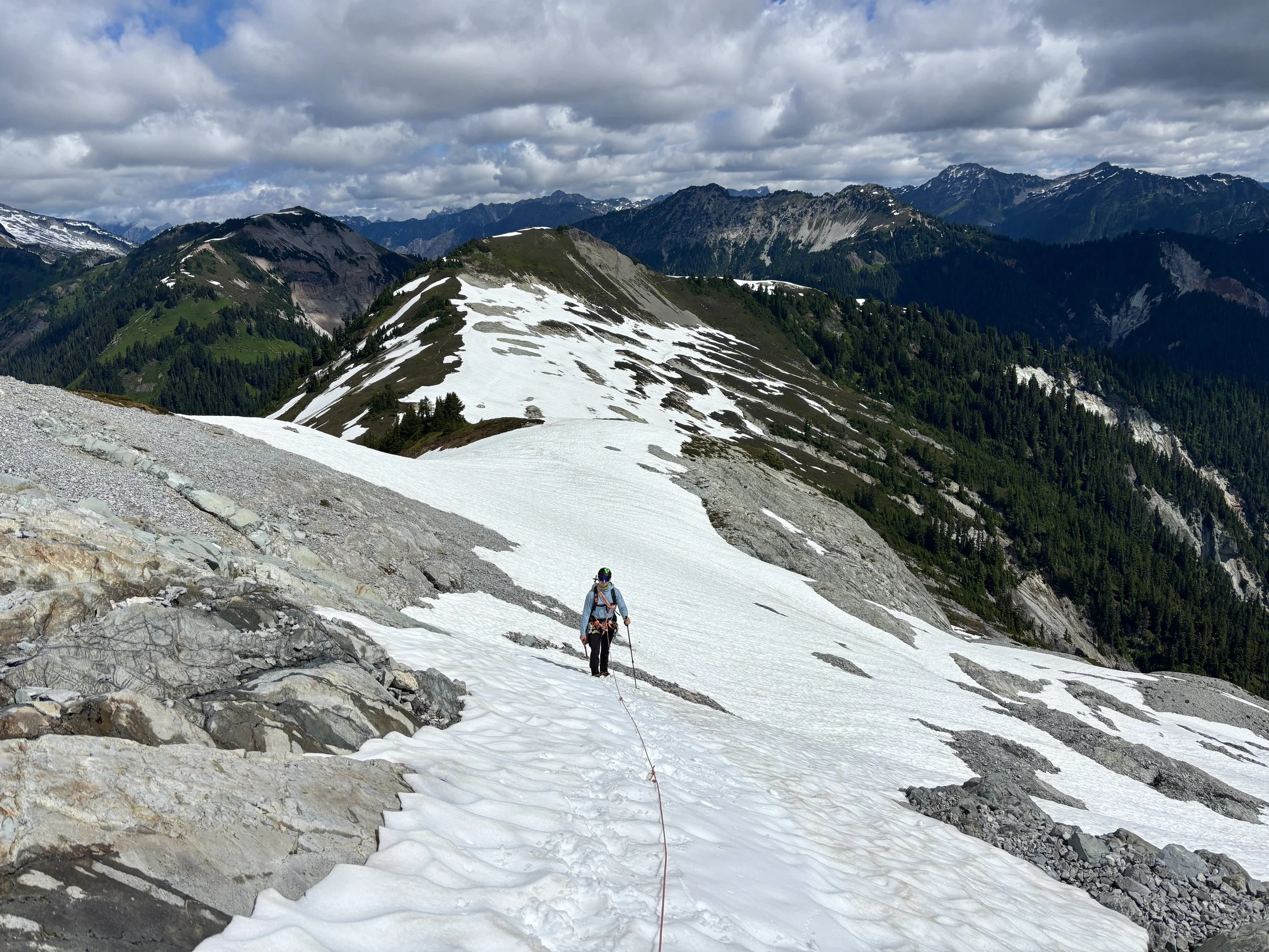
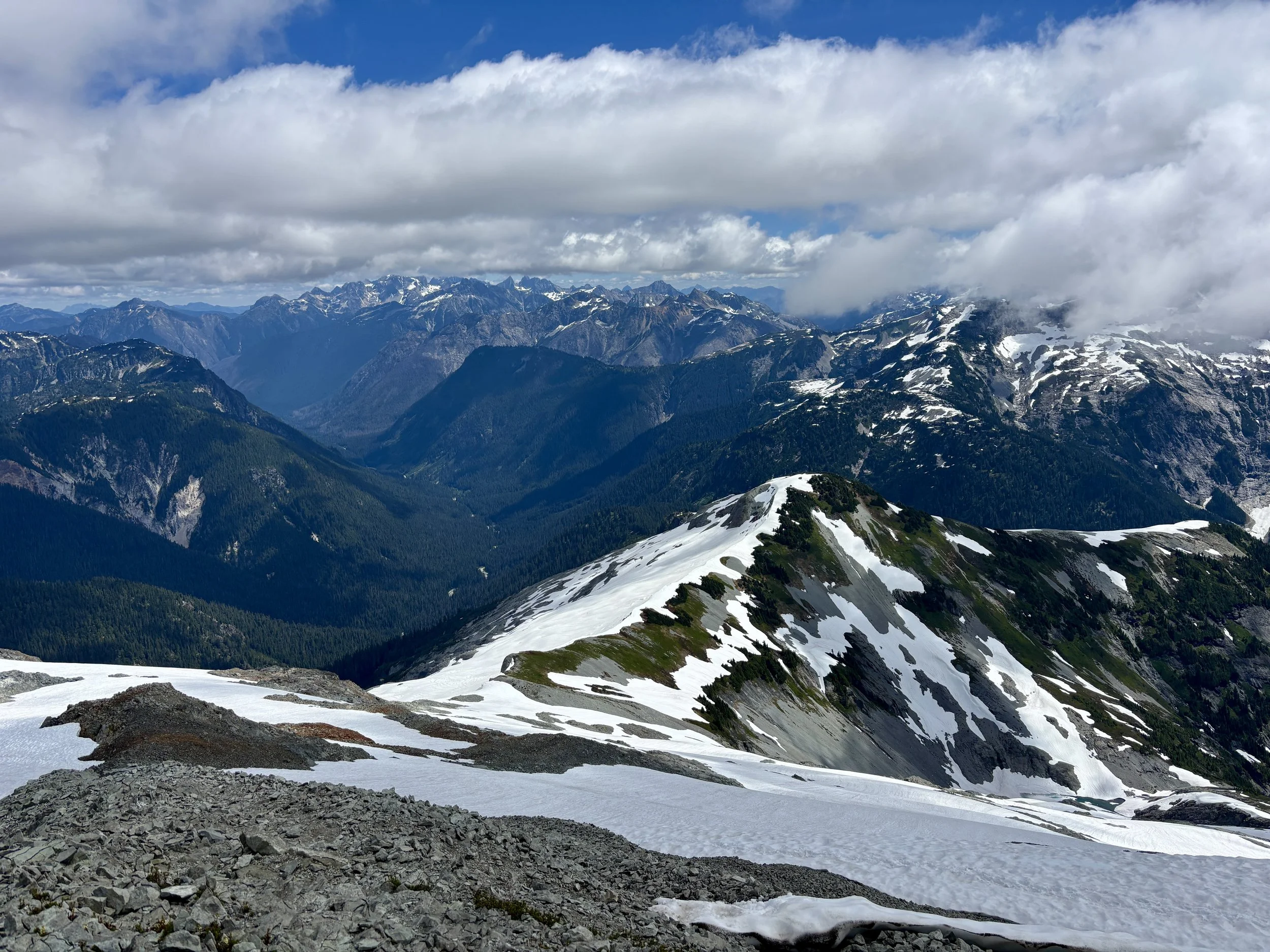
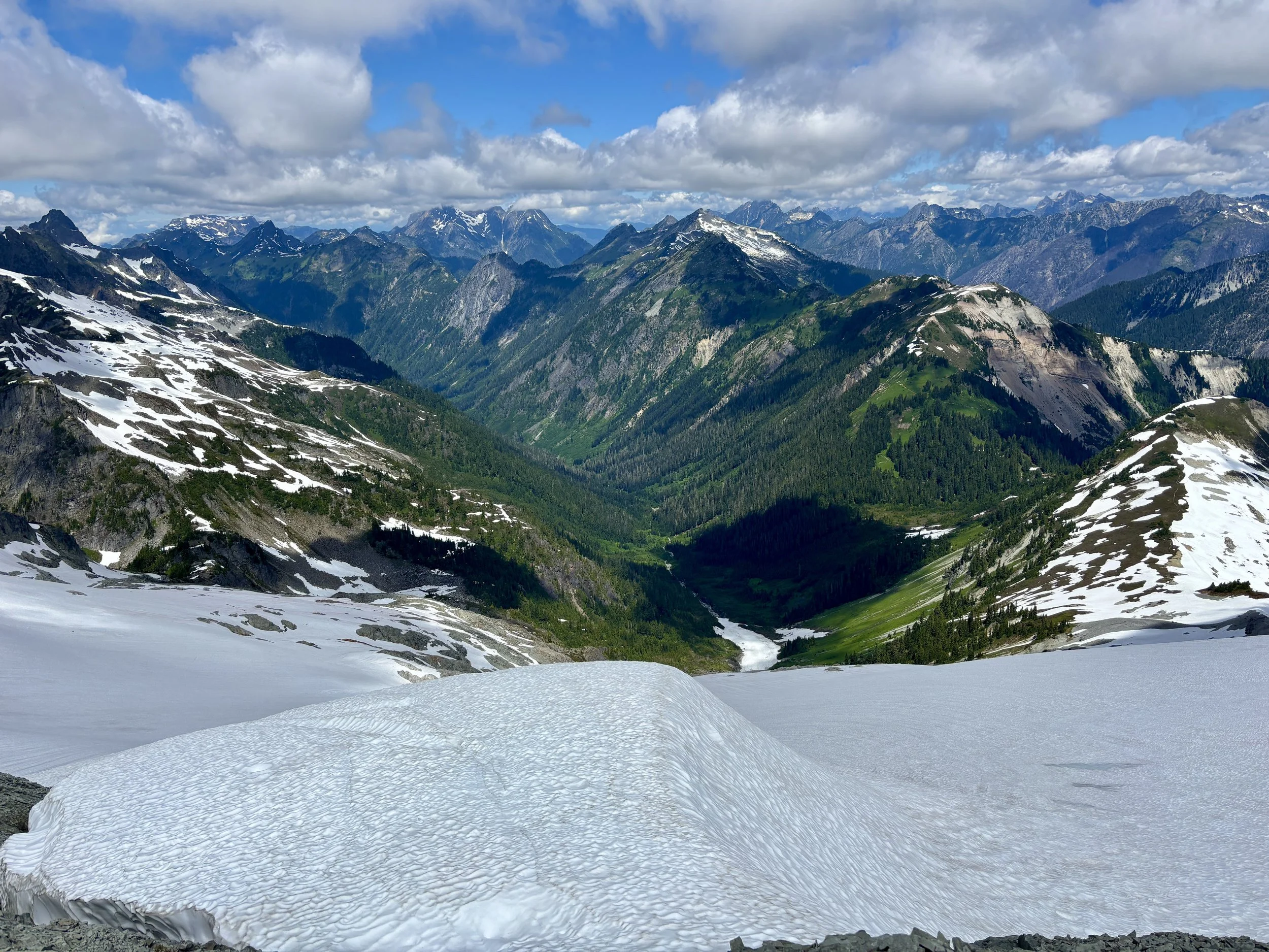
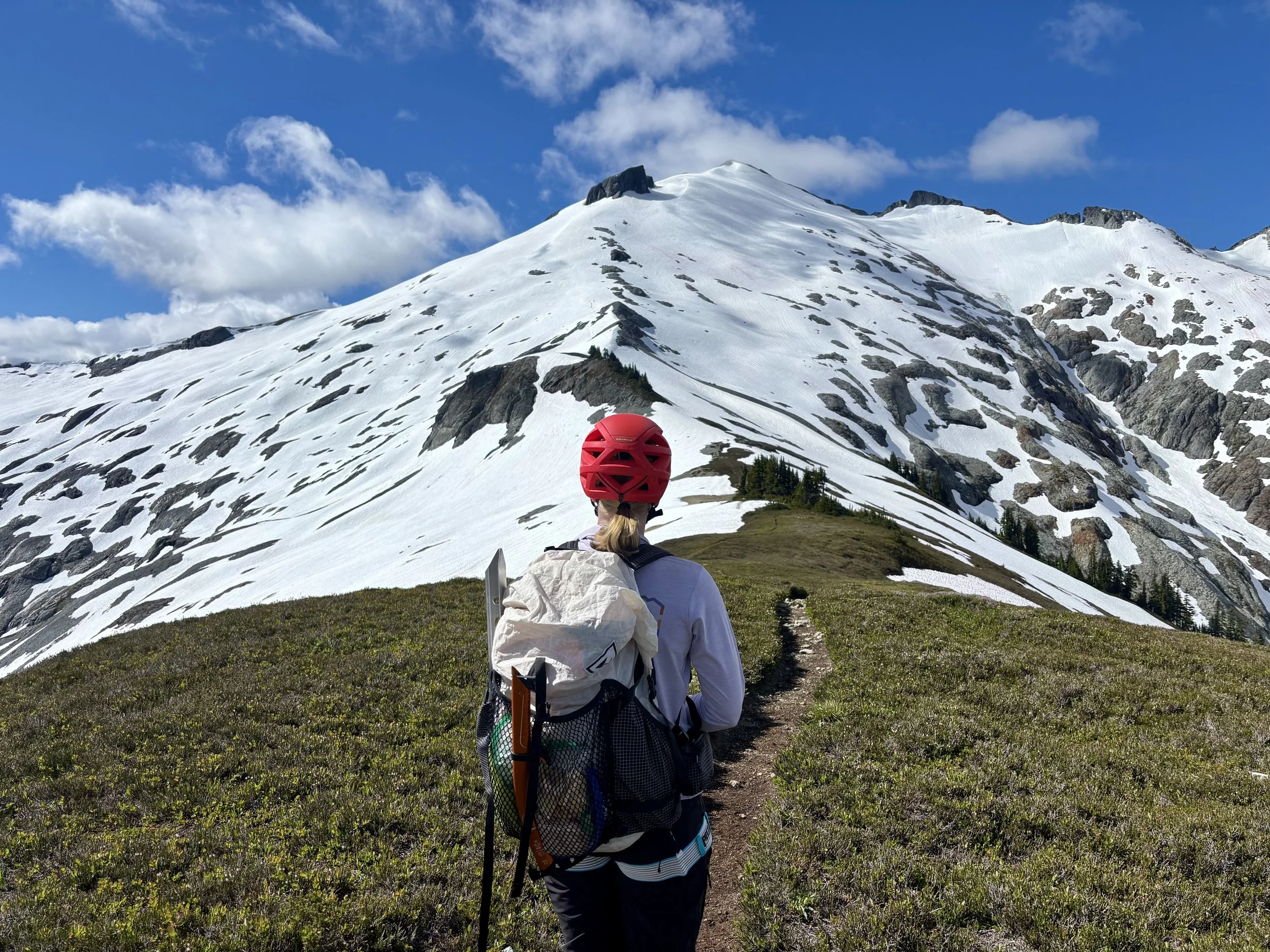
Once we got to the top of this section, we ran into our first snowfield. The trail contours around the knob in this spot, and we followed some old tracks that took us east around the knob. Once we hit the ridge, some of my favorite views of the day opened up before us, and we could see the entirety of the rest of our route. We followed the trail that was interspersed with snowfields to the saddle that was the last spot free of snow for the rest of the climb.
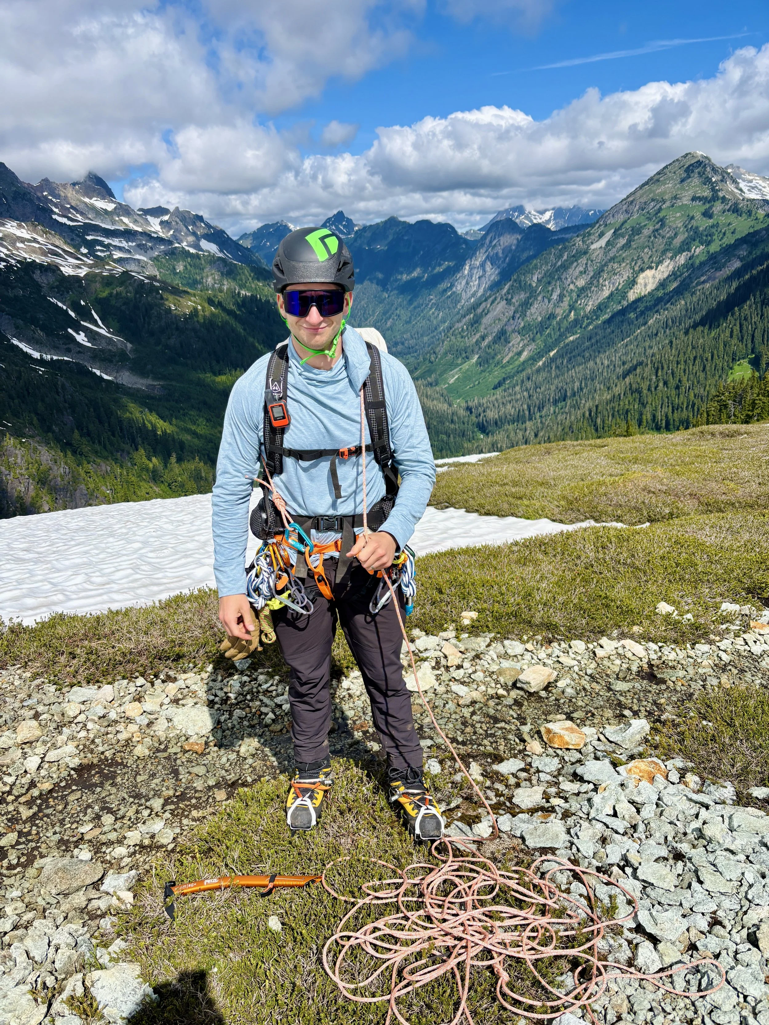
I knew we were still well below the glacier at this point, but since we had picked this mountain to shake the rust off our glacier travel skills, we decided to switch all of our gear into glacier travel mode. We put on our mountaineering boots, crampons, helmets, ice axes, harnesses, and rope.
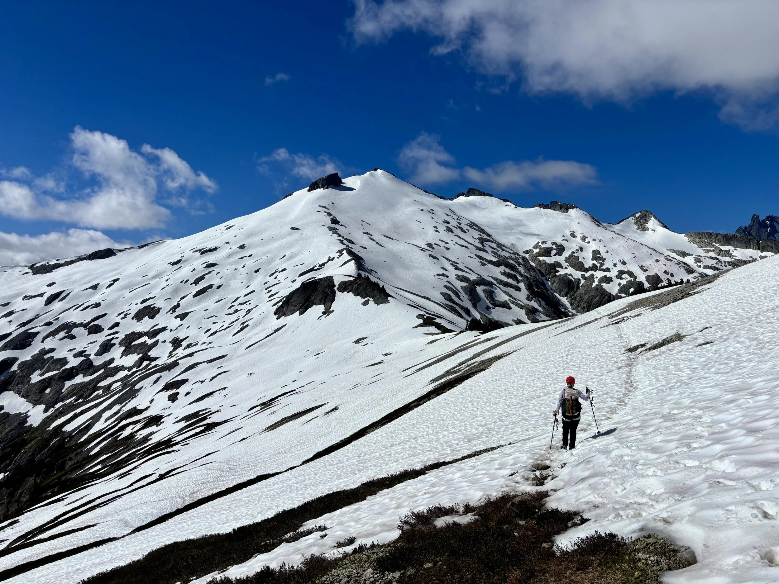
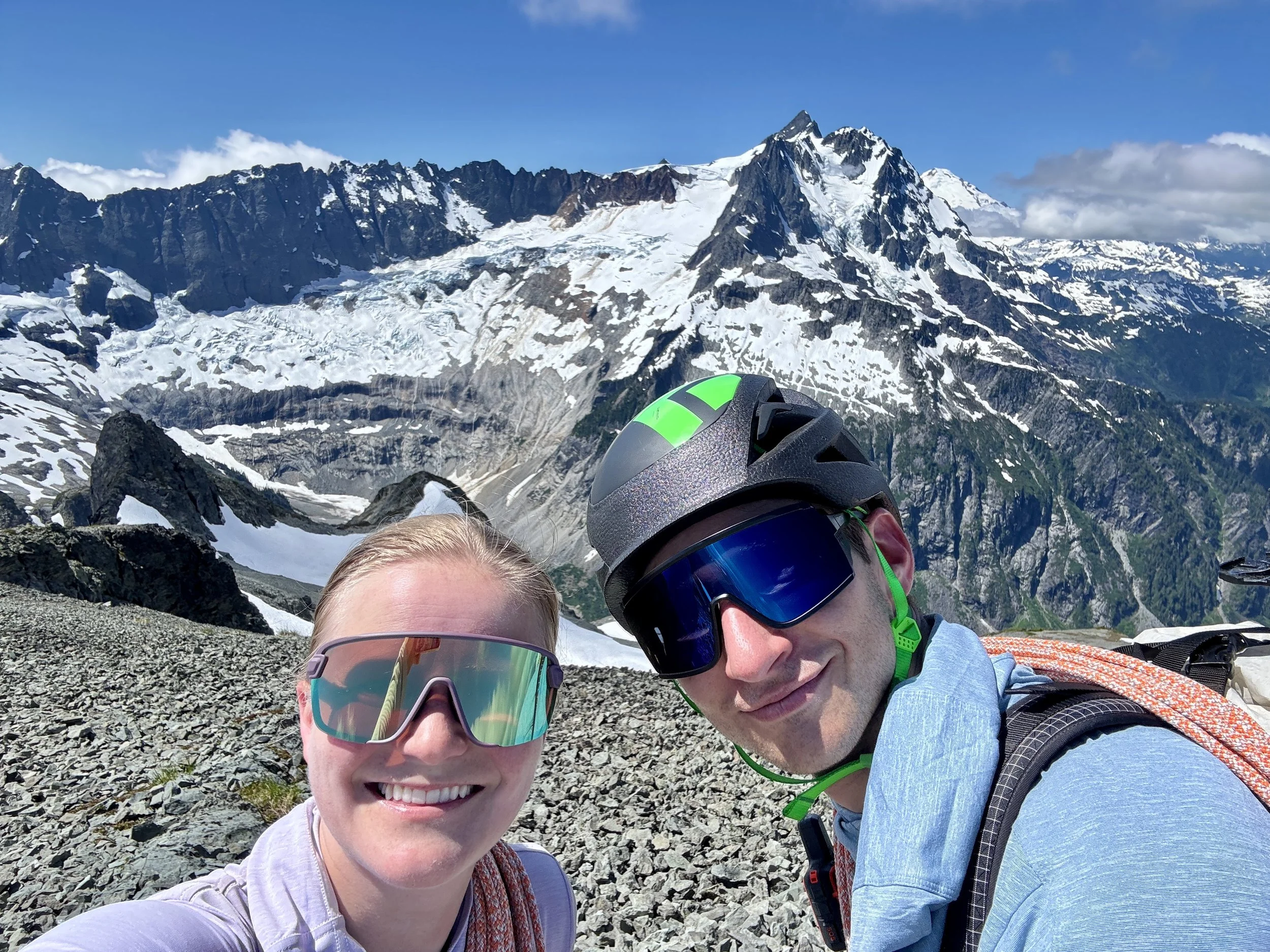
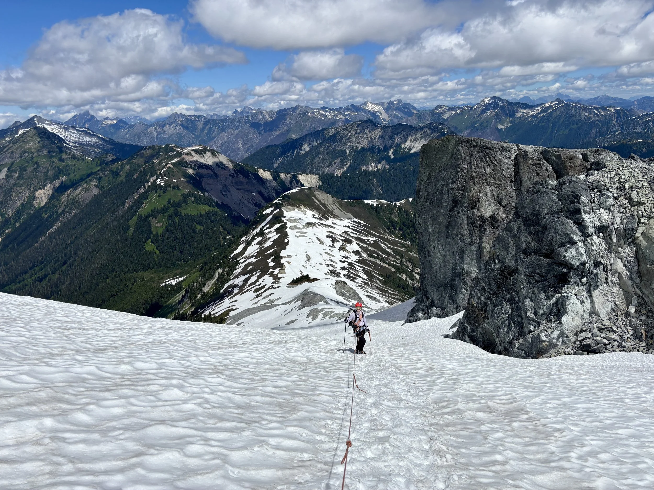
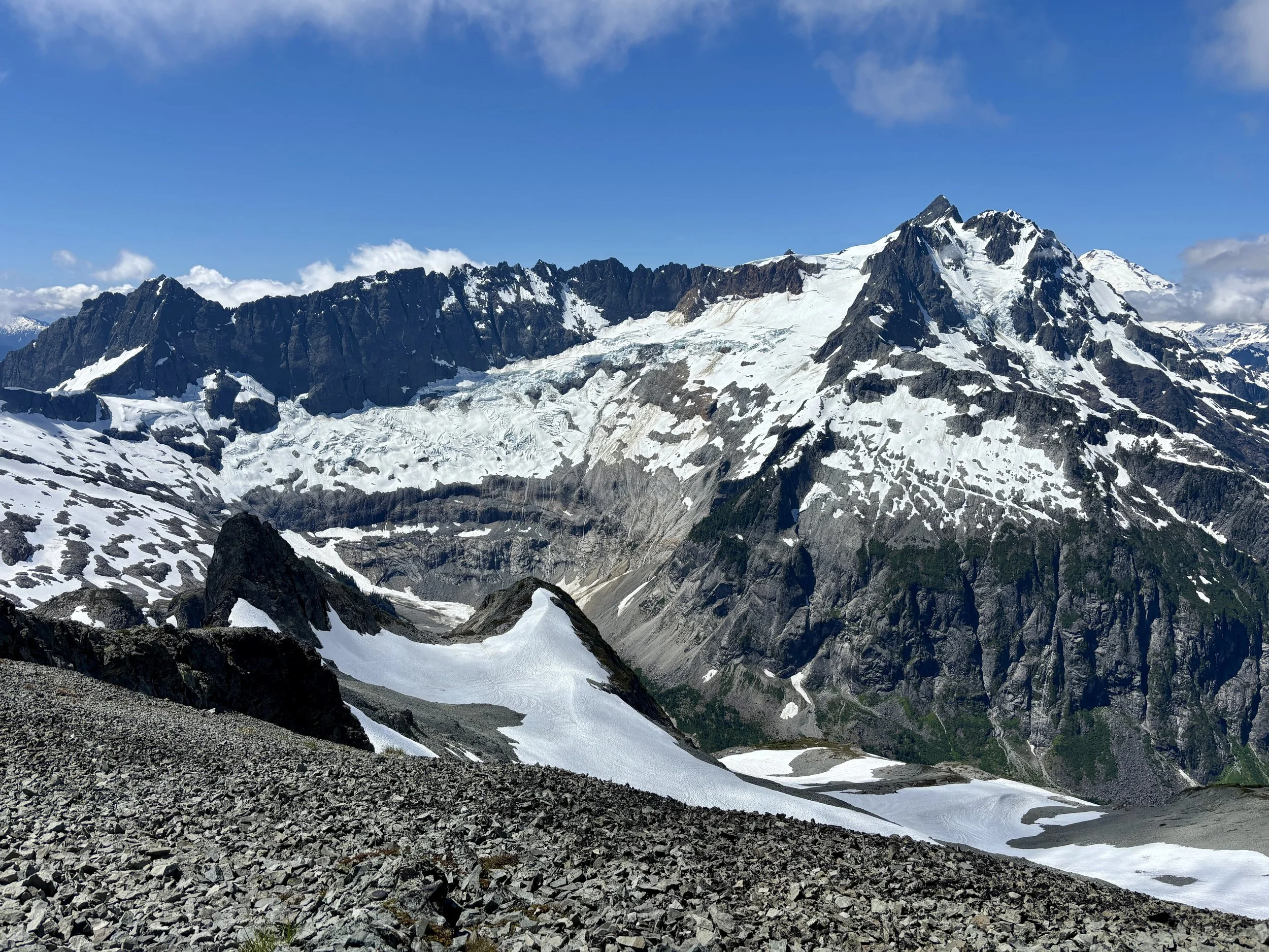
Krista in front of Ruth
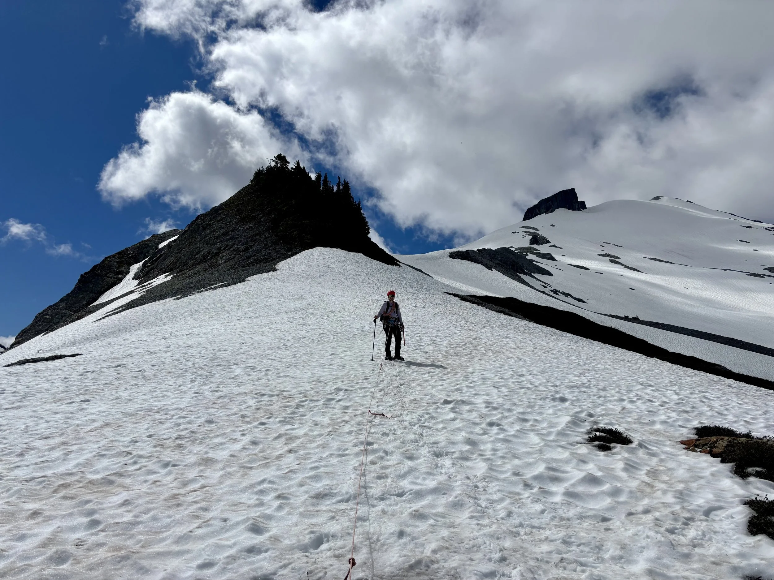
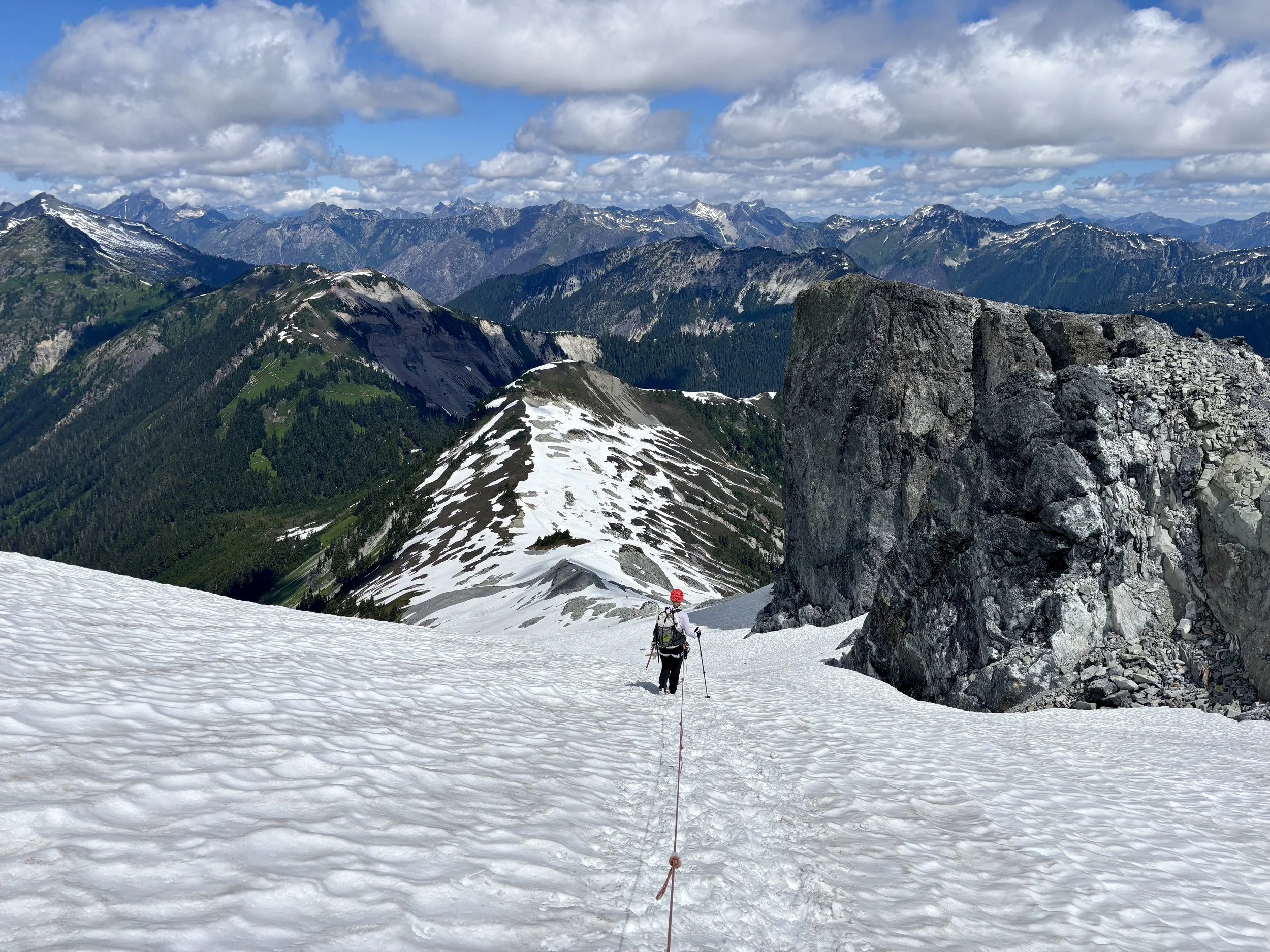
We set out along the ridge with me leading the way. We started out on the west side of the ridge, but quickly crossed over the ridge and traversed under some small cliffs and exposed rock on the right side of the ridge. We continued up the snow and before the largest rock tower before the summit, decided to traverse to the right of it even though the “trail” on Gaia went left. Why did we choose to do this? Simple: we could see the terrain and felt comfortable with what we had to walk through instead of picking a route that we hadn’t laid eyes on. We soon found ourselves ~50 ft below the rocky summit and took off our crampons and walked up to the summit.
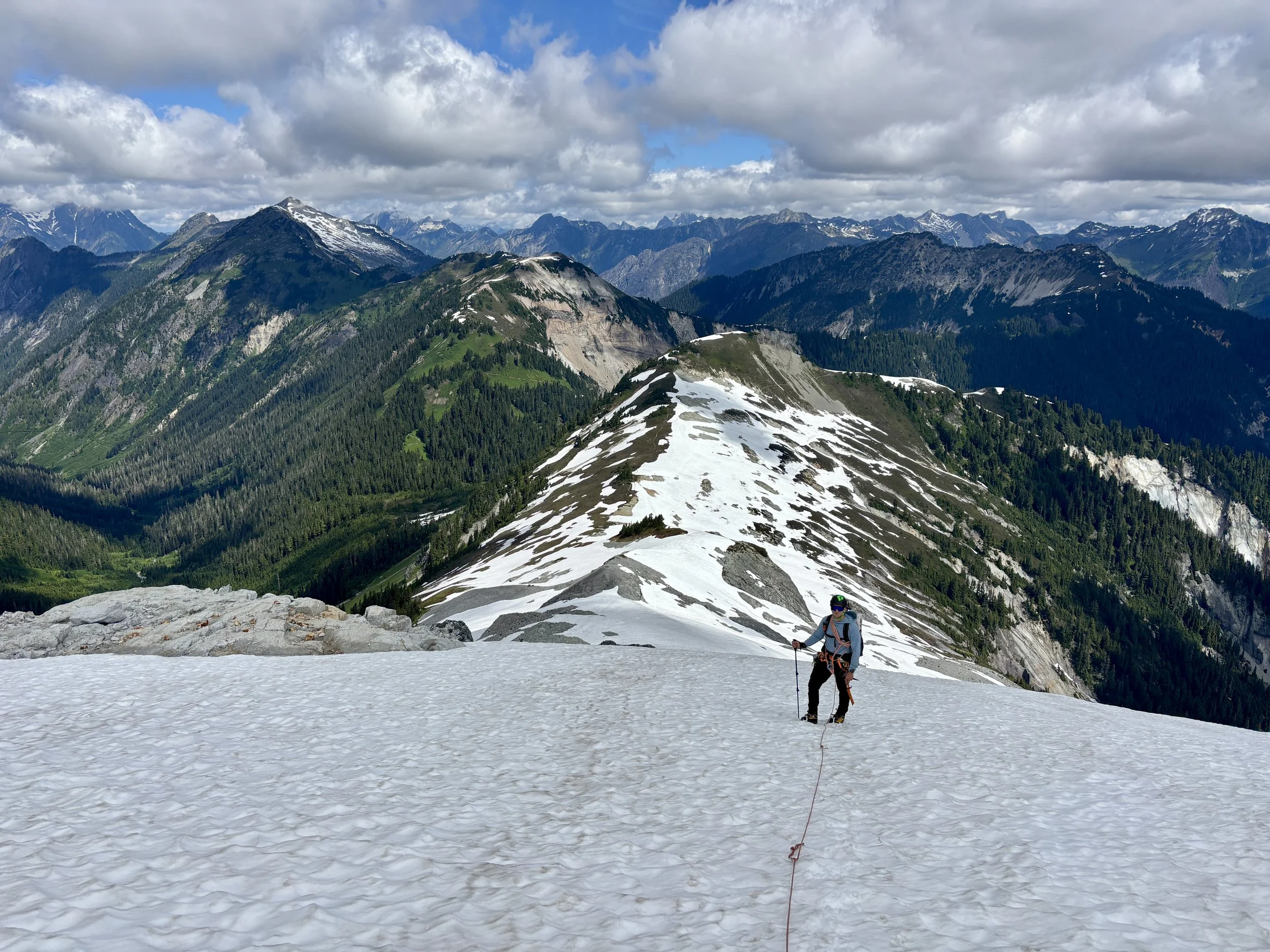
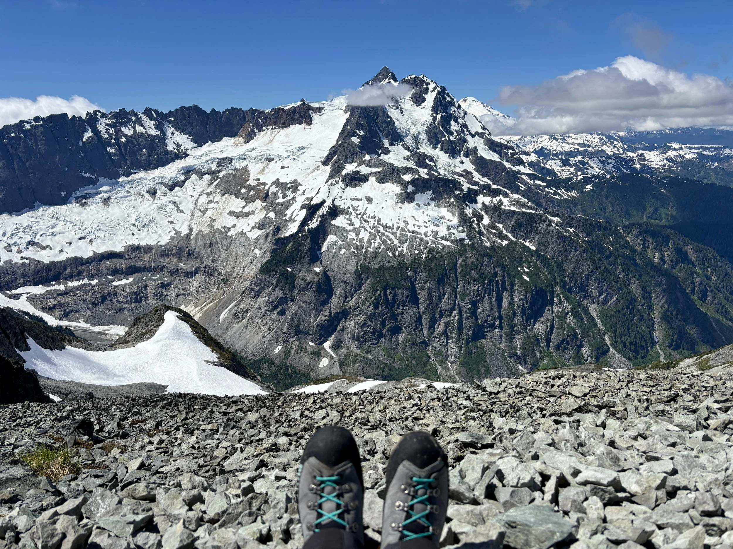
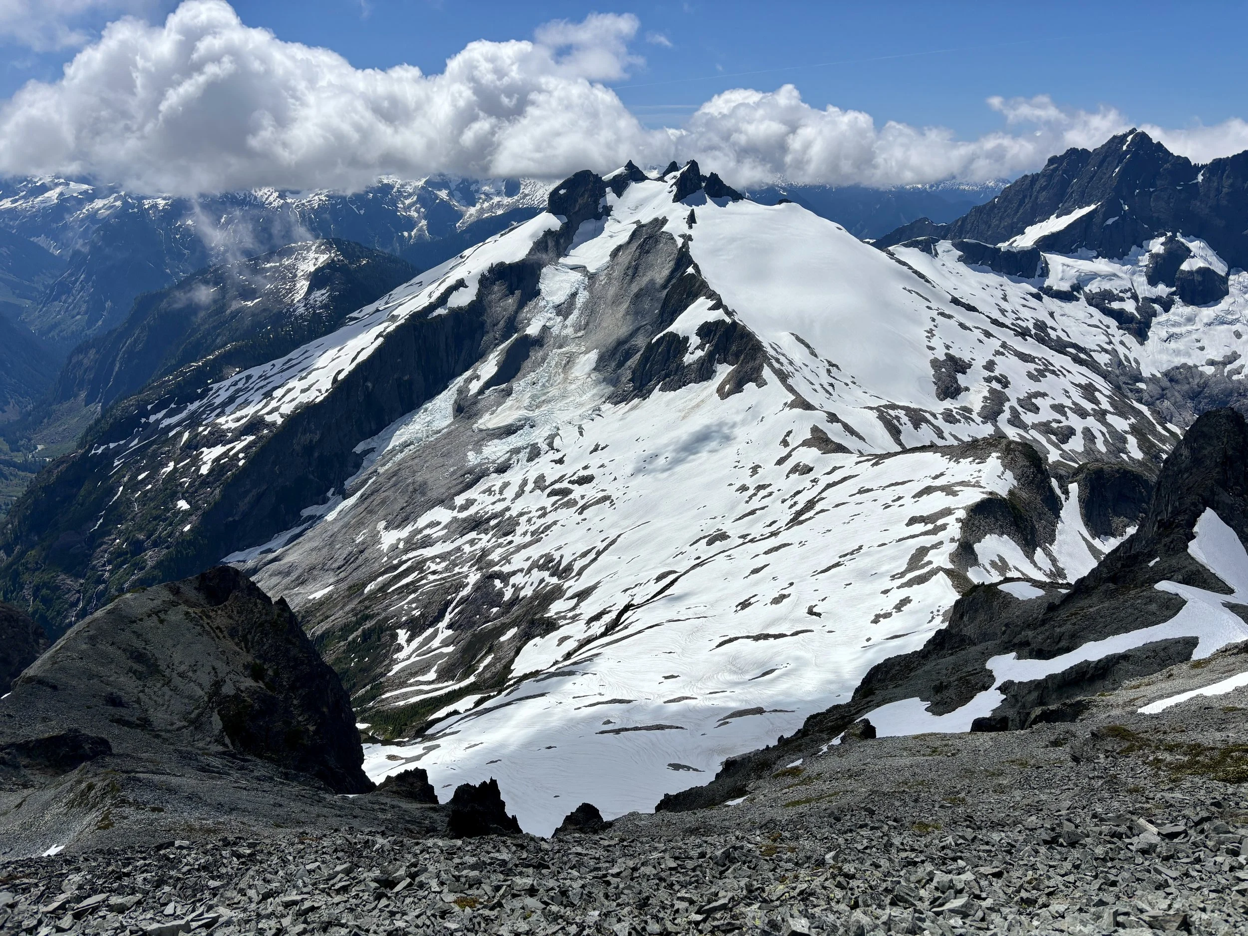
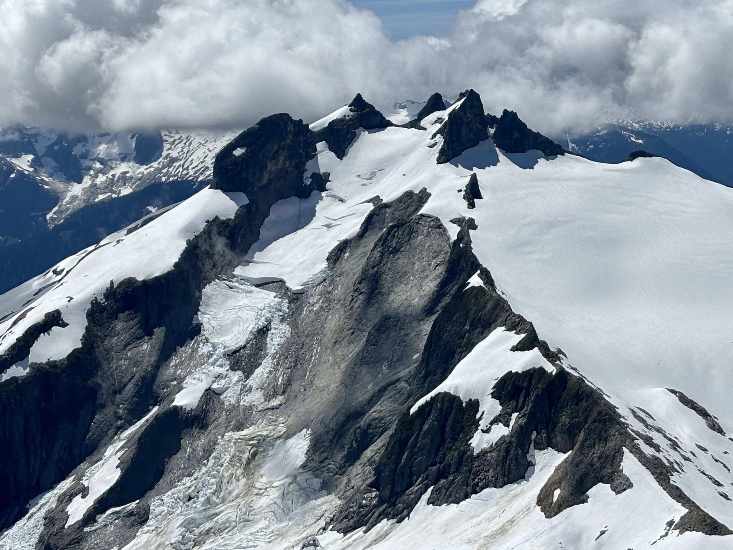
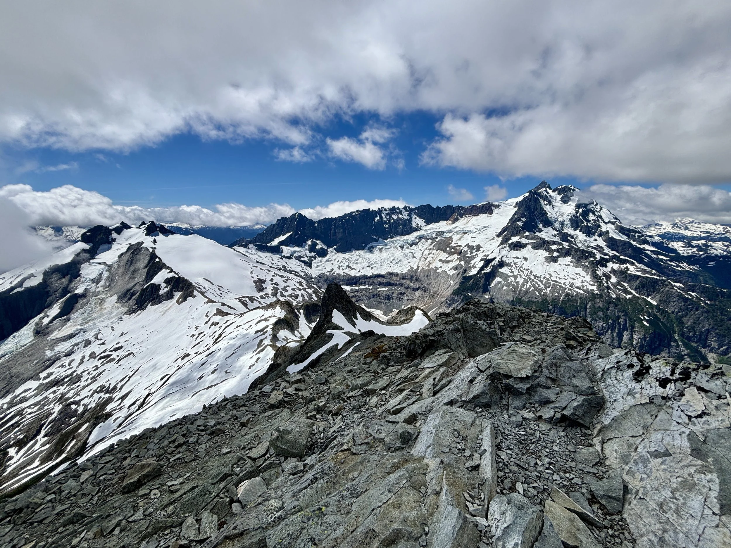
Wow. Were those views breathtaking. Mount Shuksan looms large in front of you. As I had mentioned, we climbed that peak last summer so it was really neat to see a different side of it from a different peak. We admired how cool of a climb Nooksack tower would be. We then walked over to where we had better views of Icy Peak and noticed that it looked like the glacier on that mountain had very recently broken off. Fresh looking debris could be seen. We talked about how wild it would have been to see that in person. It was also sad to think about how quickly the glaciers are disappearing in the region.
Shuksan
After taking time to admire our summit views, we decided it was time to head back down. We passed ~5 other groups of 2-3 people each. Some of these groups had no ropes, some did. Some folks were just in hiking boots with no crampons or ice axe. They must feel more confident on snow than I do. Once we got to the bottom of the snow, we switched back to our trail running shoes and put all of the glacier travel gear back in our packs. We were out of water so we were motivated to head back down to a spot where we could easily grab some. The descent was (thankfully) very uneventful, although quite hot. It was nice to get back to the van where some cold, refrigerated Gatorades were waiting for us.
Overall, this was such a beautiful hike. I enjoyed the views all day long. I also found this to be a great hike to refresh glacier travel skills on. I can’t wait for our next hike in the Cascades!
Total stats: 12.6 miles, 4300 ft of elevation gain.