Mount Baker via Coleman Deming Glacier, Mount Baker Wilderness, Glacier, Washington
Disclaimer: This hike involves glacier travel and/or rock climbing, which are inherently dangerous. This blog post does not include formal instruction of any kind. Please make sure you have the appropriate skills and knowledge before attempting this hike.
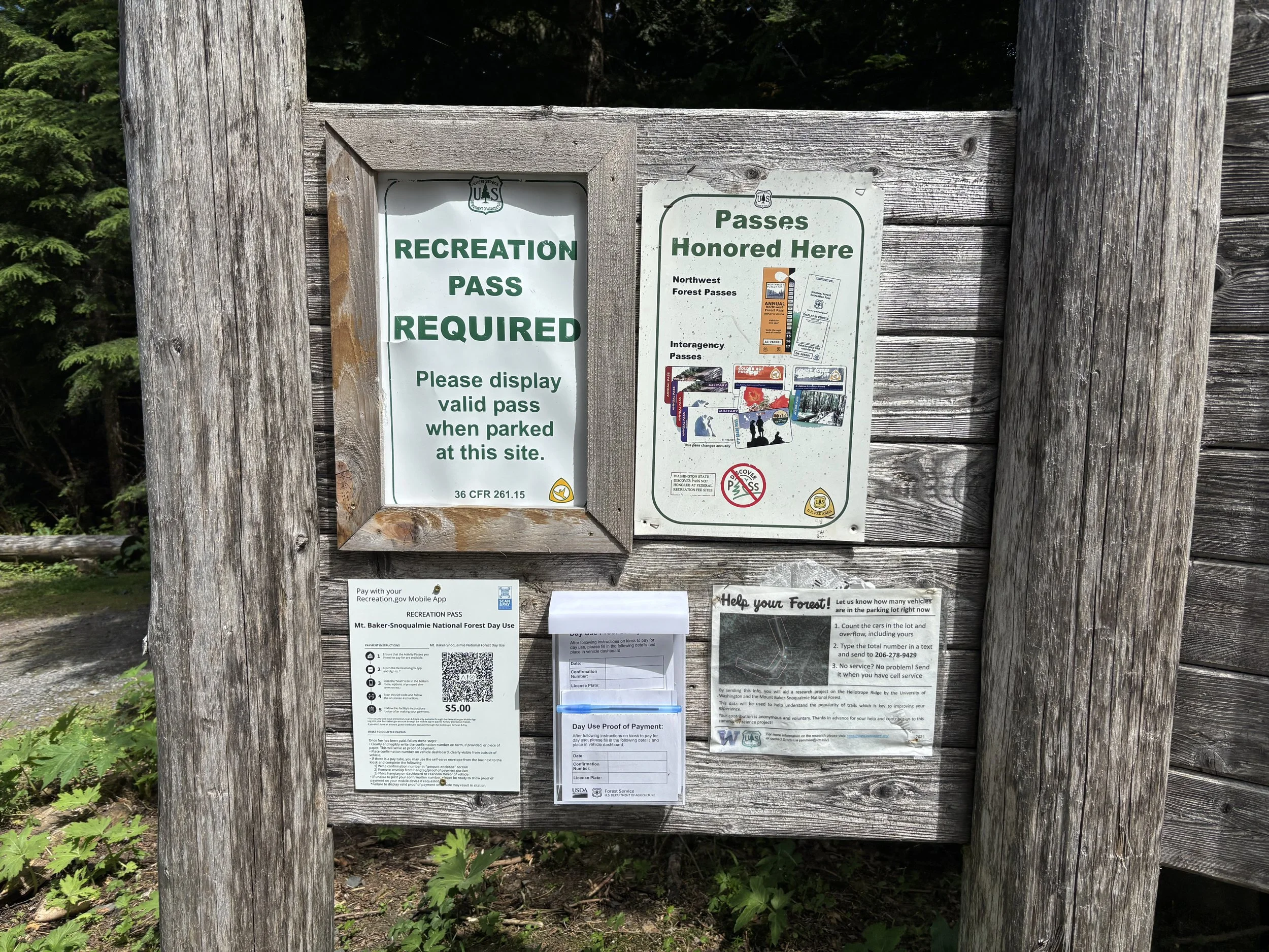
Mount Baker is such a beautiful, imposing mountain that you can see from so many different points in the state of Washington. It caught my eye as a mountain that I wanted to climb, and with a great weather window coming up, Mike and I decided we would give it a go. We decided our ascent route would be the Coleman Deming Route. The big decision we had to make was if we should try to do it in one day or two. The route was just under 13 miles with 7100 ft of elevation gain, with ~4700 ft of that elevation gain on glaciated terrain. Ultimately, we decided to do it in two days.
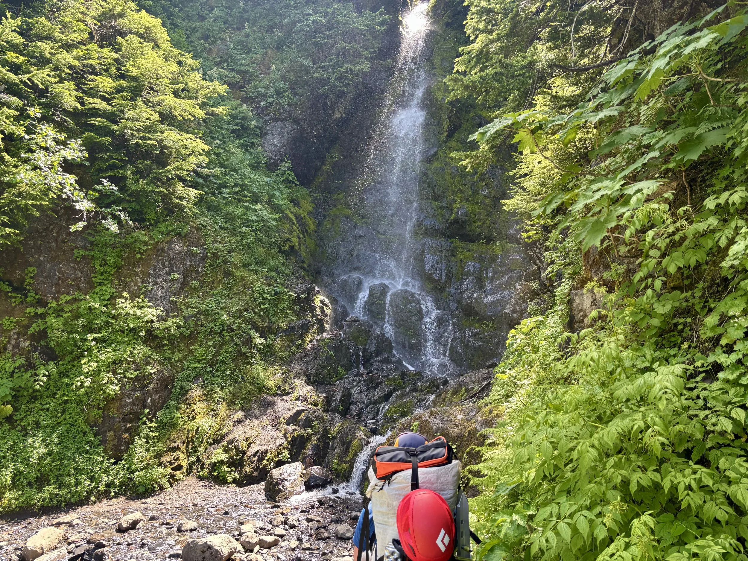
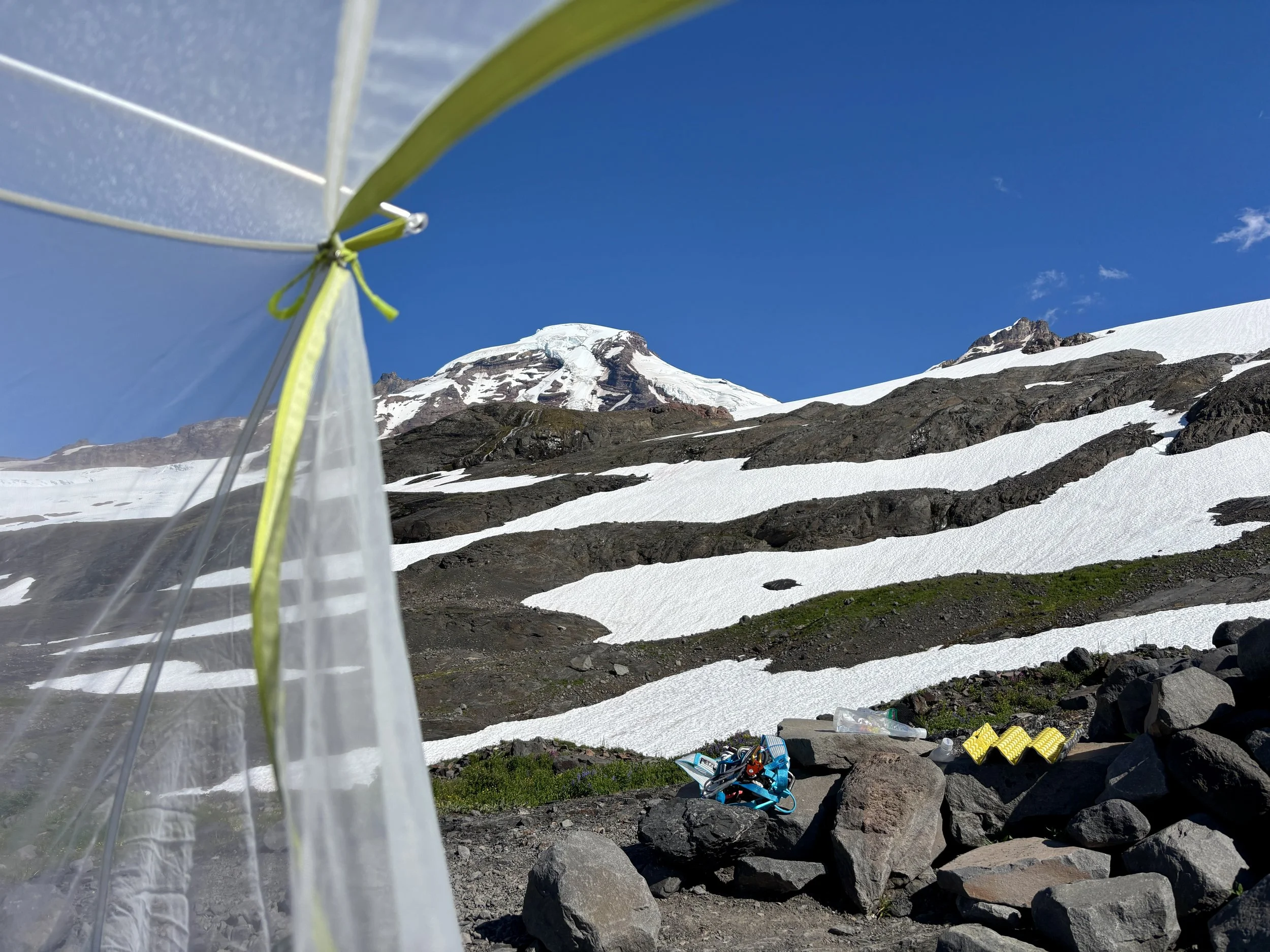
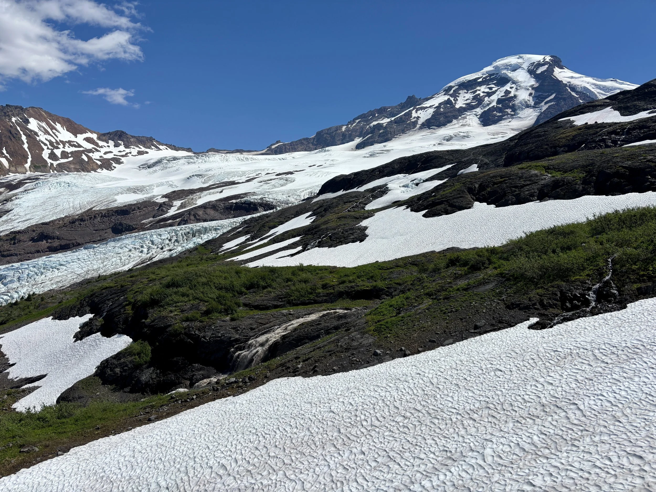
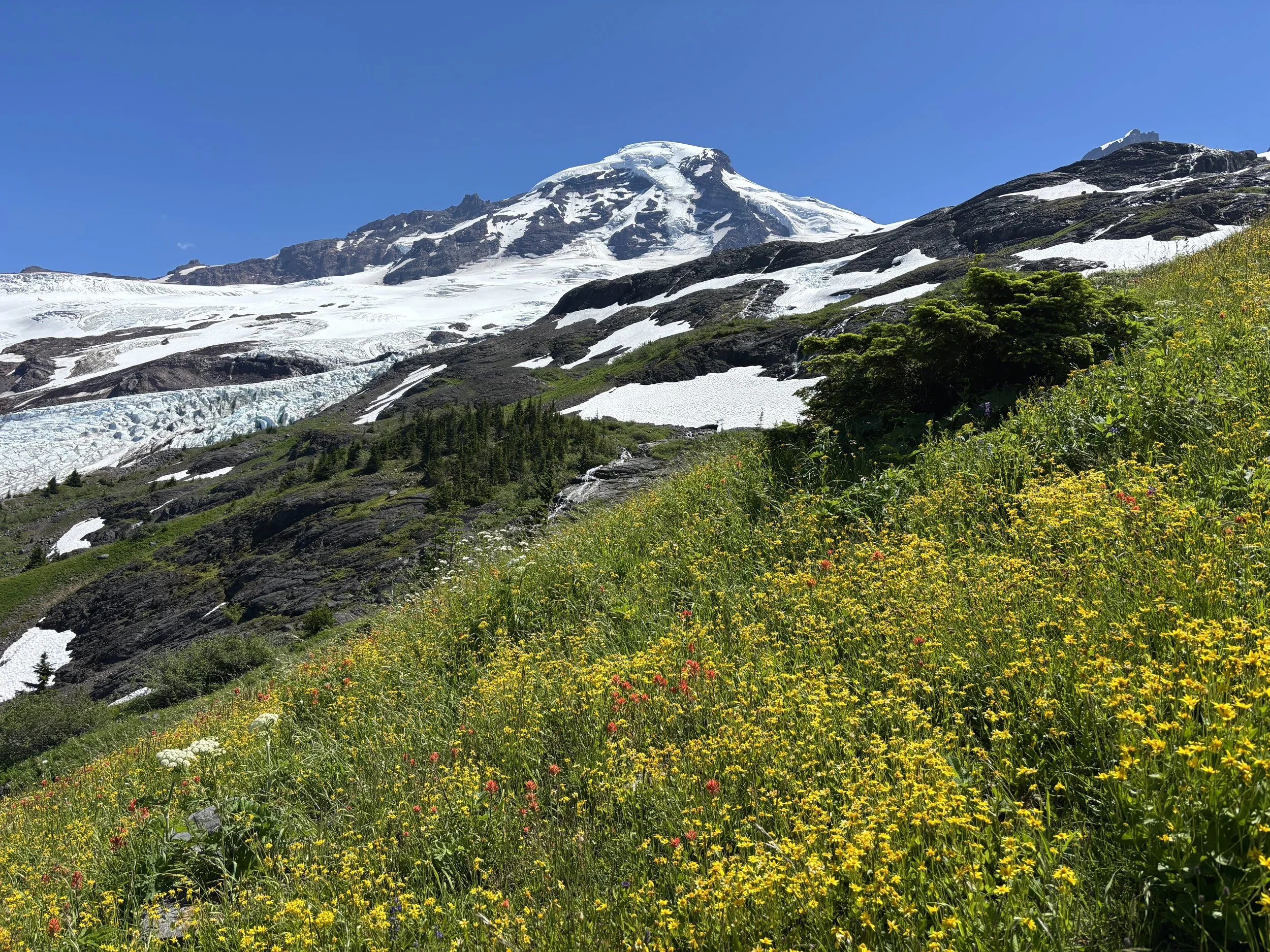
We parked at the Heliotrope Ridge Trailhead around noon on a Wednesday and cooked some lunch in the van before setting out on the trail. Turns out, my least favorite time to start hiking is at 1 pm, right after lunch and in the heat of the day. Our packs were also quite heavy with all of the glacier travel gear we had with us. So the hot slog began to the Hogsback Camp. We followed a well-maintained and heavily traveled trail for a little over 2 miles until we turned on to the climber’s trail. The climber’s trail has a sign at the intersection and there is an obvious intersection for it. We were looking for the turn off for the trail too early and wasted some time looking for the trail when we weren’t at it yet. Once we found the turn off, the trail went from feeling like a groomed sidewalk to feeling like a climber’s trail very quickly. We went straight up a ridge that took us to camp. Thankfully, the views of Mount Baker and the wildflowers around it were breathtaking and a good distraction.
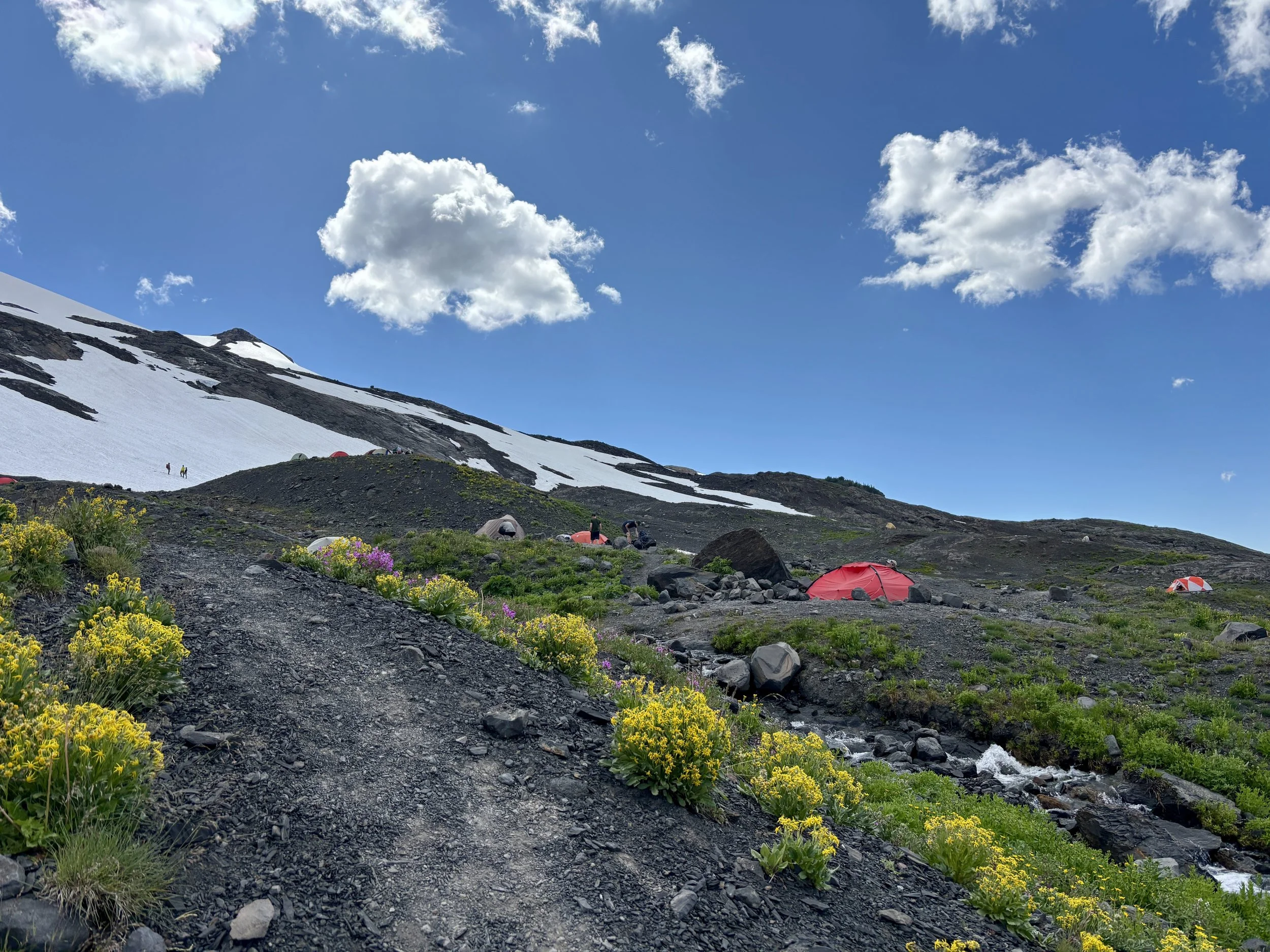
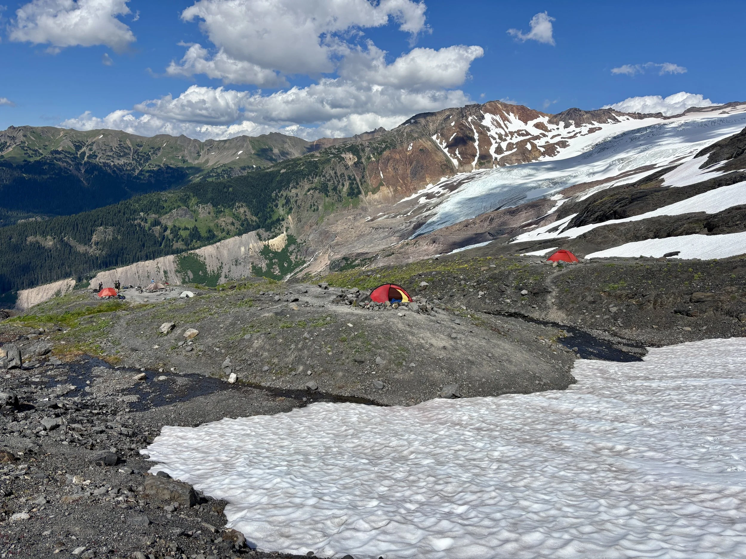
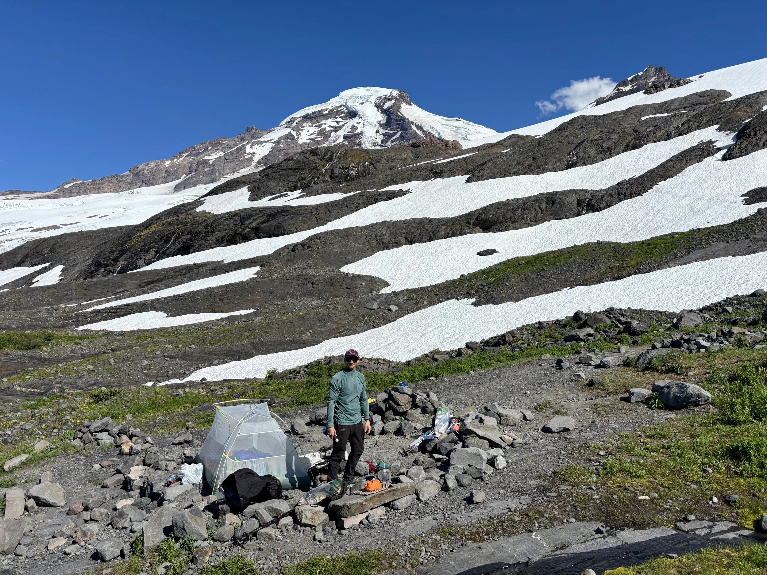
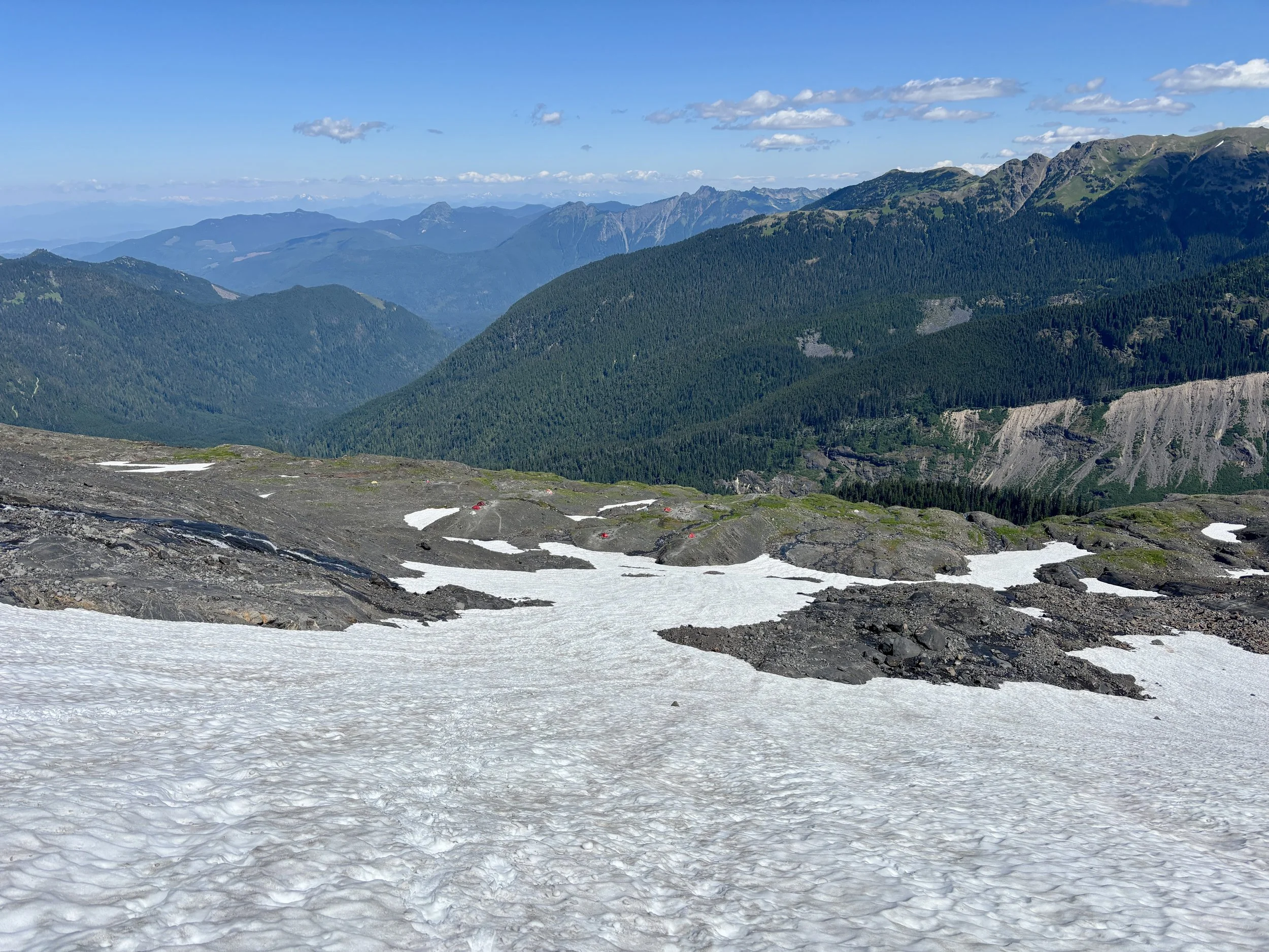
Once we got to Hogsback camp, we found 10-15 other tents all clustered together and decided to pick a campsite a little bit farther away from everyone else. This campsite is such a beautiful area to camp in, with magnificent views of Baker from all of the campsites and cascading waterfalls all around you. We set up camp and unpacked and found it was already dinnertime. After dinner we tried to head to bed early, but with sunset being at 9:10pm and with our campsite being hit by the sun until then, it was hard to fall asleep before the sun went down. Sunset was worth being awake for though.
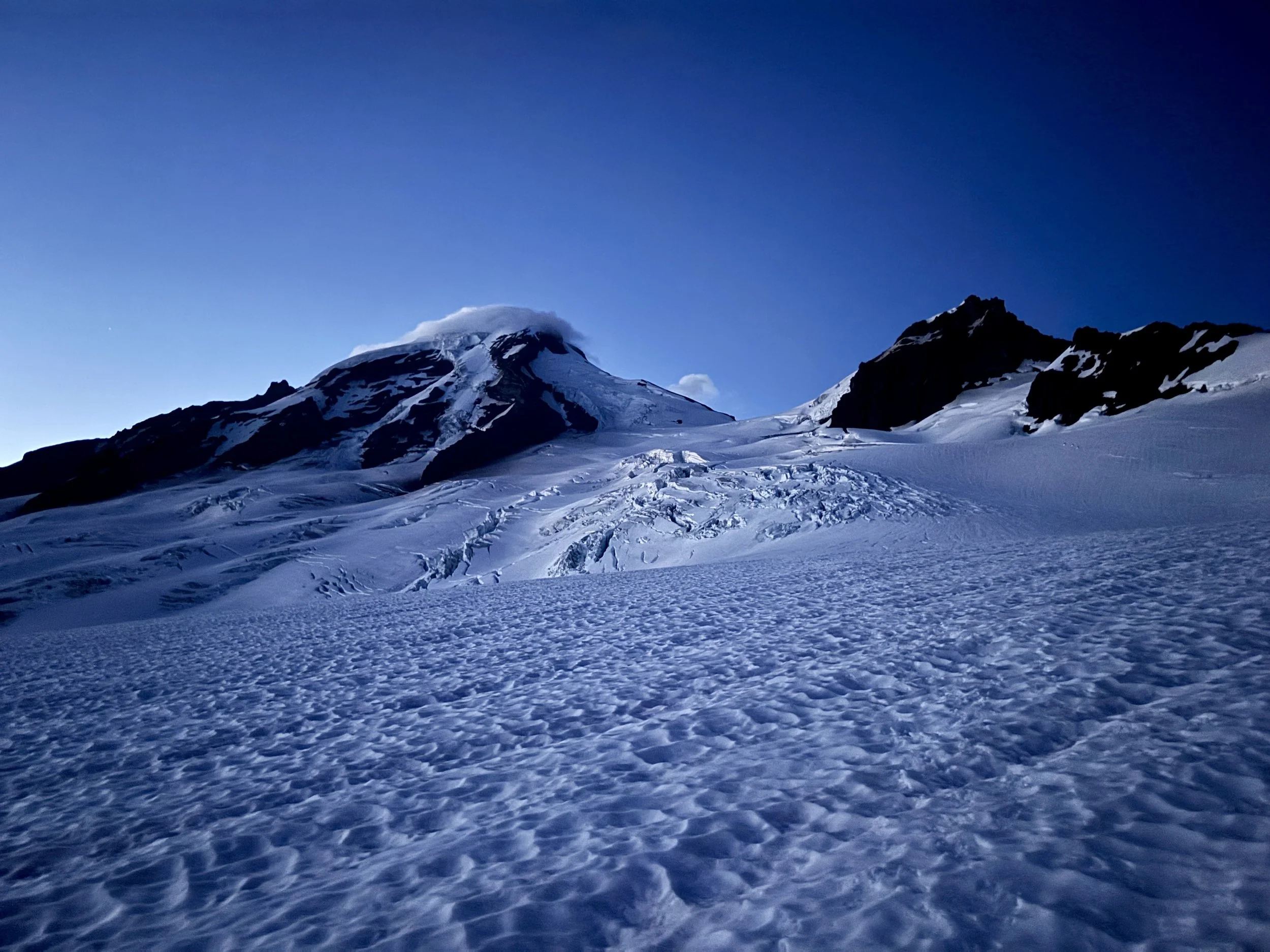
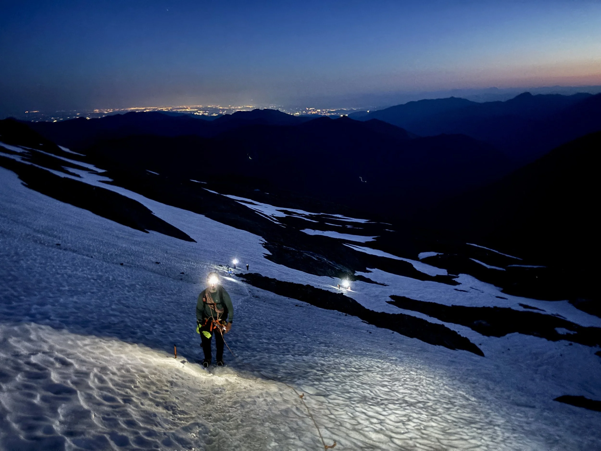
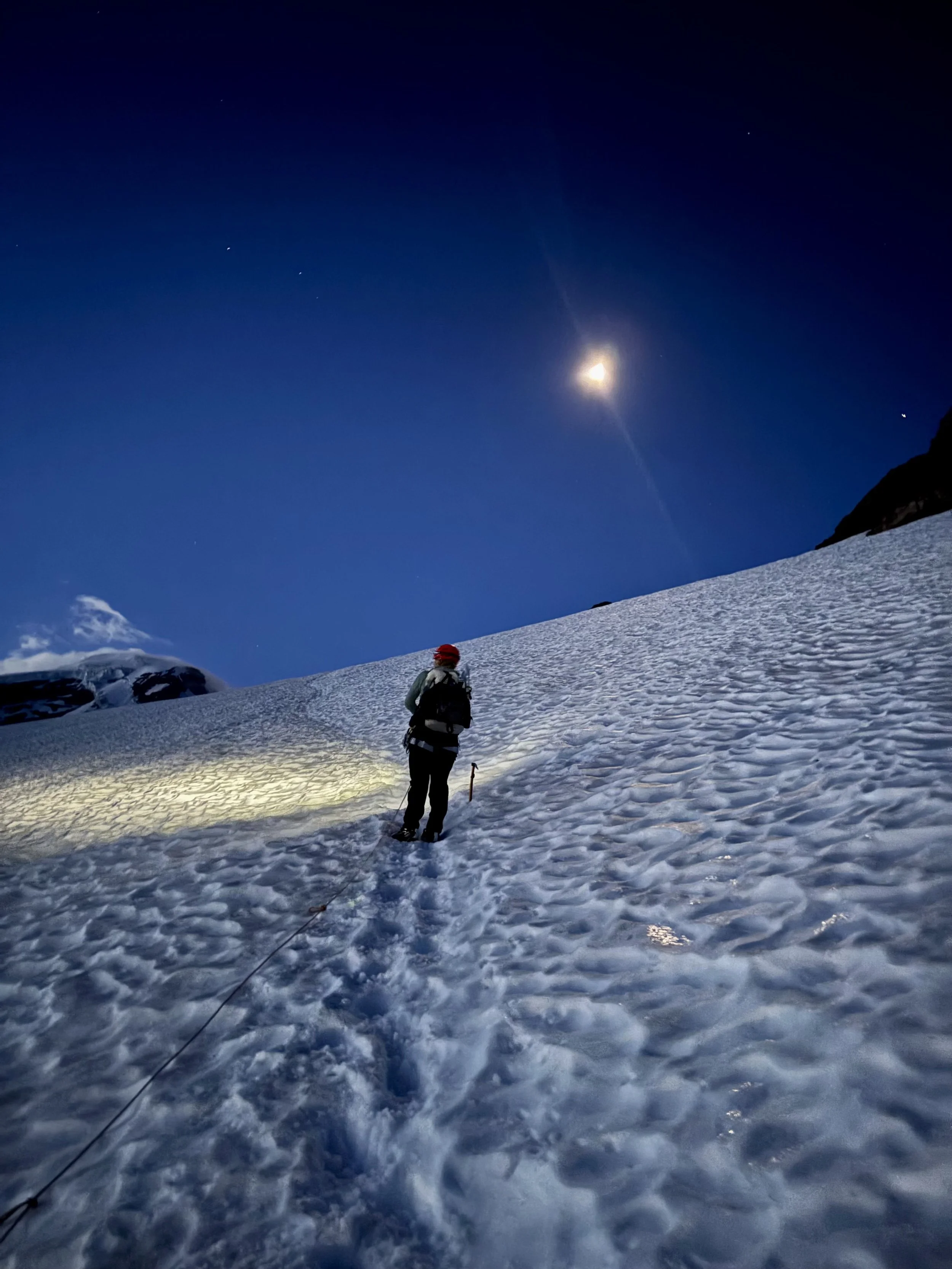
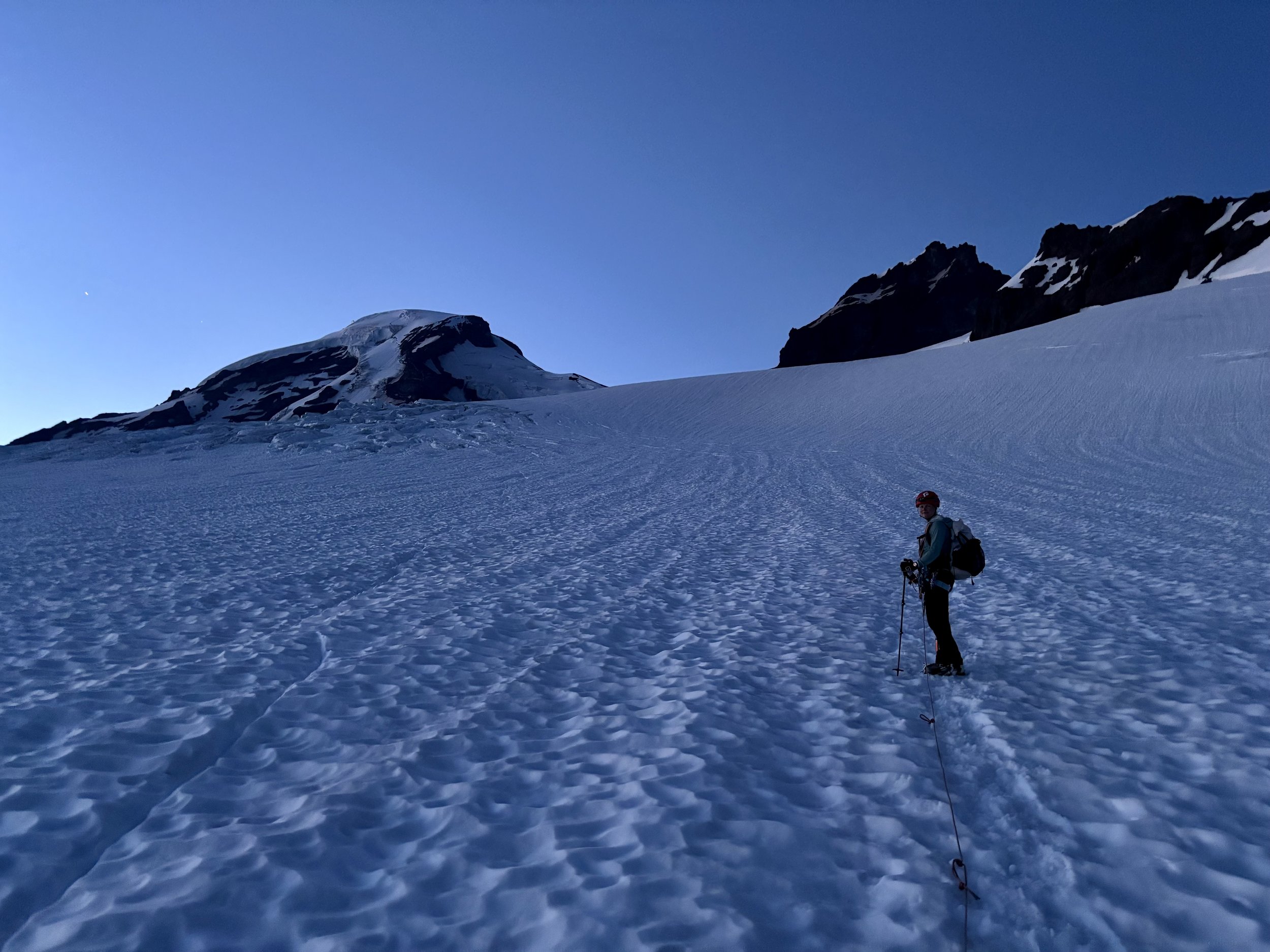
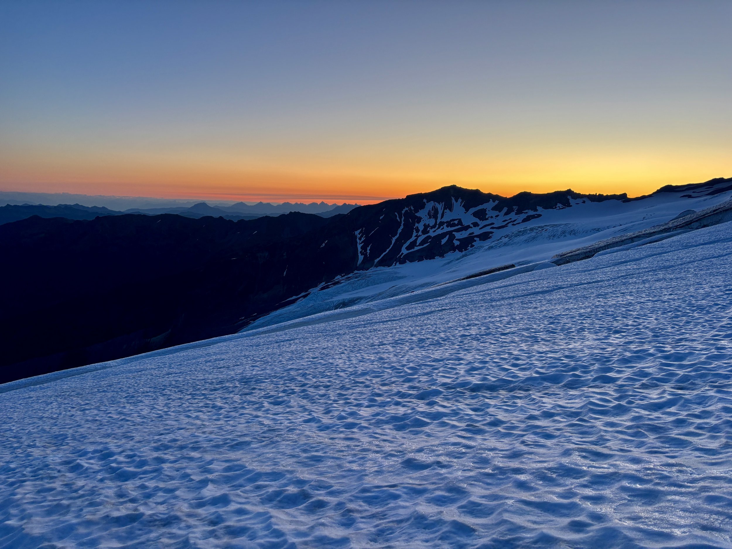
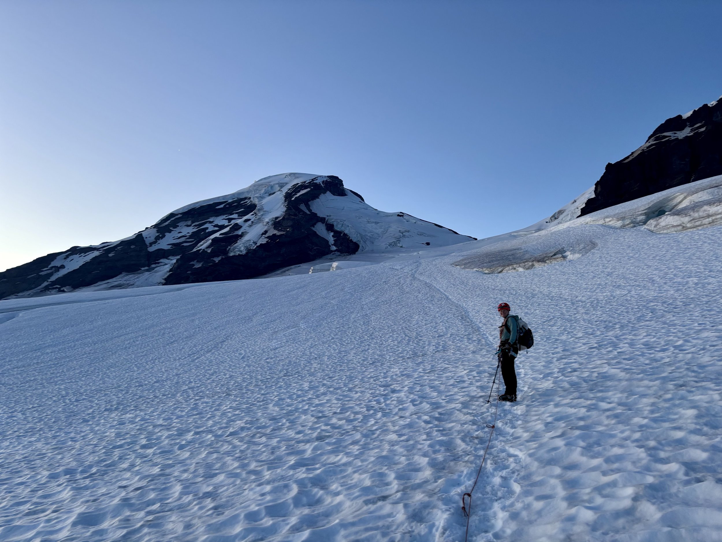
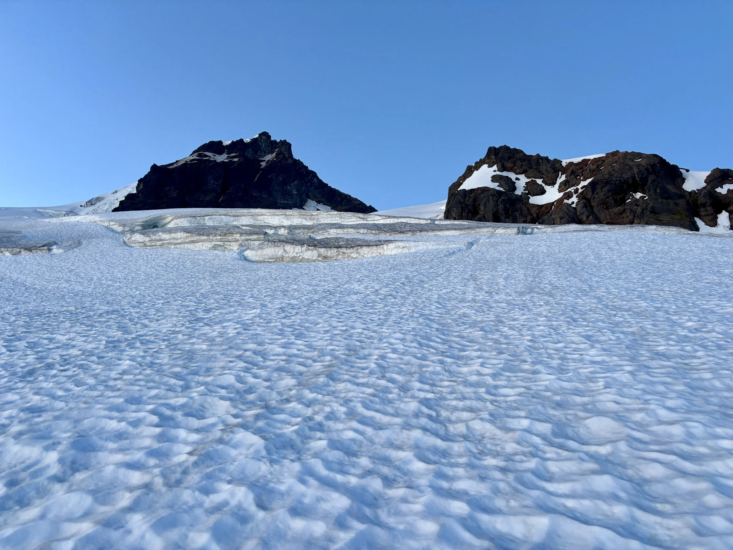
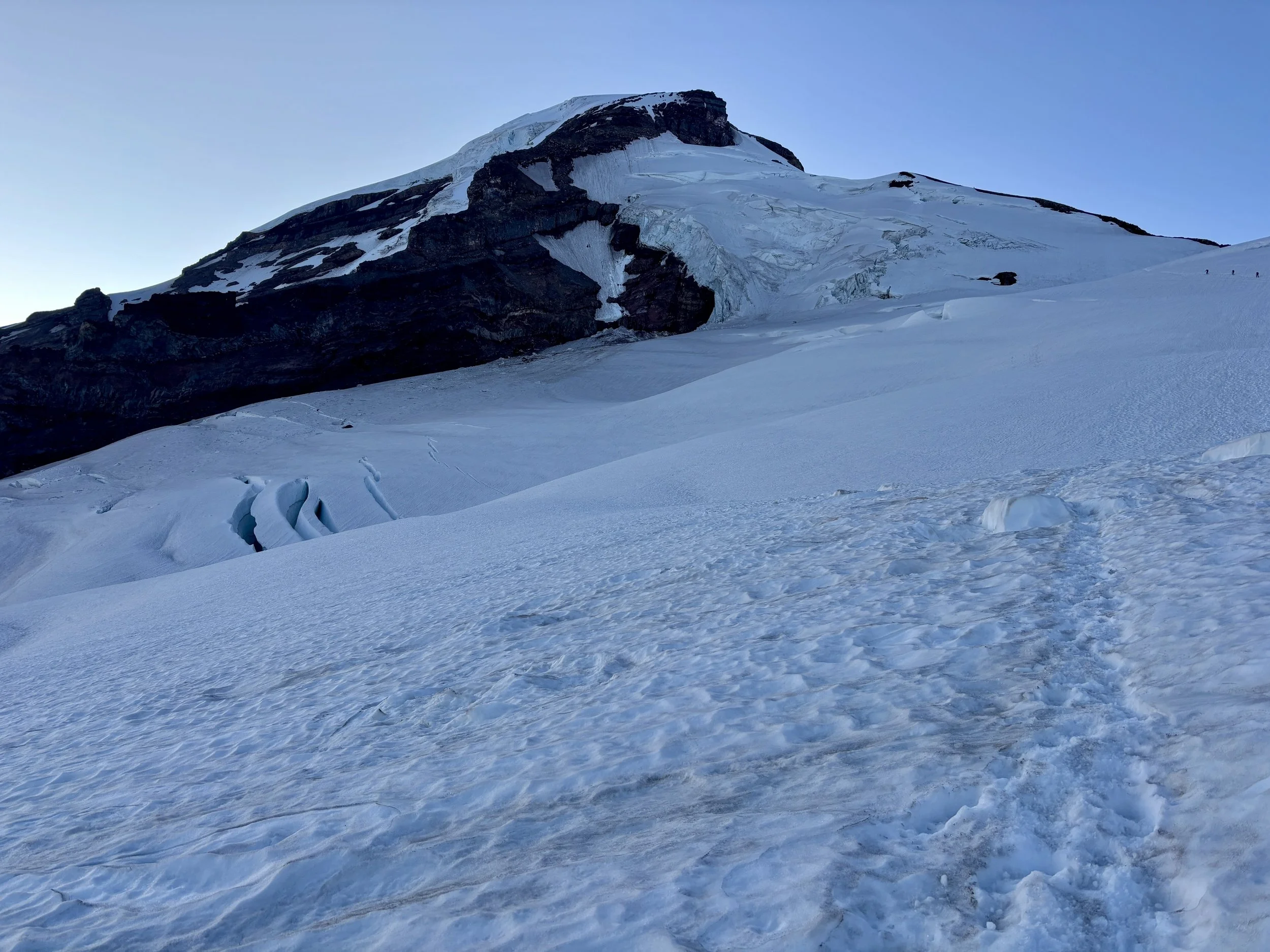
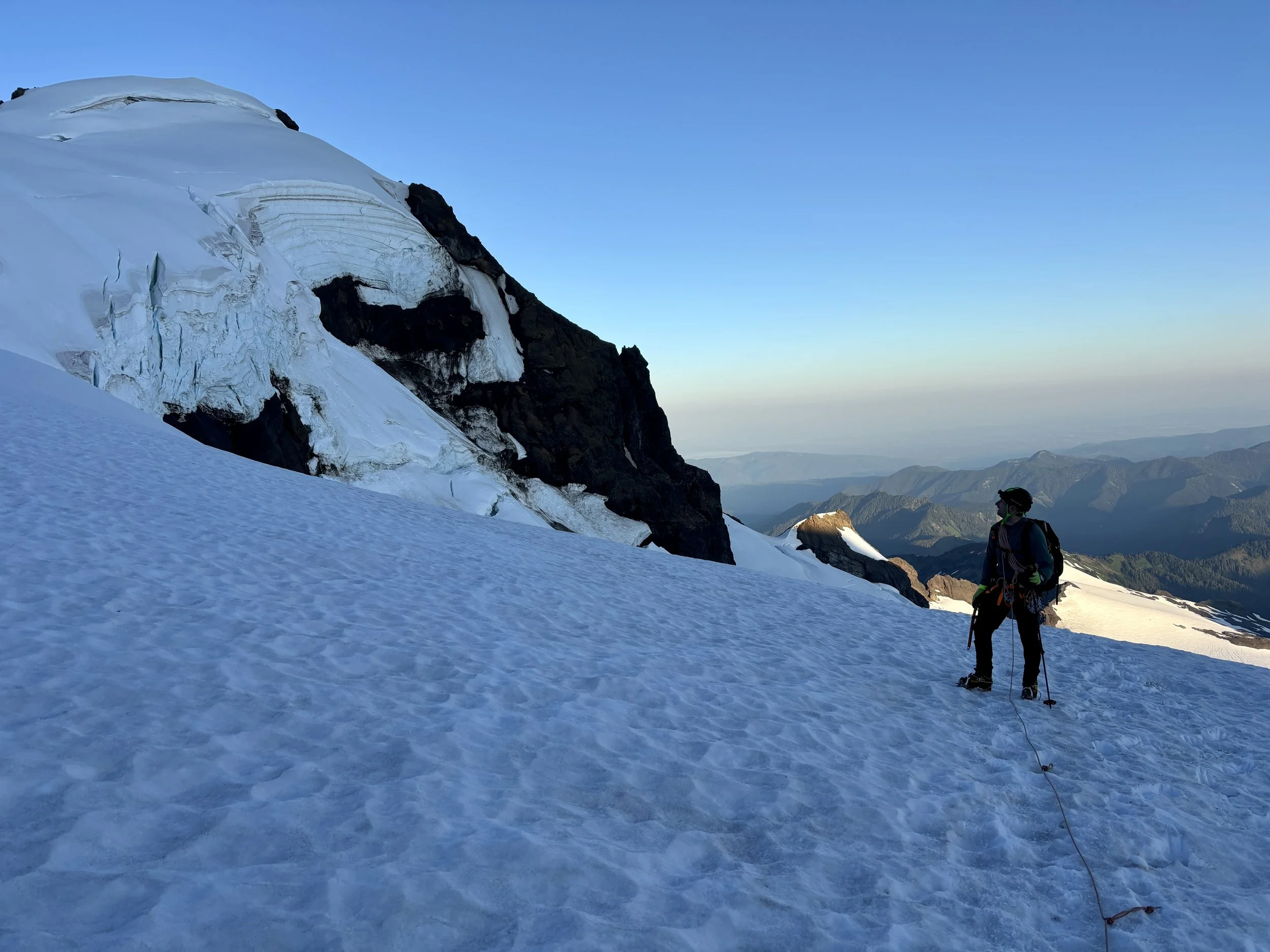
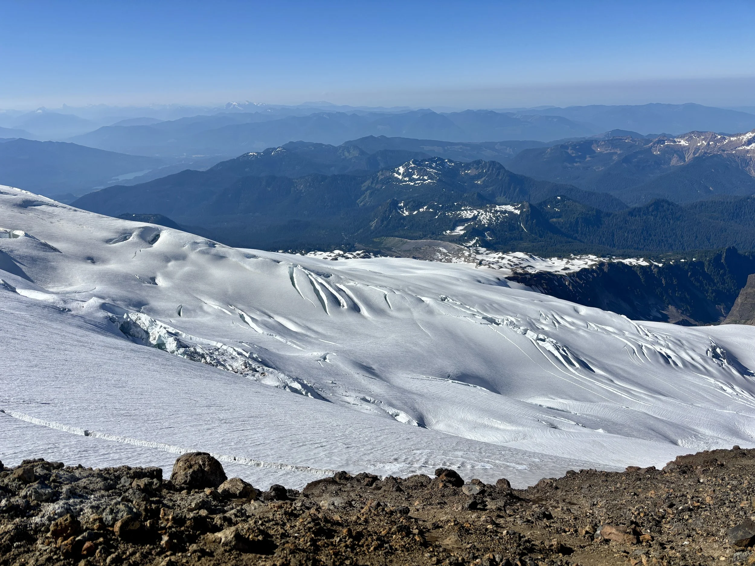
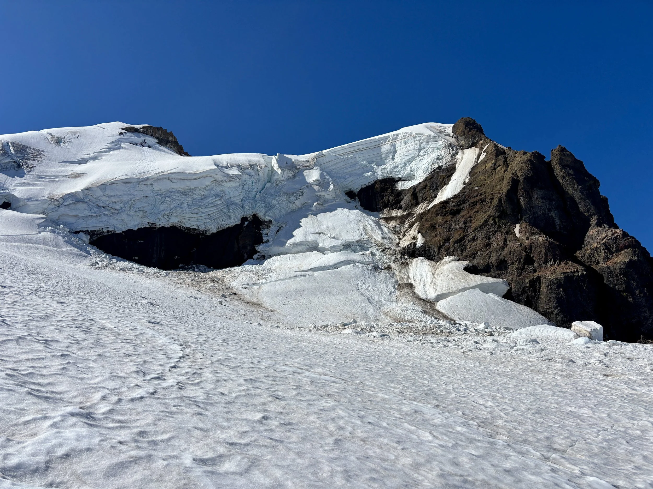
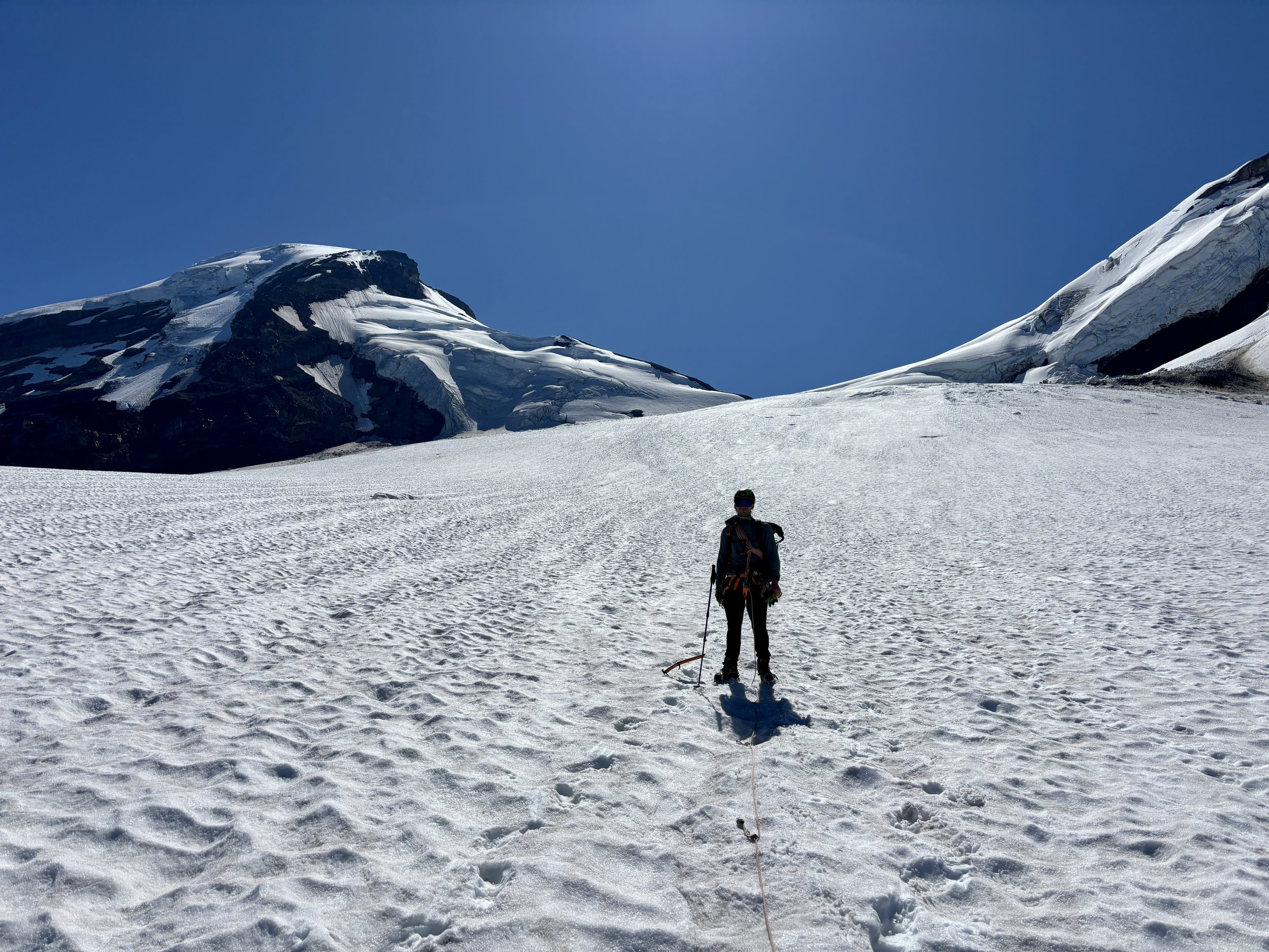
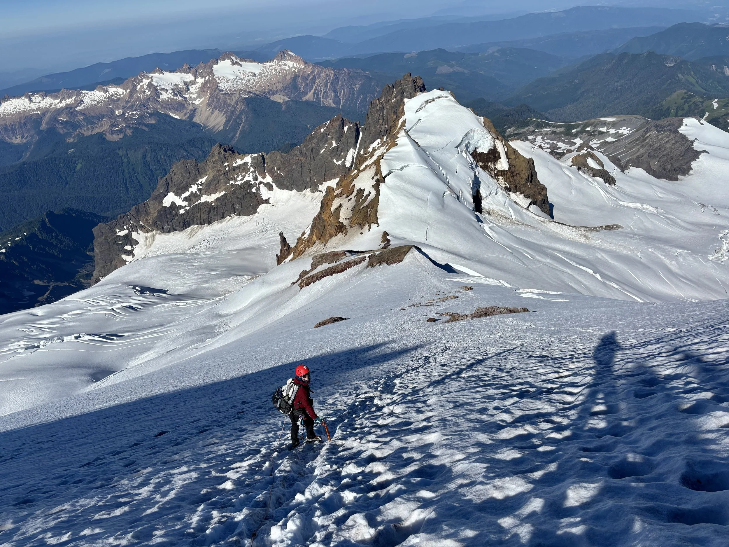
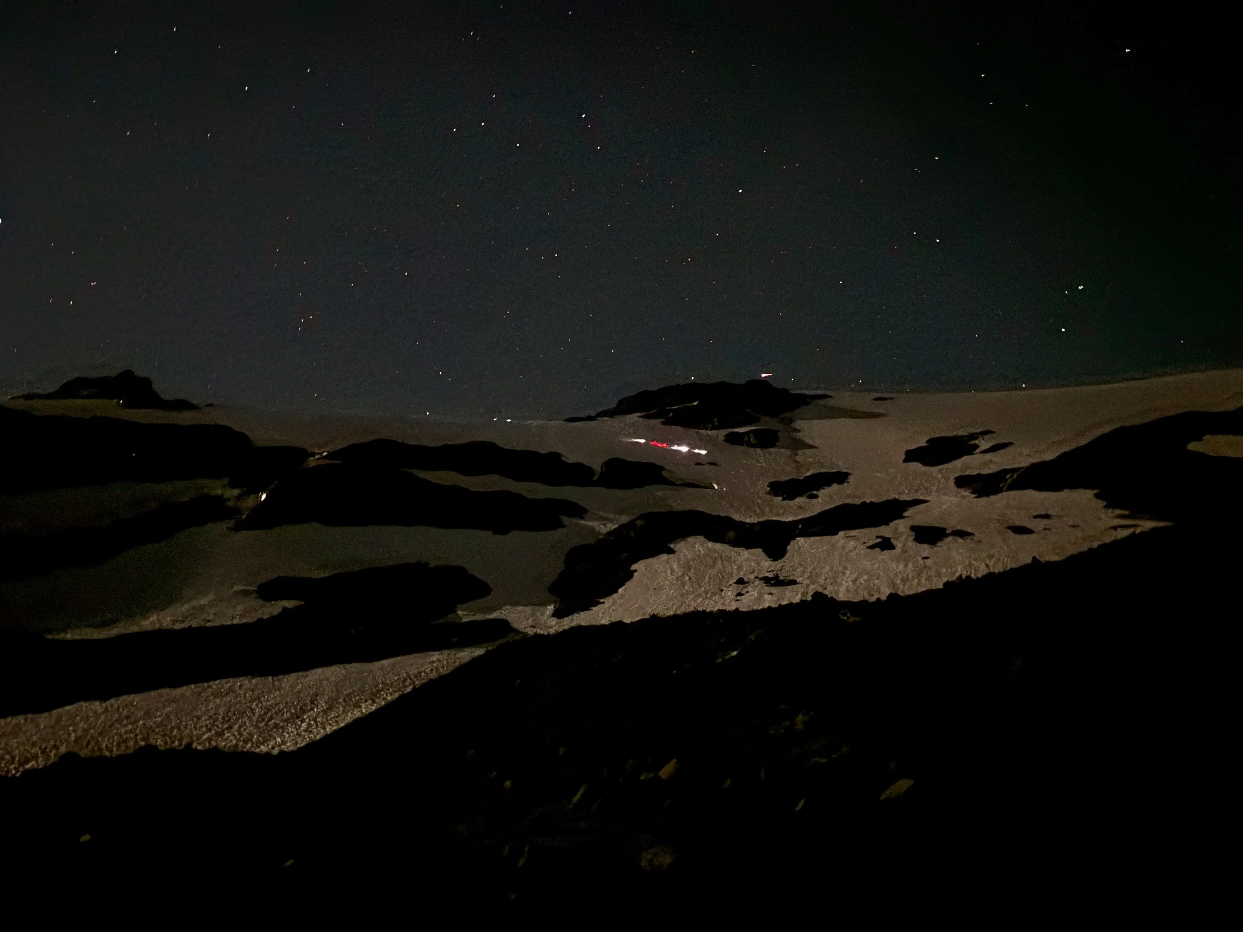
I set my alarm for 2:15 am. When we woke up, we saw a trail of headlamps heading up the snow already. We forced ourselves to eat some breakfast and packed all of our gear that we’d need for the day. We were up on the snow moving by 3:45 am with other groups also starting at the same time. The slow climb began. Because of the weather being so warm in the days leading up to our summit day, the snow was quite slushy in the beginning which made it more effort to walk. I was hopeful conditions would firm up as we ascended and make walking easier. Thankfully this did happen. For much of the ascent, there was a path in the snow that could be followed or at least loosely followed as sometimes it did disappear. We did not encounter any real issues navigating crevasses as it seemed like snow coverage was still pretty decent in mid-July.
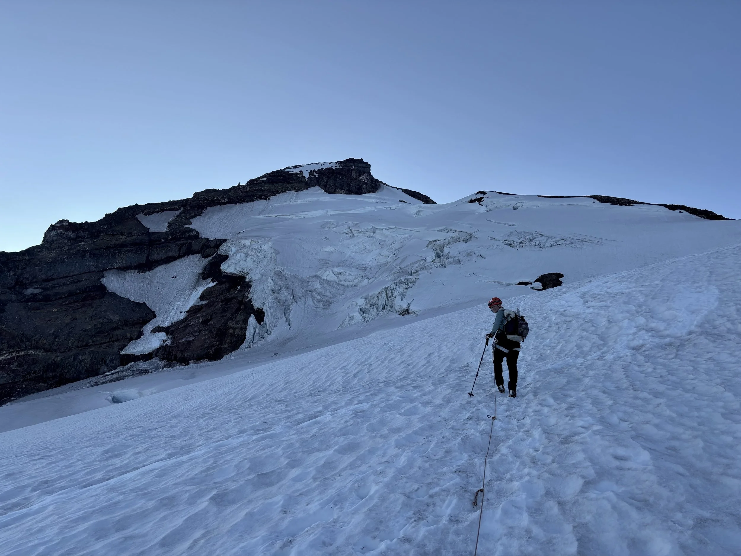
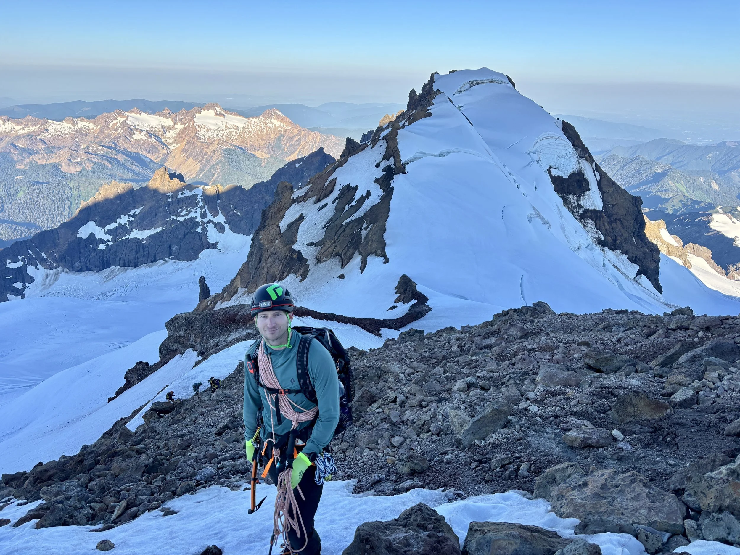
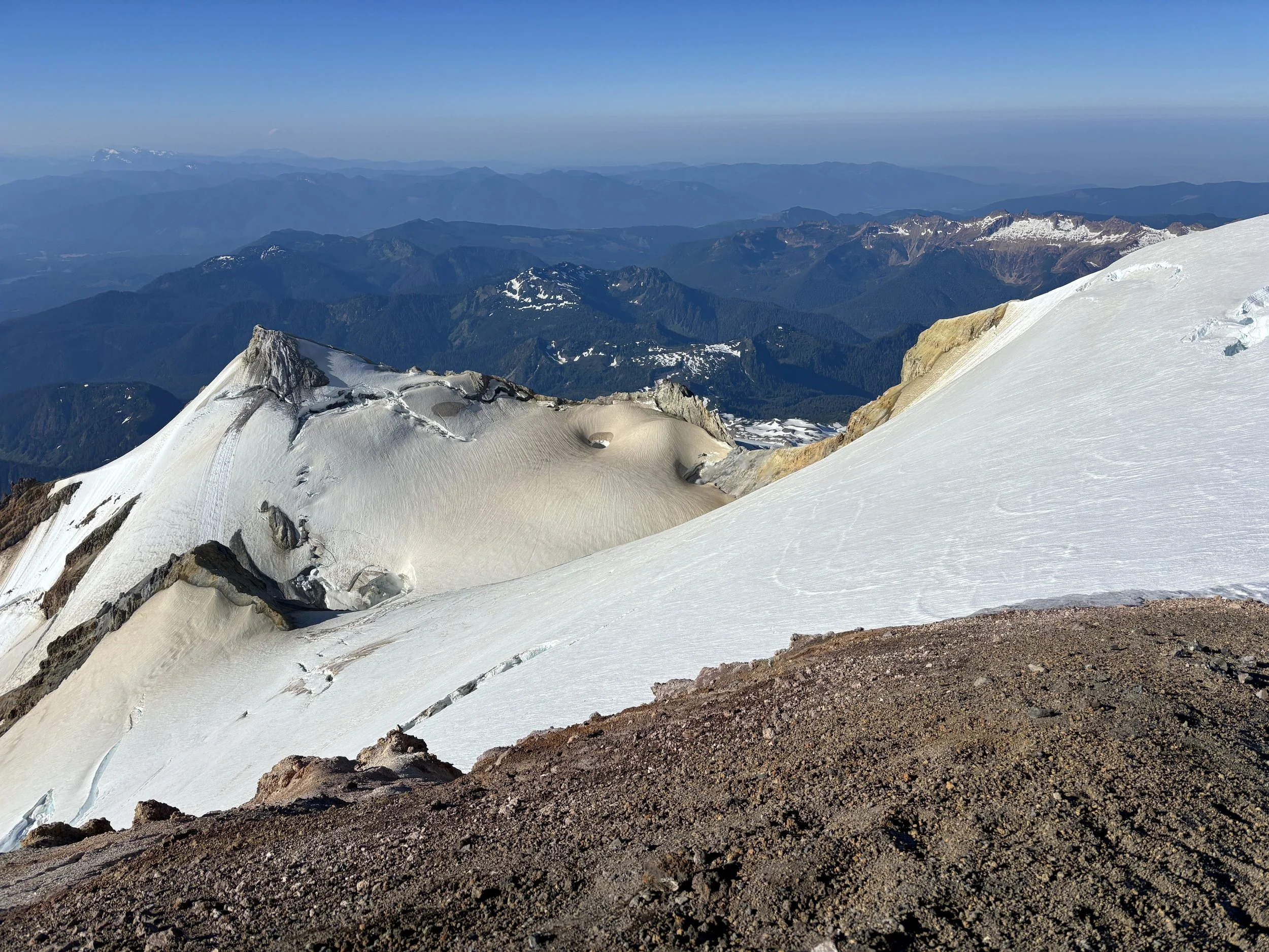
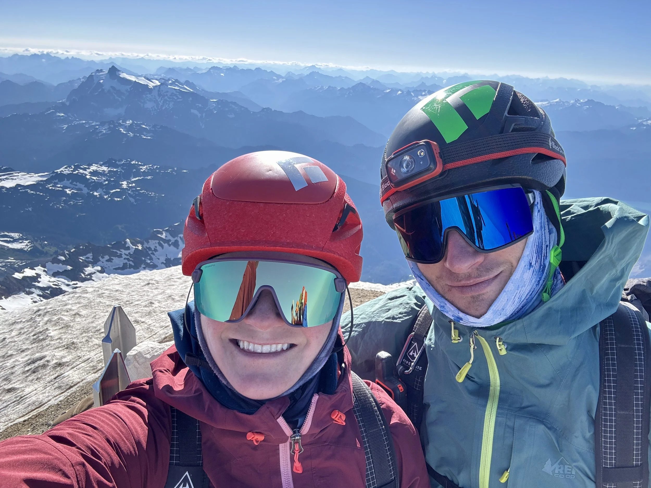
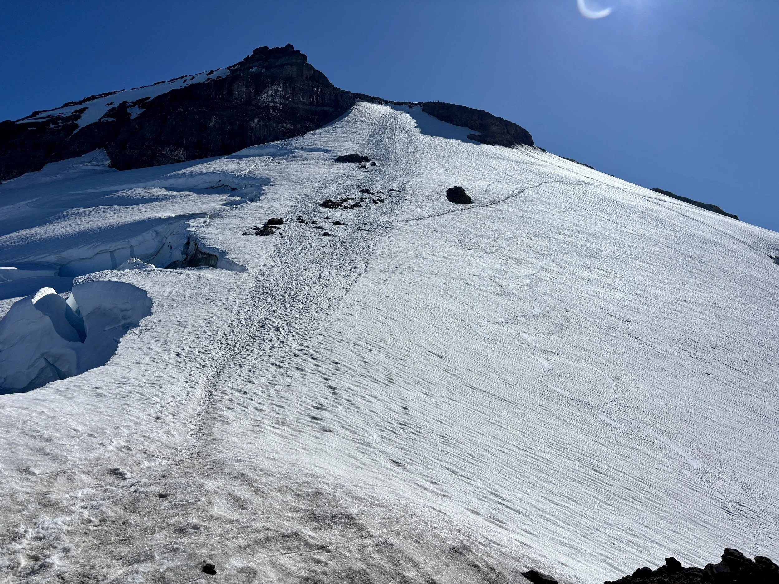
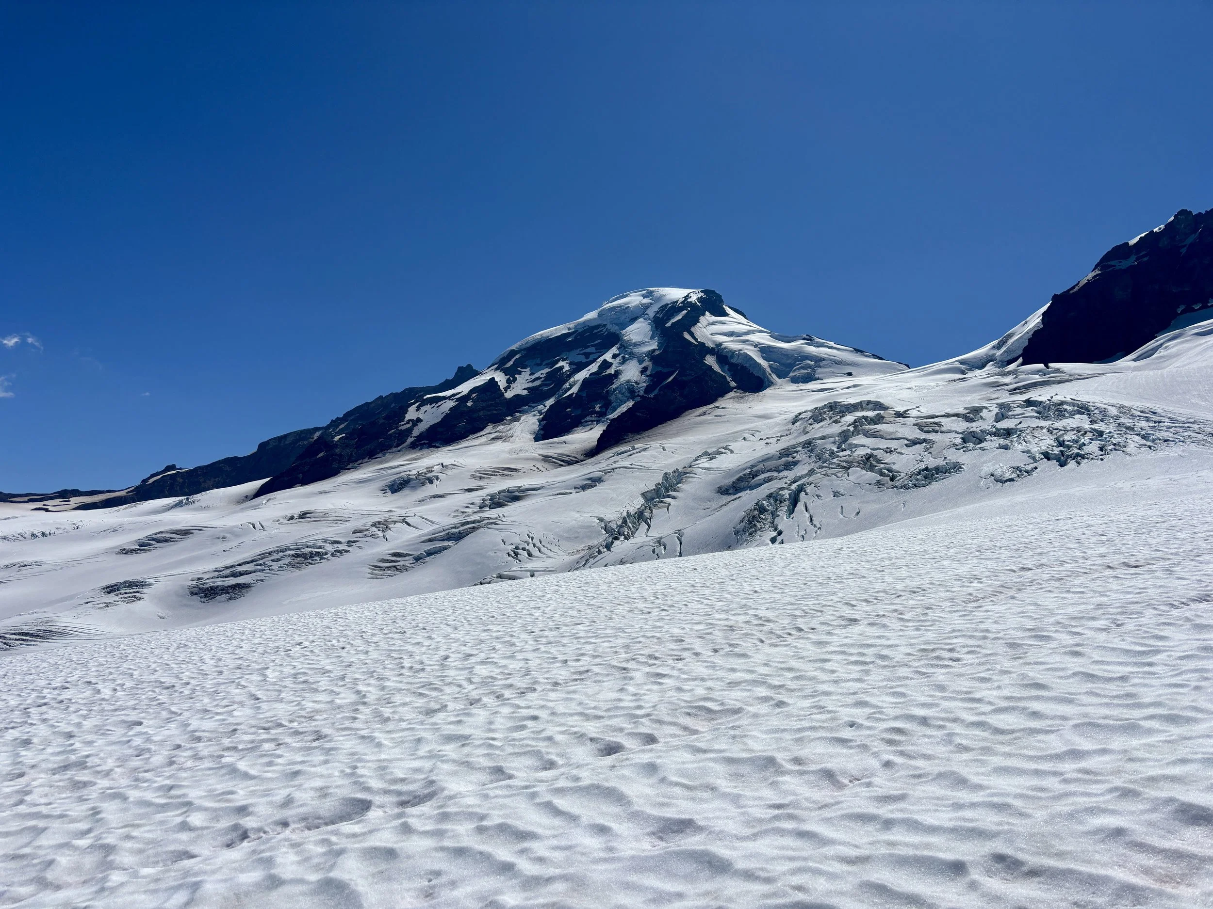
As we approached the ridge leading up to the Roman Wall, the terrain got steeper. Unlucky for us, this is when we caught the guided groups that headed out before us, and we found ourselves behind 3 guided groups in an area that was not the friendliest for passing. This slowed our pace for a bit, but once we gained the ridge, we were able to pass them. The ridge involved some dirt/rock walking and then we found ourselves on the last pitch, called the Roman Wall, before the flat summit of the mountain. The temperature also dramatically dropped in this area and the wind really picked up. We added a few layers and put on warmer gloves and continued up the last steep slope. Towards the top, we had to traverse some mixed rock/ice/snow for 10 ft and then found ourselves on a very gradual snow slope. We walked across this slope to the true summit where we found two separate, large groups of ~10 people each. They both seemed to be classes. The views from the summit were great, although they were a little bit hazy as it seemed there was some smoke that had blown in overnight. We were looking right at Mount Shuksan, a peak we had climbed the previous summer. Regardless, we were all smiles as we were on the summit without a cloud in sight and felt like we had done a good job at navigating our way there. After a break and some pictures, we headed back down the exact same way we came up.
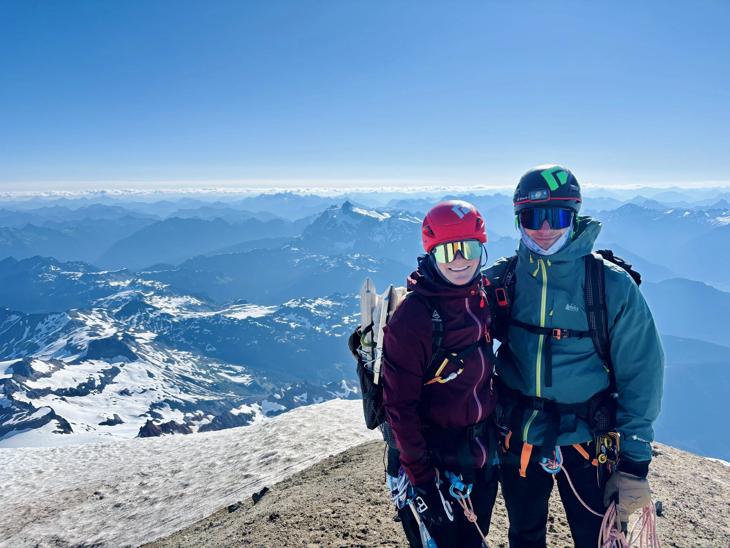
Summit!
On our descent, we found two of the guided groups navigating their way up the short rock/ice/snow traverse, which delayed us a bit again as their guides were putting the guests on belay to get through this section. Once we had a window, we scrambled back down this spot and began the steep descent. My knees quickly reminded me that they preferred skiing down steep snow faces instead of walking. 4,700 feet of elevation loss later, and we were back at our campsite. It took us 7 hours and 15 minutes to go from camp to summit back to camp, including all breaks and time waiting for the guided groups. Both my knees and Mike’s knees were ready for a quick break. We took a lunch break, filtered some water and rehydrated, and packed up camp. We then continued on the trail back to the car. After another 2.9 miles and 2200 ft of elevation loss, we were back at the car. I normally don’t enjoy sitting in the car, but after having descended nearly 7000 ft in 6 miles, I was quite happy to have a bit of a car ride to just sit and rest.
Overall, this is a trip I’ll remember for the rest of my life. The views of the mountain, the flowers, the waterfalls, the glaciers, and the overall experience made for a memorable outing.
Total stats: 12.1 miles, 6900 ft of elevation gain.
Day 1 stats from trailhead to Hogsback camp: 2.9 miles, 2200 ft of elevation gain.
Day 2 stats from camp to summit back to camp: 6.3 miles, 4700 ft of elevation gain.