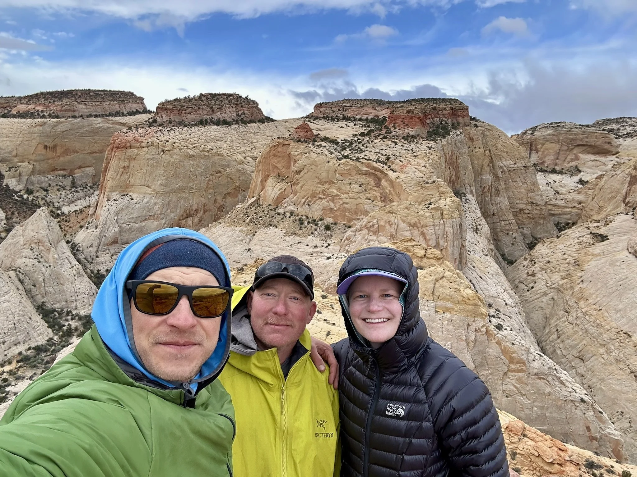
Beehive Traverse Backpacking Trip, Capitol Reef National Park, Fruita, Utah
Up until this trip, I hadn’t spent any time in Capitol Reef National Park. I had seen a trip report for a cool looking backpacking trip through a mostly off-trail section of the park that looked beautiful. It was called the Beehive Traverse. It seemed like it’d provide the solitude I typically look for on backpacking trips, which can sometimes be hard to find in National Parks. Thankfully, getting a backpacking permit at Capitol Reef is quite easy and you can just get one at the Ranger’s station on the day you plan to start your trip.
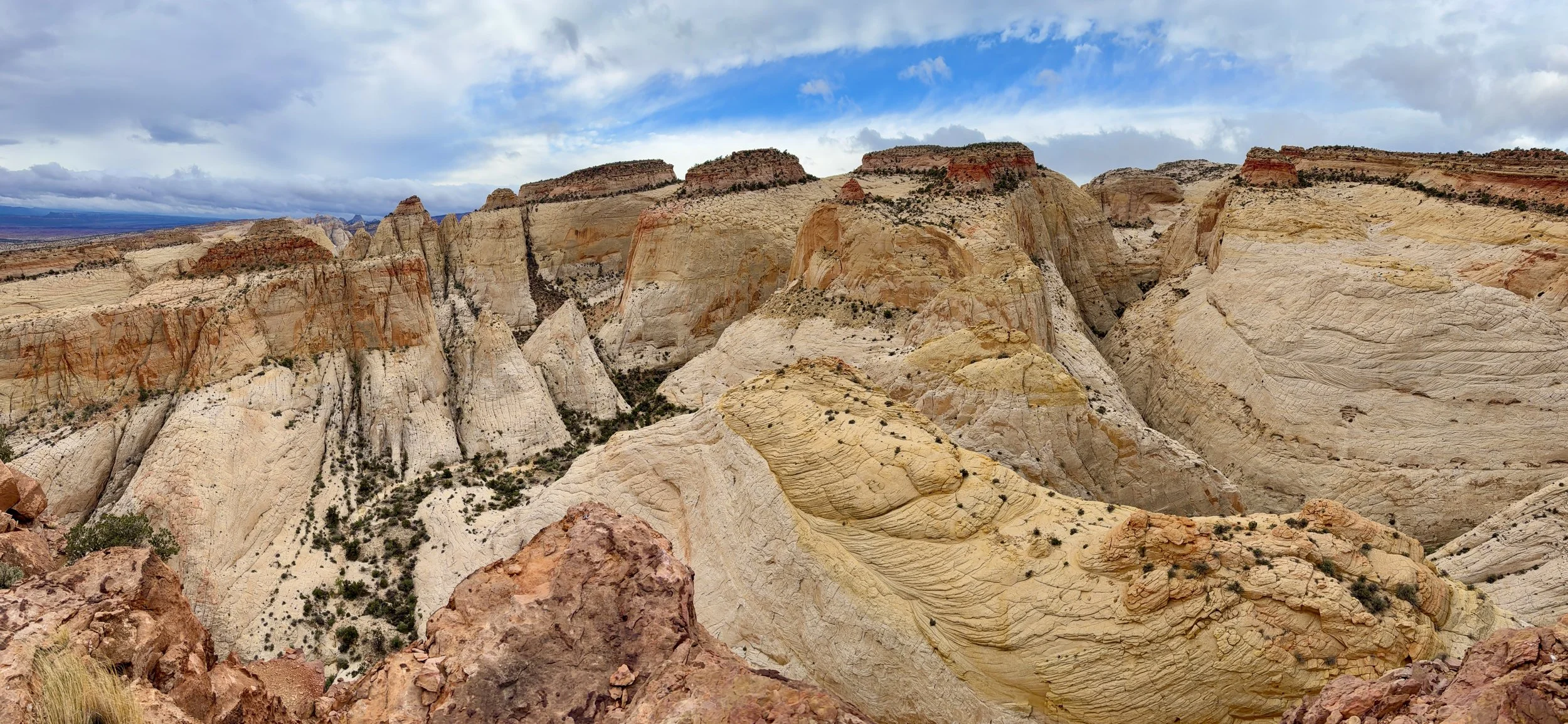
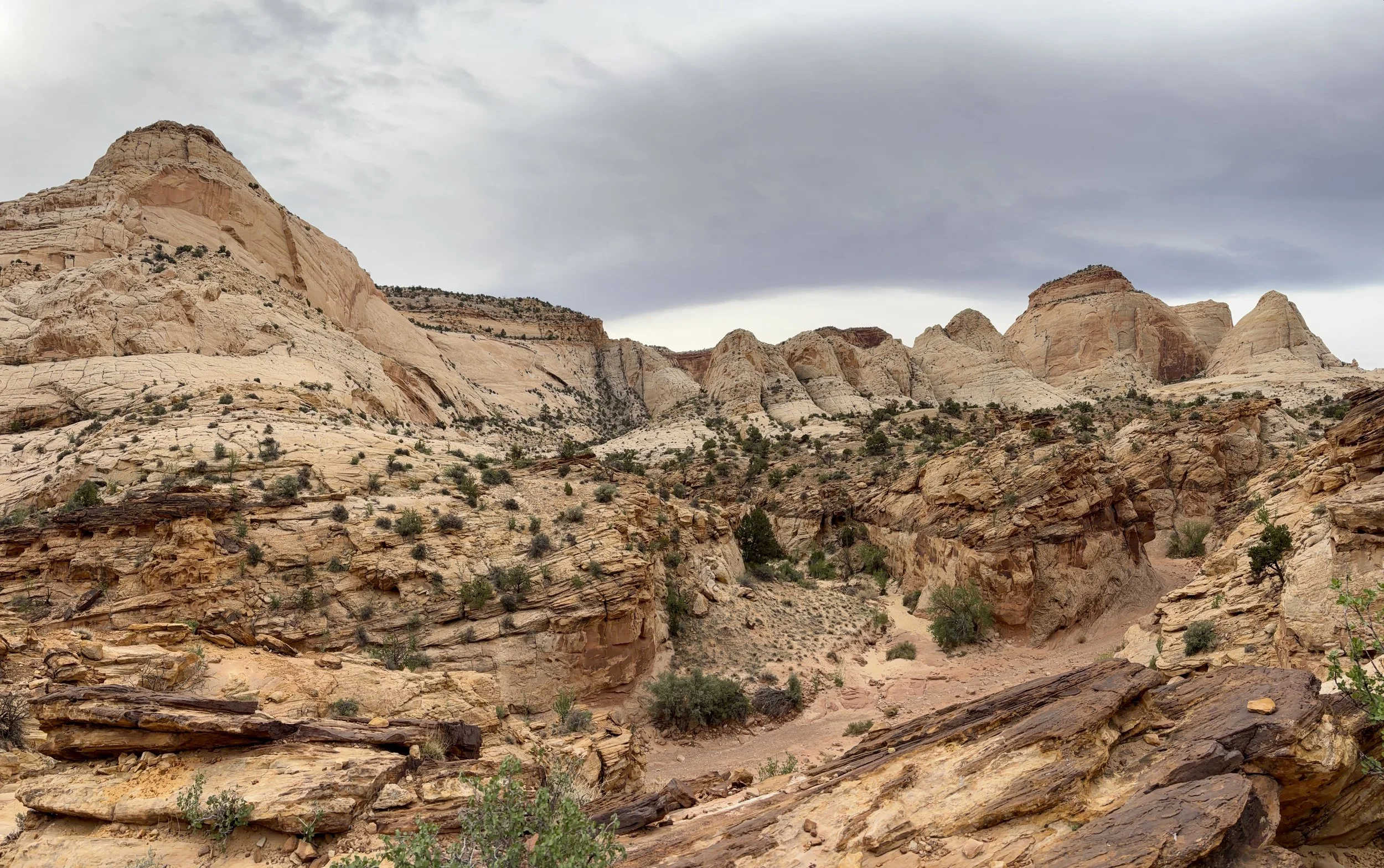
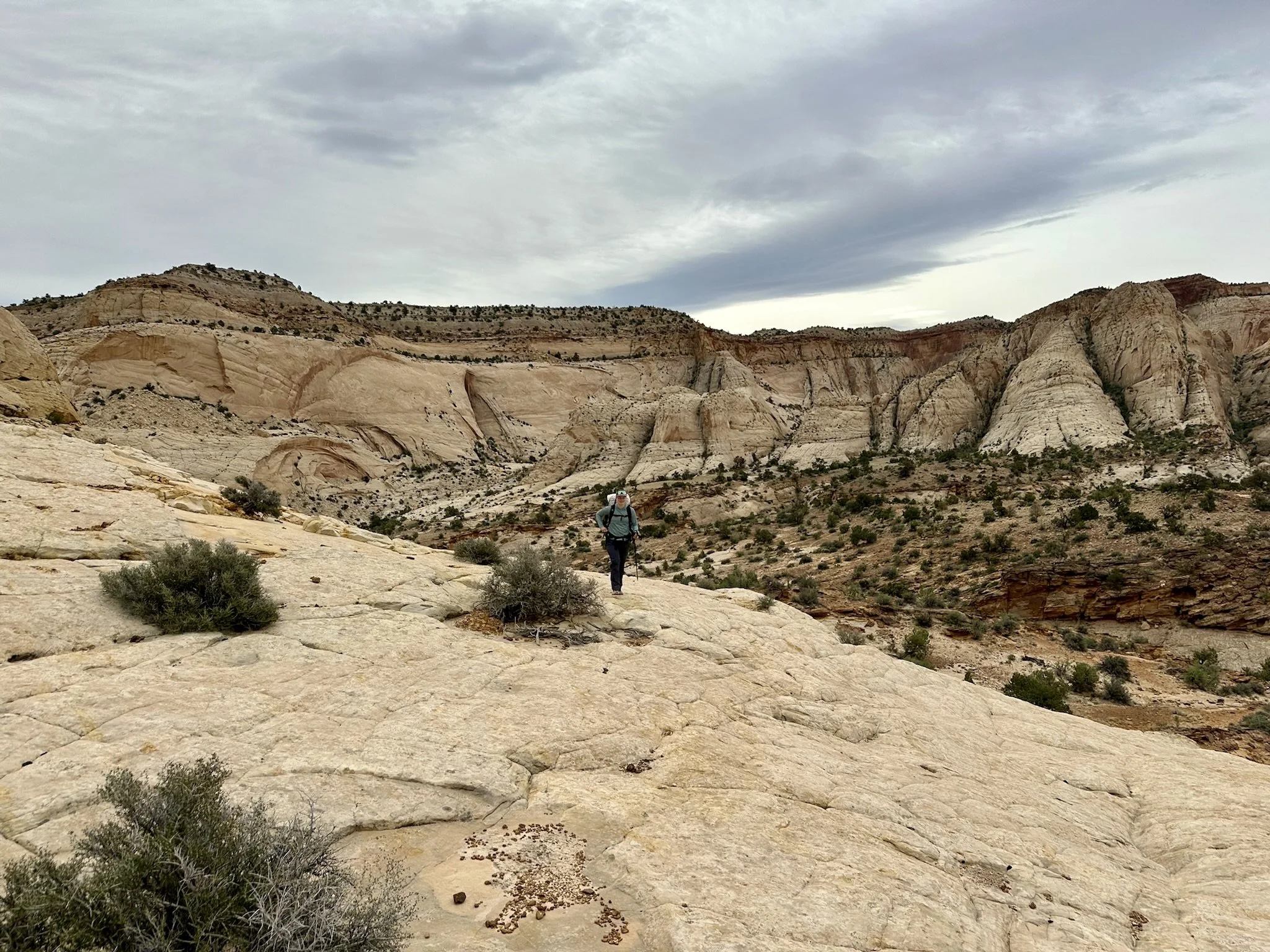
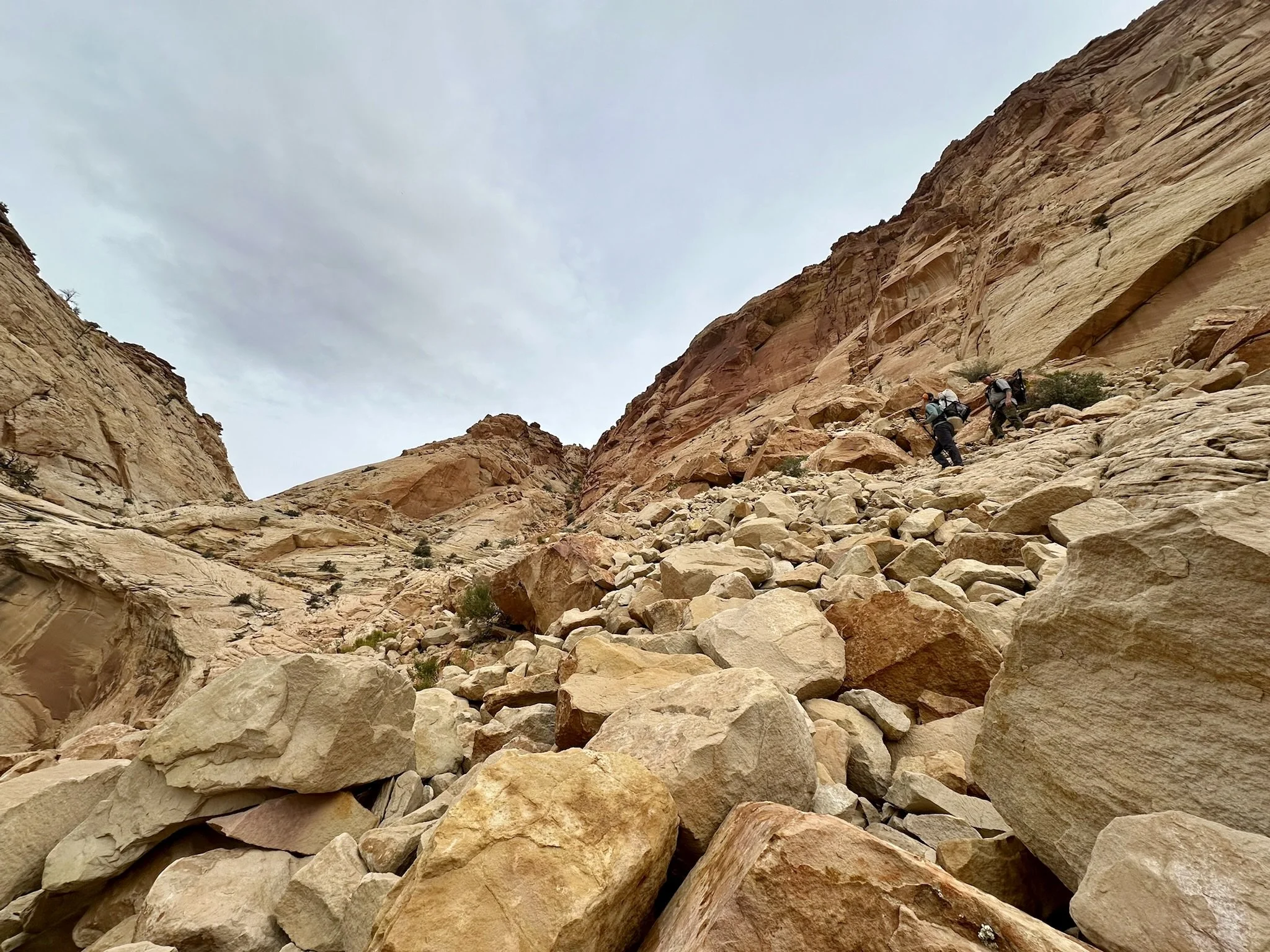
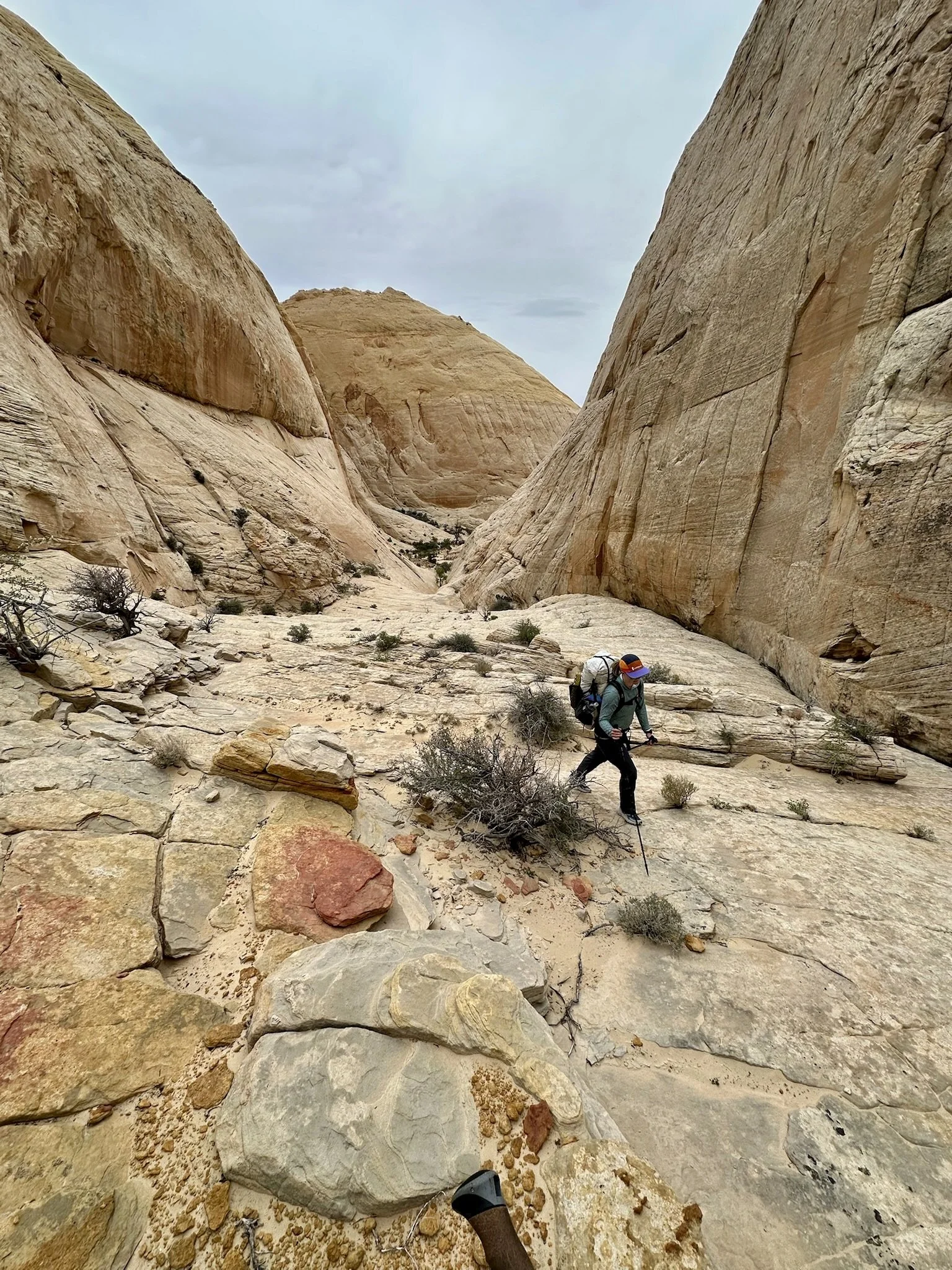
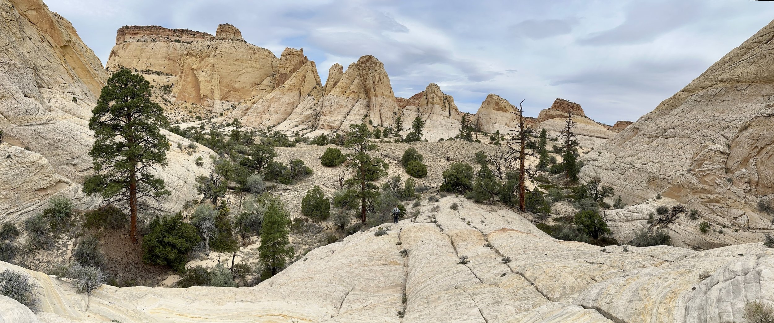
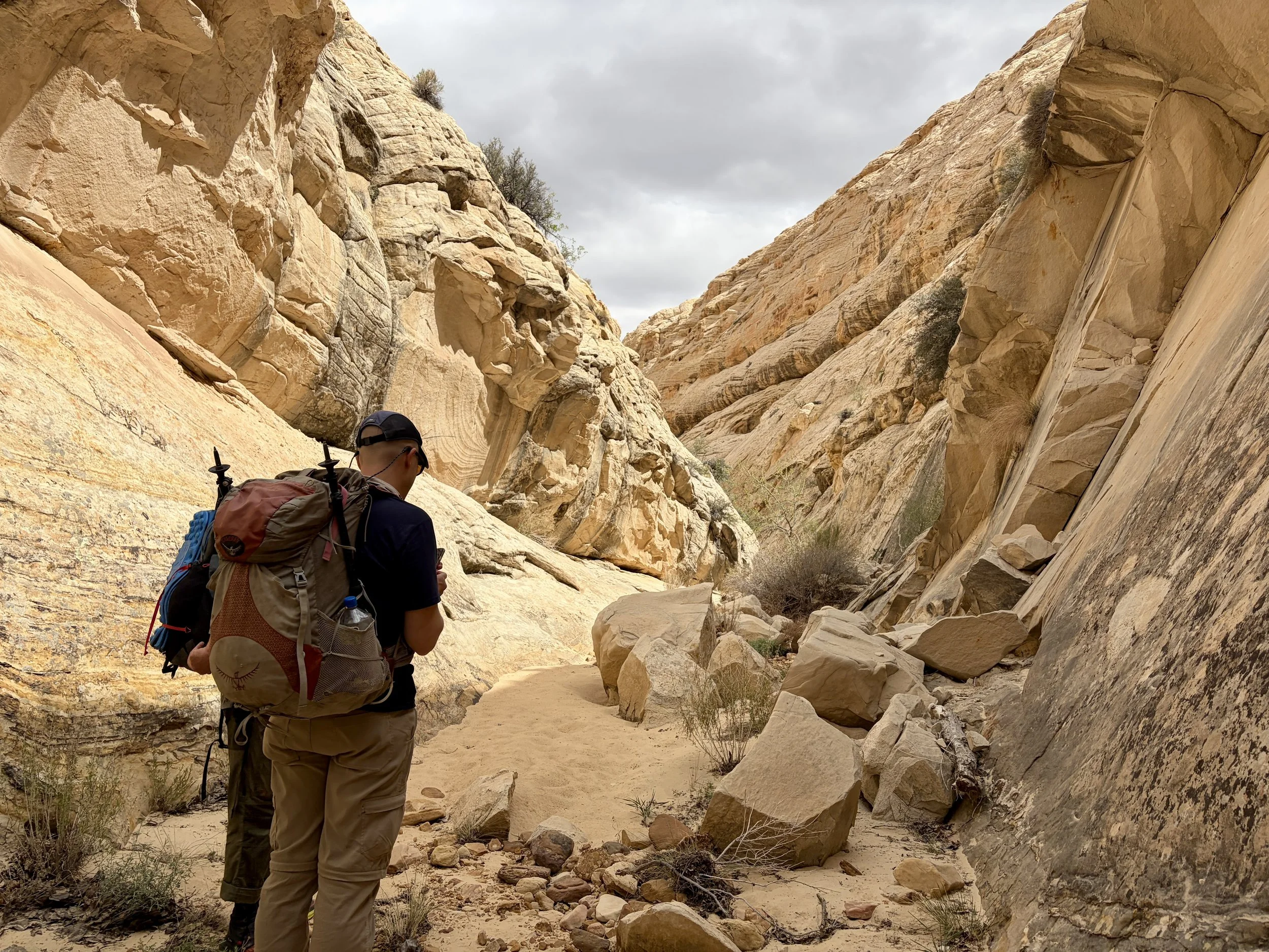
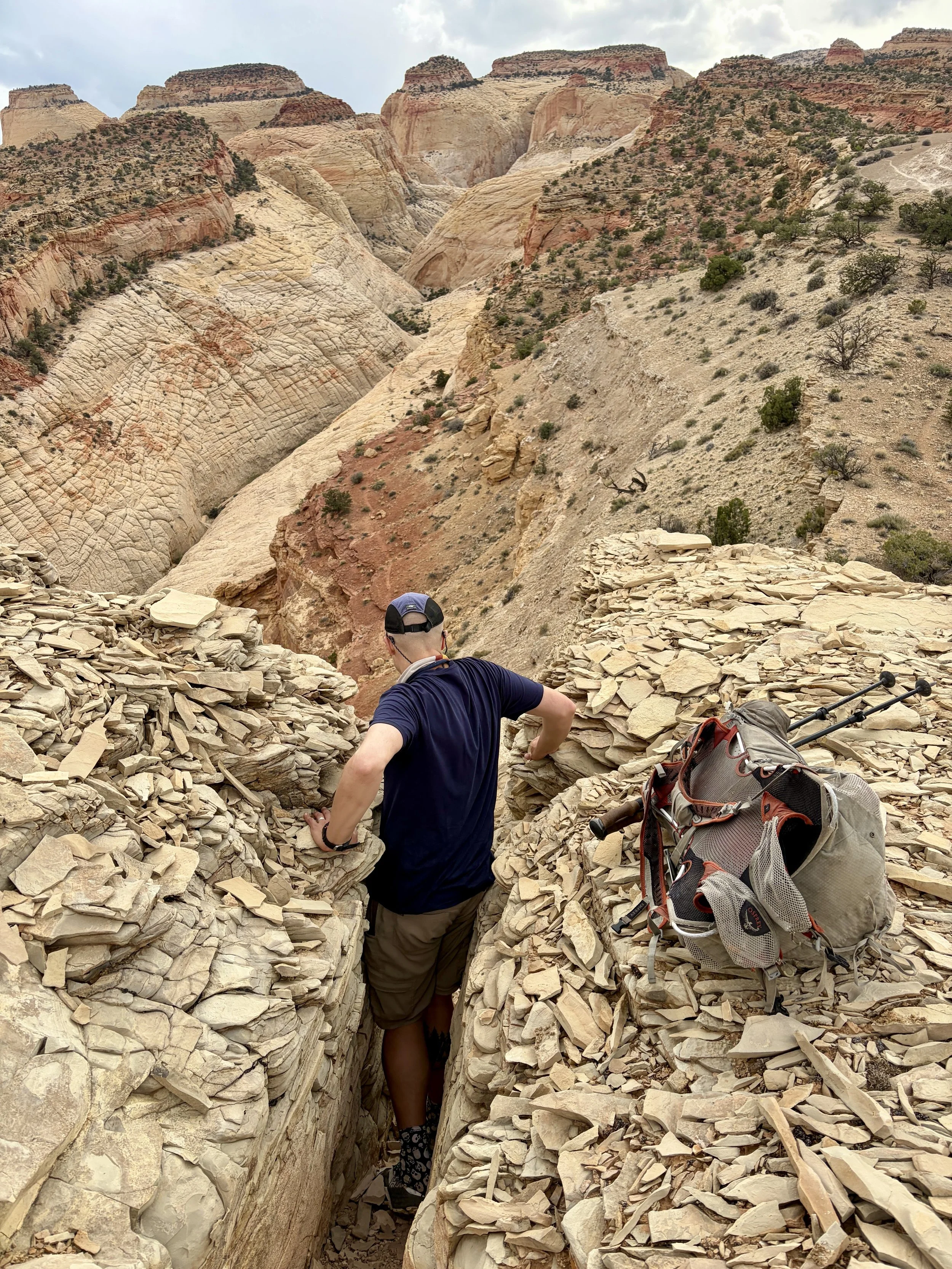
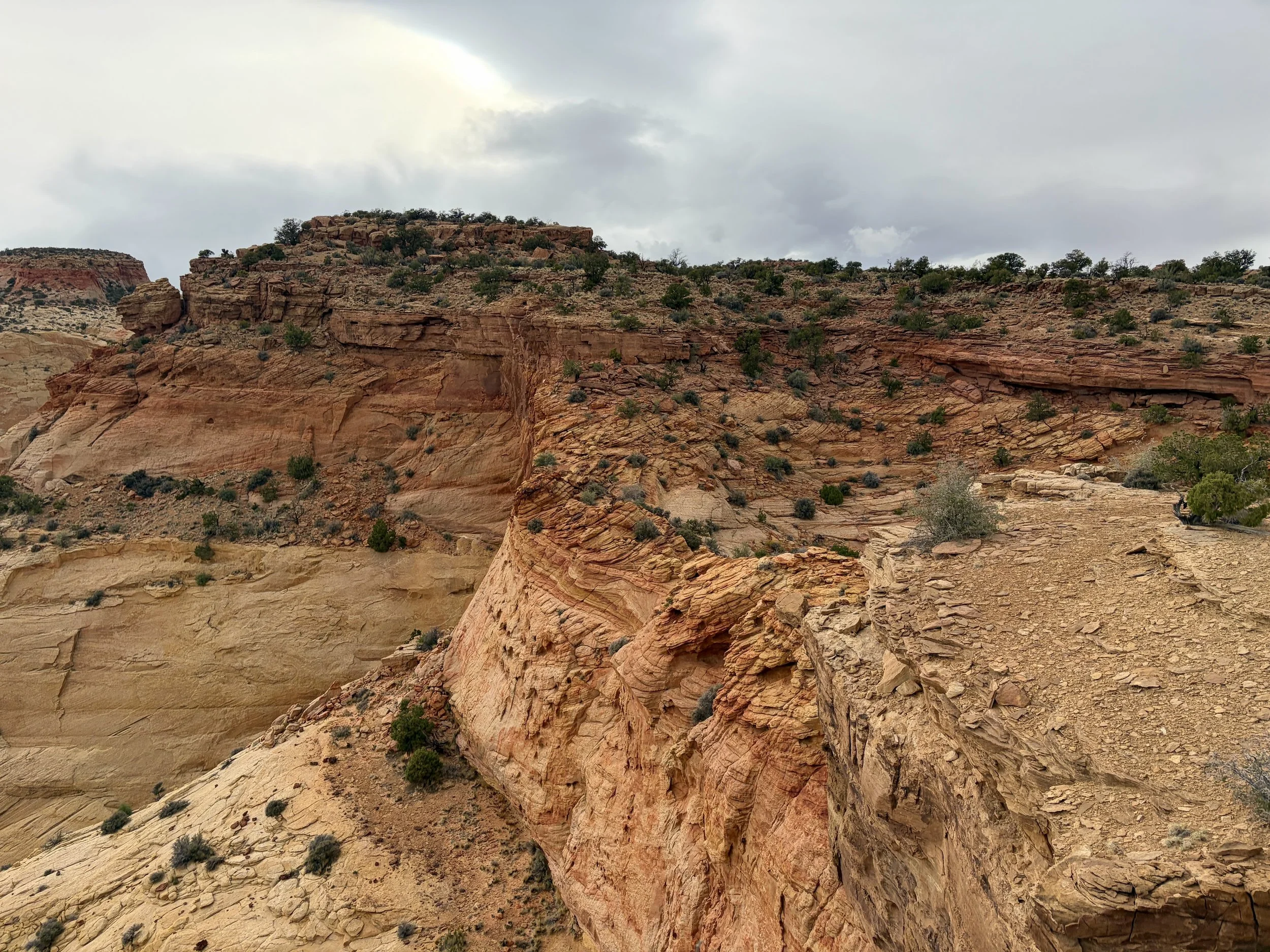
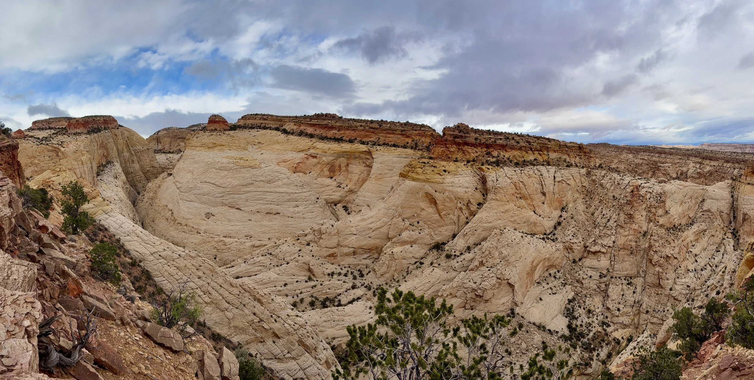
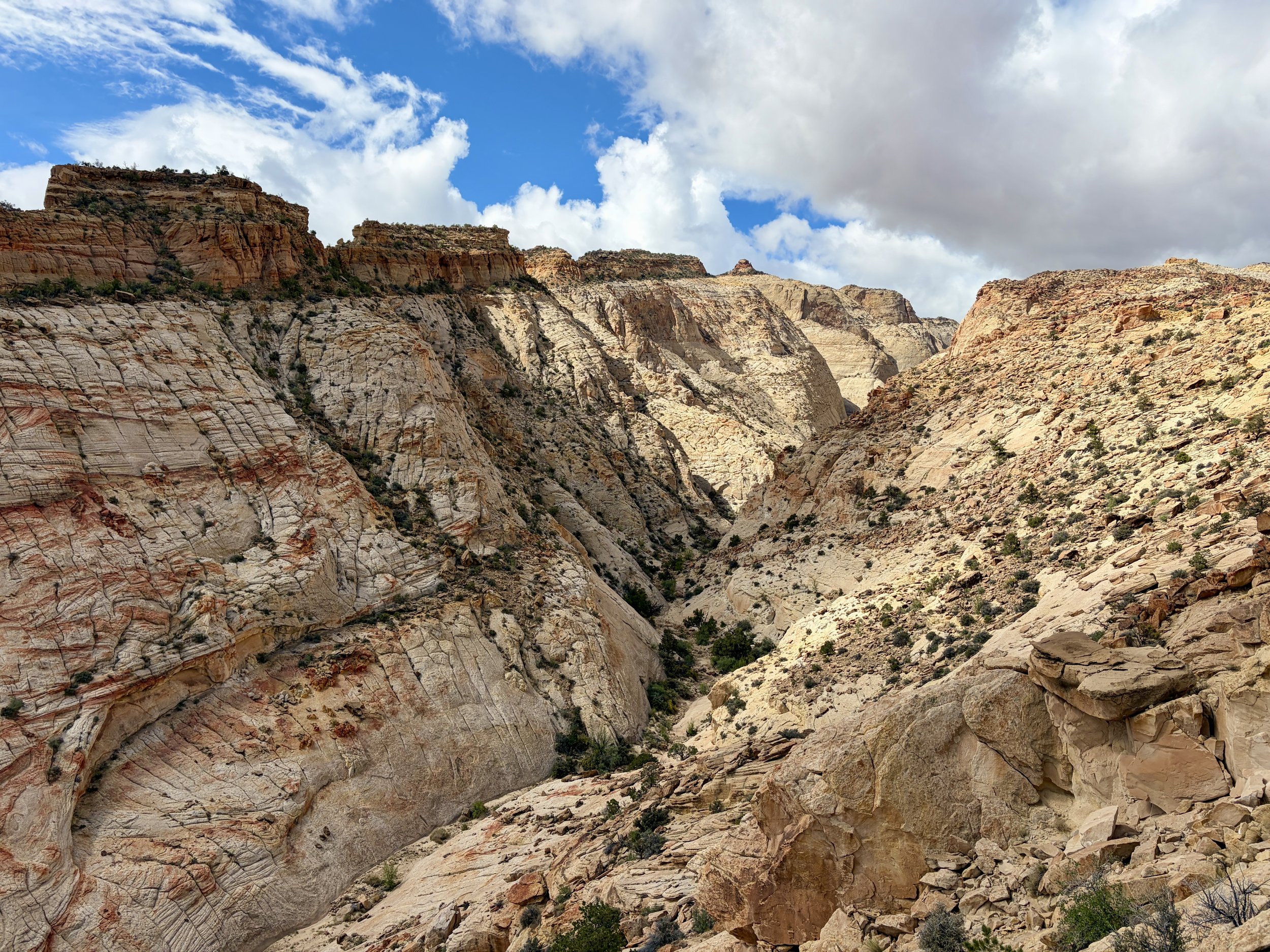
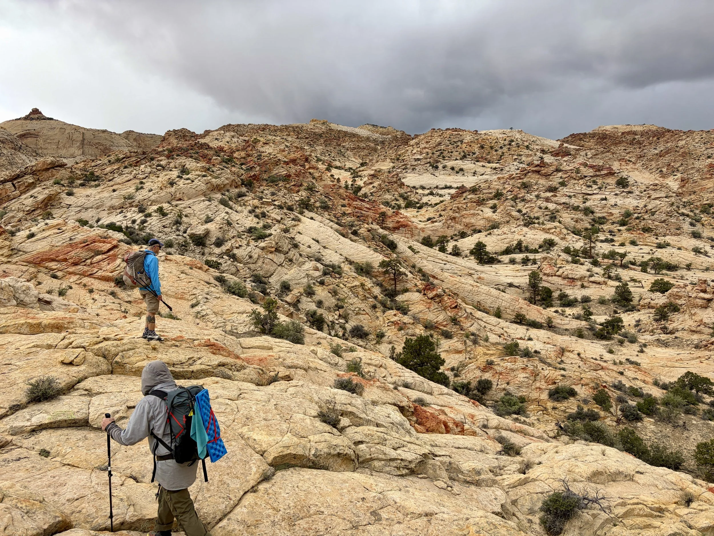
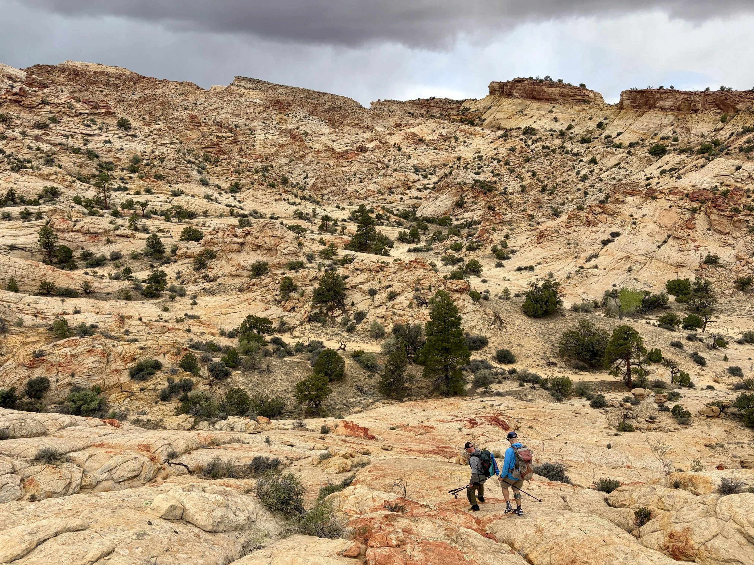
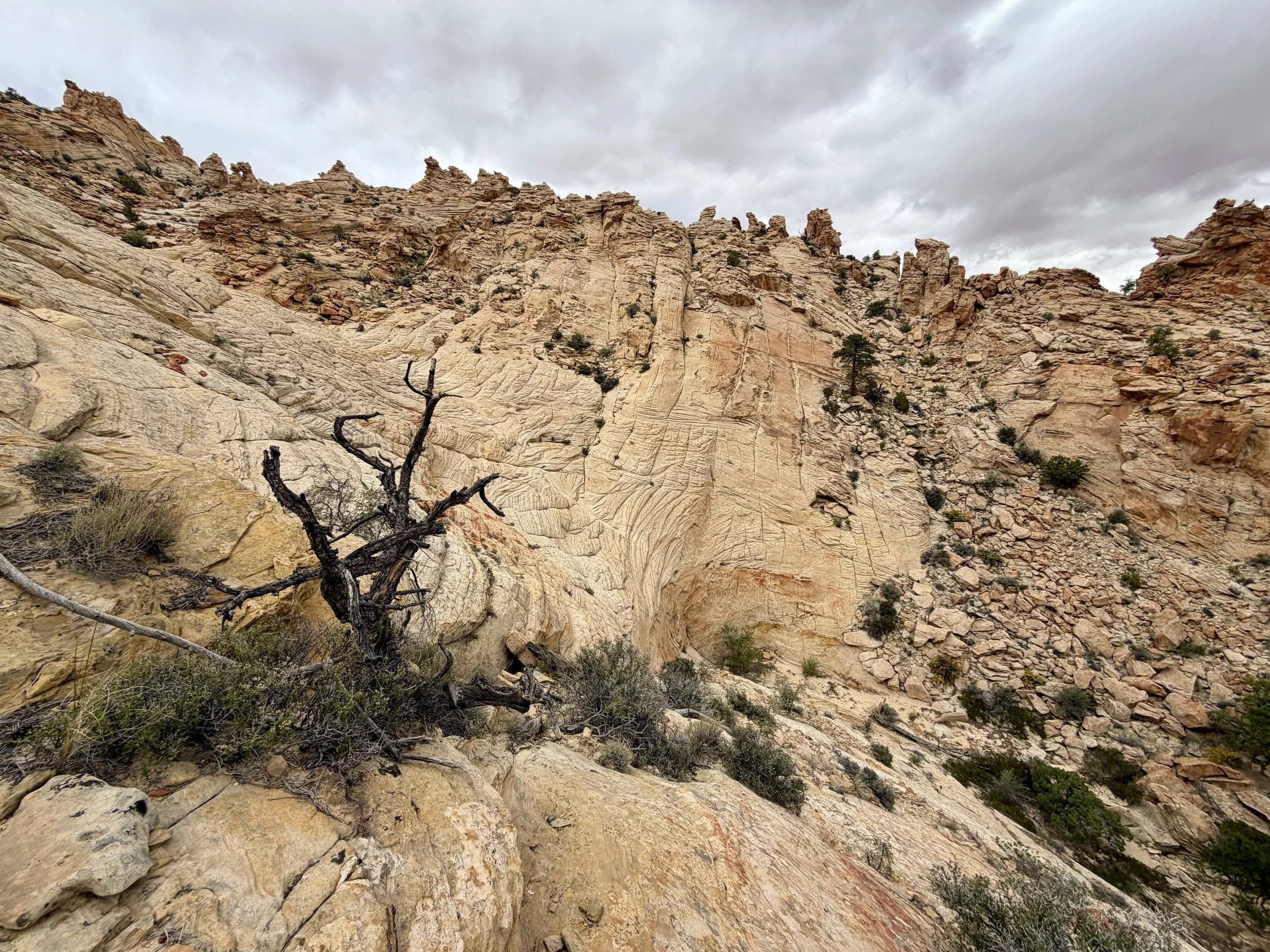
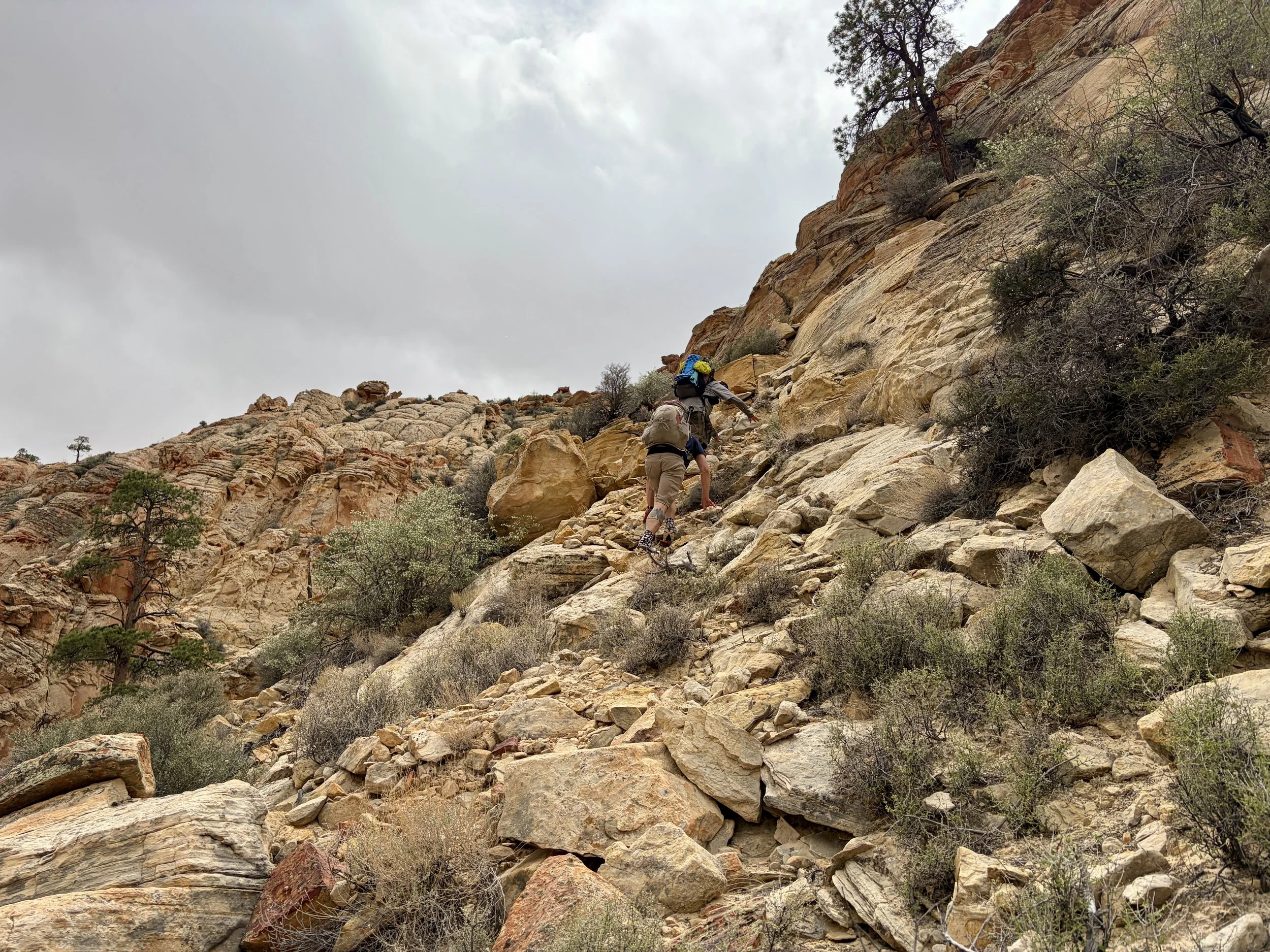
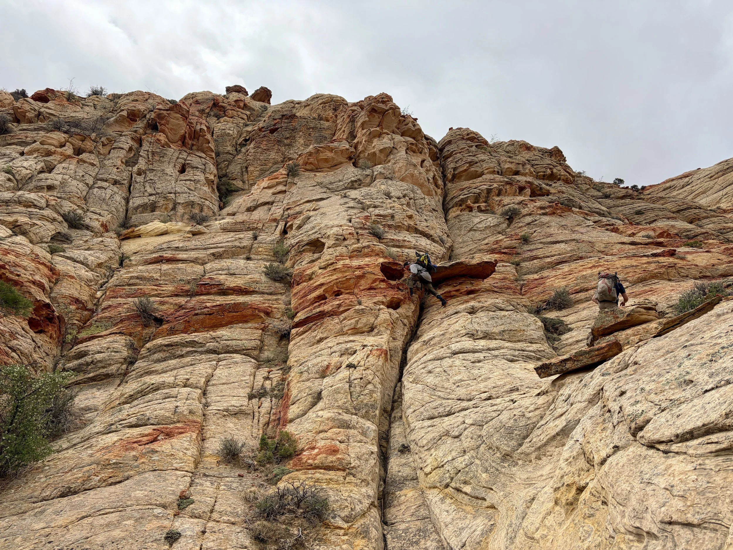
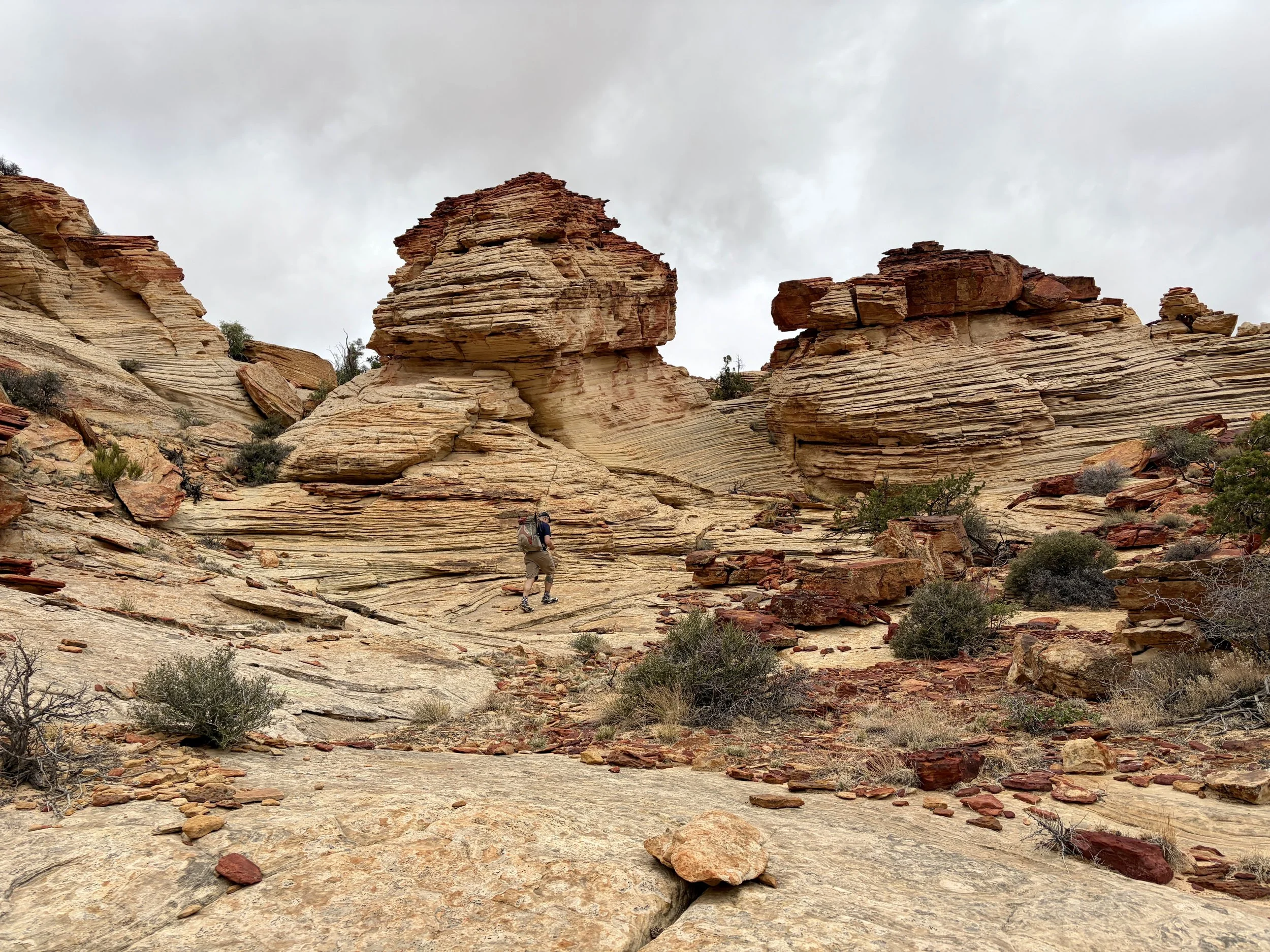
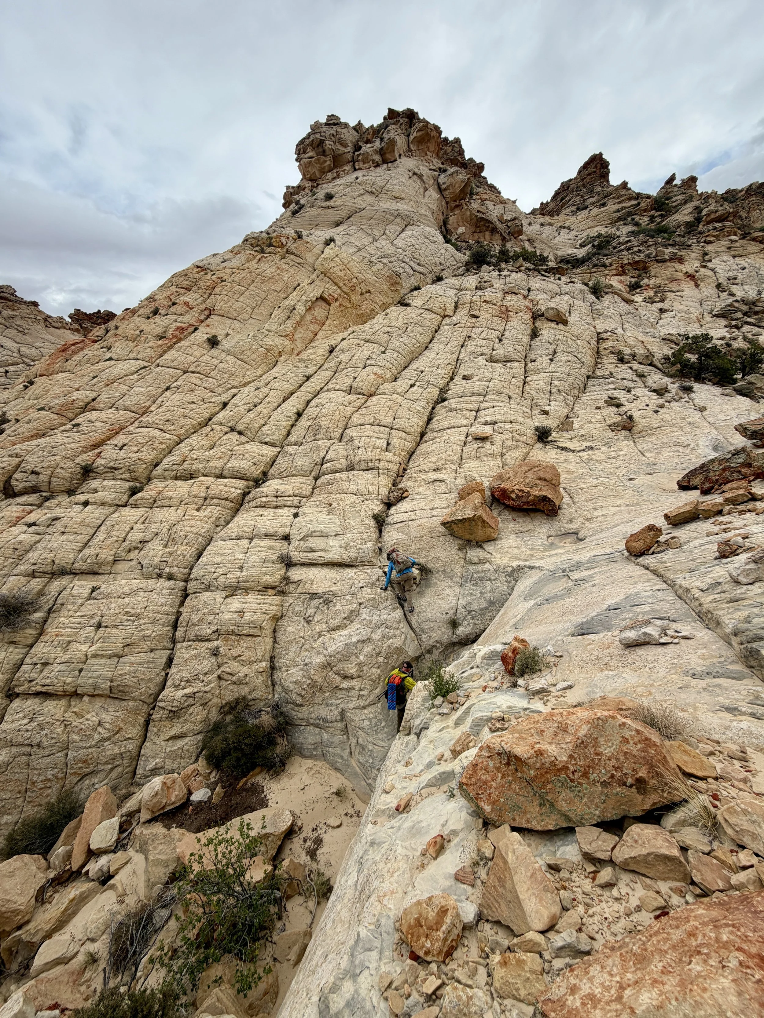
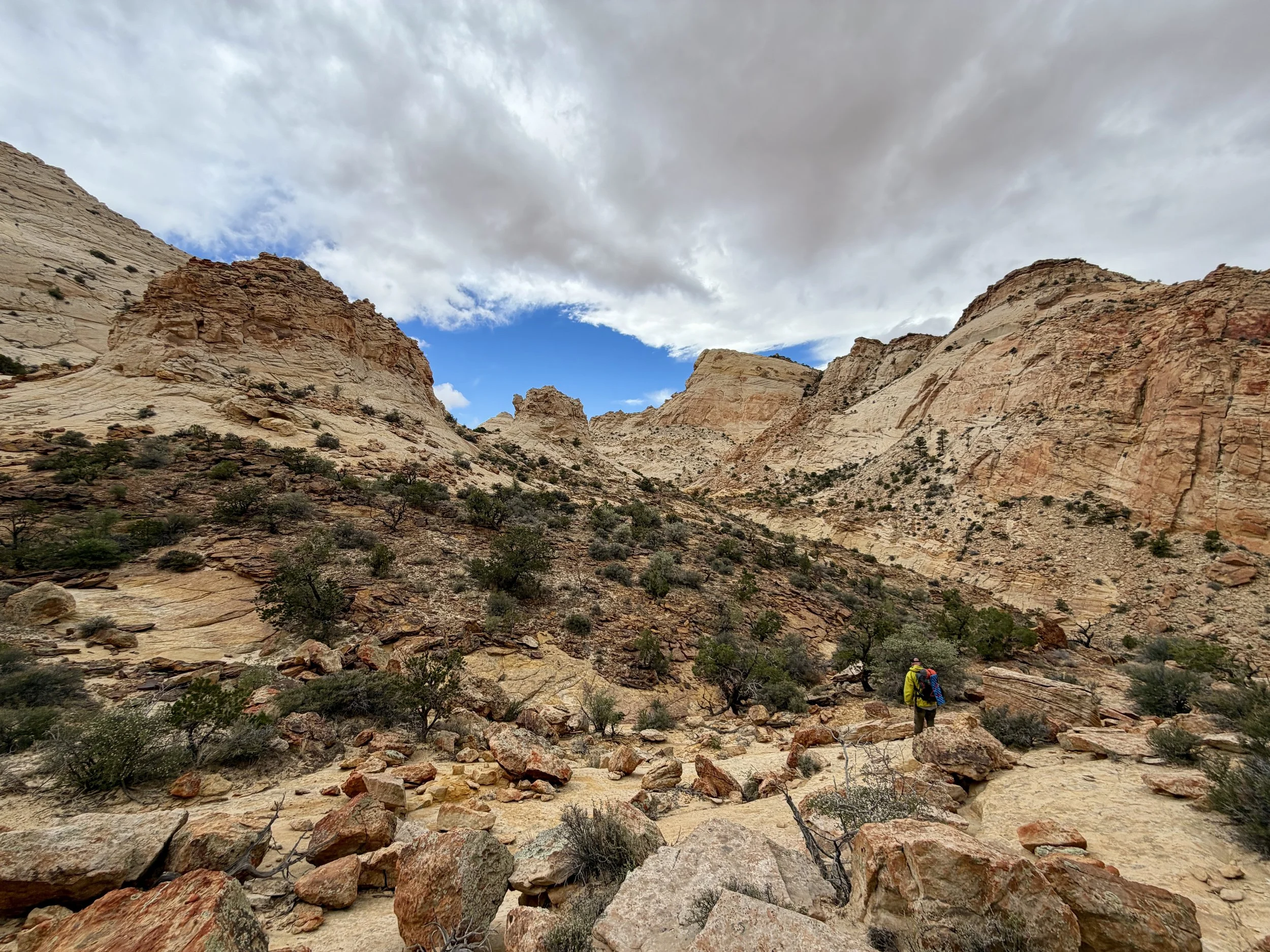
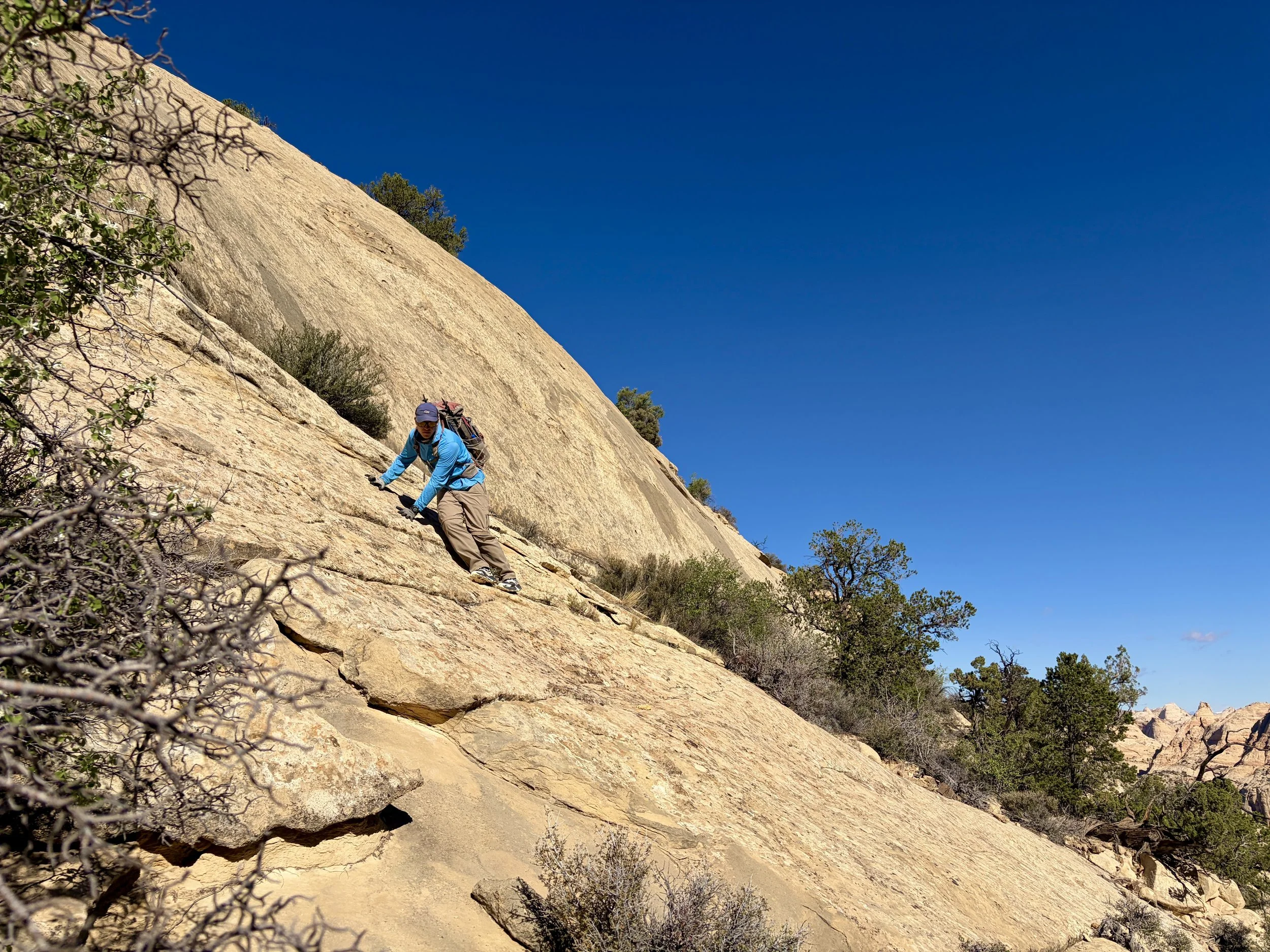
The Beehive Traverse is a ~20 mile mostly off-trail hike from Pleasant Creek to Grand Wash. Our total mileage was 23 miles, which included a few miles of hiking on trail after we finished the traverse. This route is only for the advanced backpacker with very strong off-trail navigational skills and one that’s comfortable scrambling through class 3 terrain with a heavy pack. Mileage is very slow, but the views are extremely rewarding.
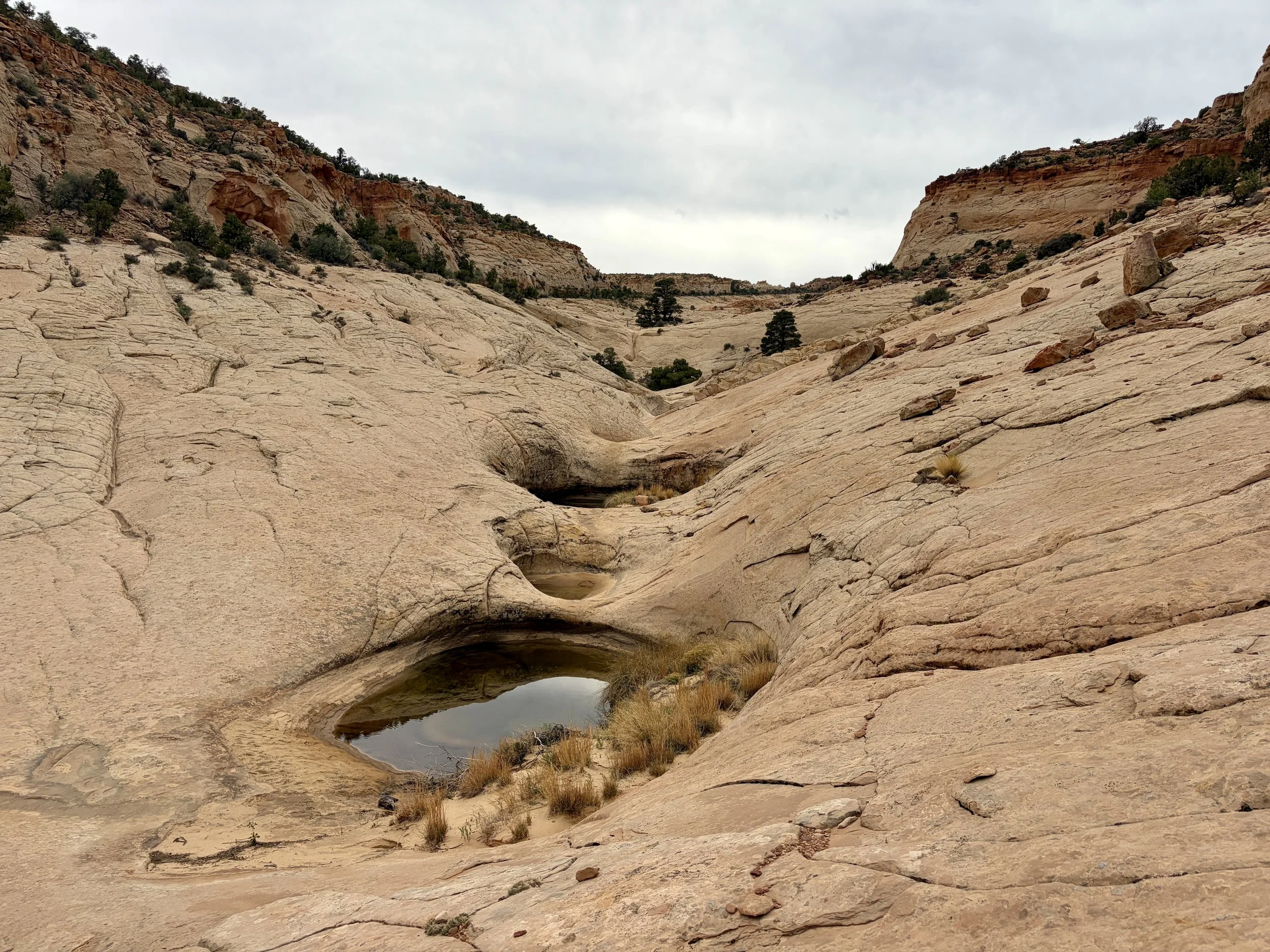
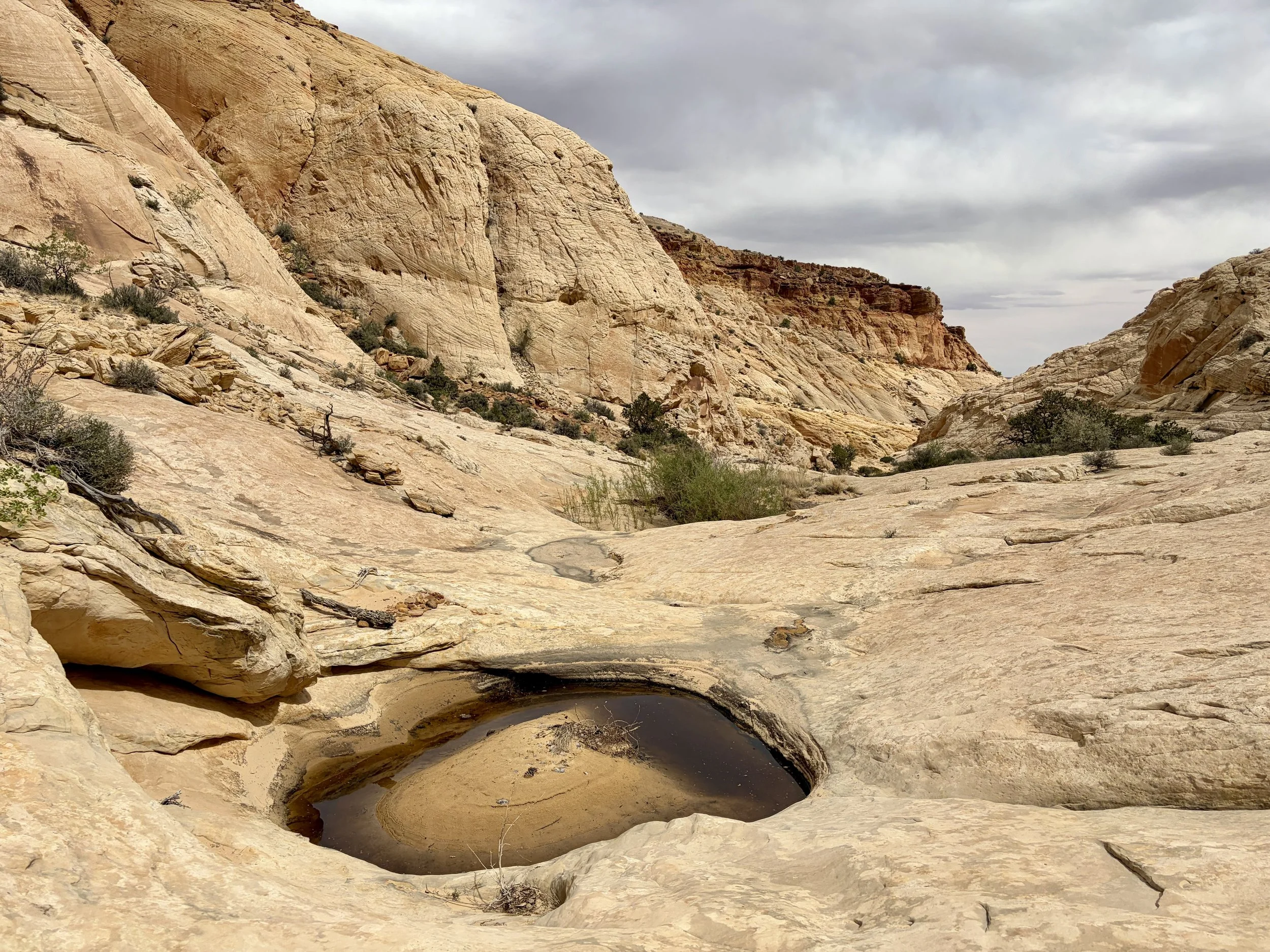
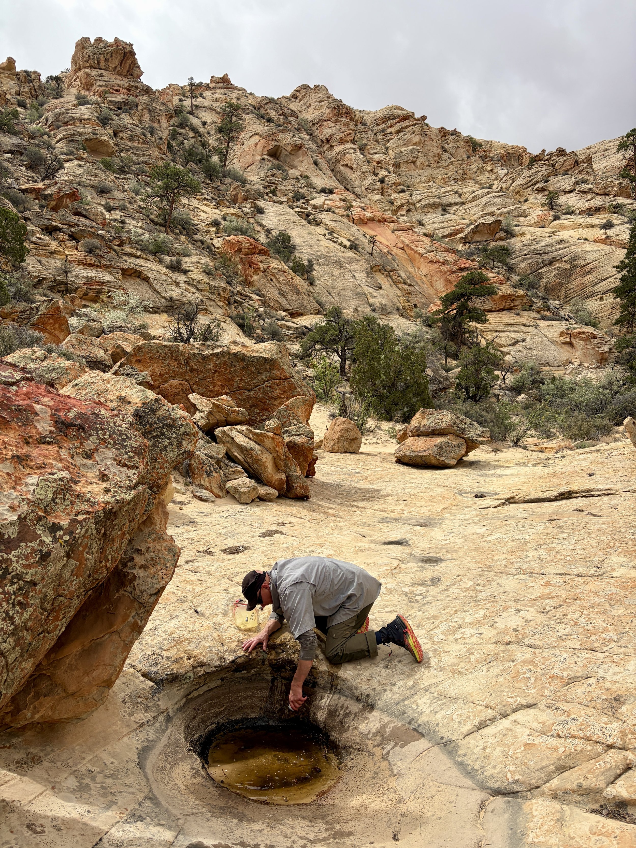
With an exceptionally dry winter, one of our biggest concerns about doing this traverse would be water availability. We had some information about where potholes had been full in the past, but there was no way of knowing what those would look like this year. We tried to get some information from the rangers at the visitor center, but, unfortunately, they didn’t have much useful information to give us. We figured we’d give the traverse a try anyway and set it up in a way that if we hadn’t found any potholes with water by midday on the second day, we’d adjust our plans and do a different route.
Day 1
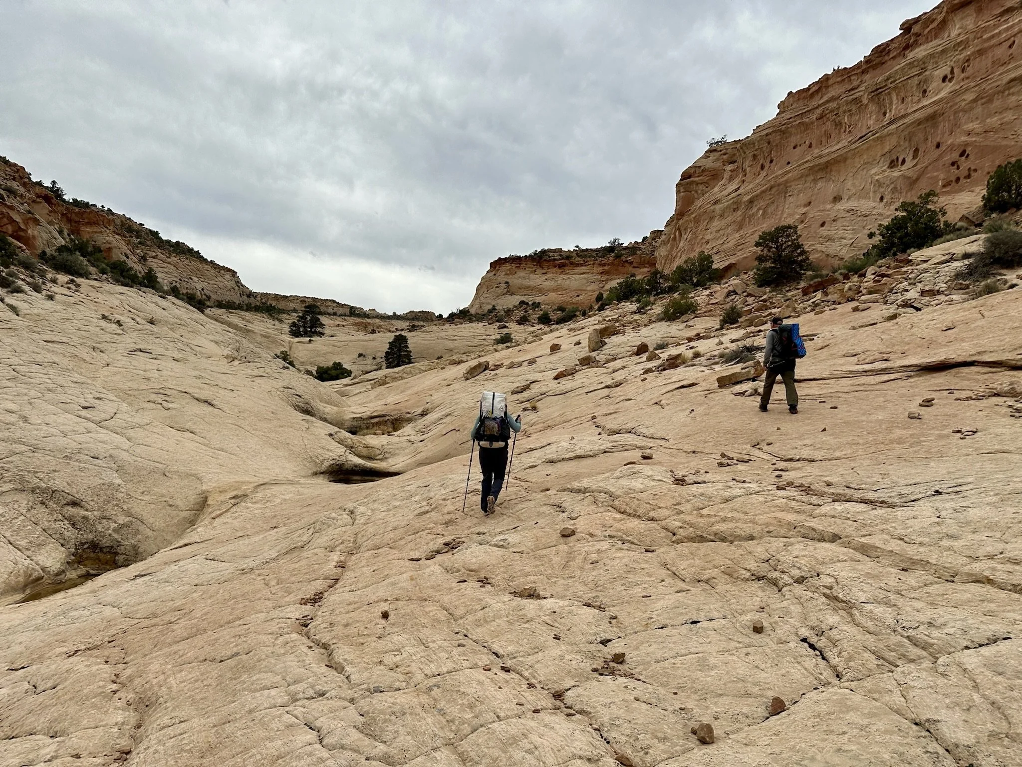
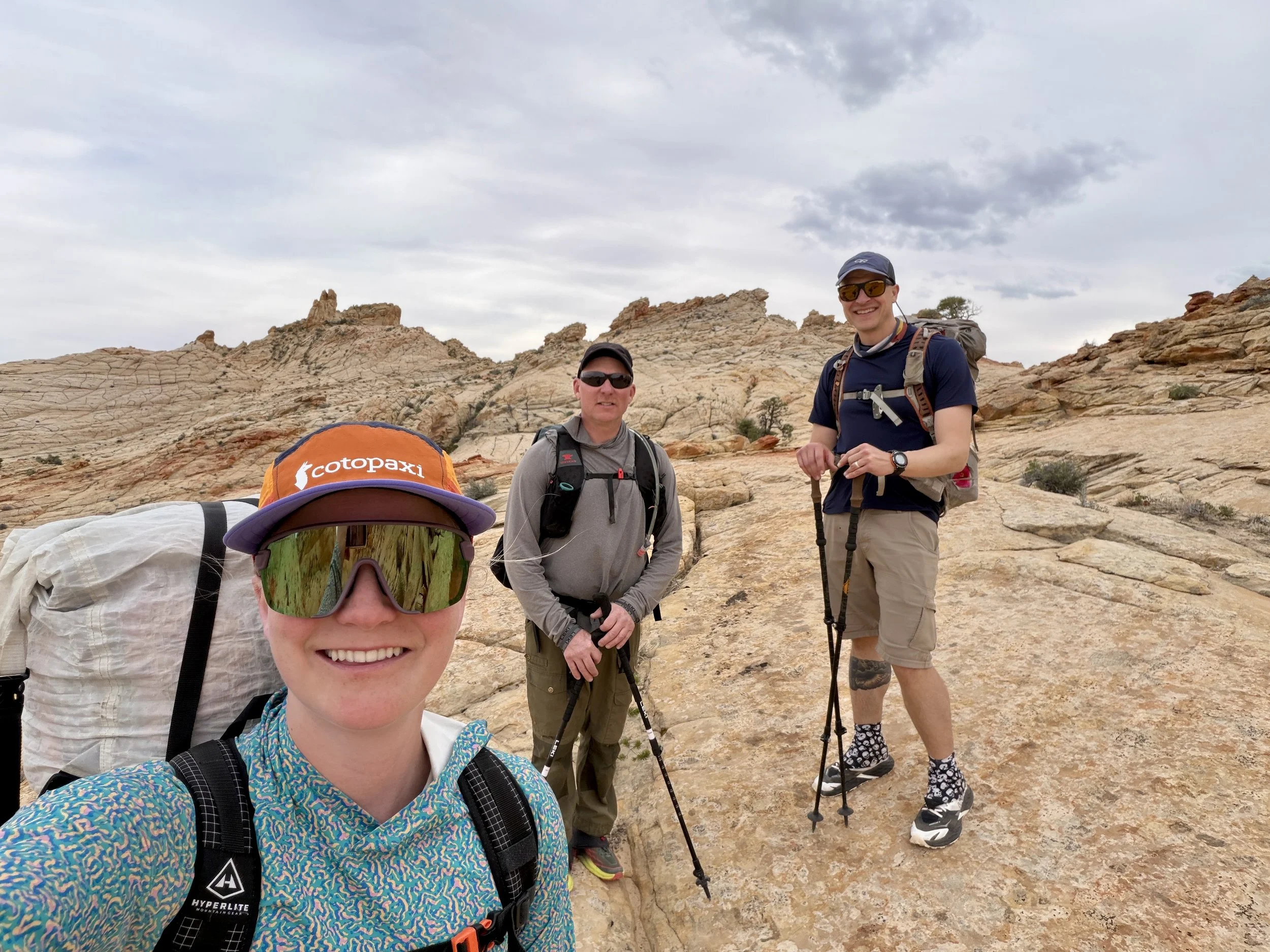
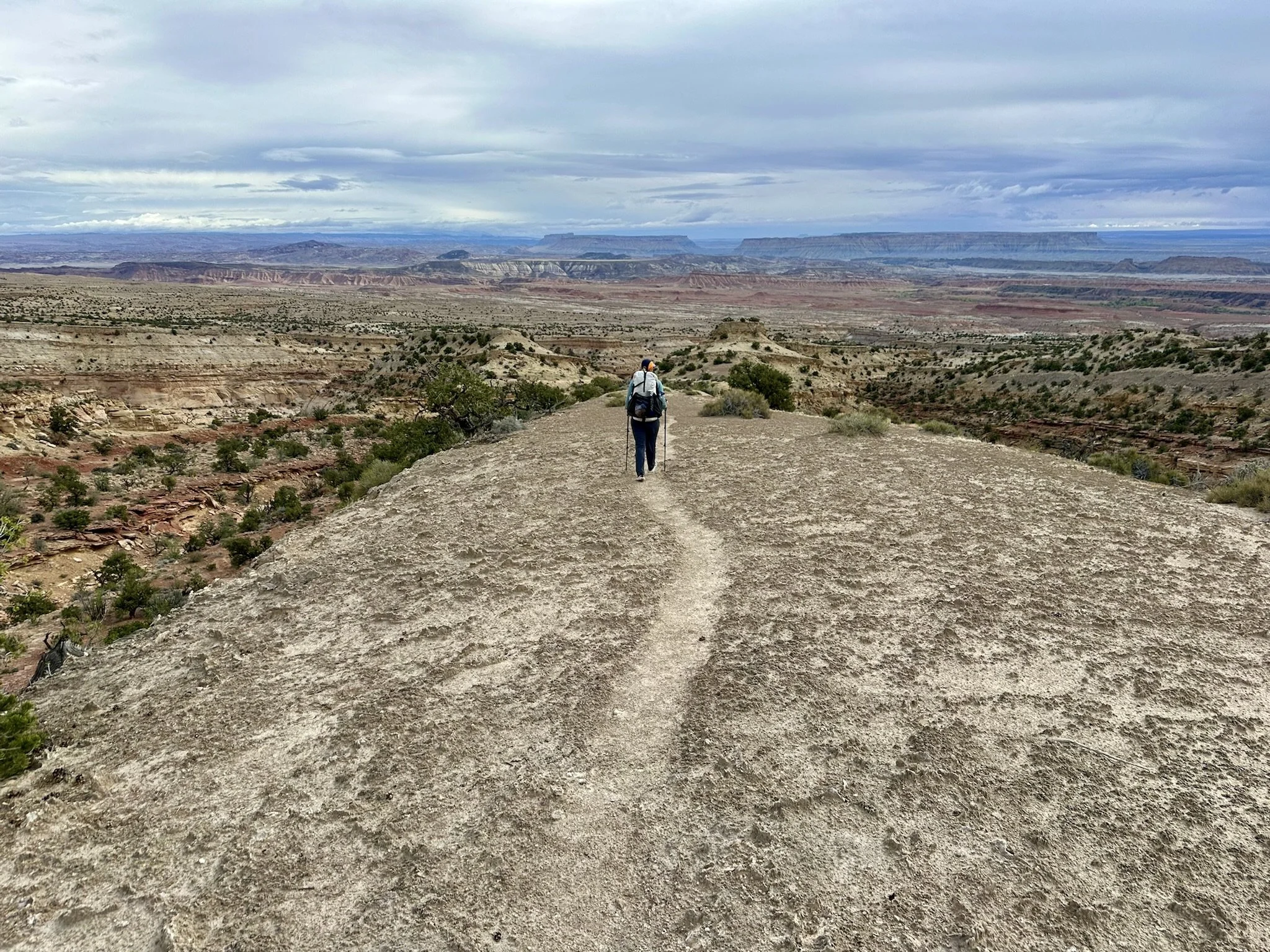
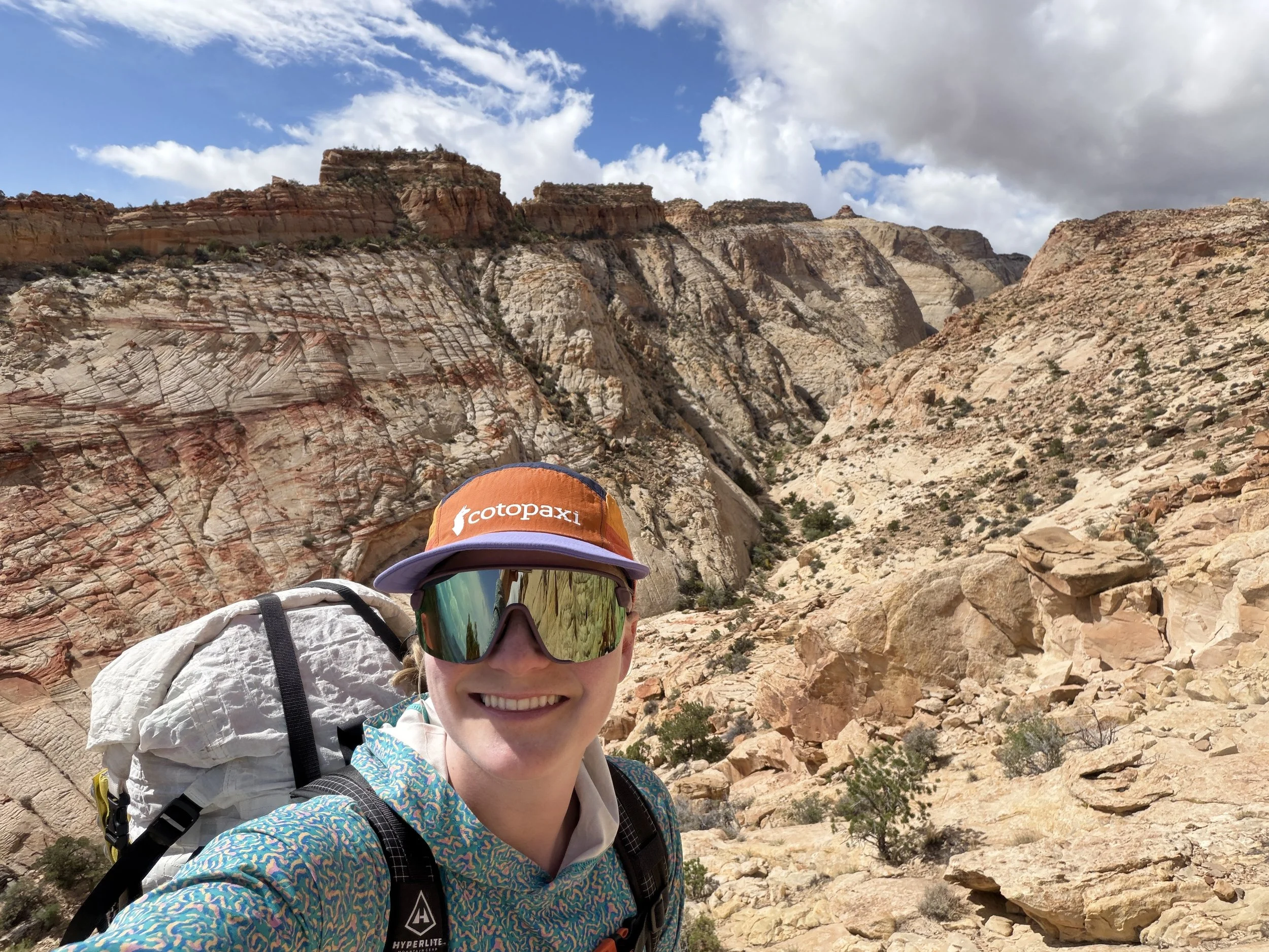
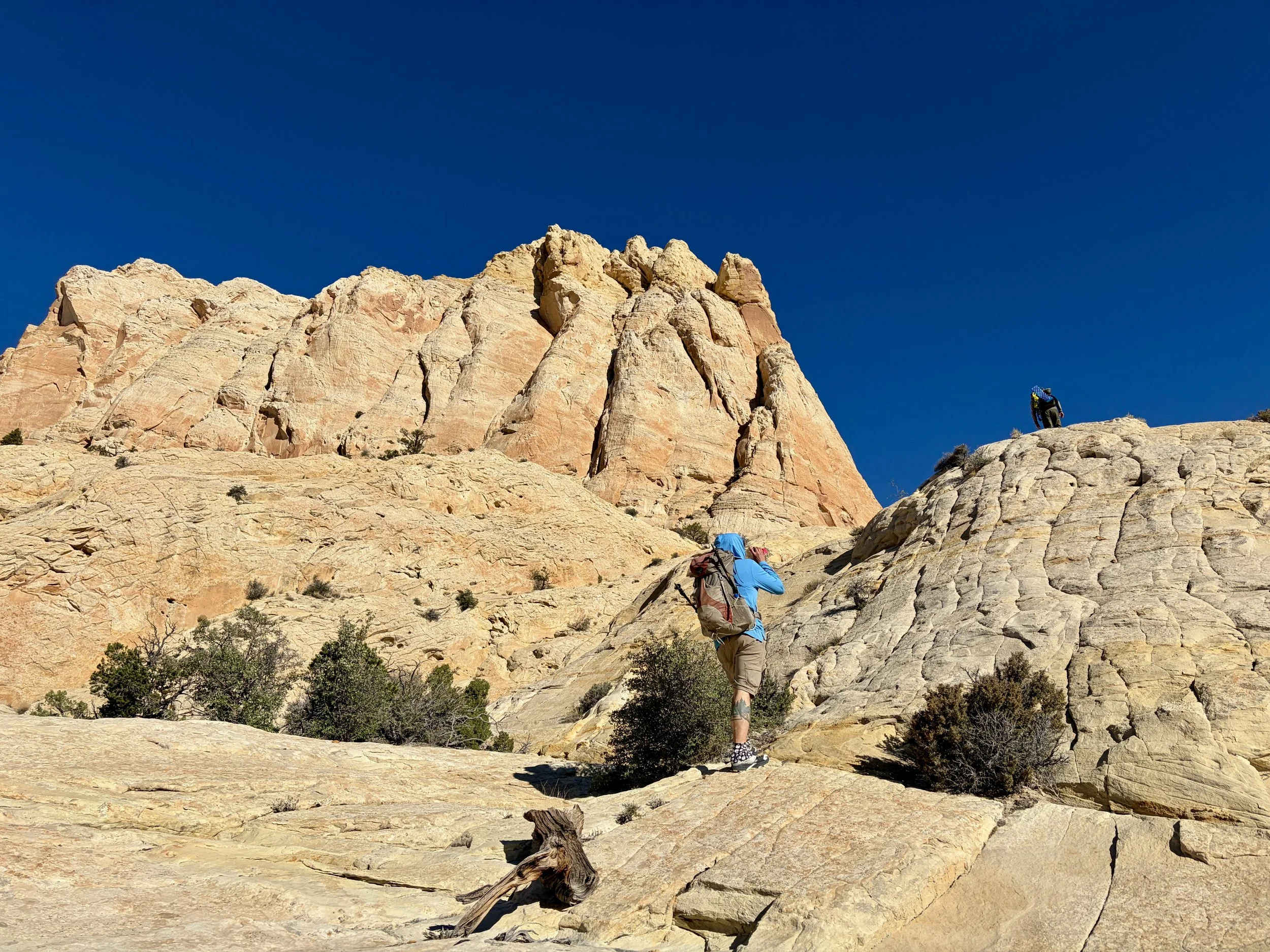
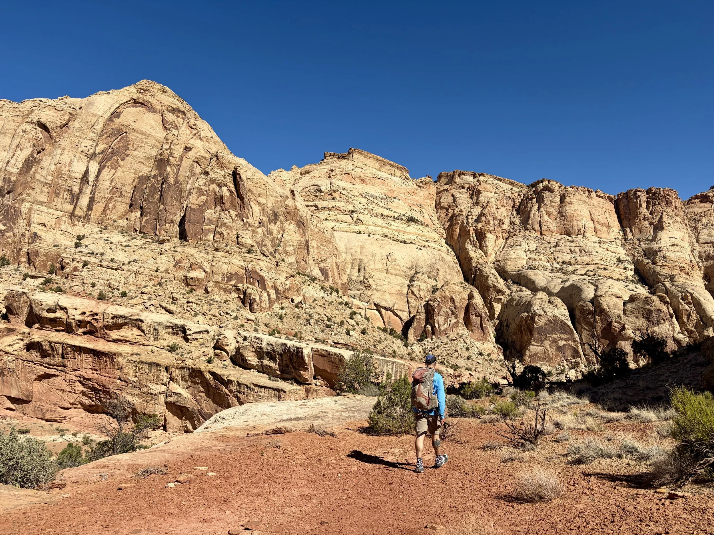
Since this would be a thru hike, the three of us met at the trailhead with two cars. We left one car at the trailhead we would finish the trip at and all hopped in the other car to drive to the starting trailhead together. We didn’t start hiking the first day until 3pm, which led to a shorter mileage day. We each carried ~5 liters of water so that we would be ok to dry camp that night incase we saw no water. With heavy packs and a very specific route to follow, we set out from the trailhead and began the southern portion of the traverse.
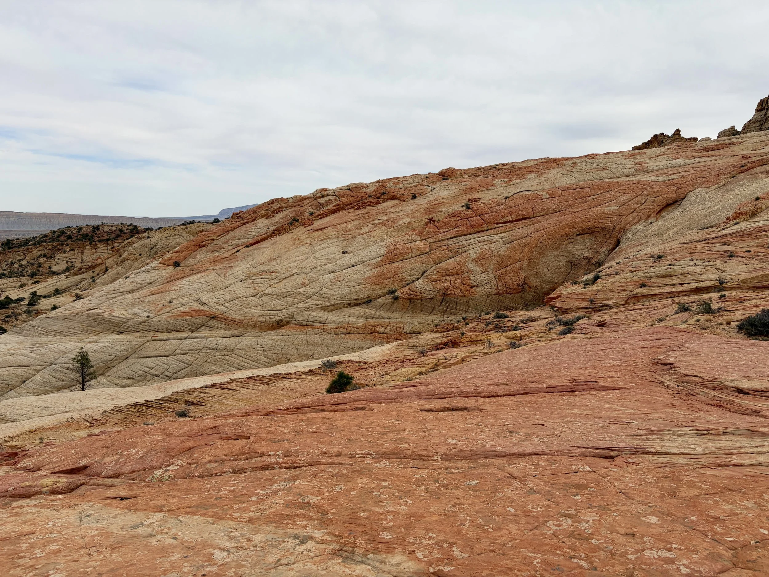
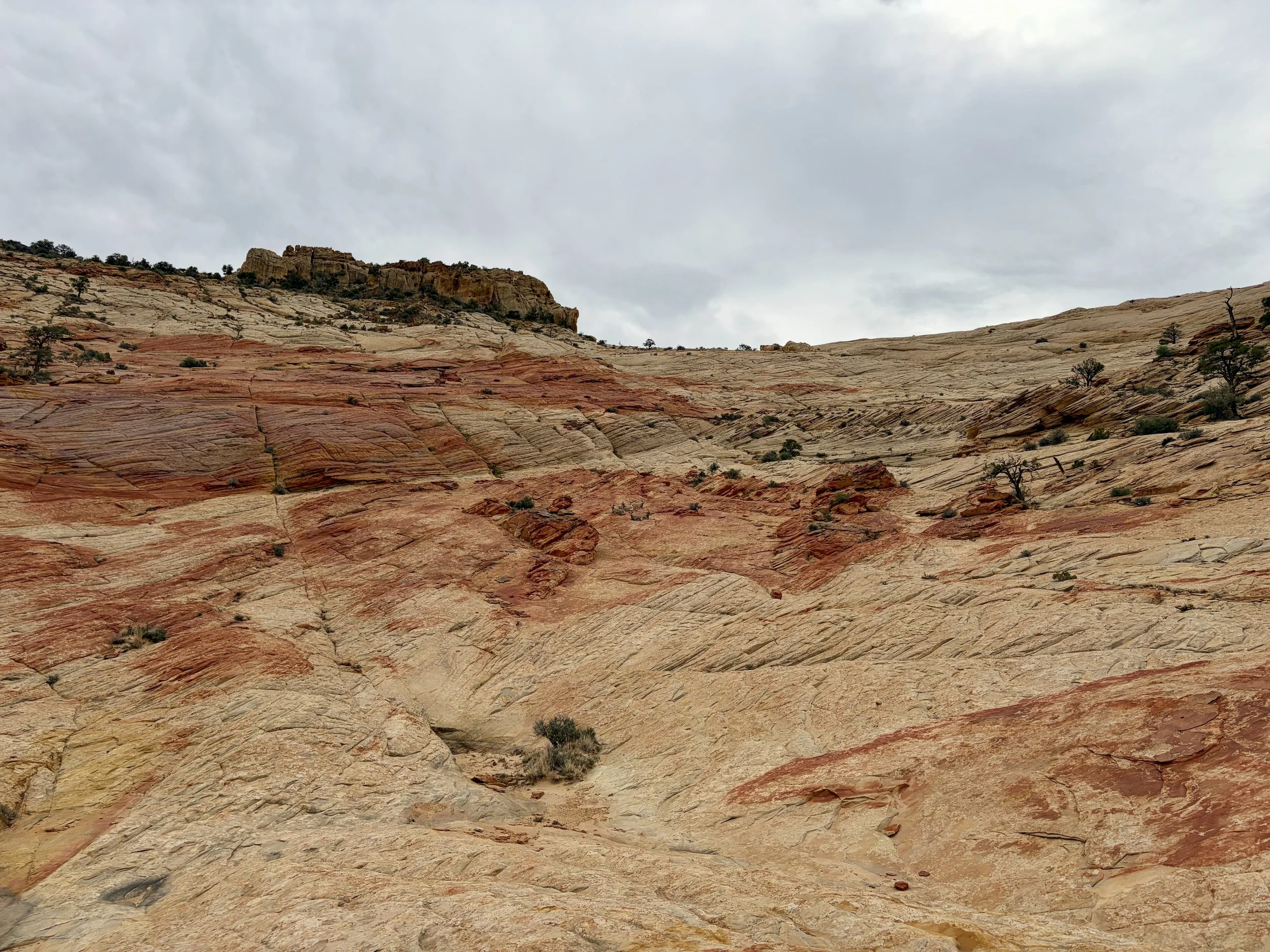
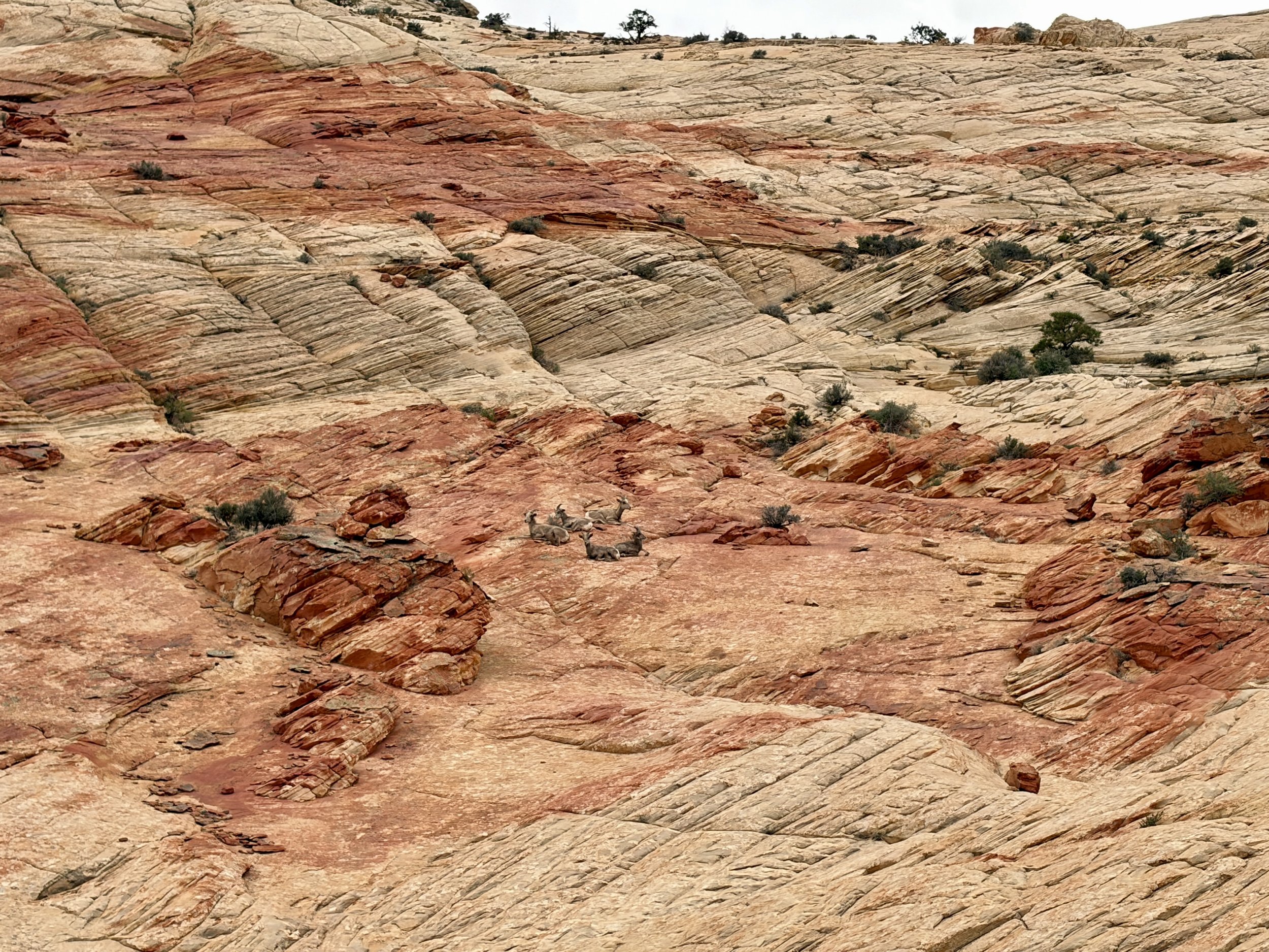
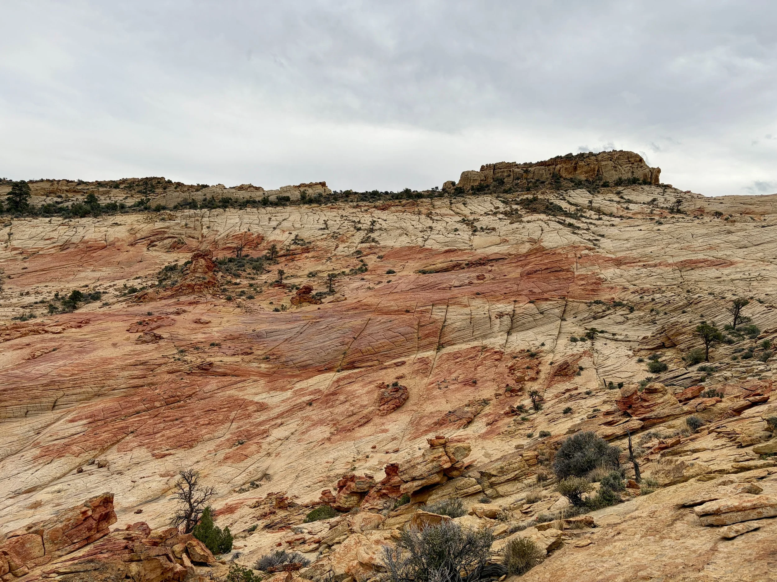
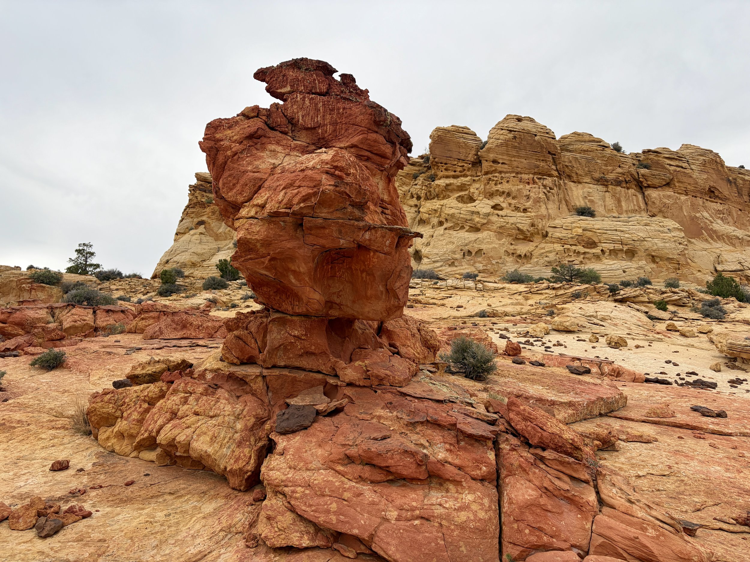
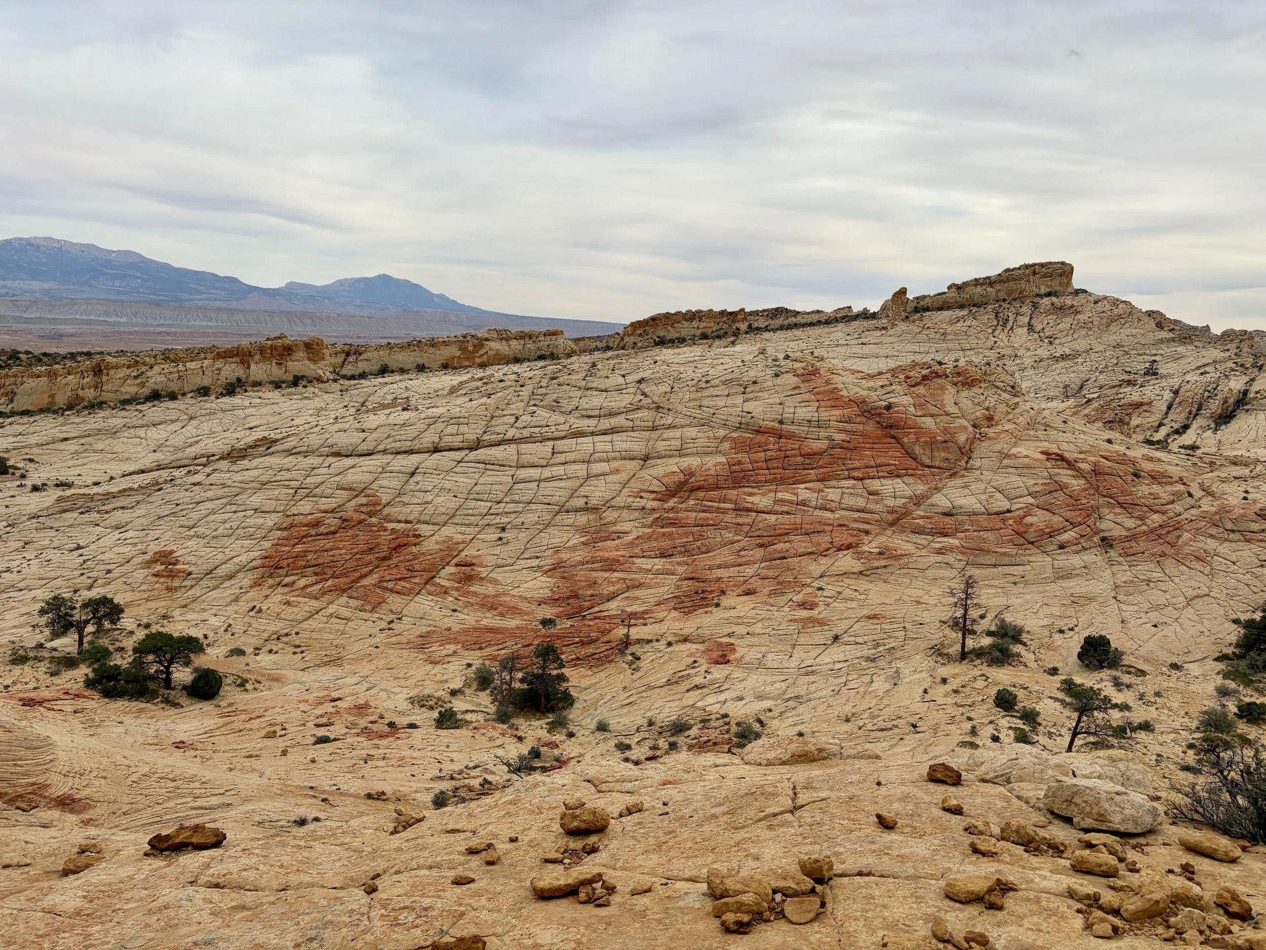
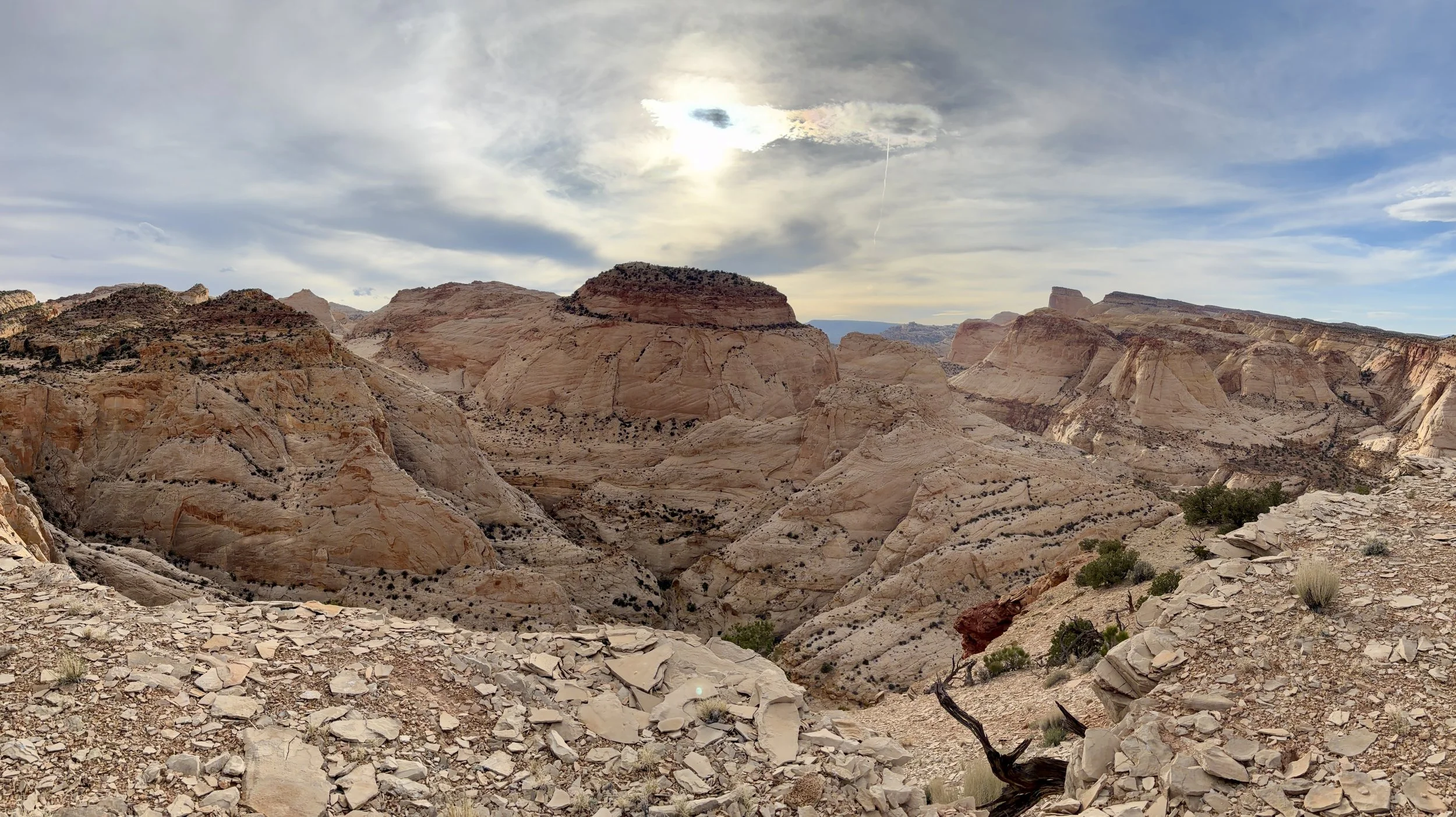
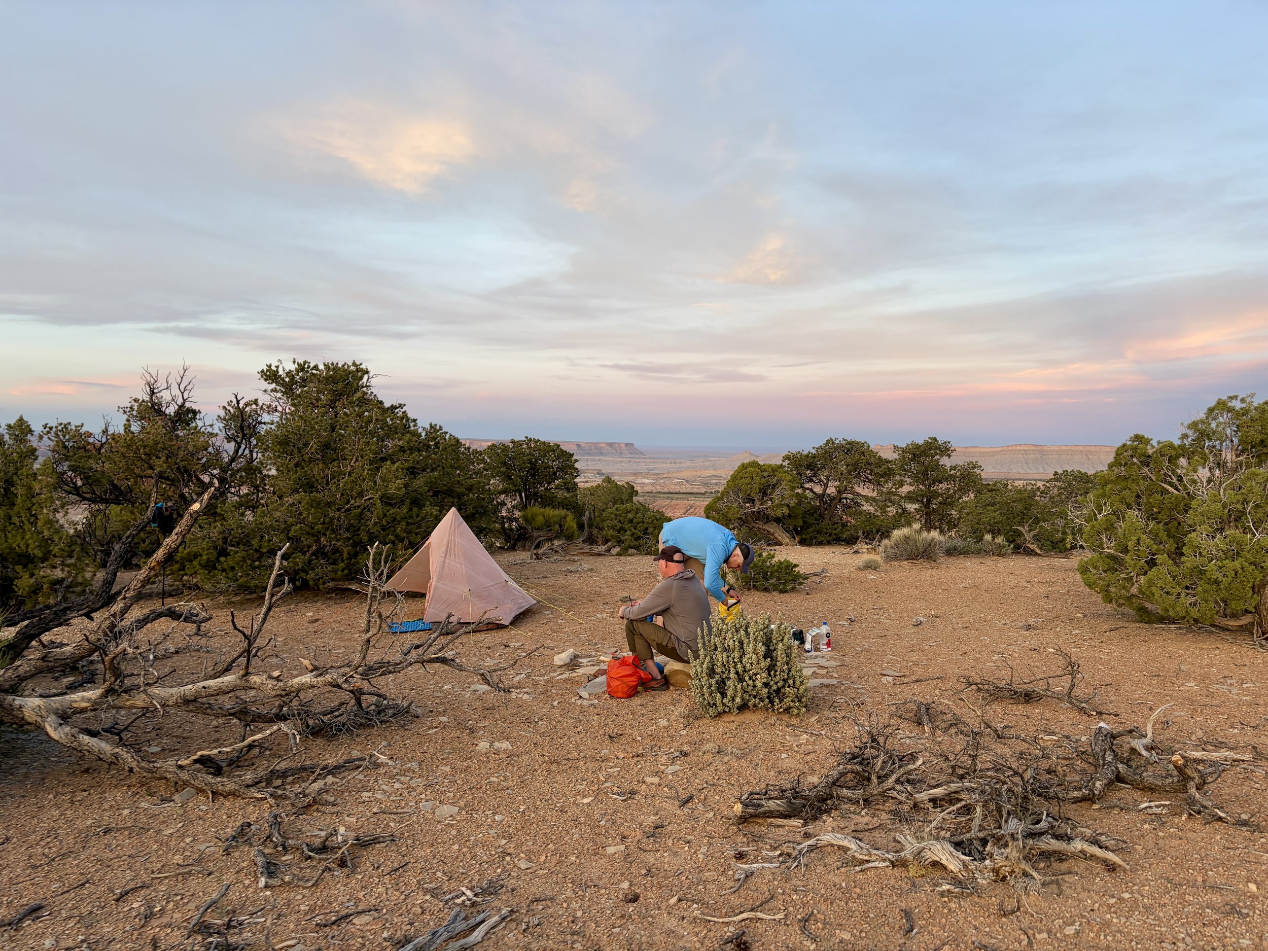
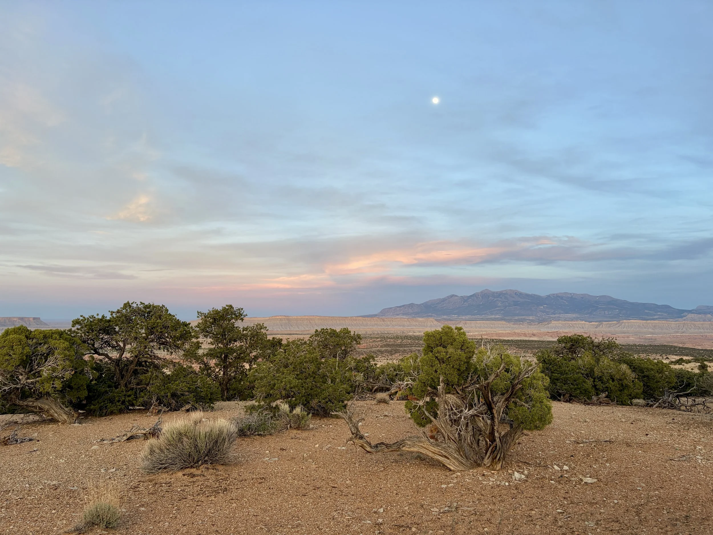
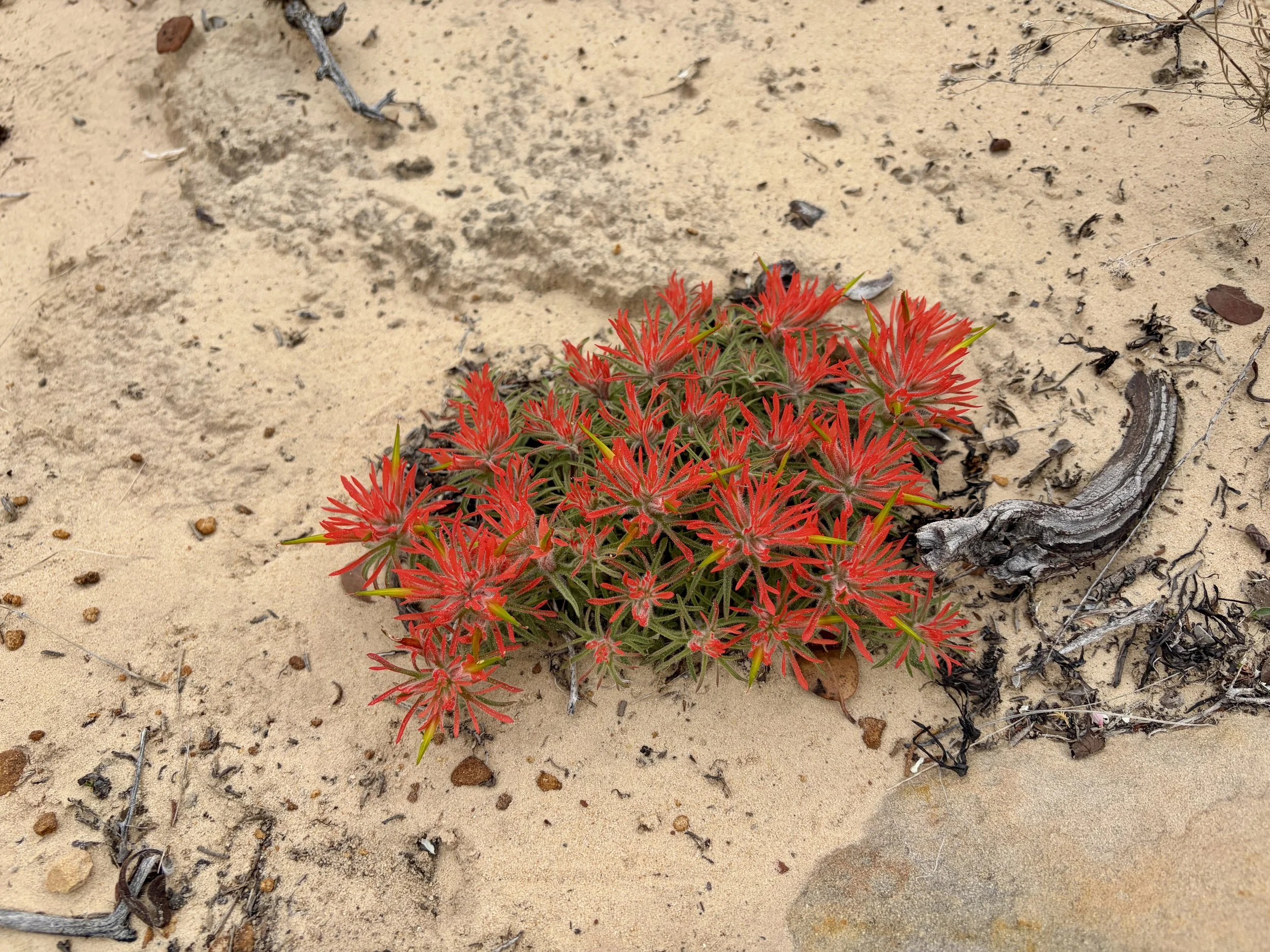
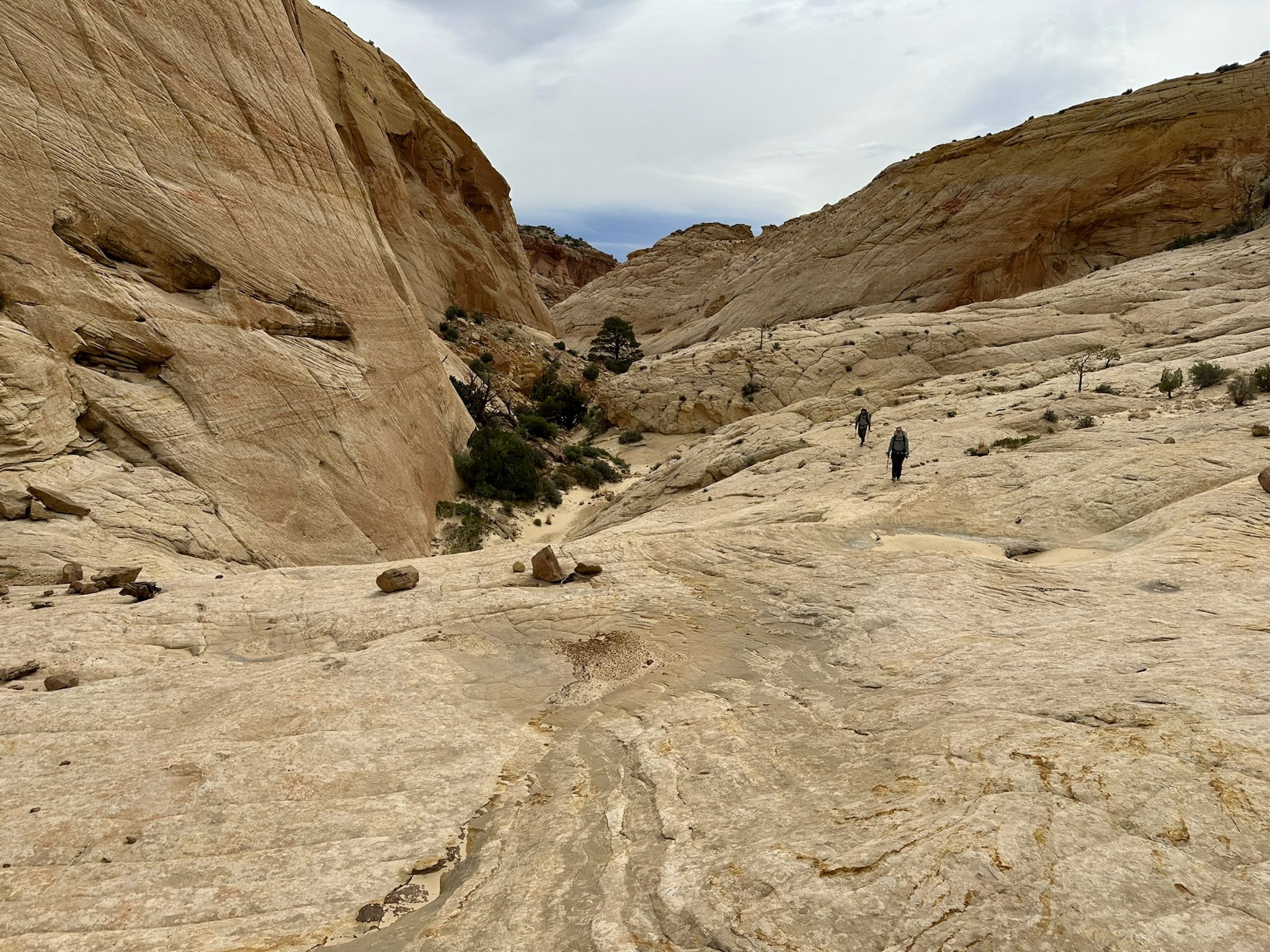
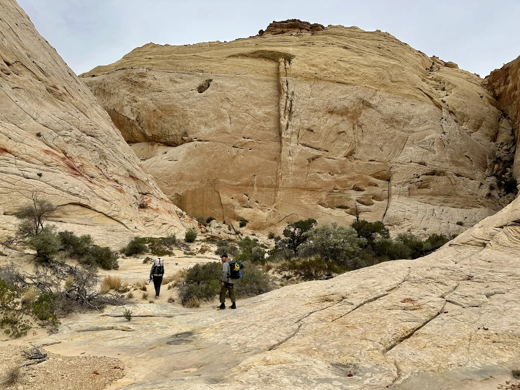
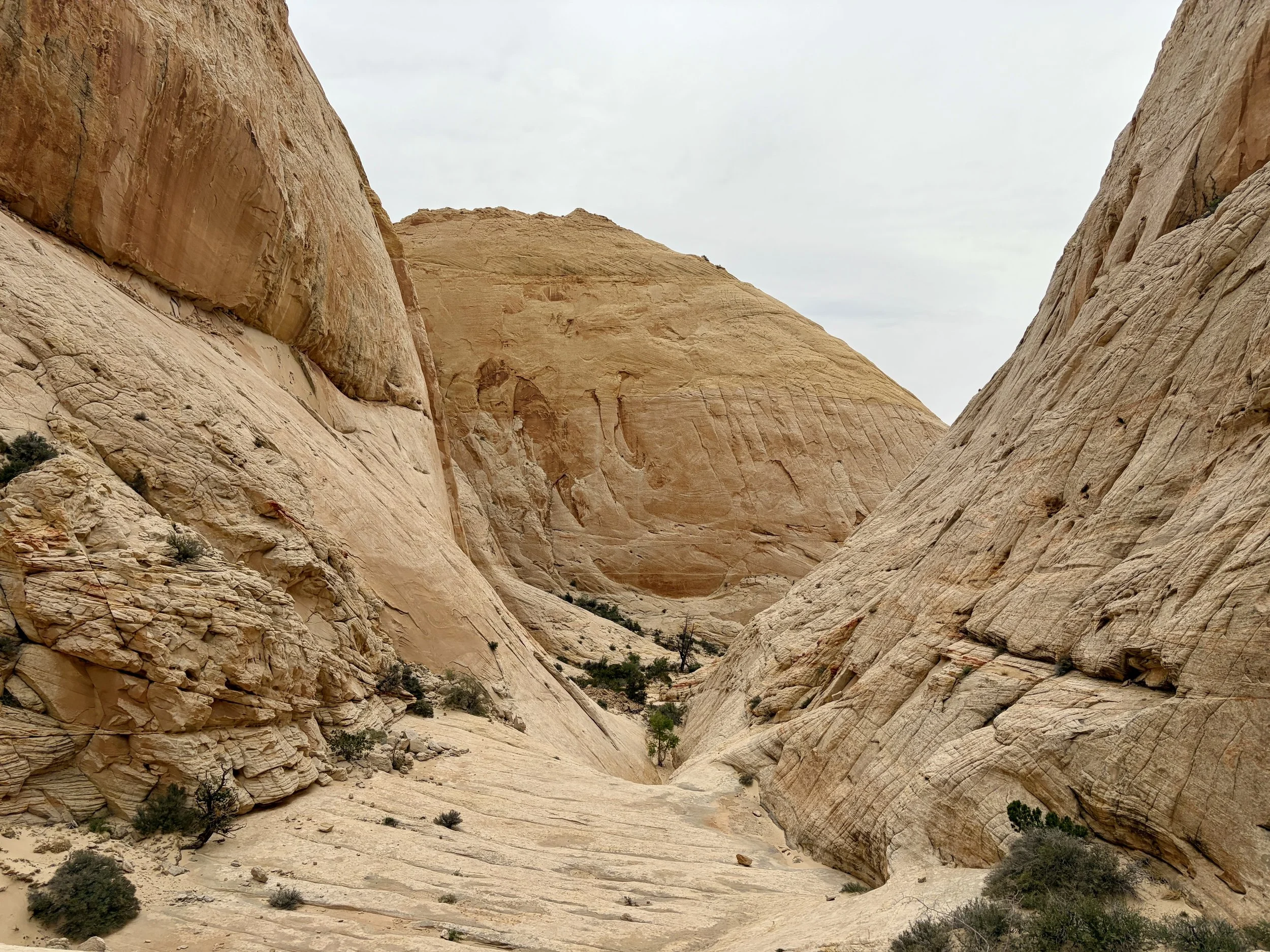
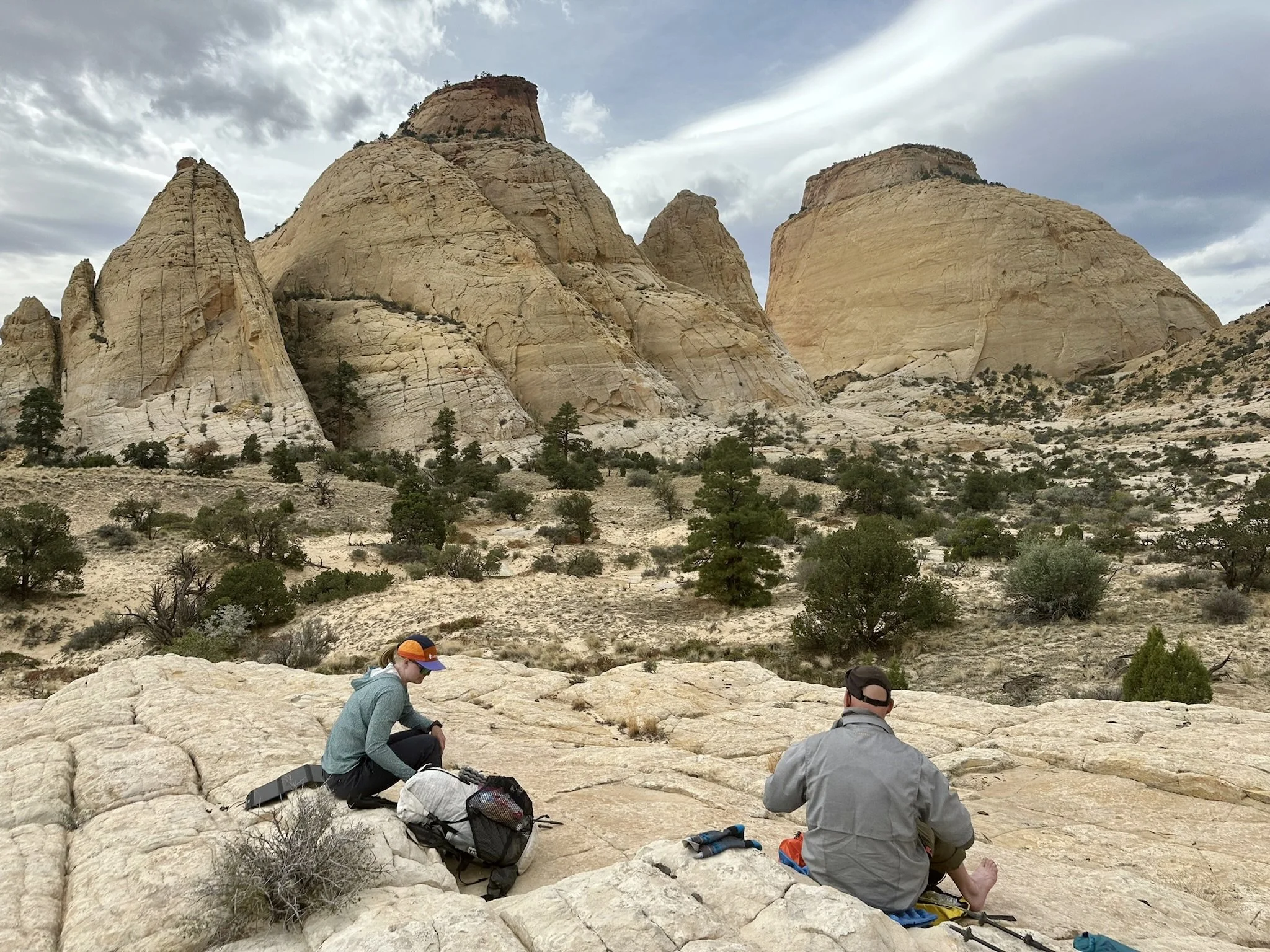
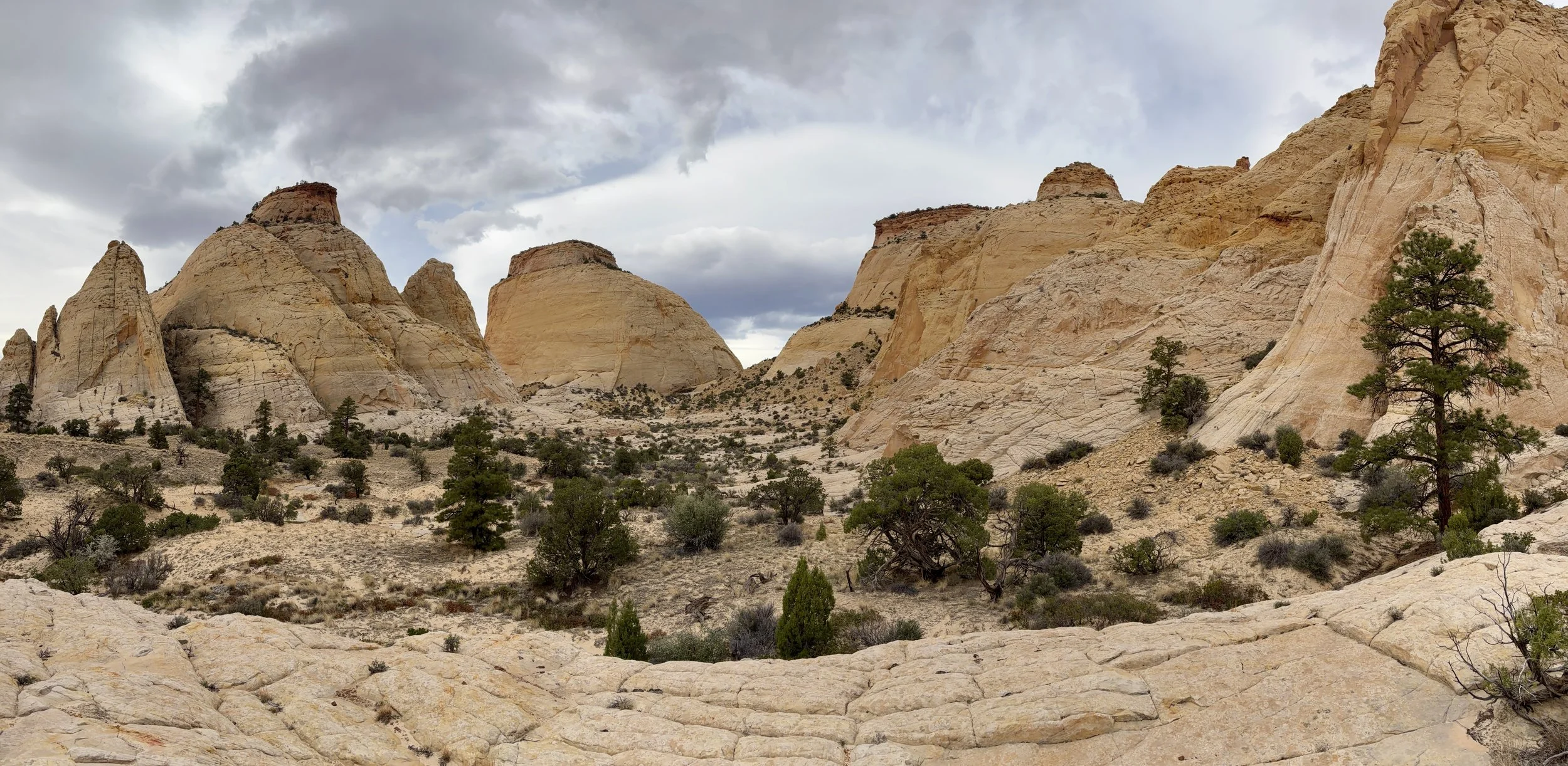
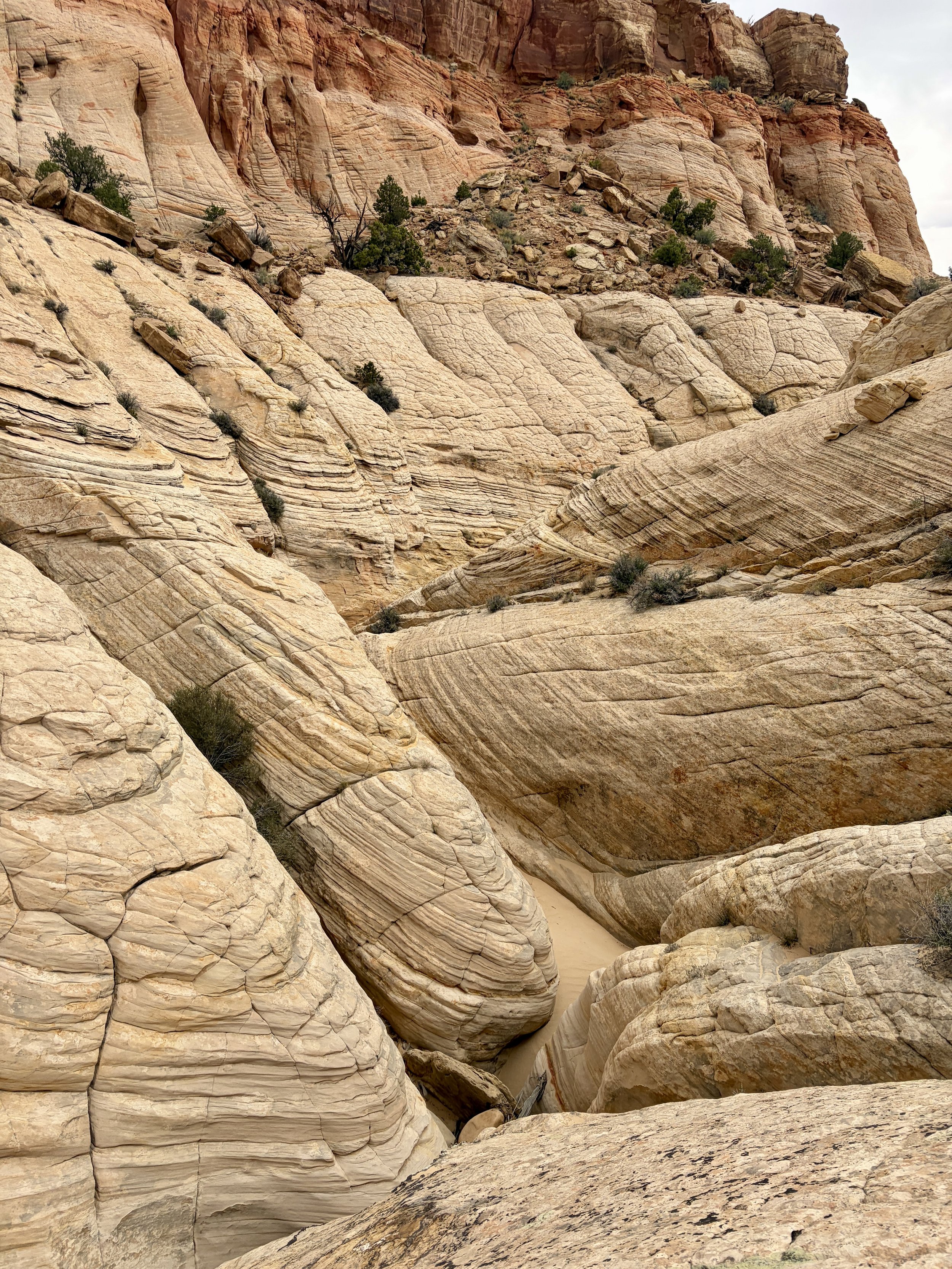
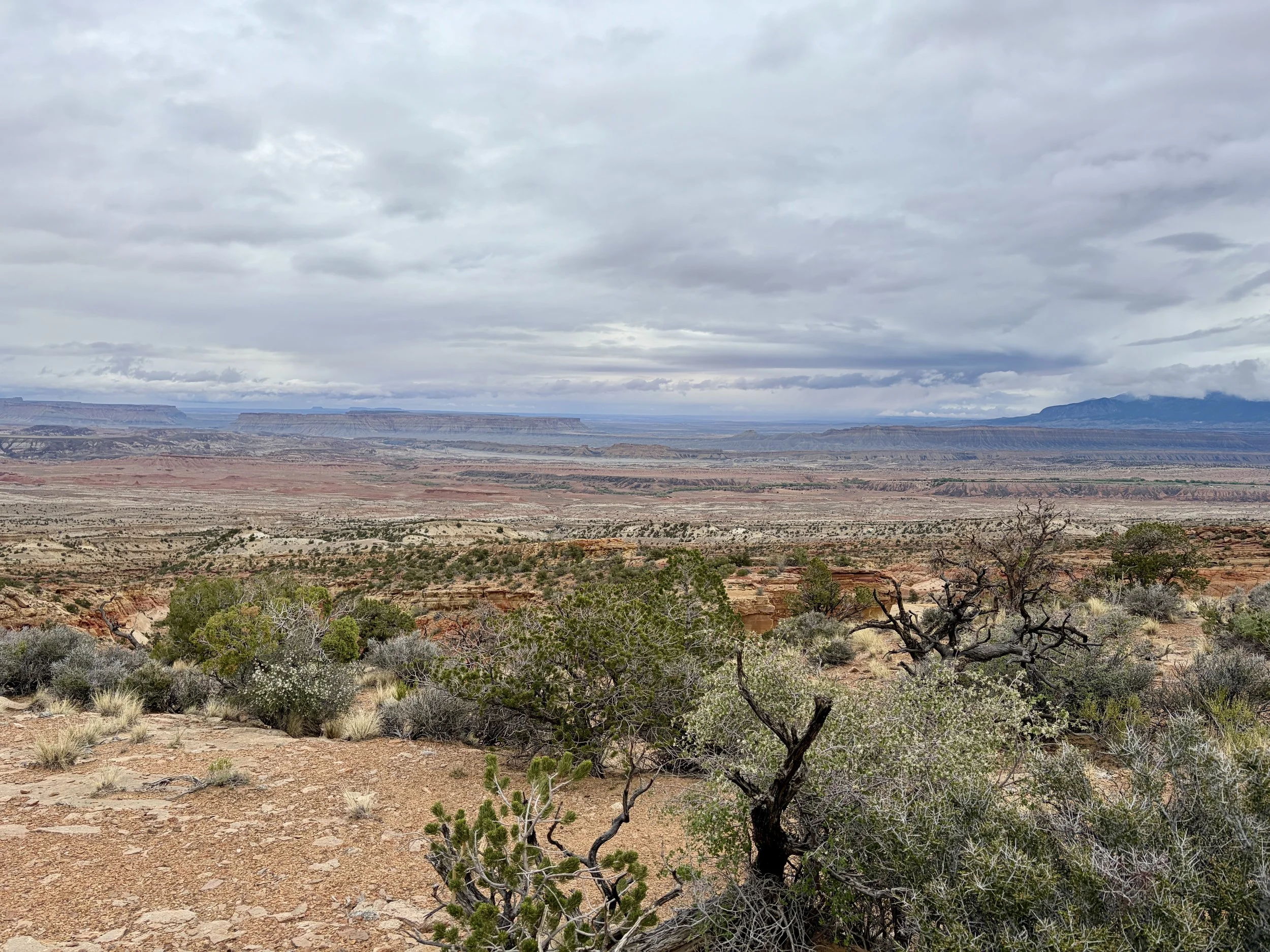
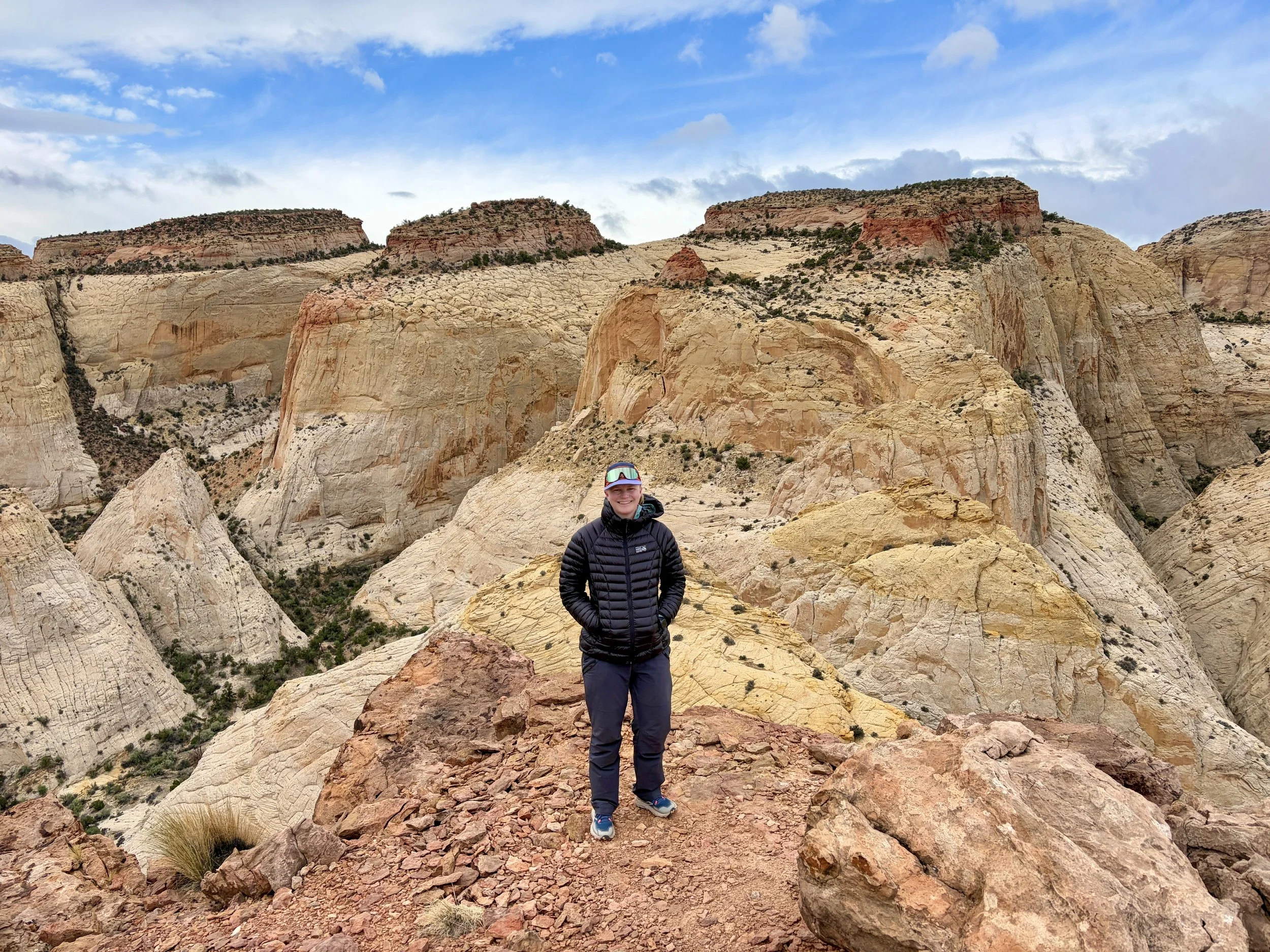
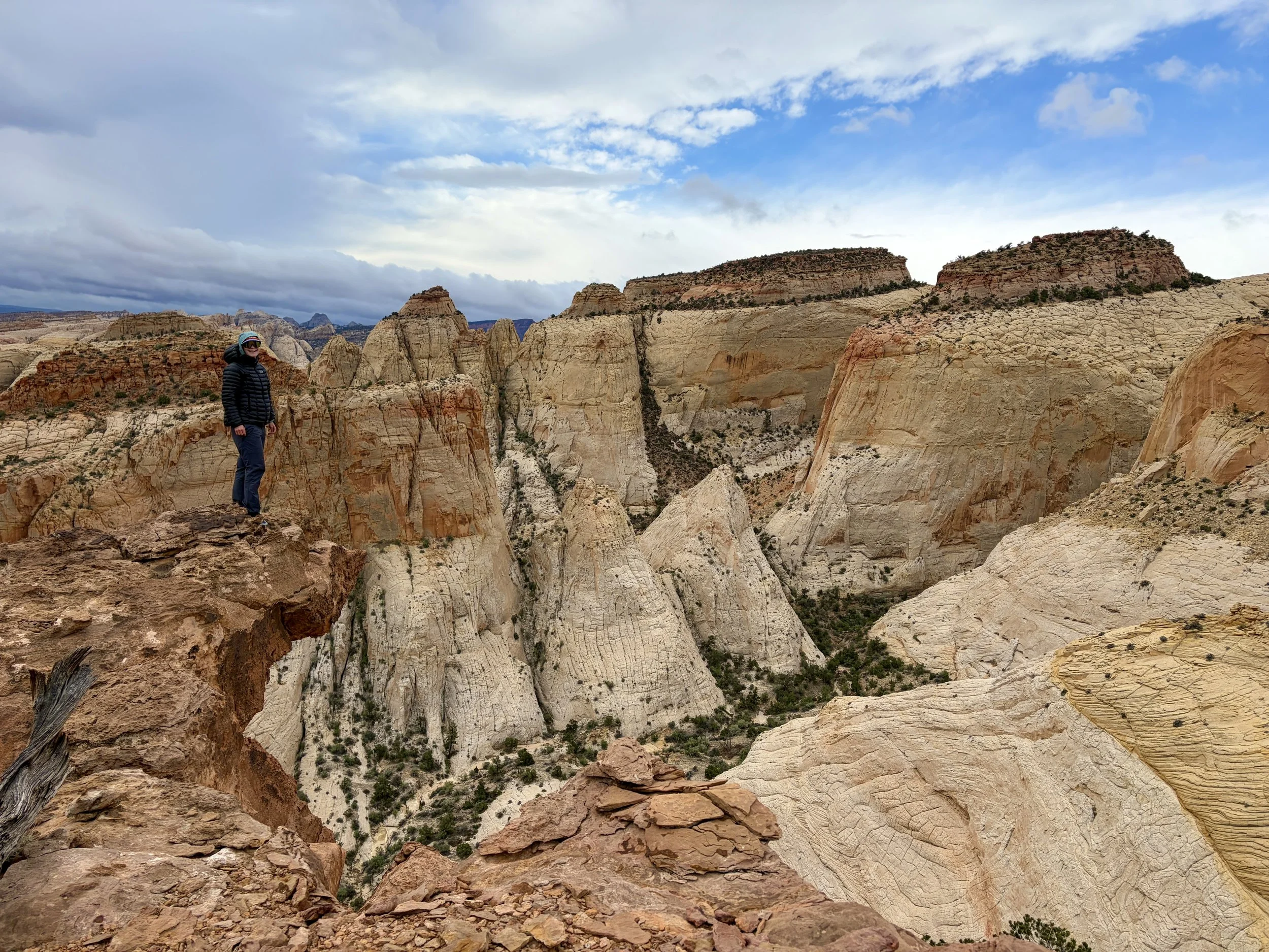
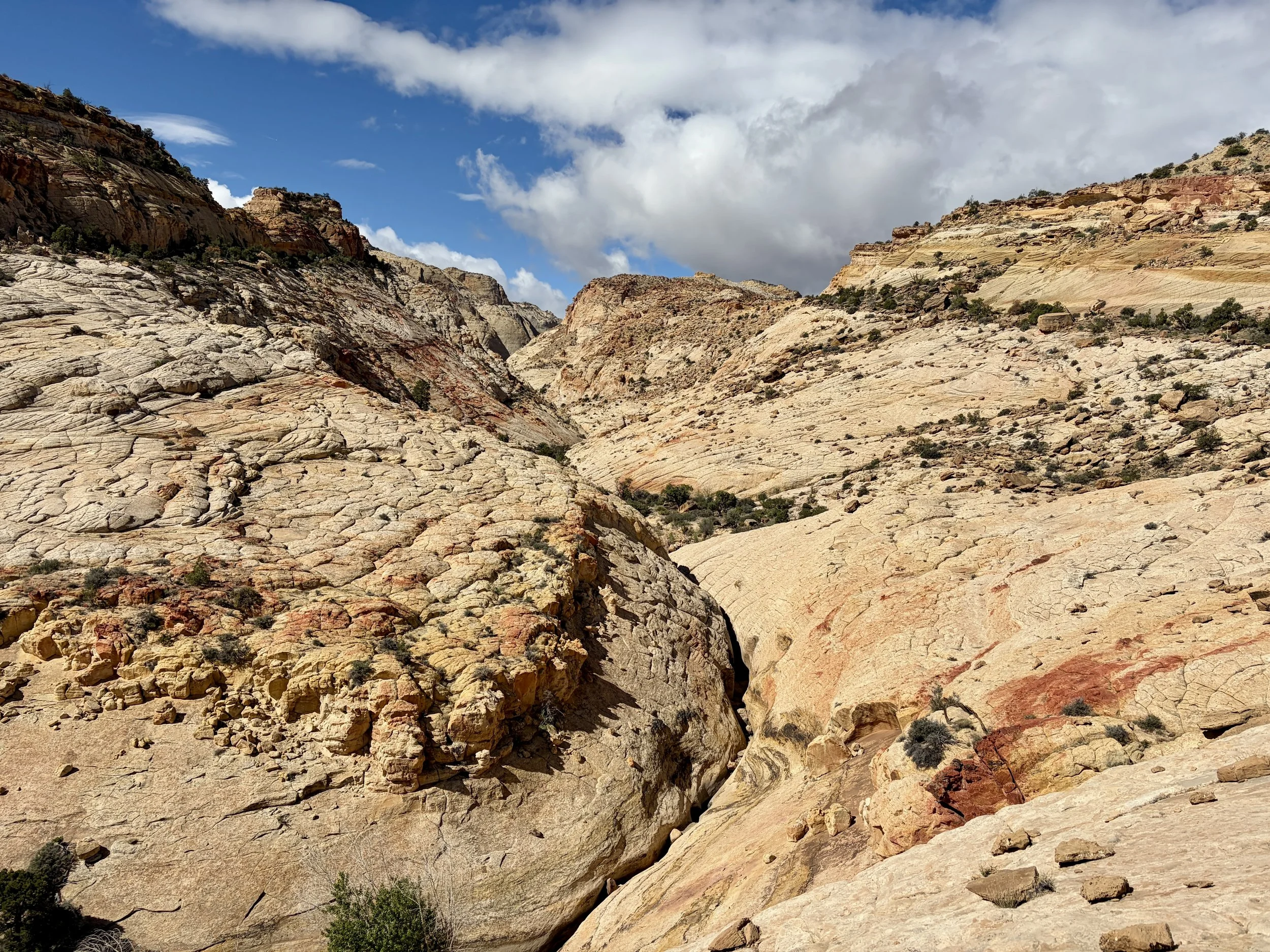
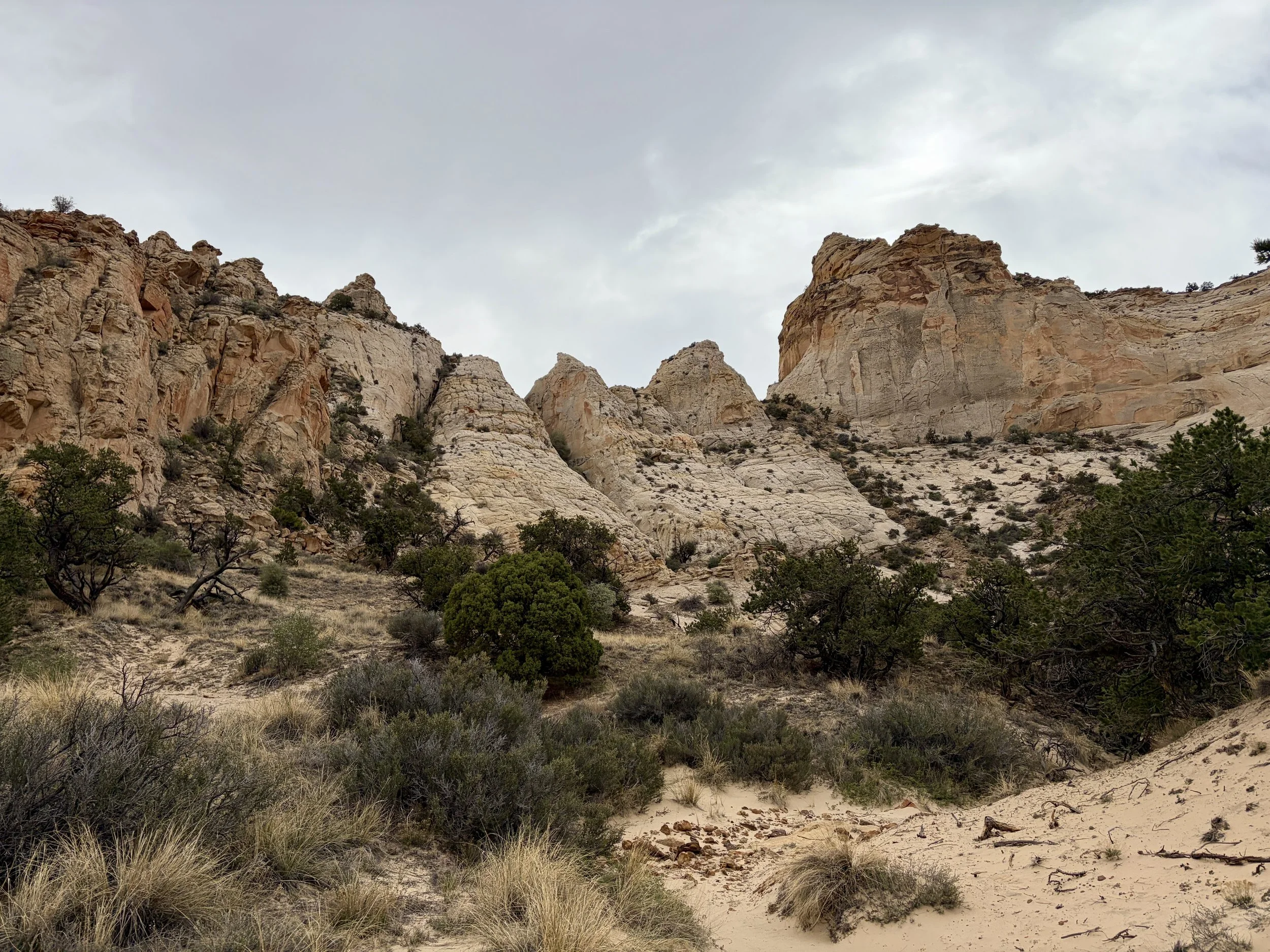
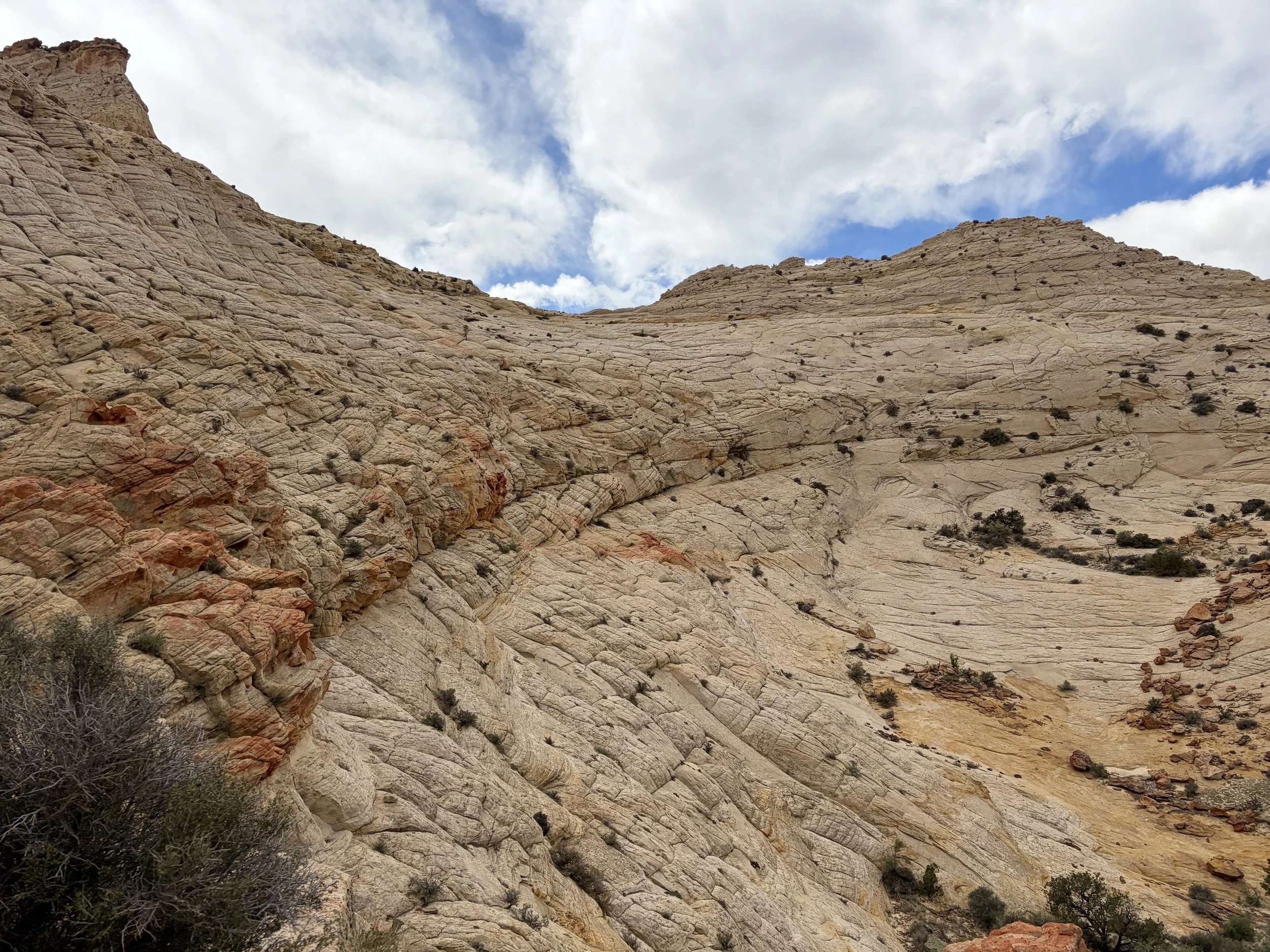
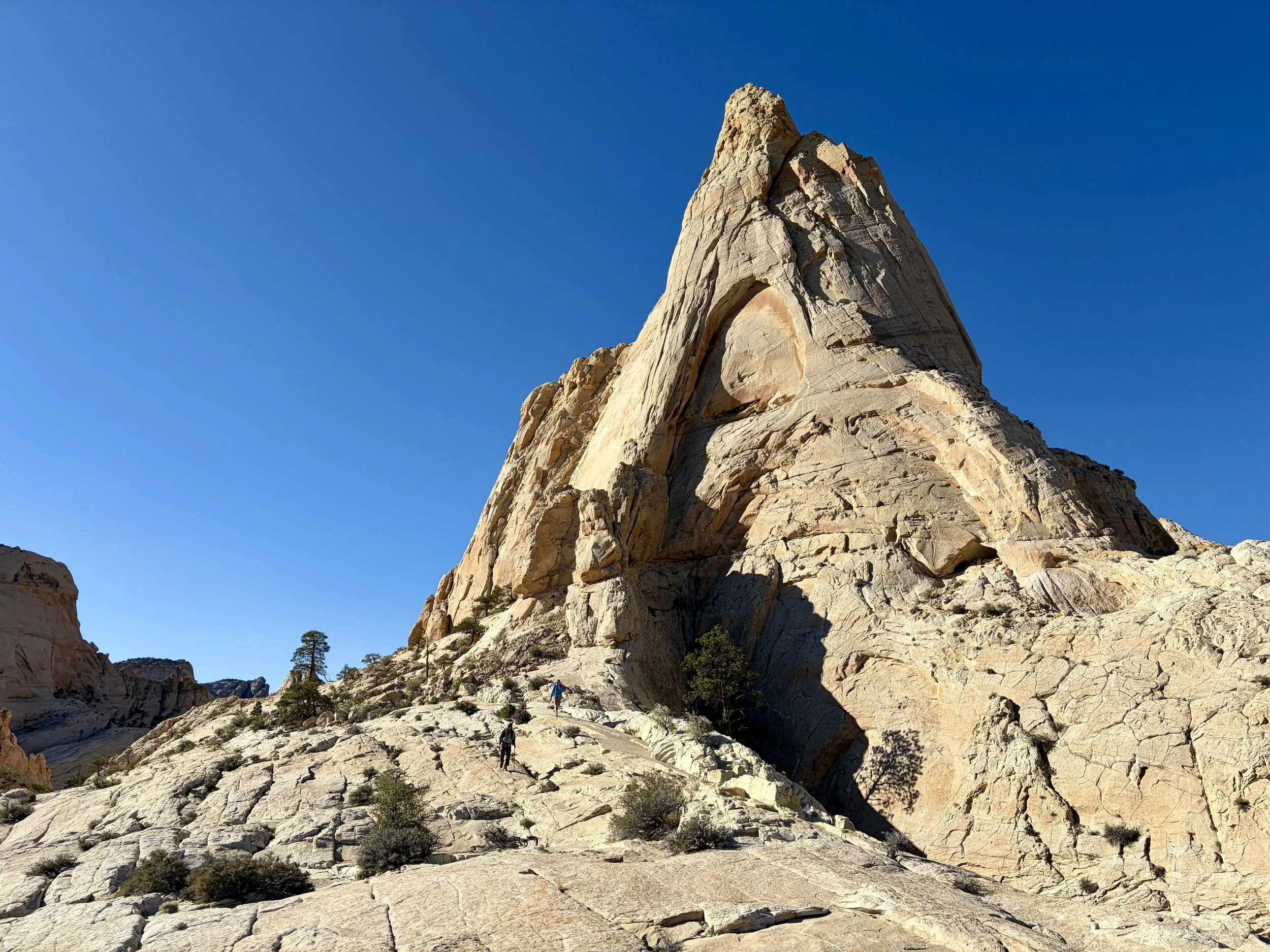
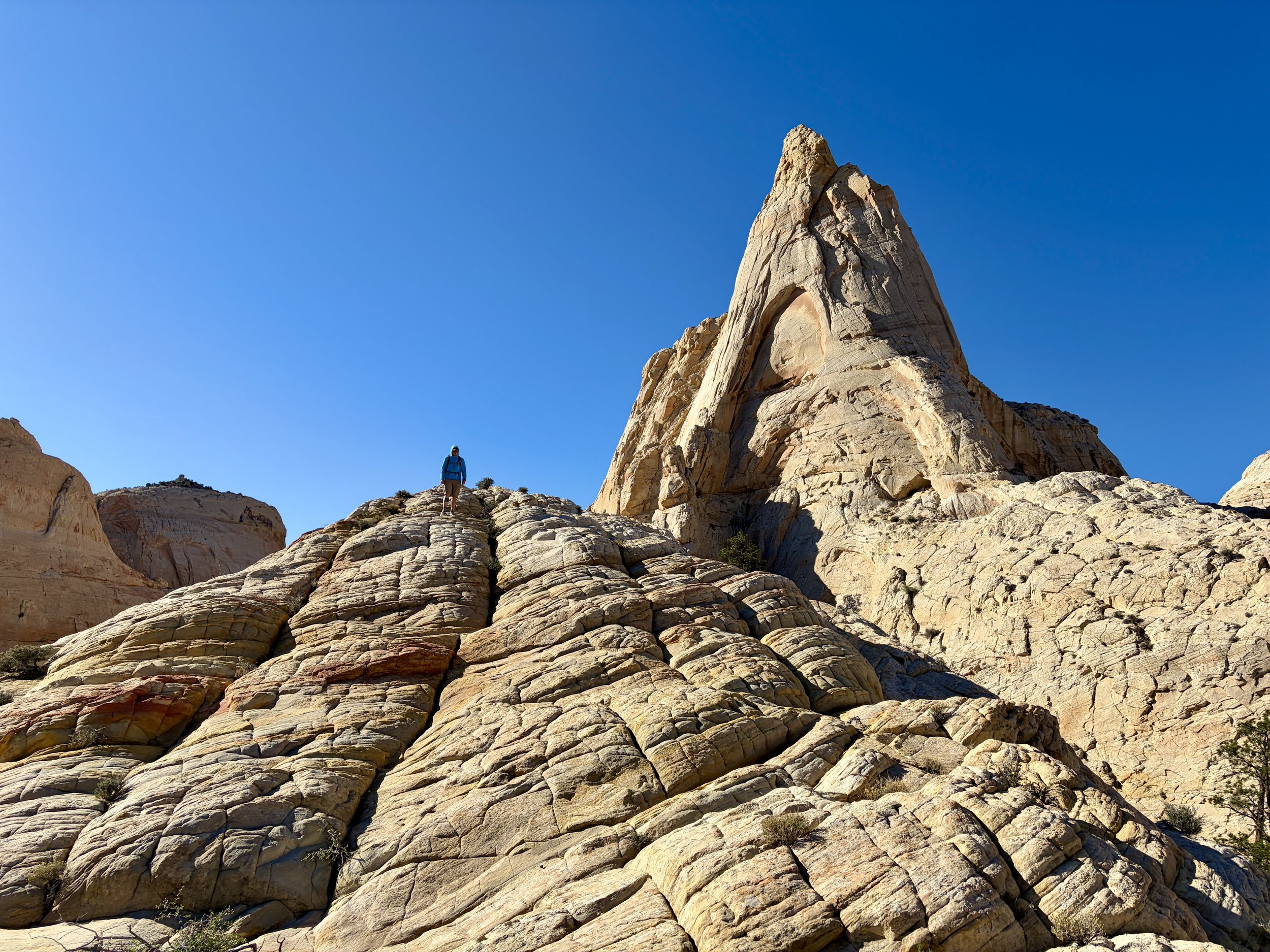
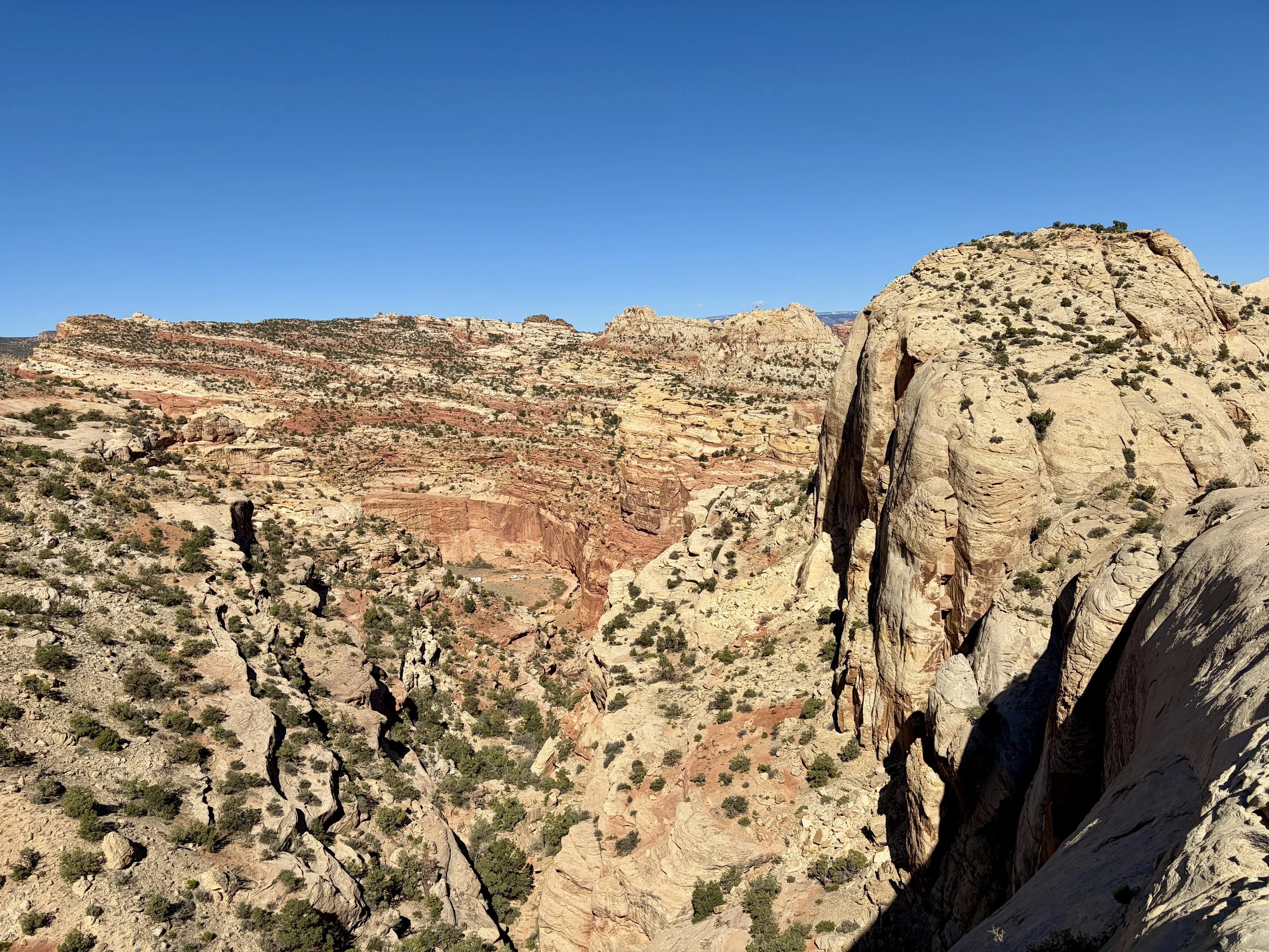
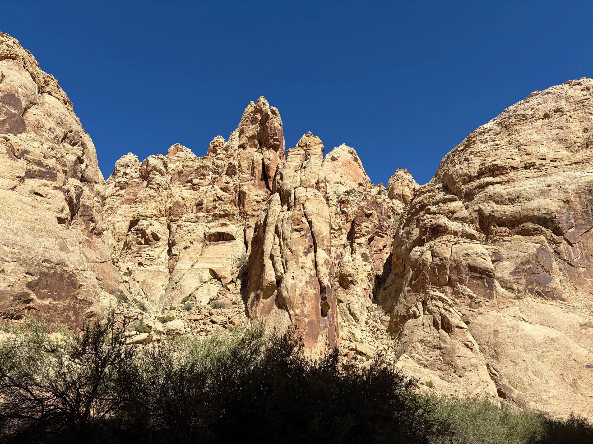
We didn’t have to hike for long before we soon found ourselves walking in these beautiful, multicolored slick rock drainages. We found plenty of large potholes full of water. We even saw some bighorn sheep that blended in with their surroundings watching us at one point. We walked from one drainage to another and enjoyed the beautiful views along the way. As we started approaching dinner time, we found ourselves on a ridge that provided some great campsite options with views of Capitol Gorge. We decided that would be a great spot to camp on our first night. We watched a pretty sunset and headed to bed, with a plan to get an early start the next morning.
Day 1 stats: 4.1 miles, +933 ft of elevation gain, -437 ft of elevation loss
Day 2
We wanted to make our second day a full day of hiking because there was a decent chance of rain on day 3. We wanted to give ourselves a cushion for day 3 that didn’t require a full day walking on slick rock in the rain. So a full day of hiking on day 2 it would be!
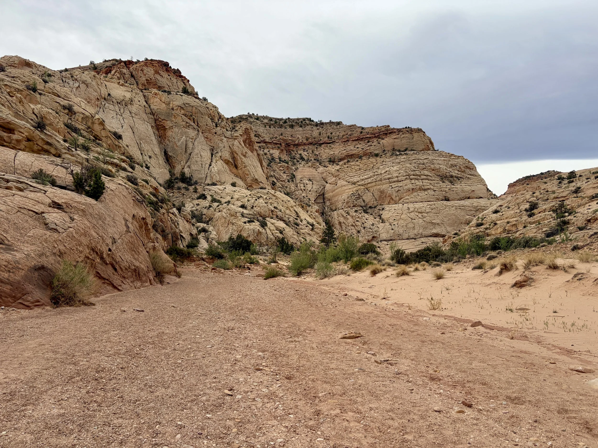
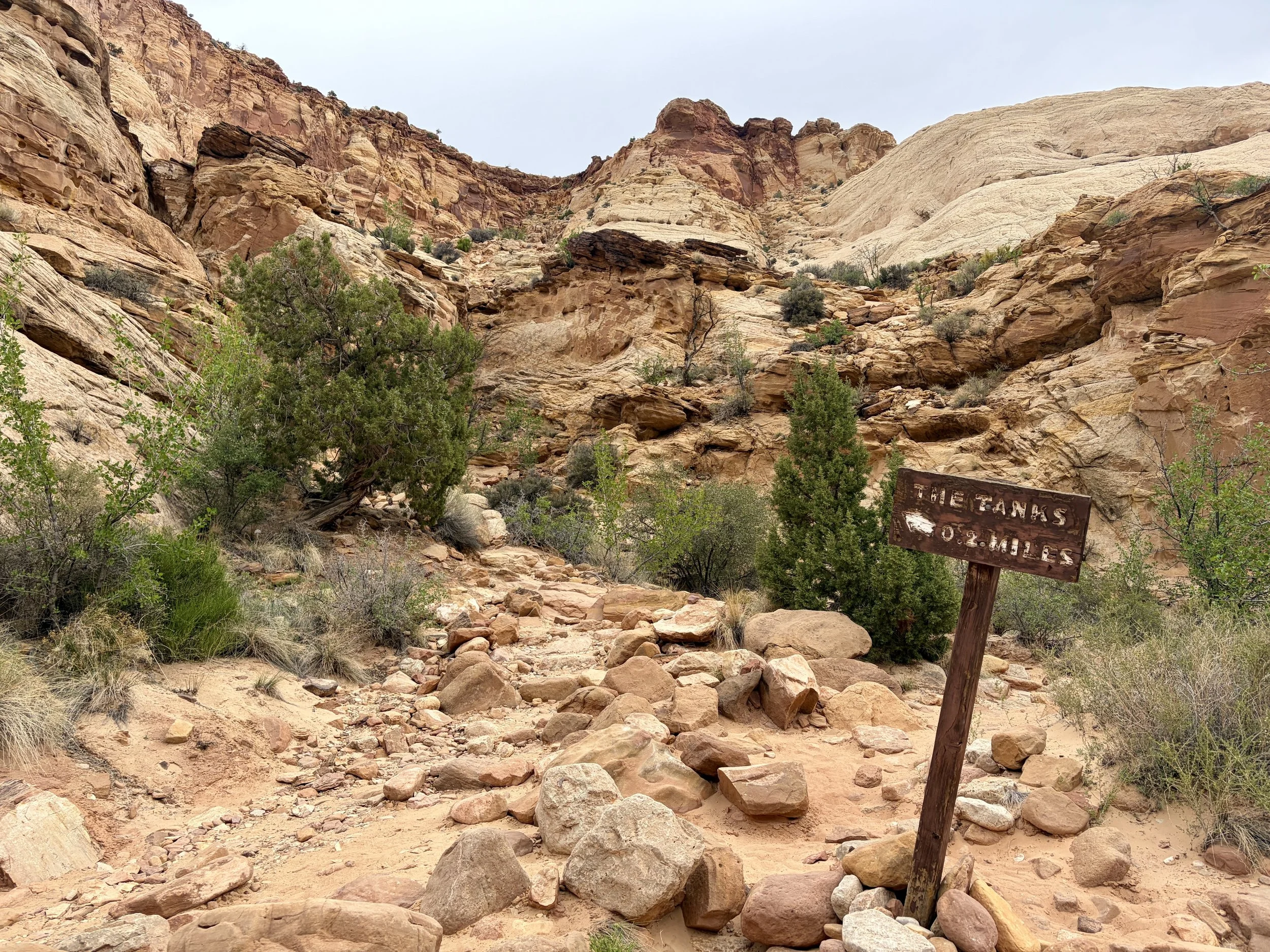
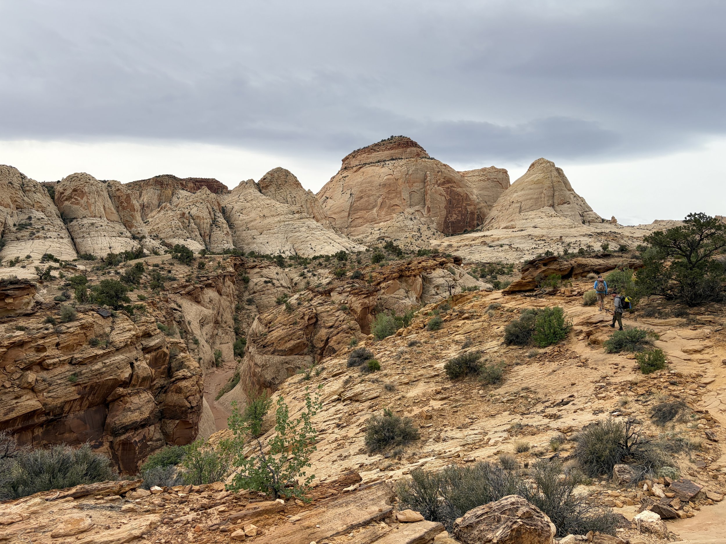
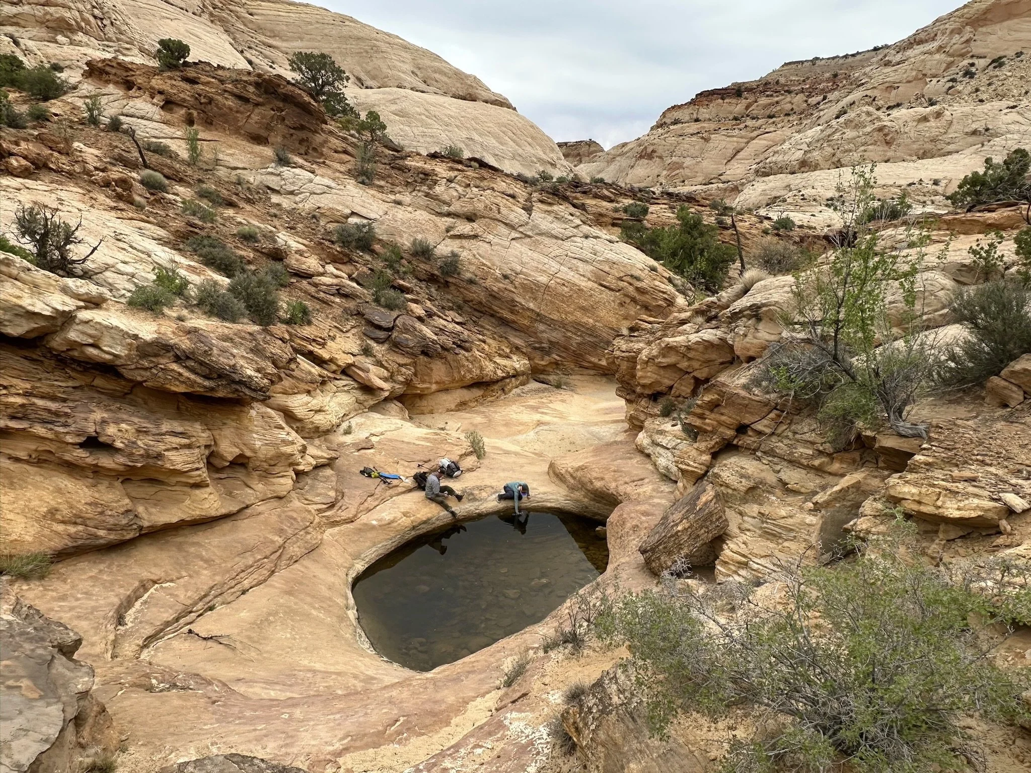
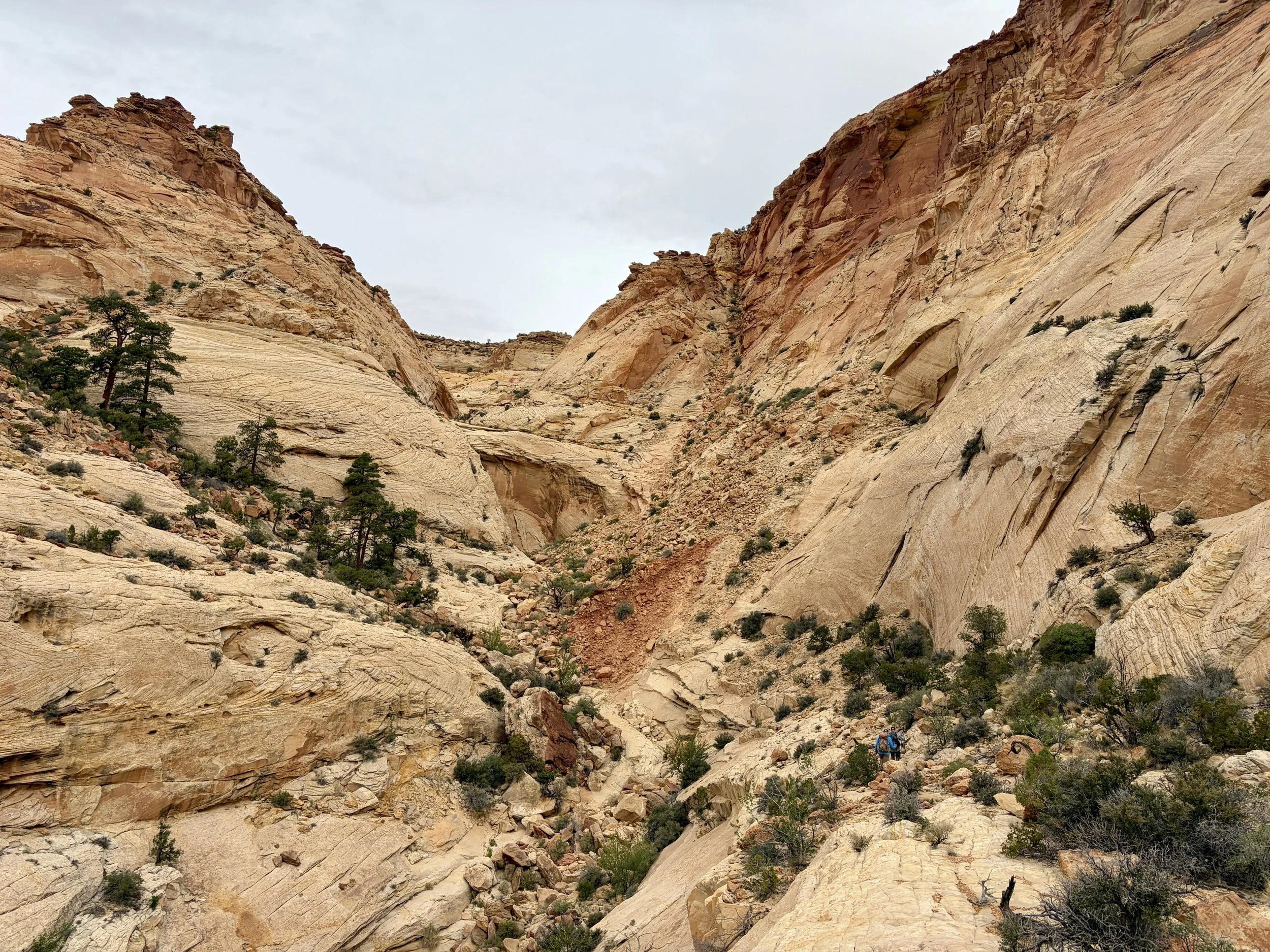
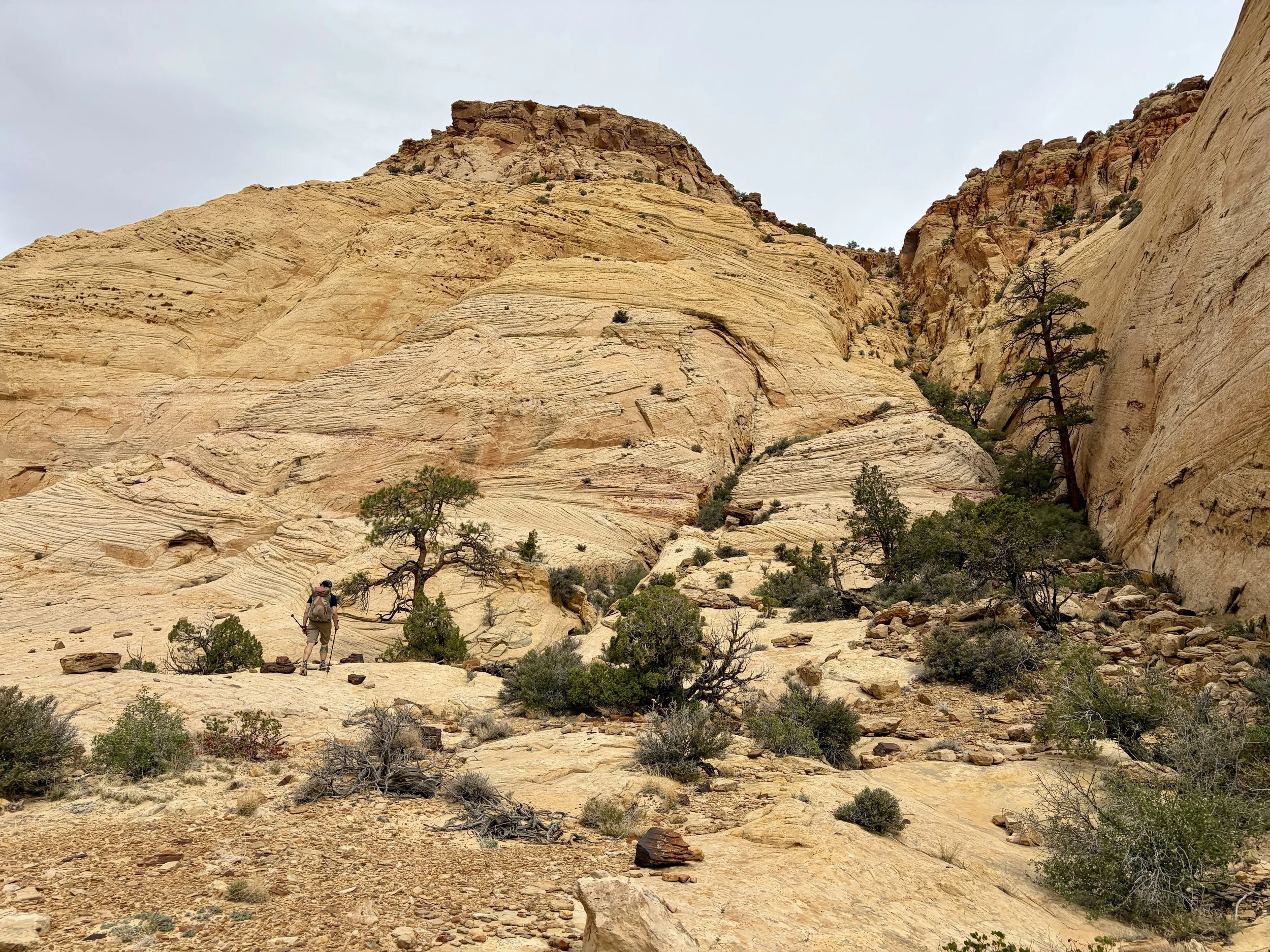
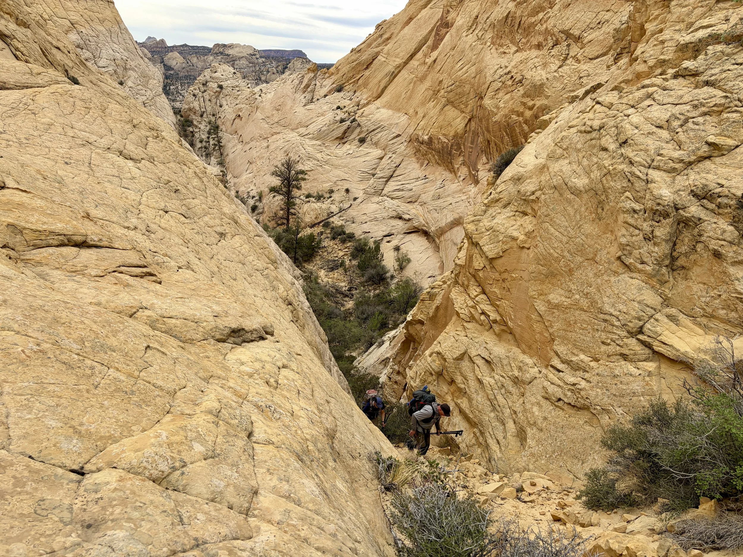
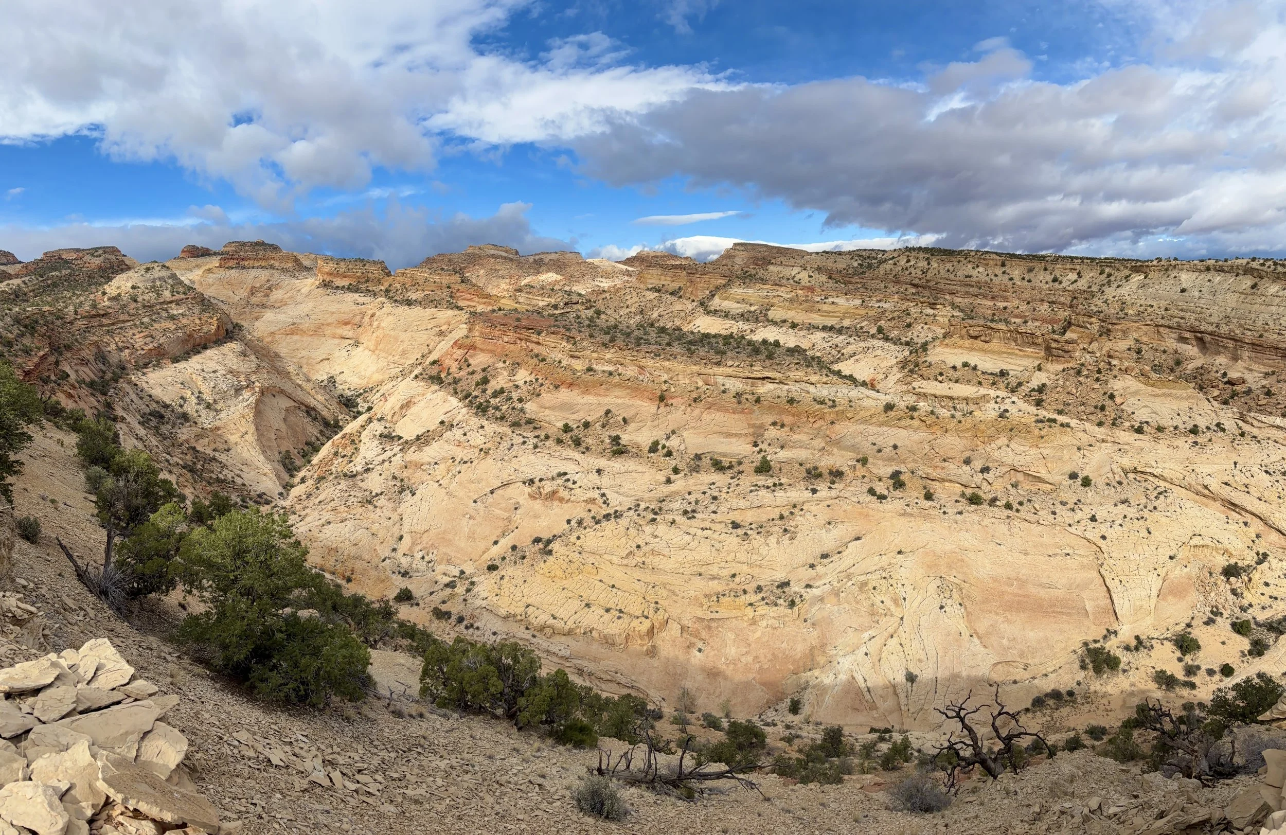
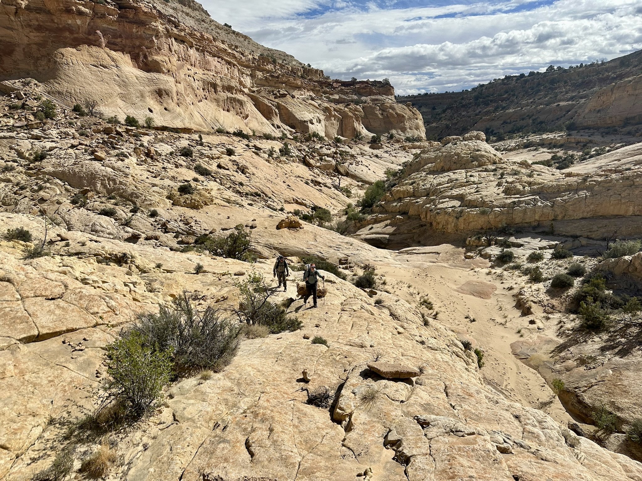
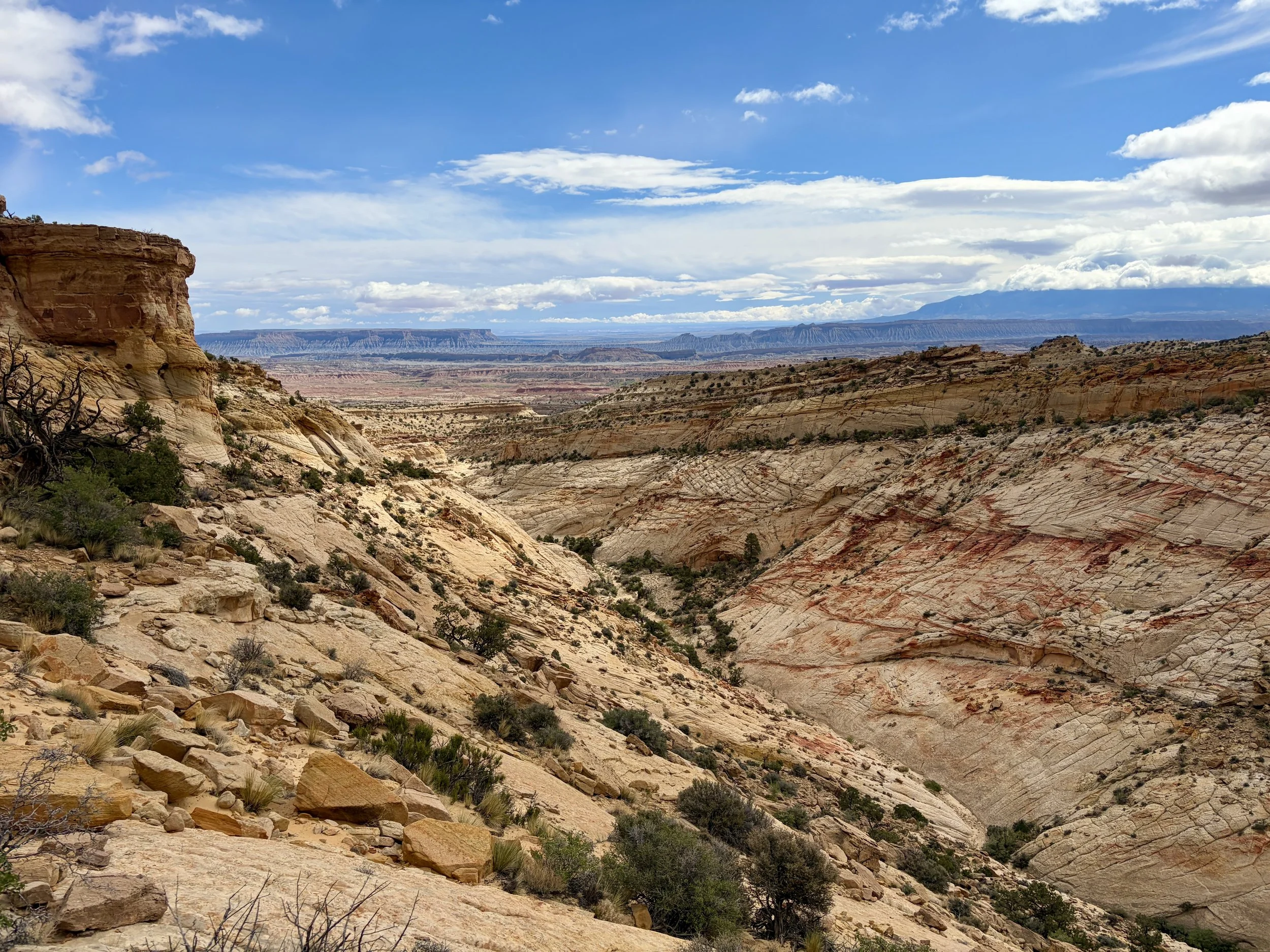
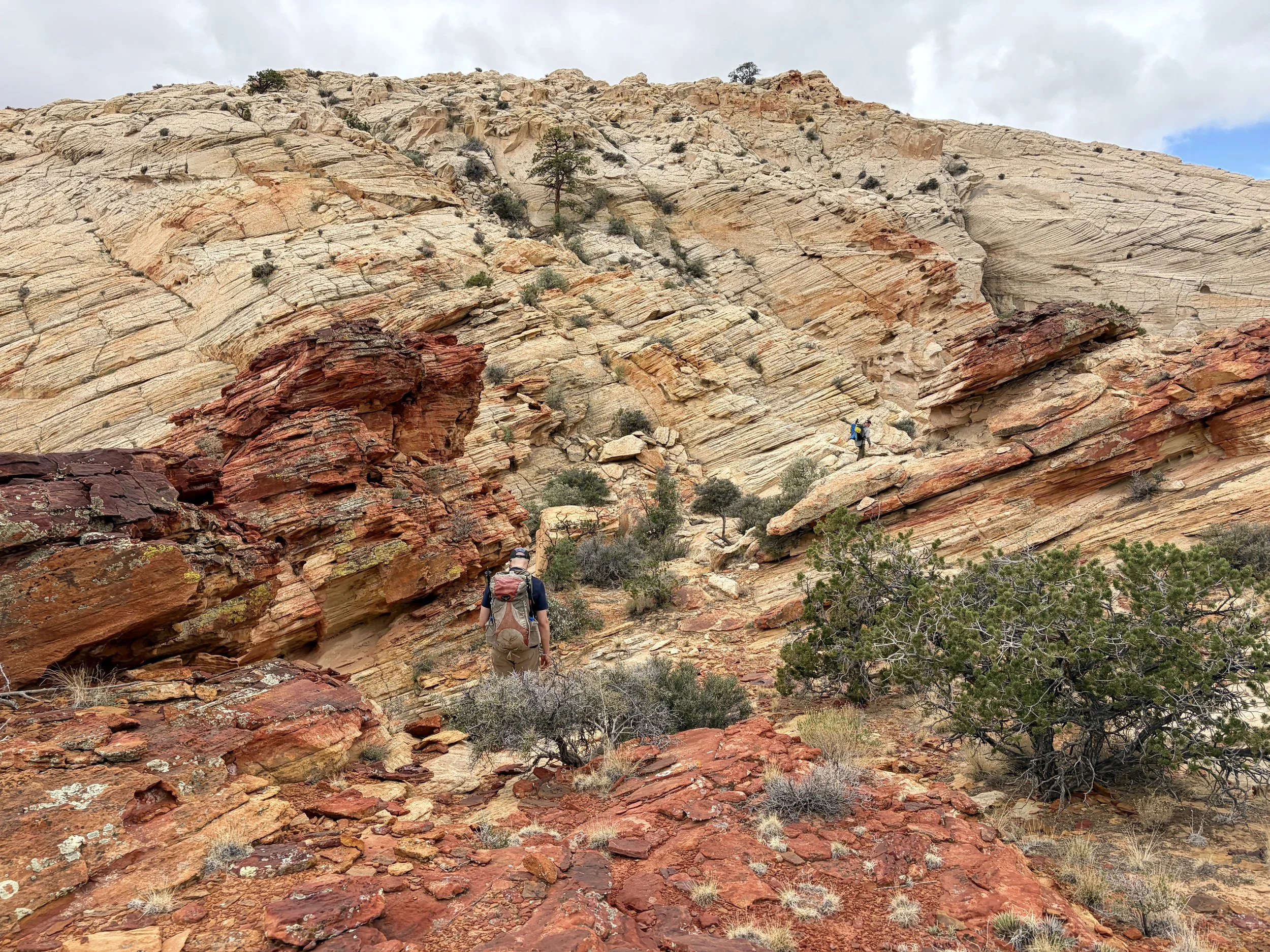
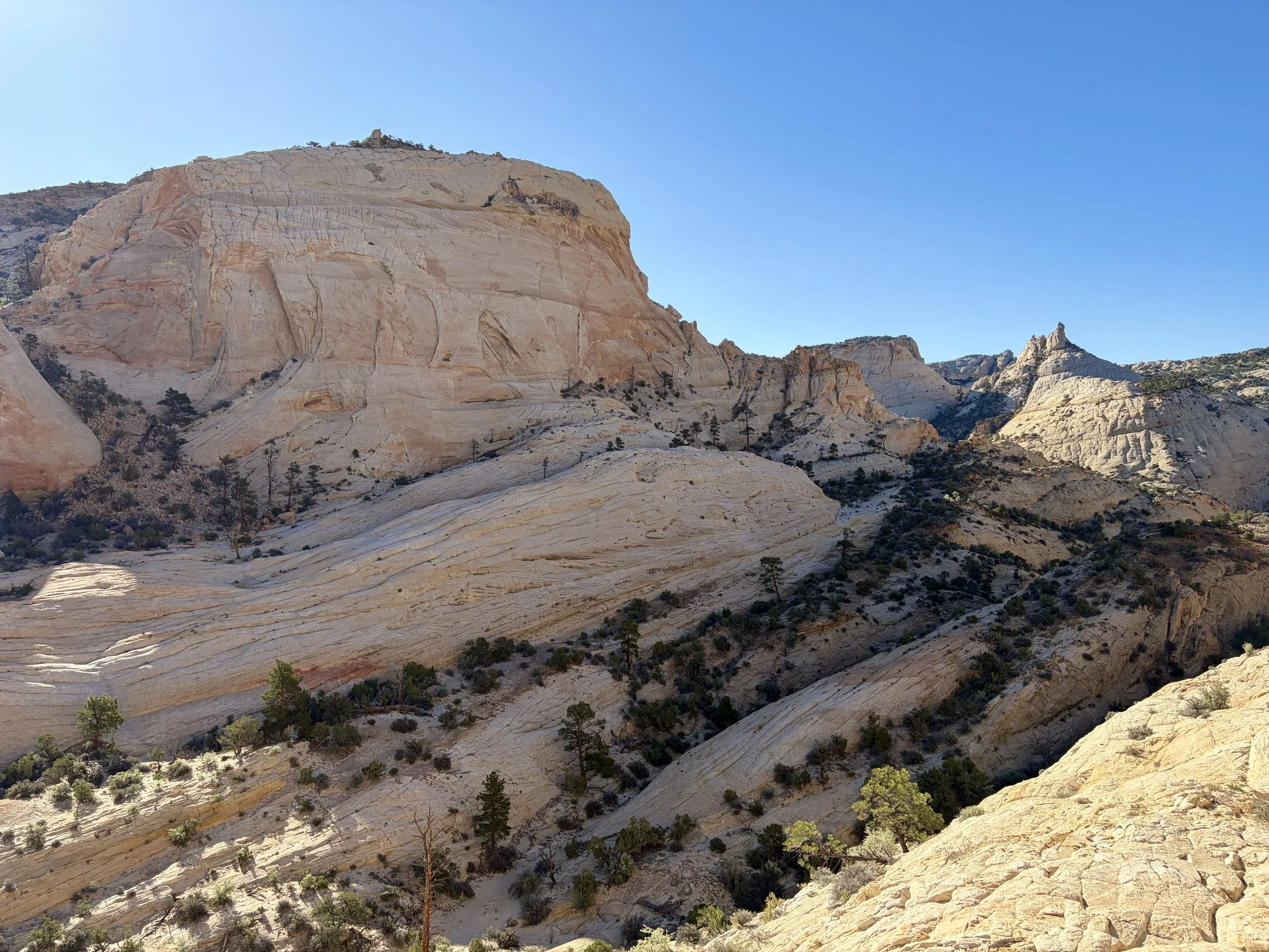
We headed down the ridge and soon found ourselves in Capitol Gorge. We refilled on water at the water tanks in Capitol Gorge and continued on our way. We saw a handful of other potholes that morning with water and were happy to see that water might not be as big of a concern as feared. We ate lunch with beautiful views of Golden Throne and then headed down one of the steeper gullies I have gone down to get to the next drainage.
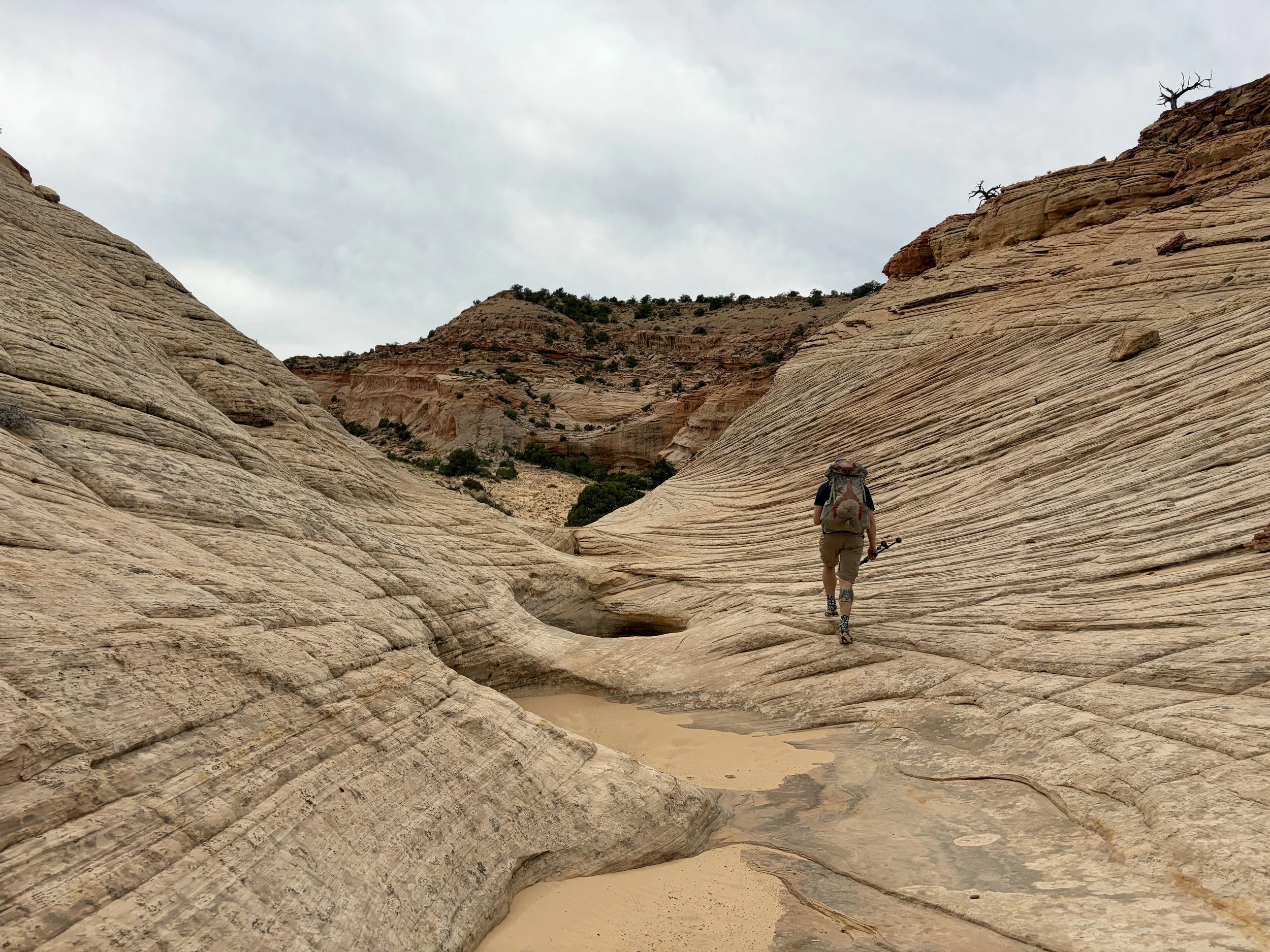
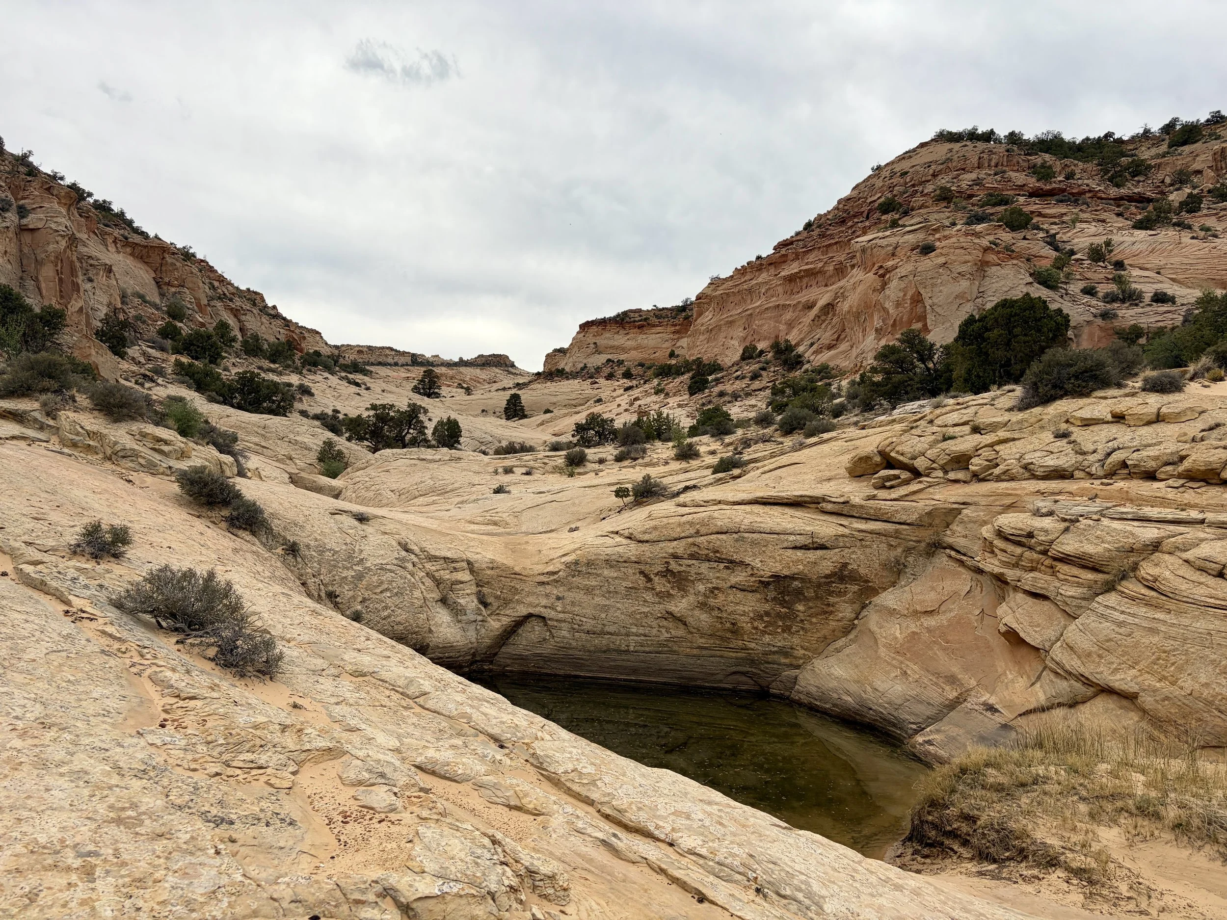
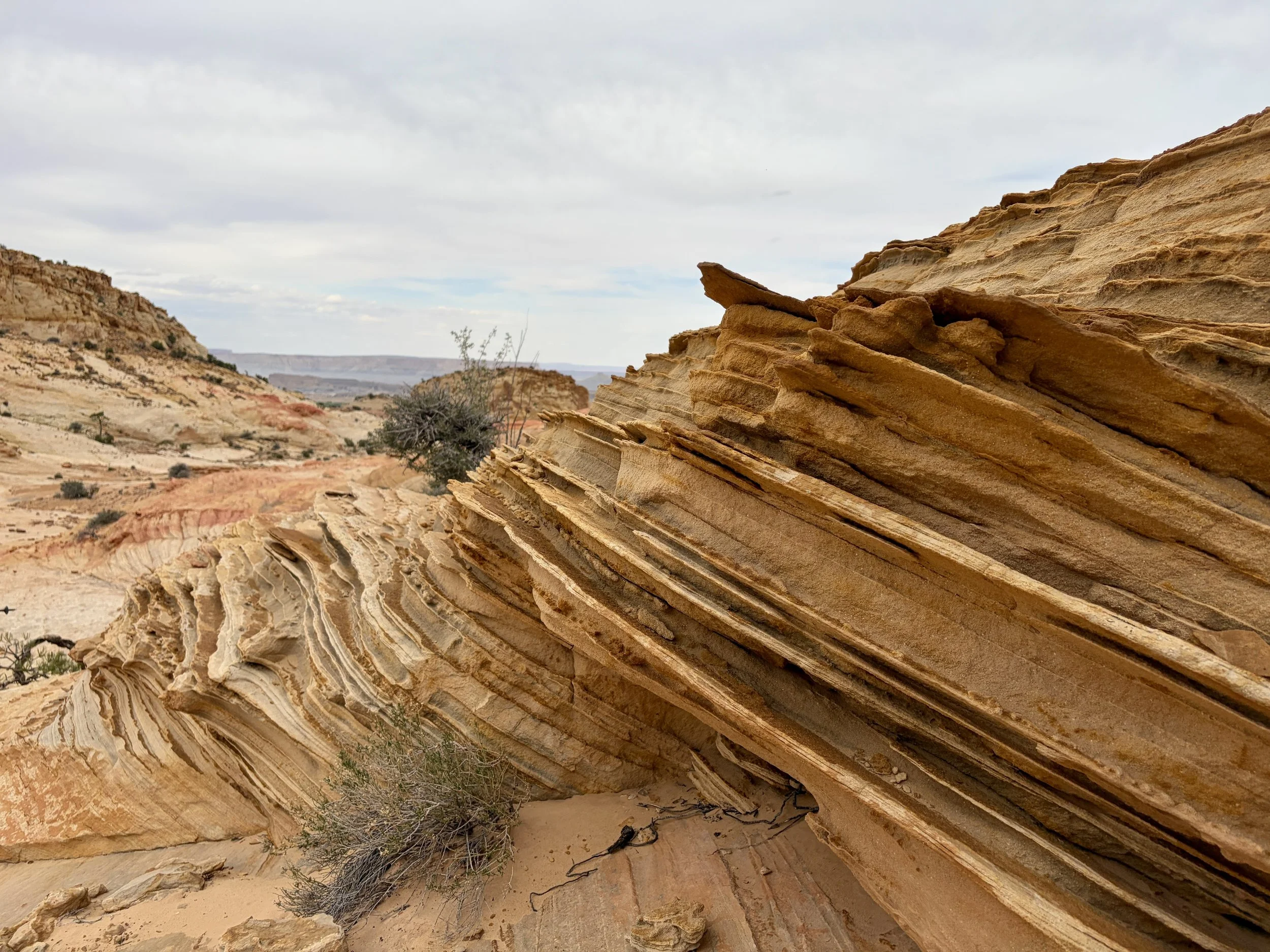
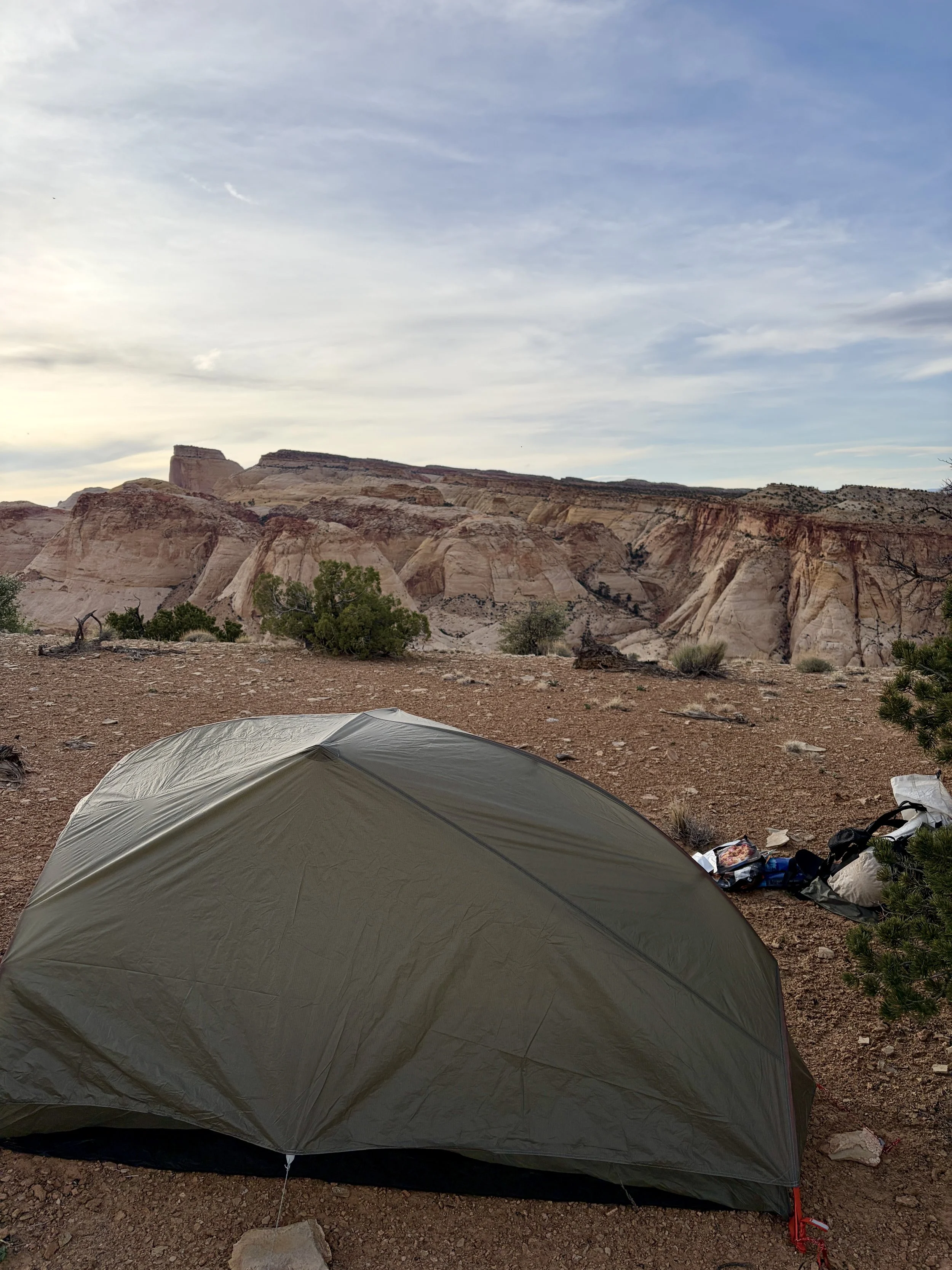
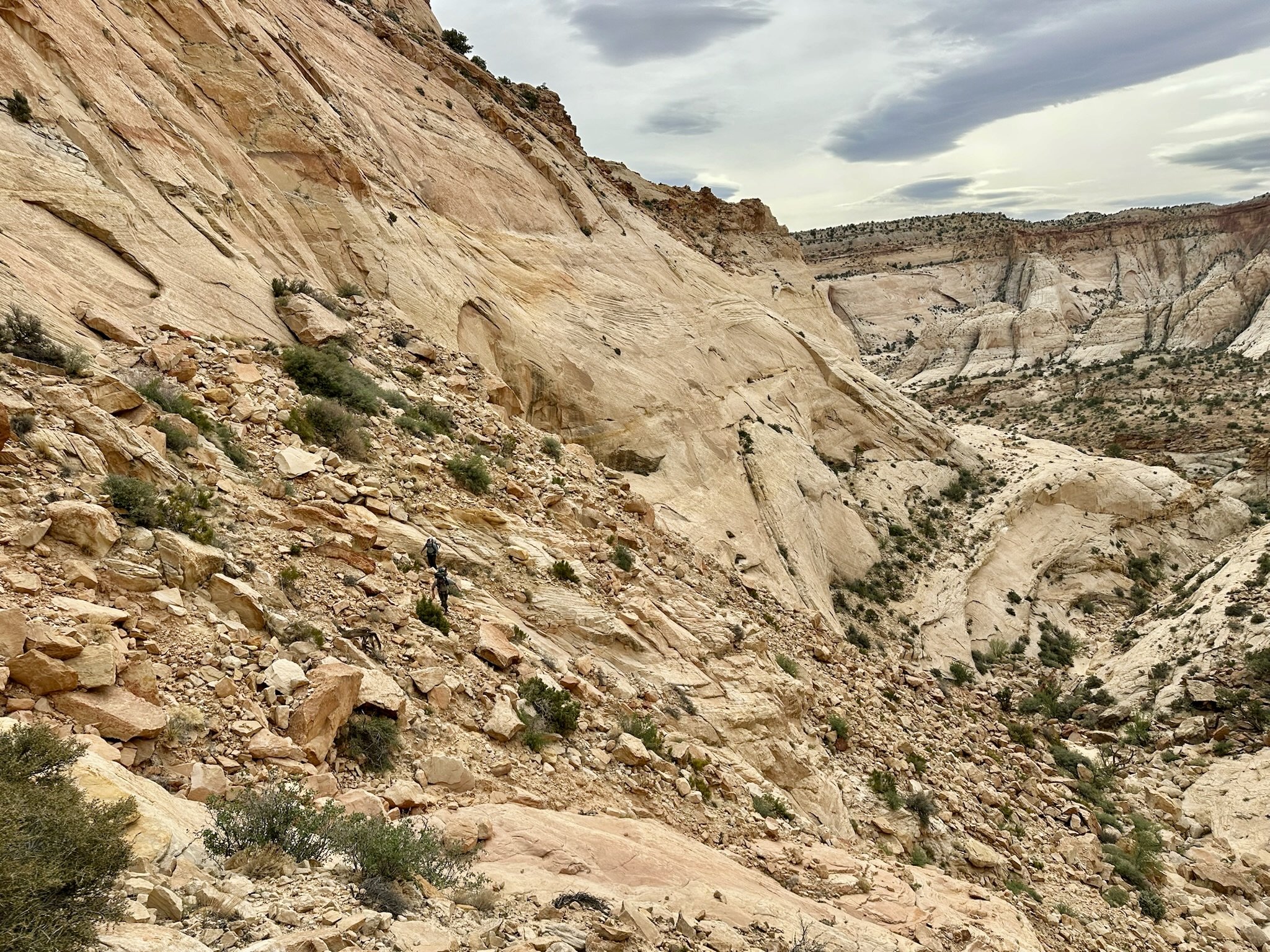
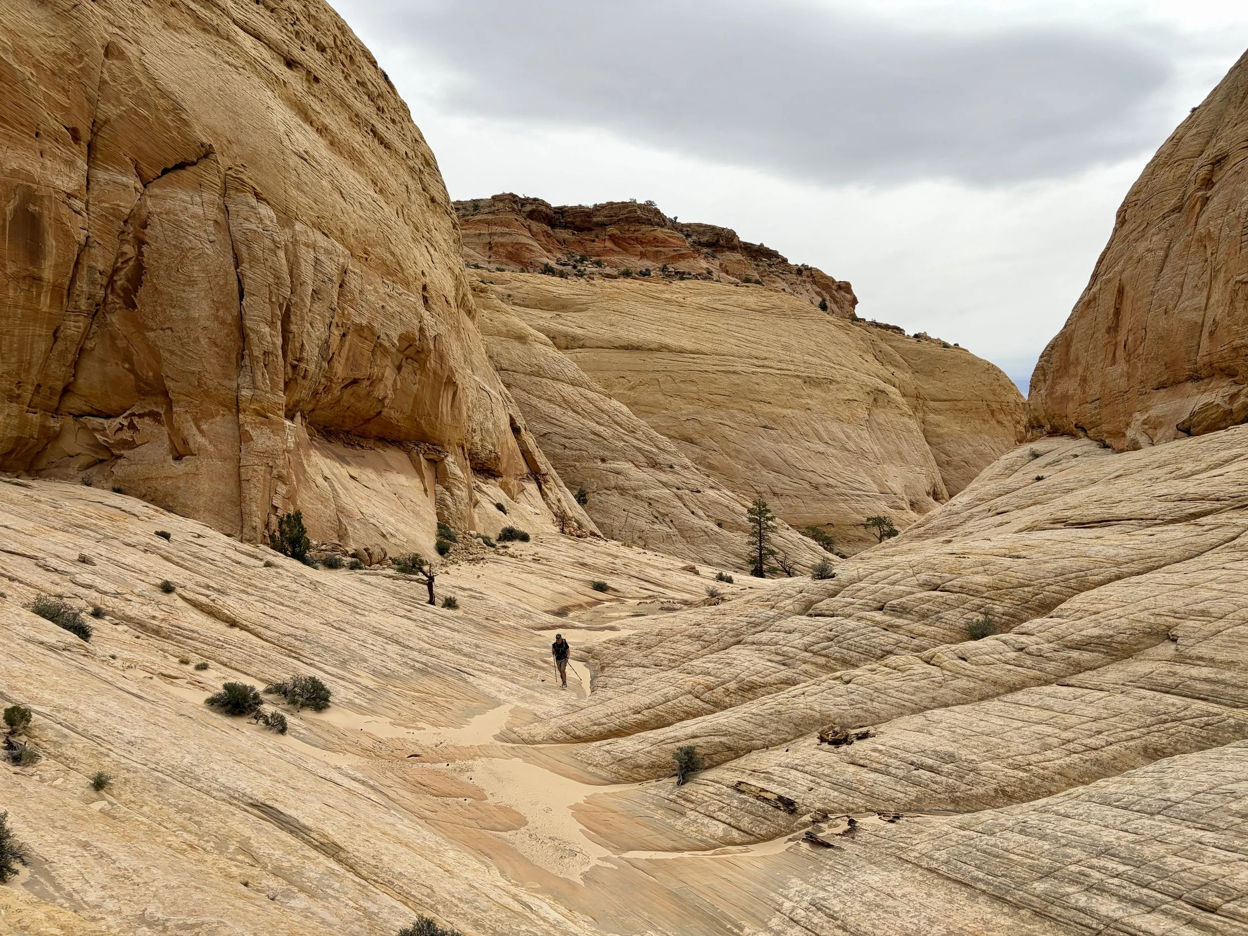
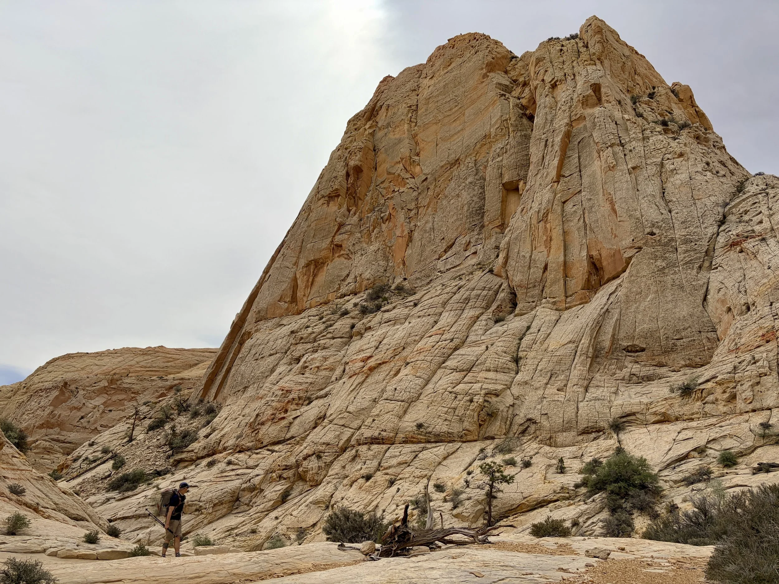
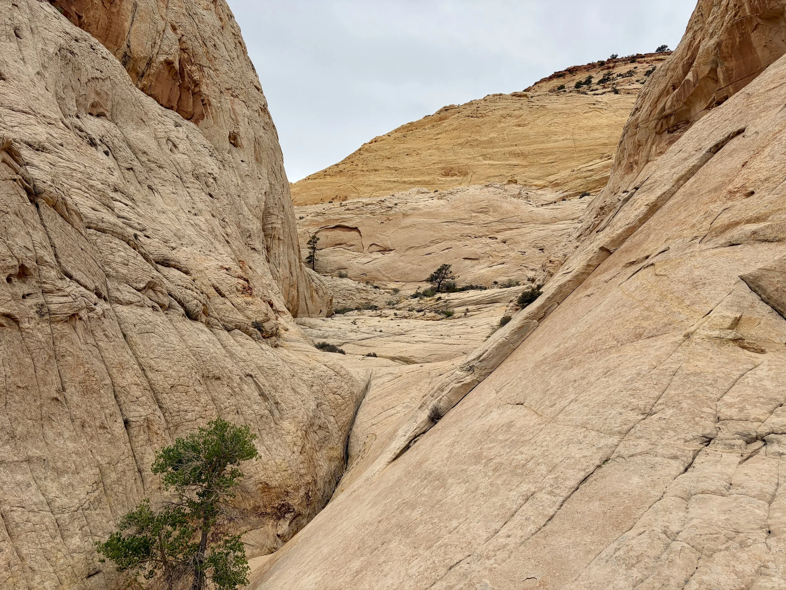
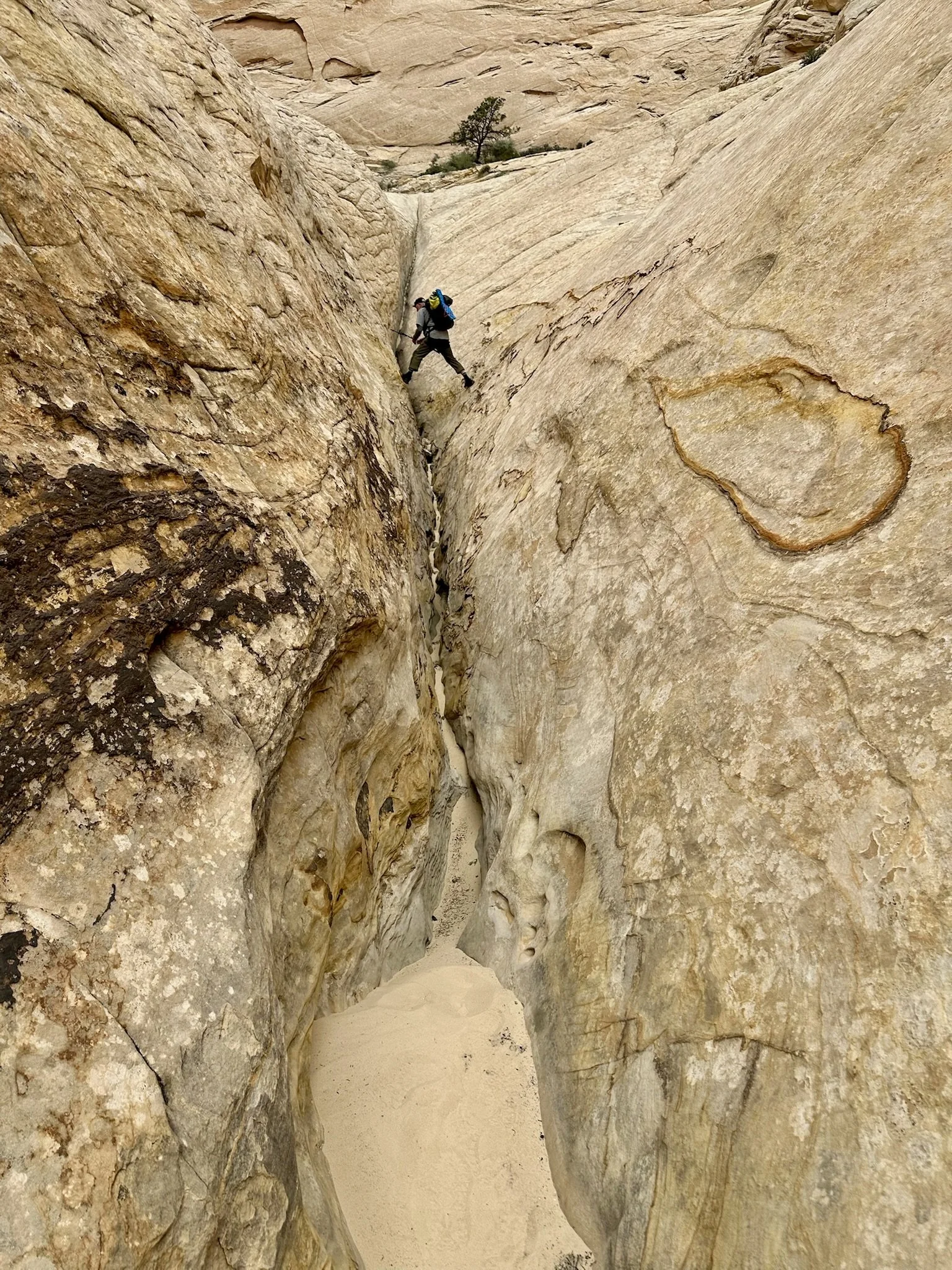
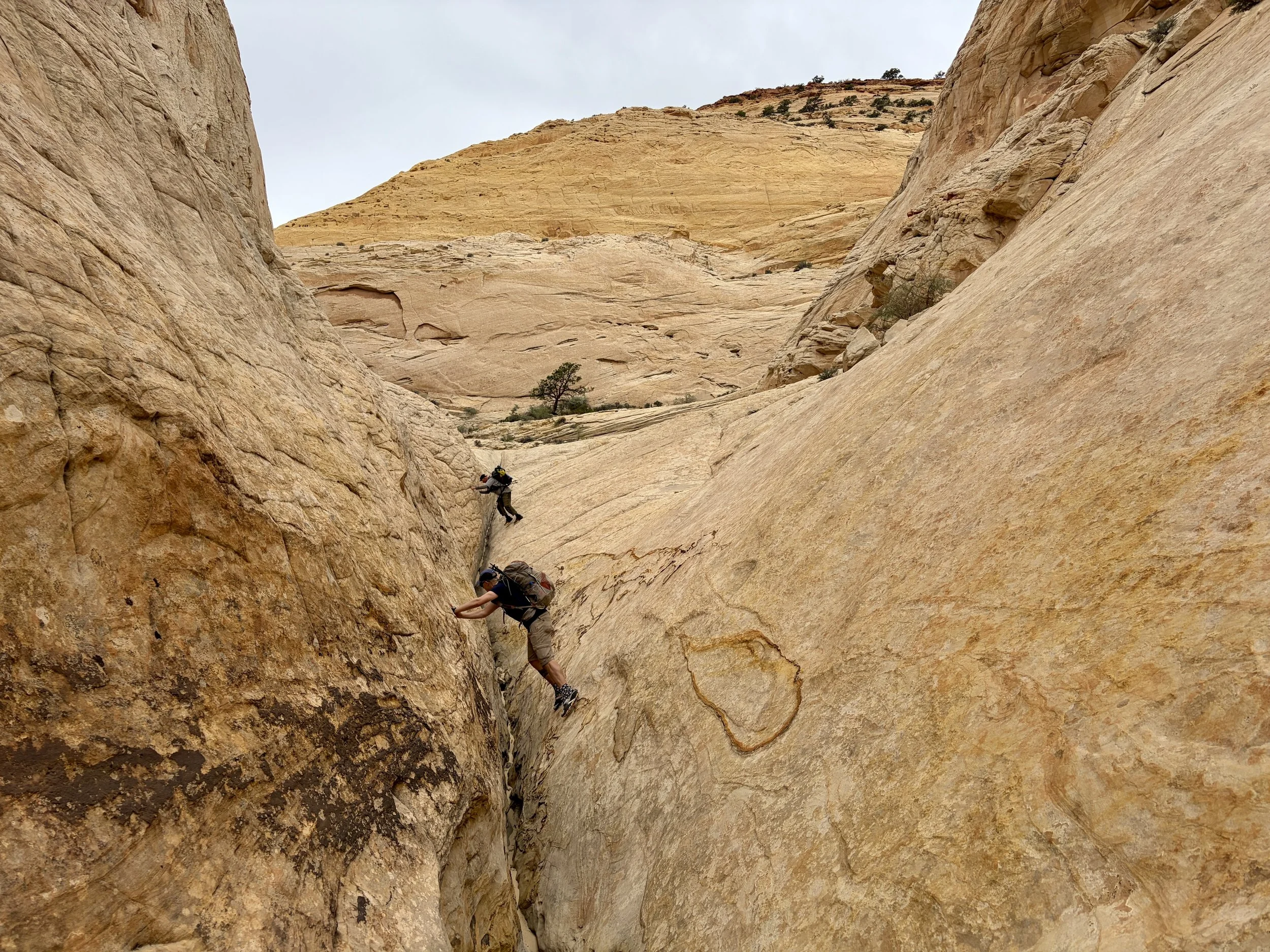
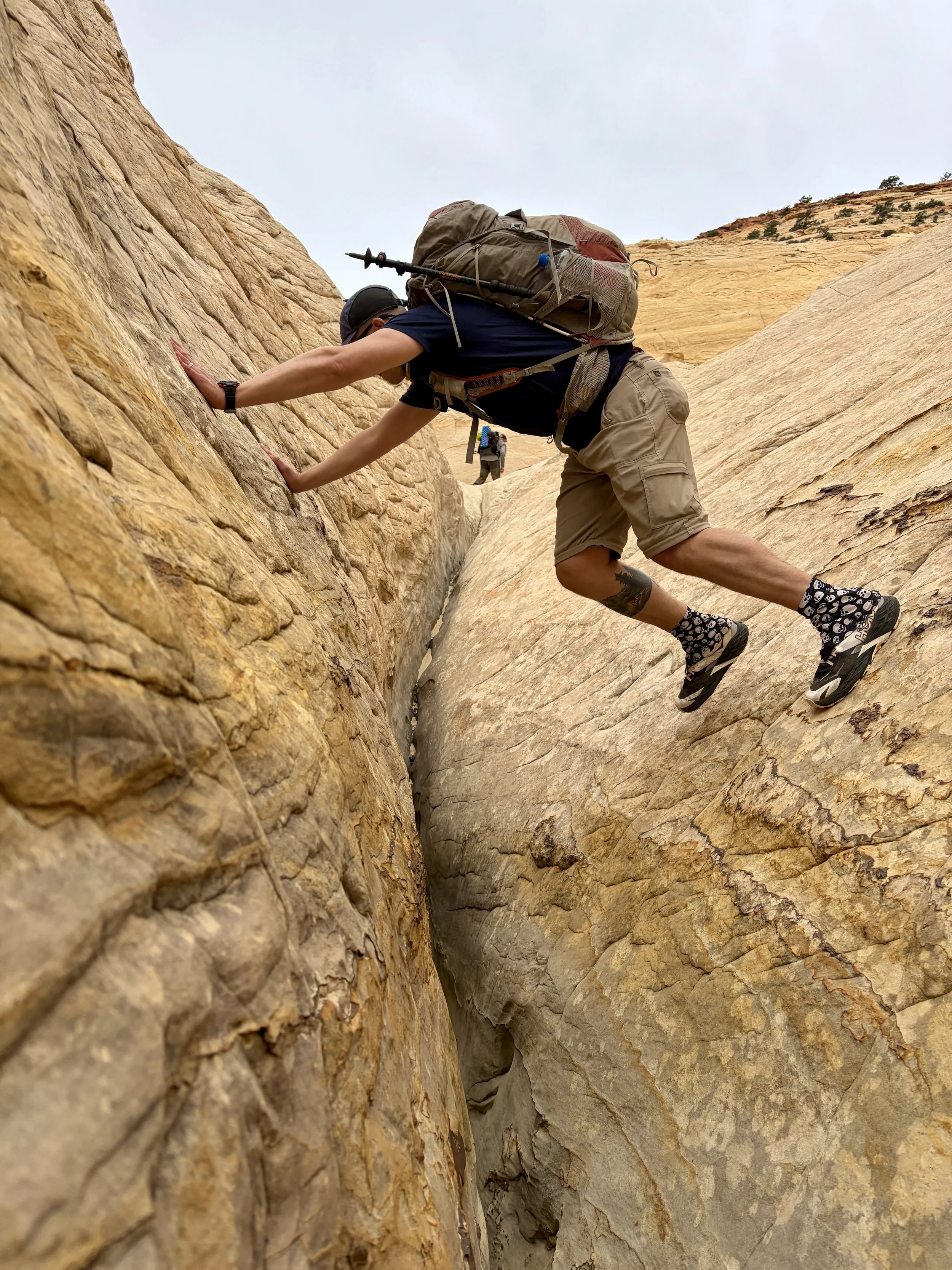
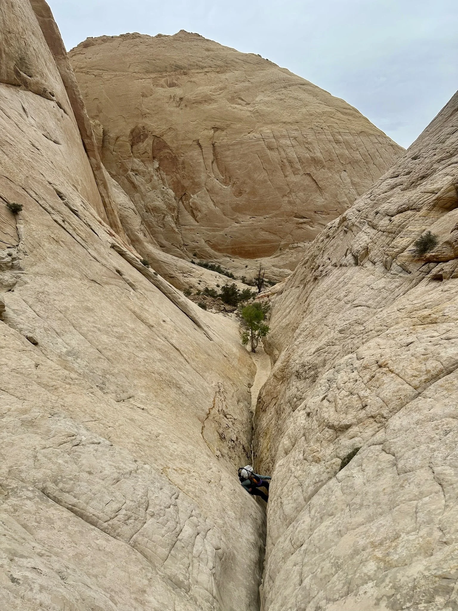
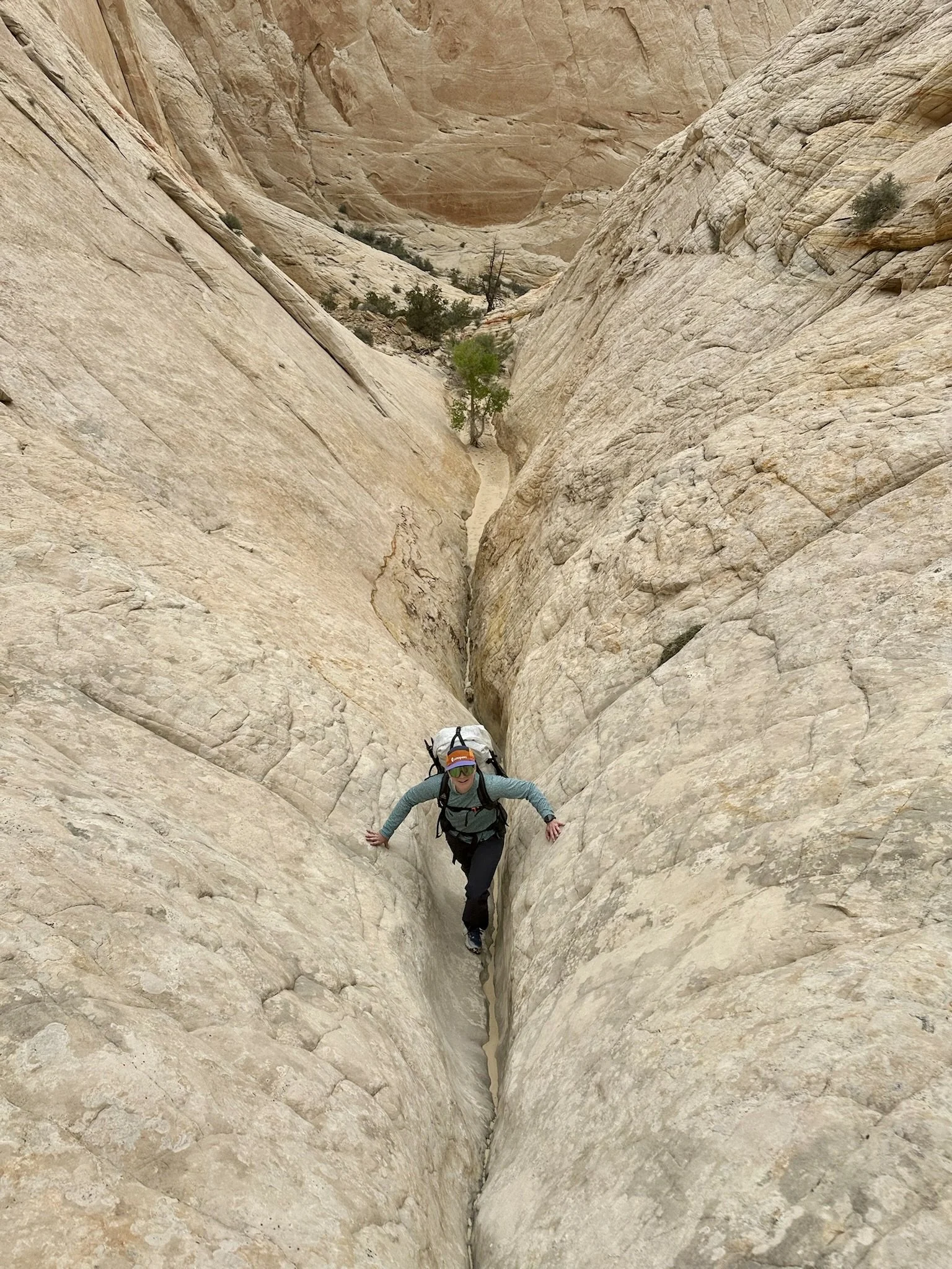
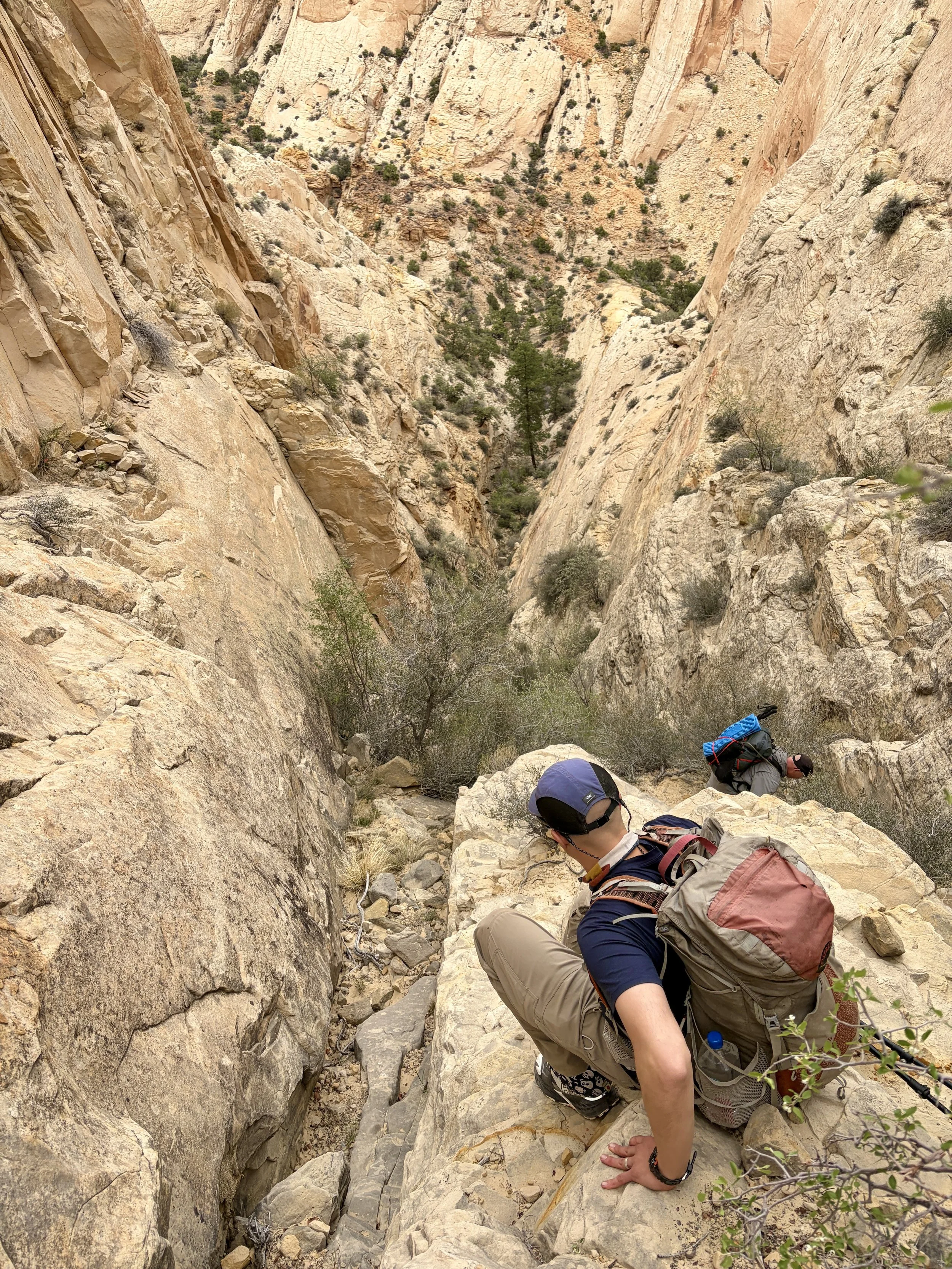
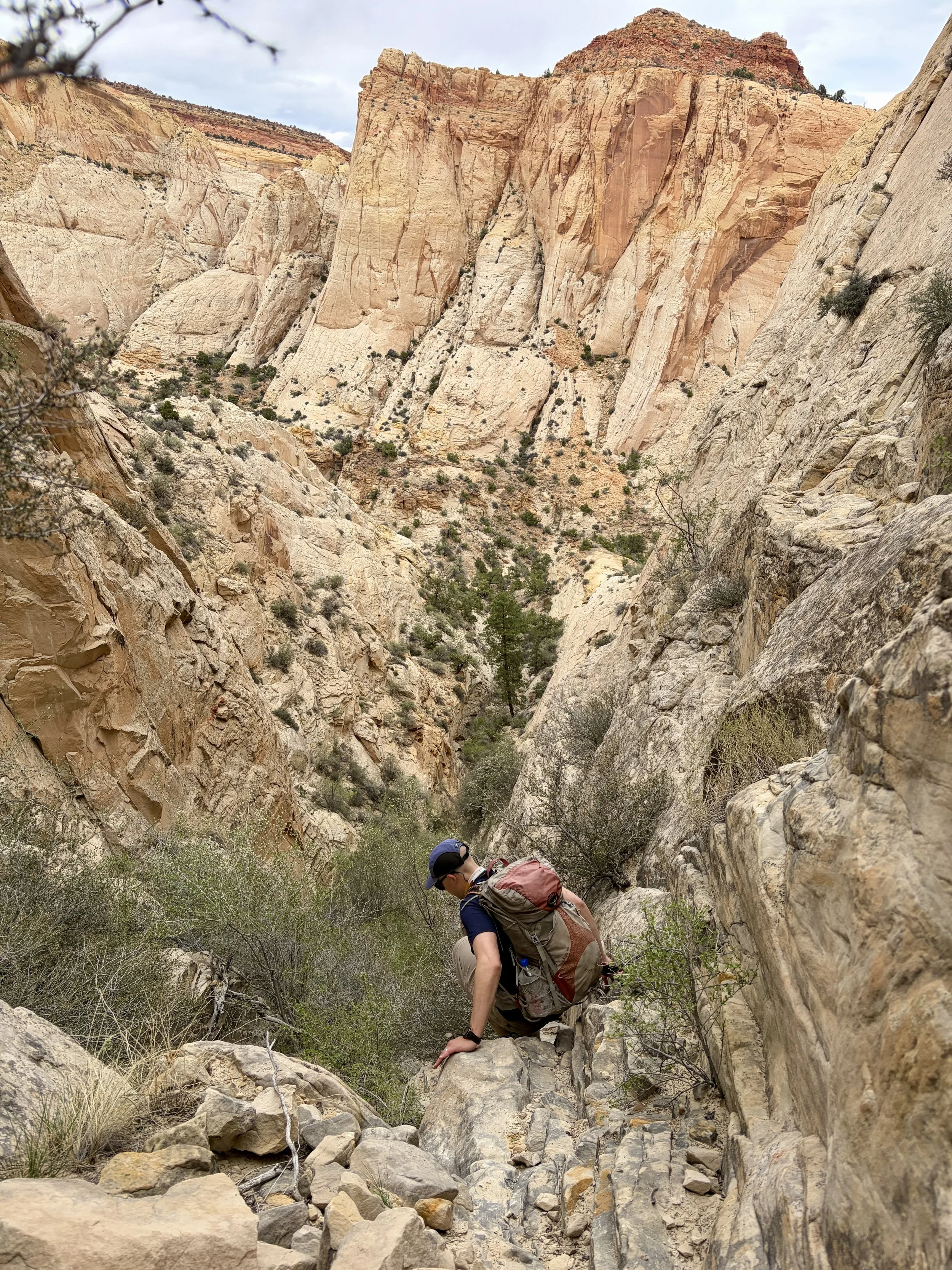
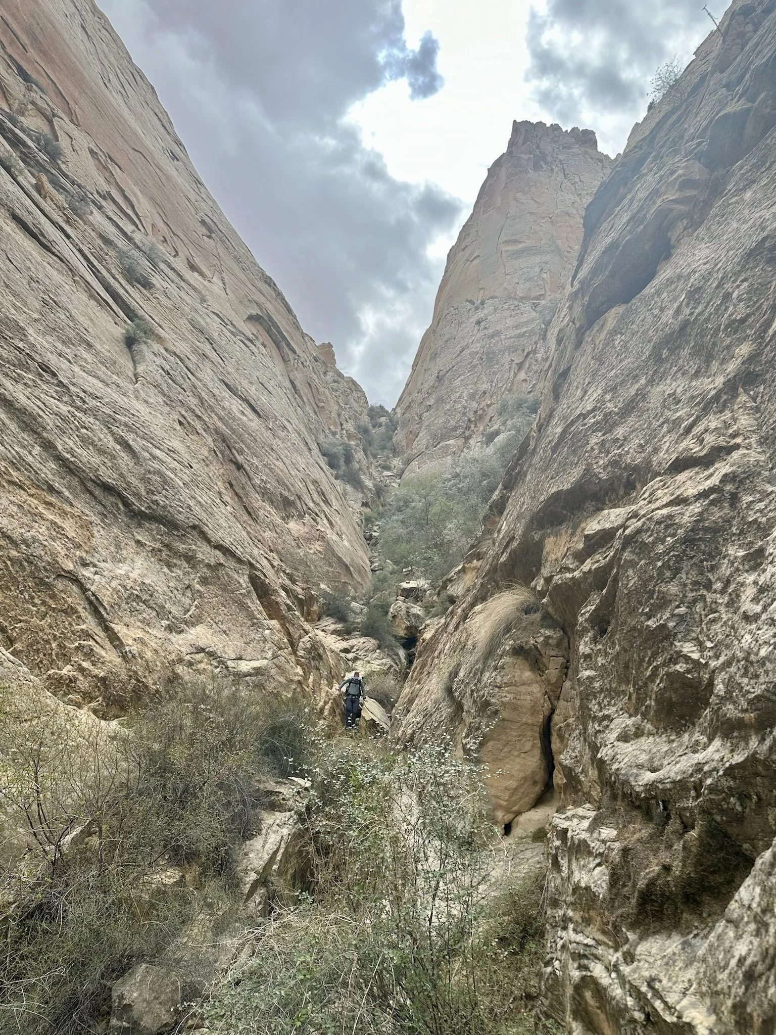
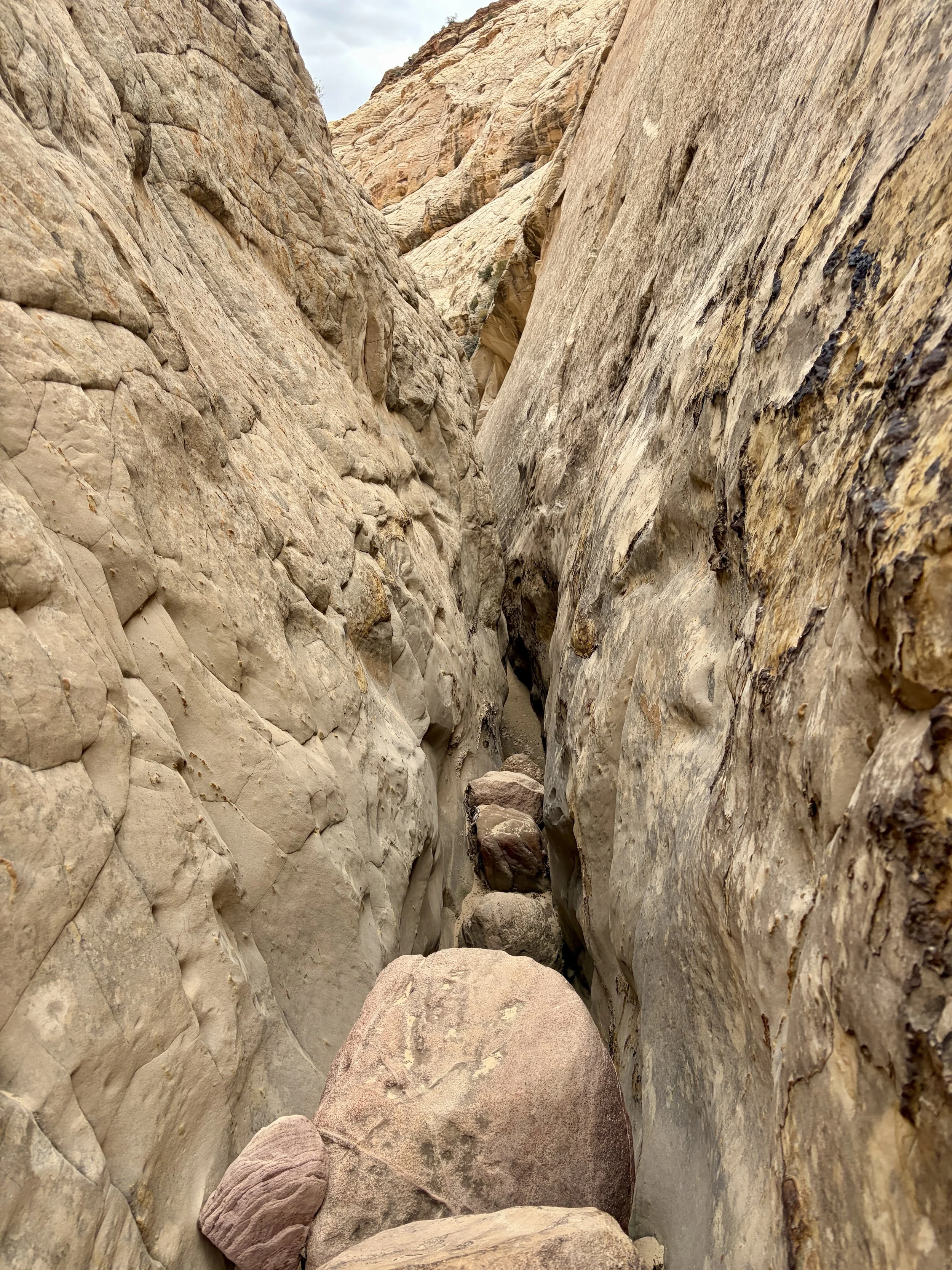
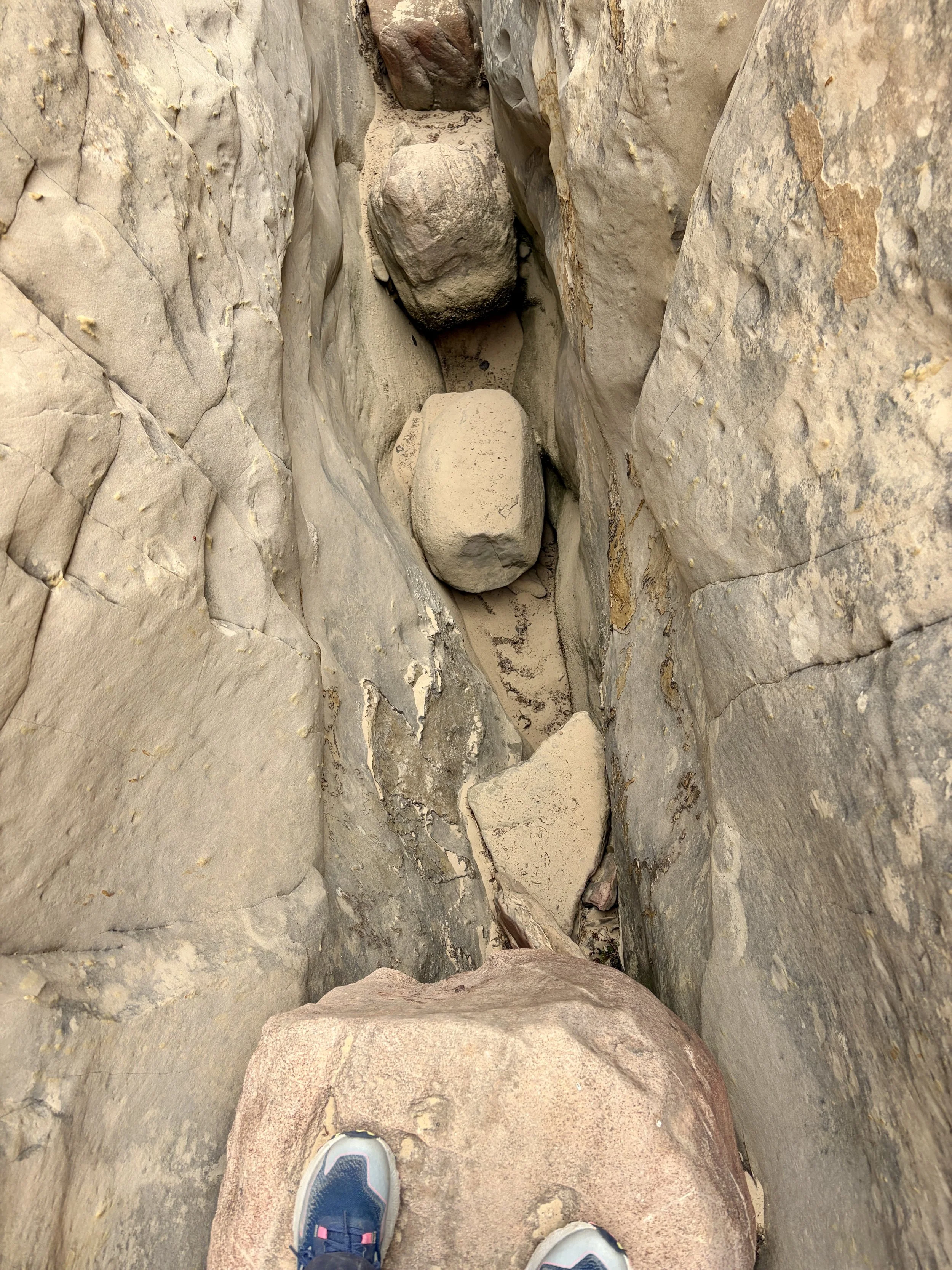
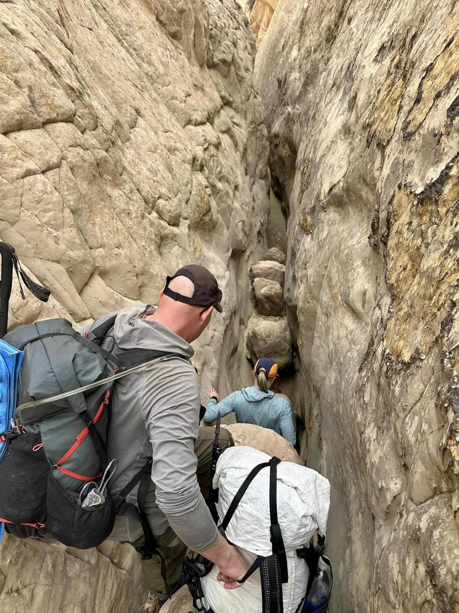
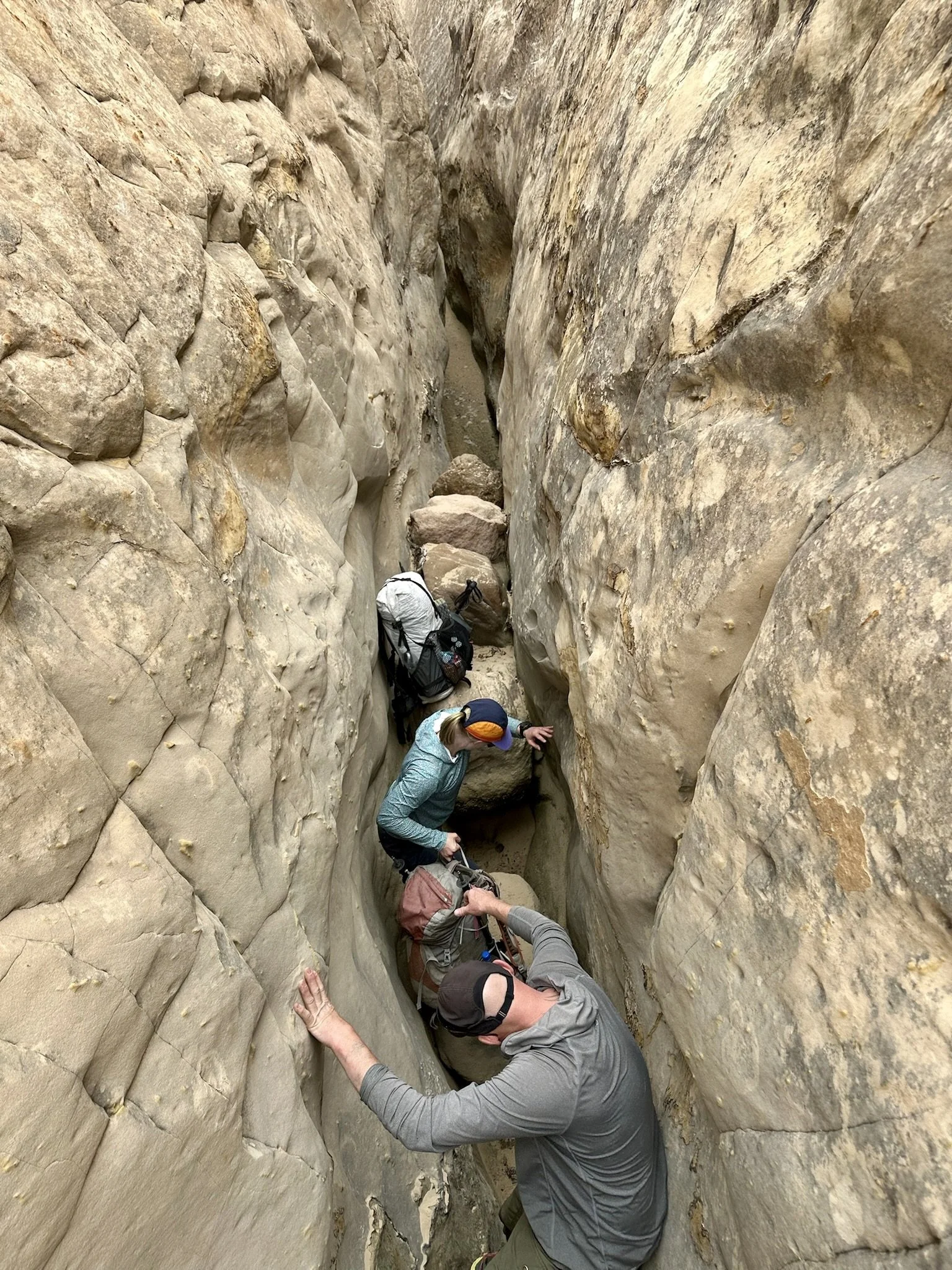
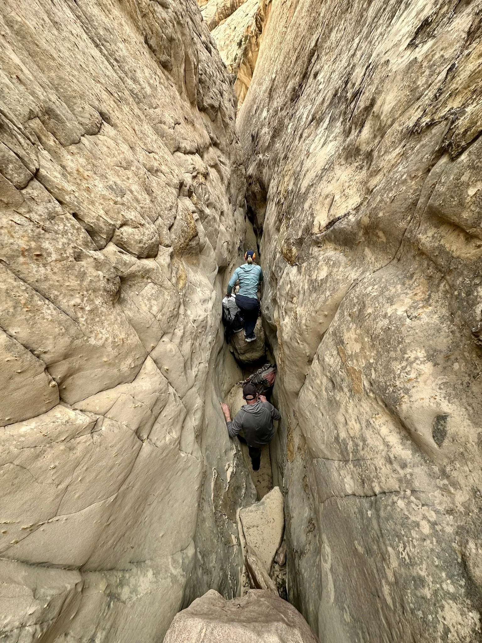
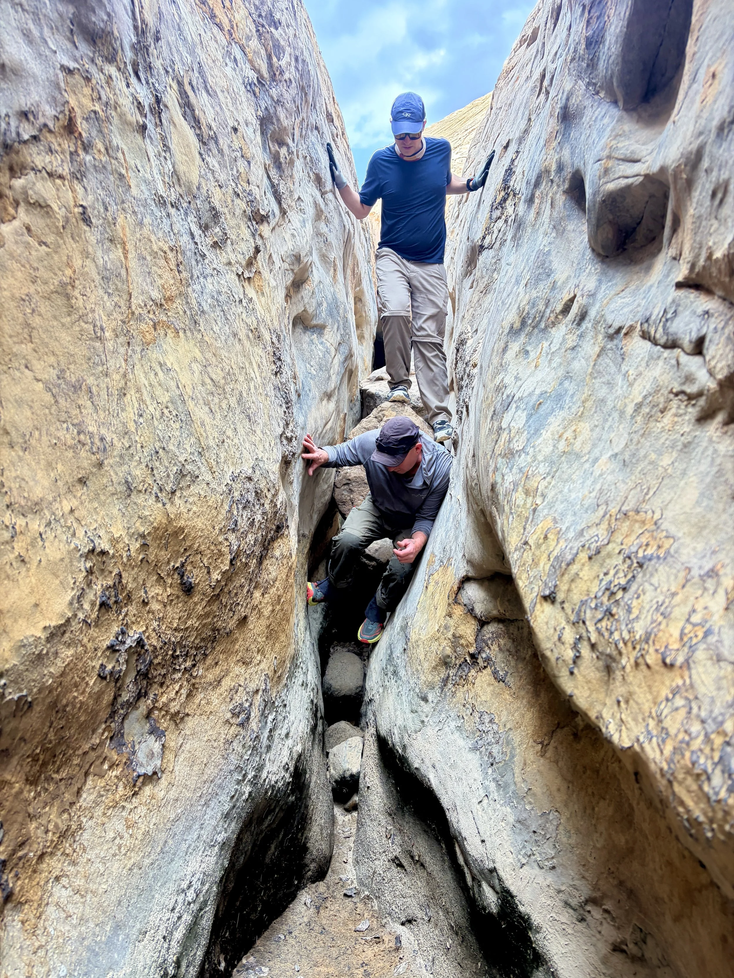
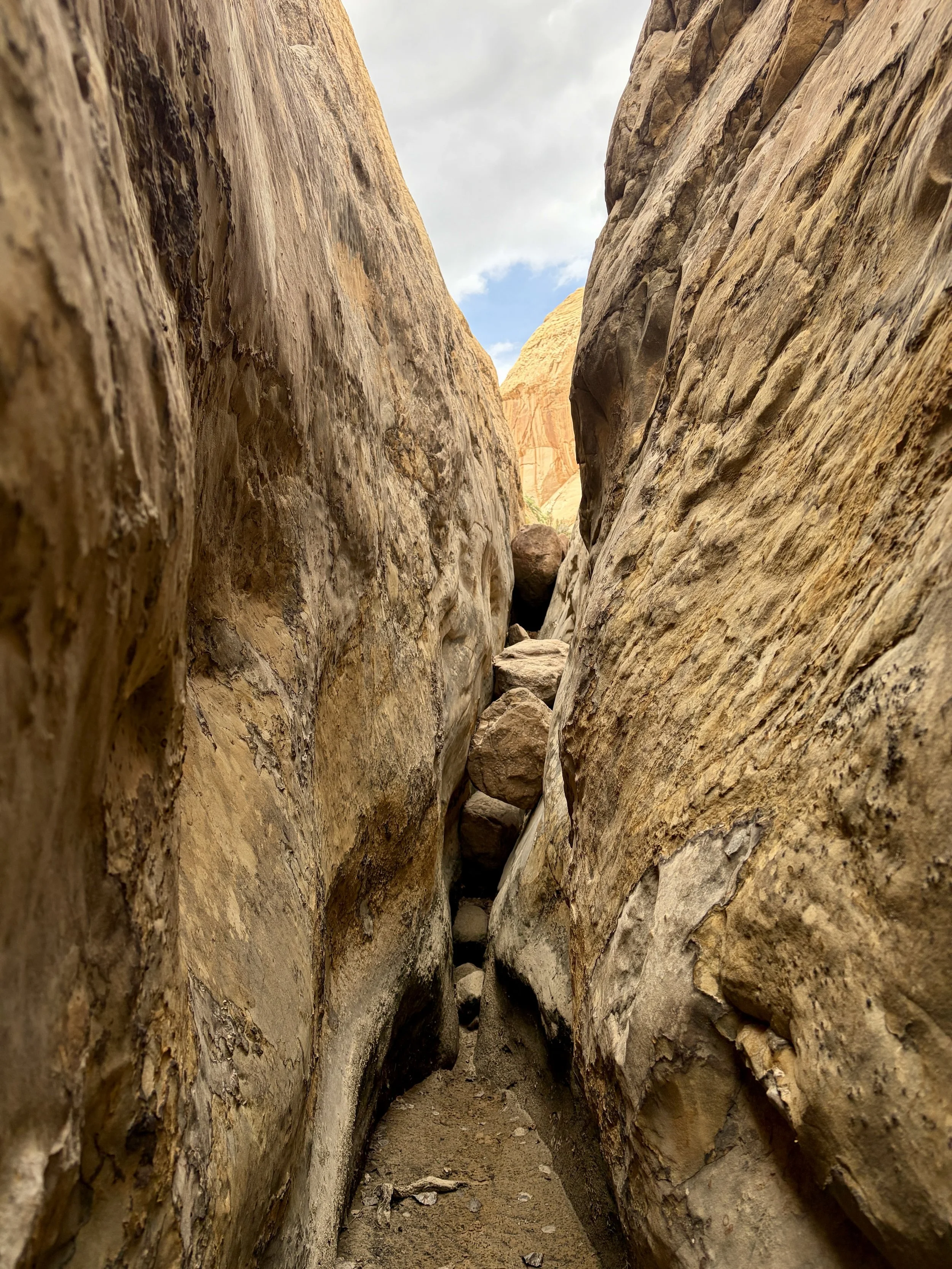
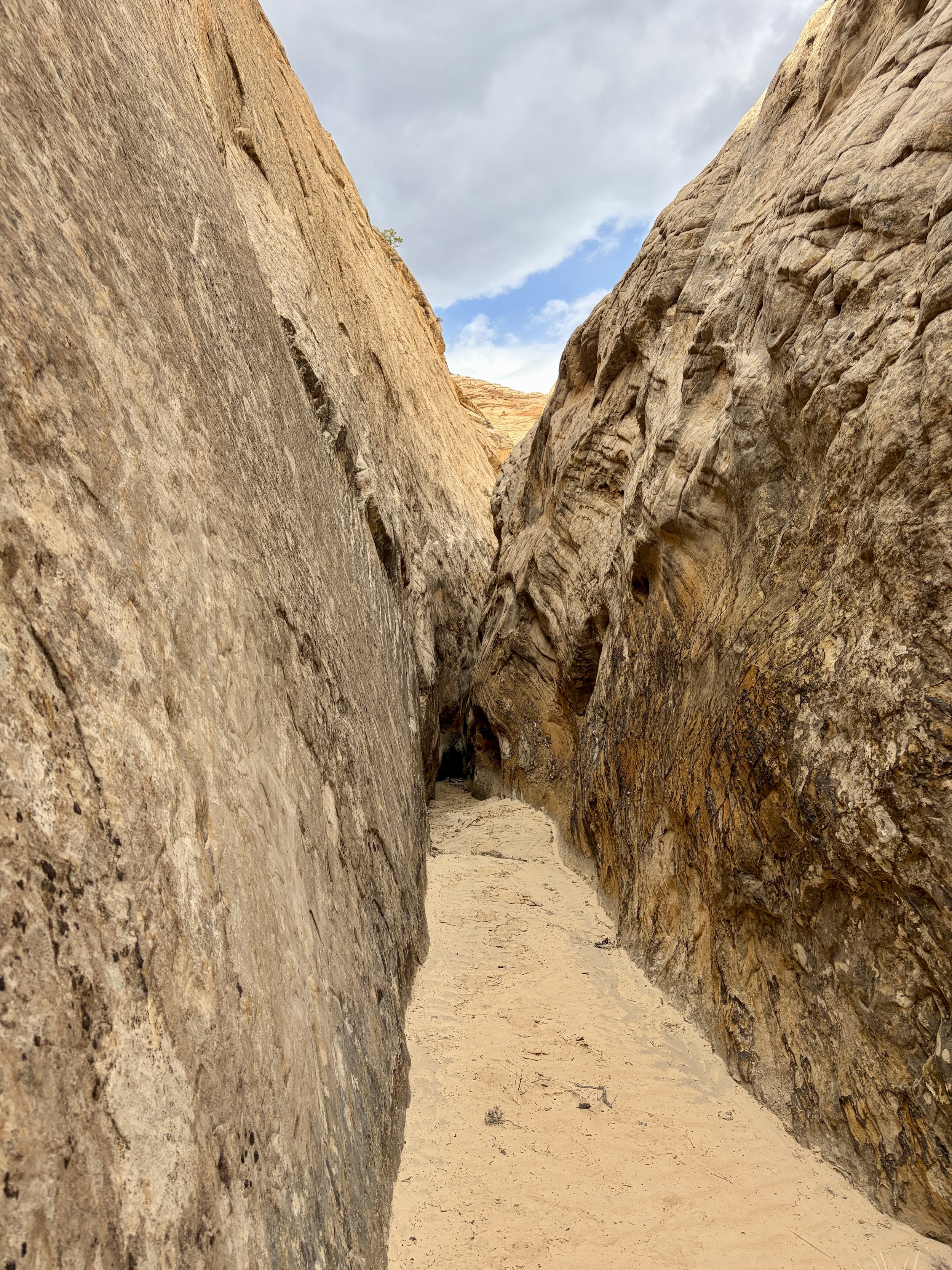
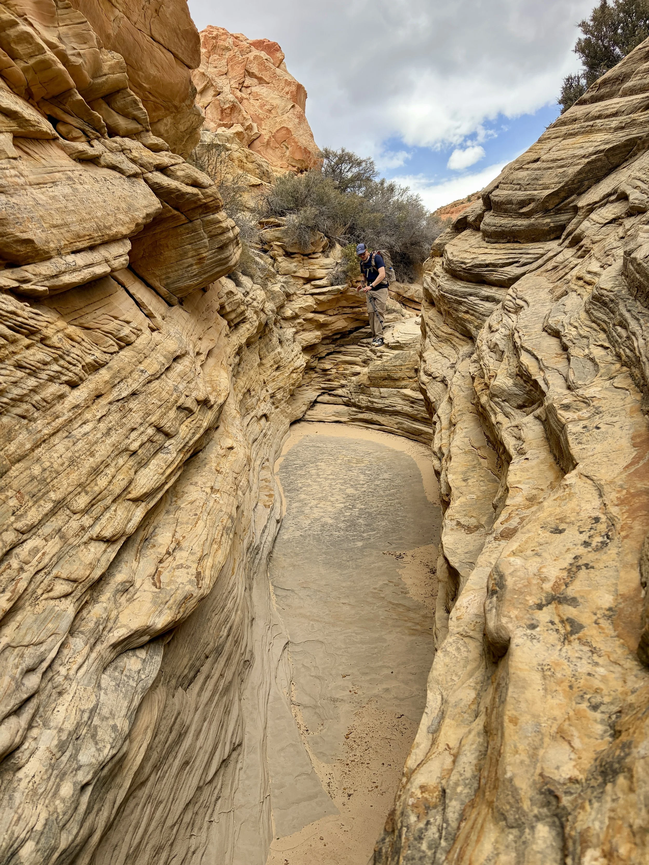
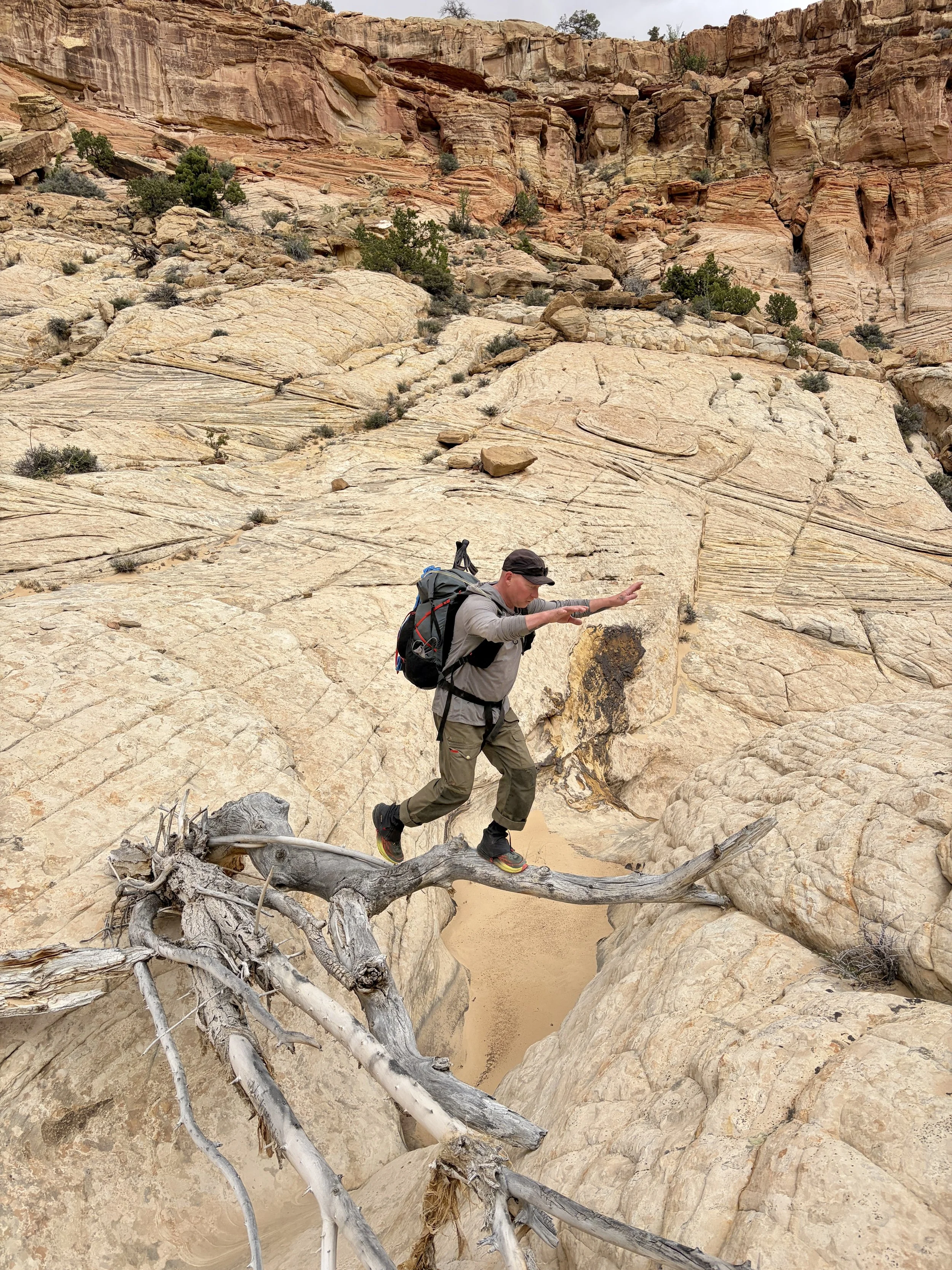
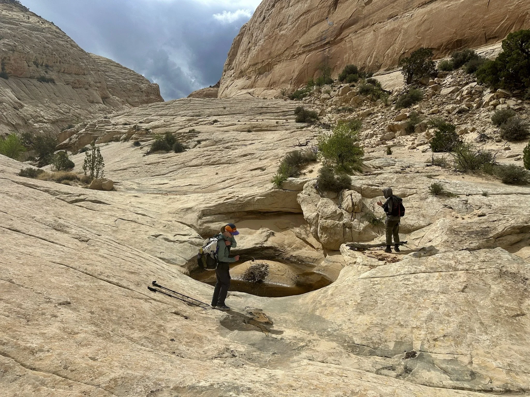
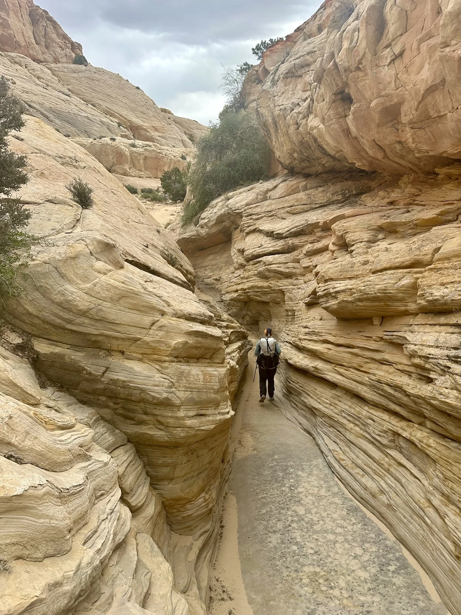
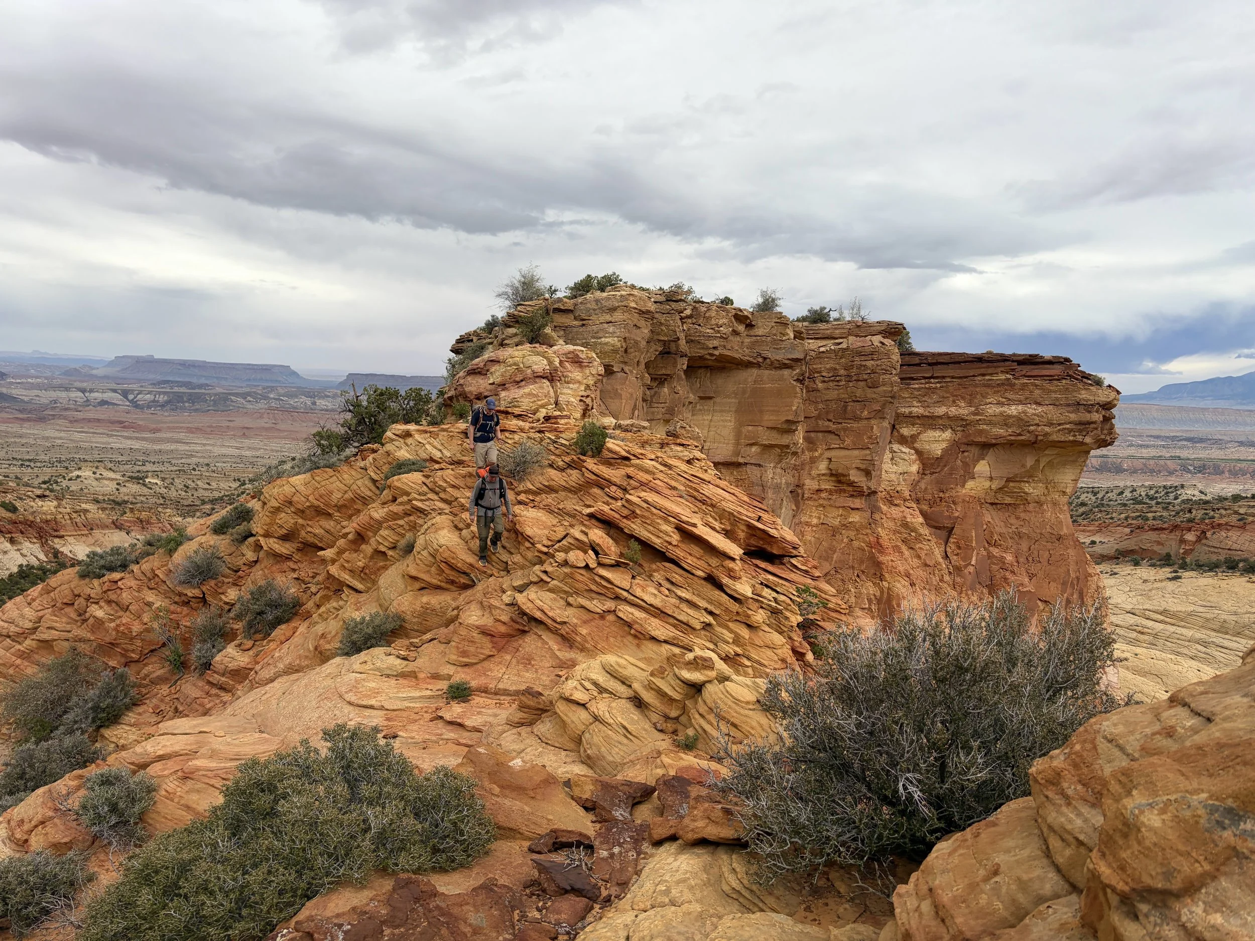
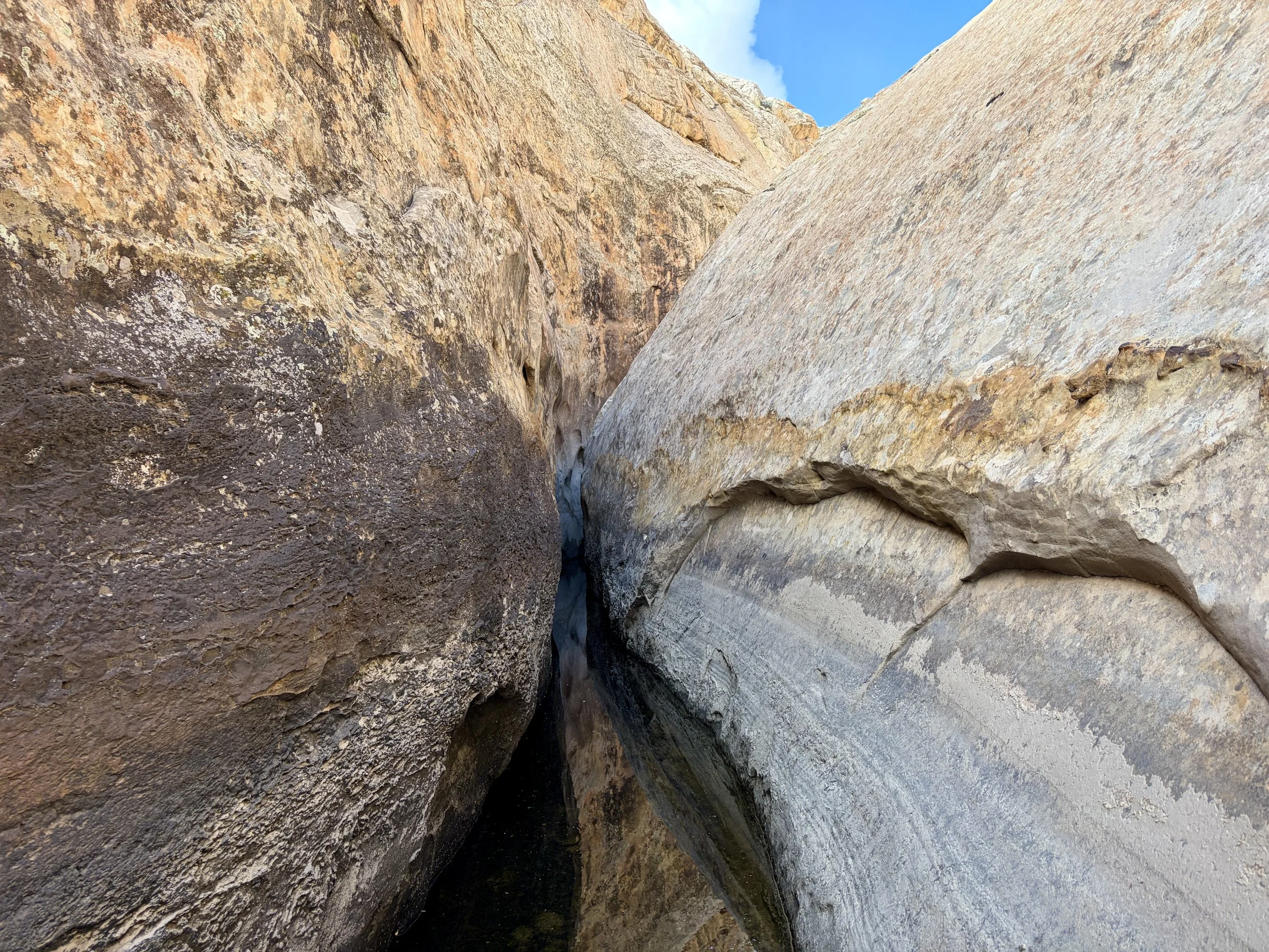
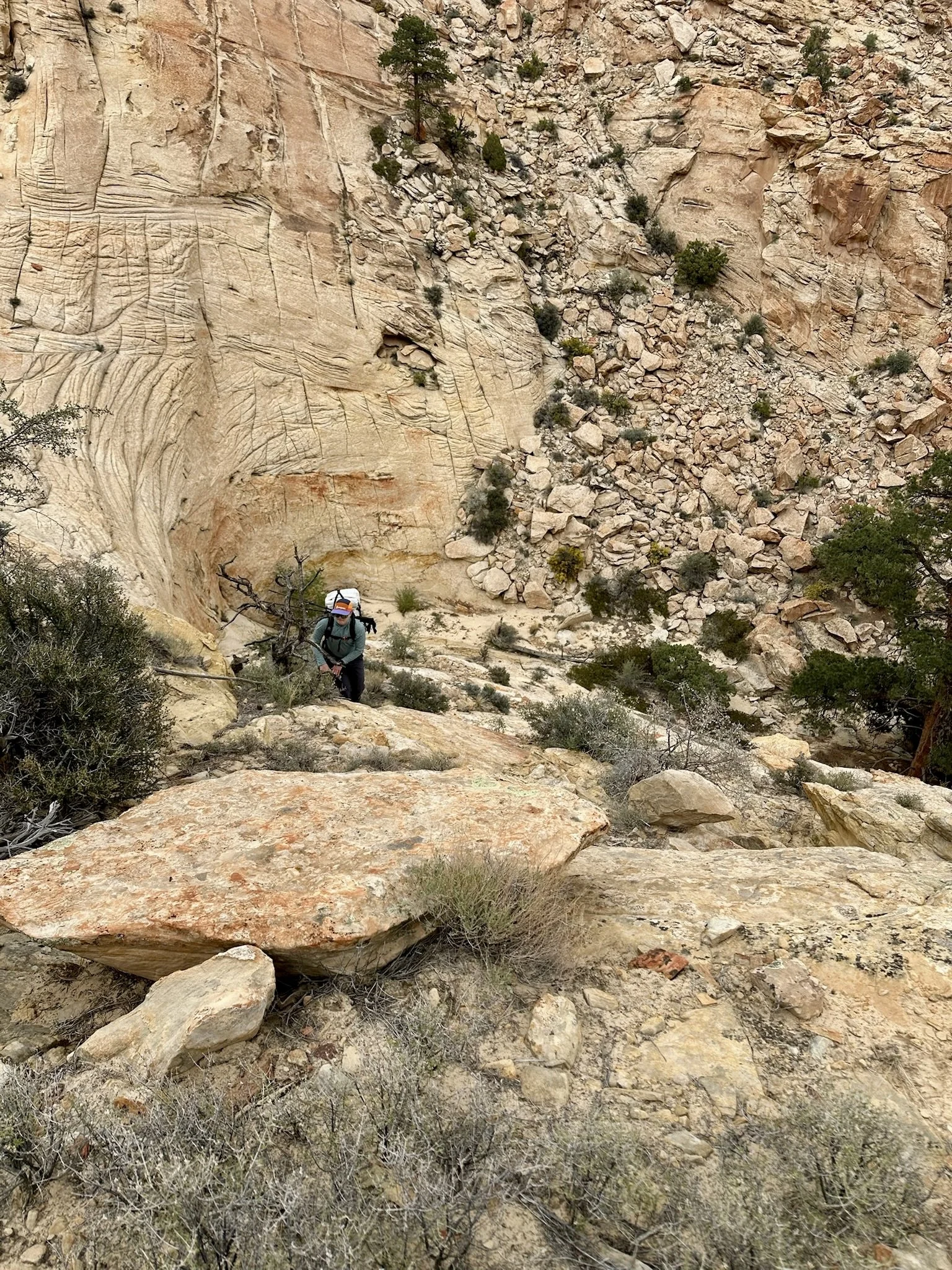
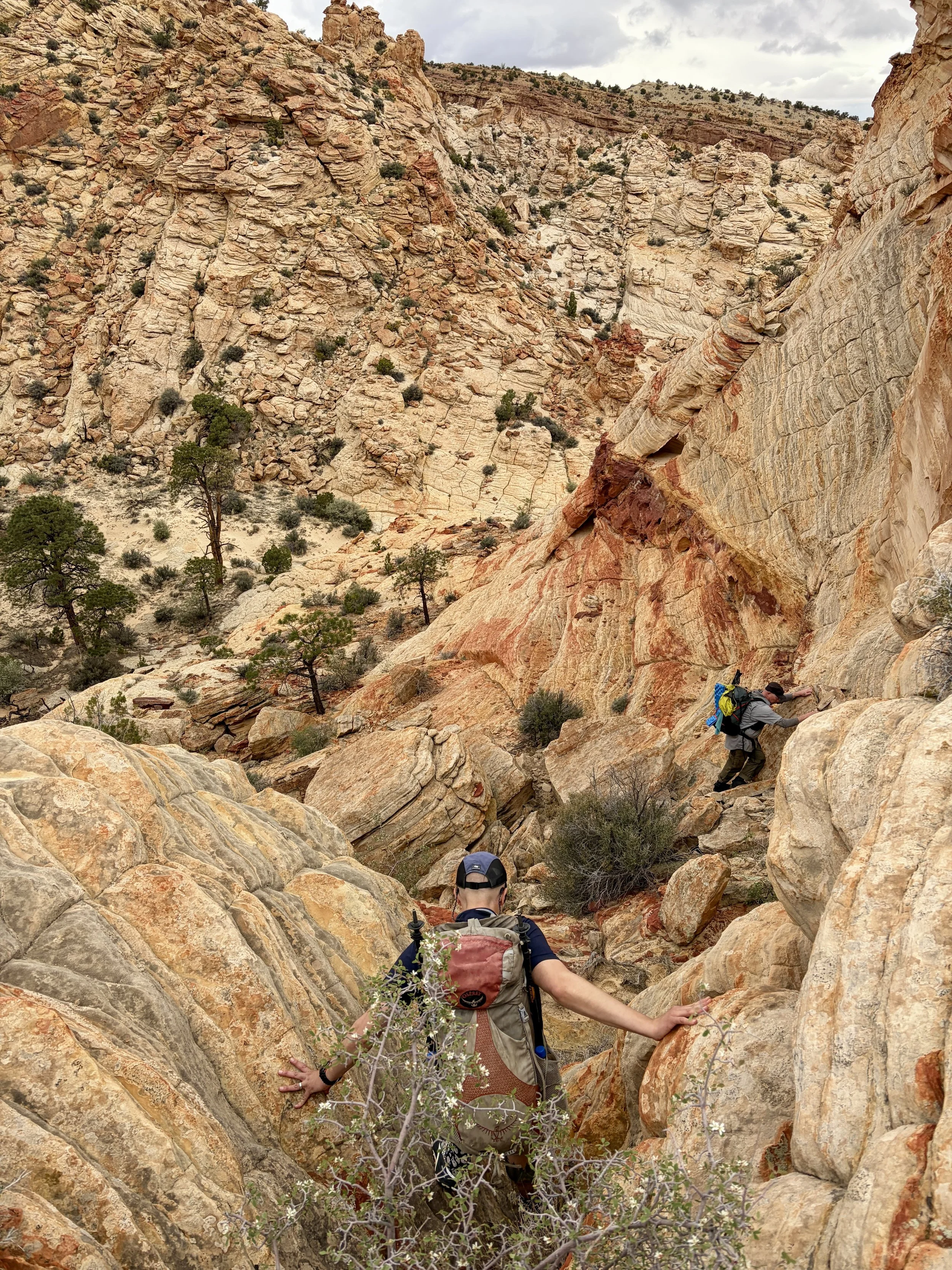
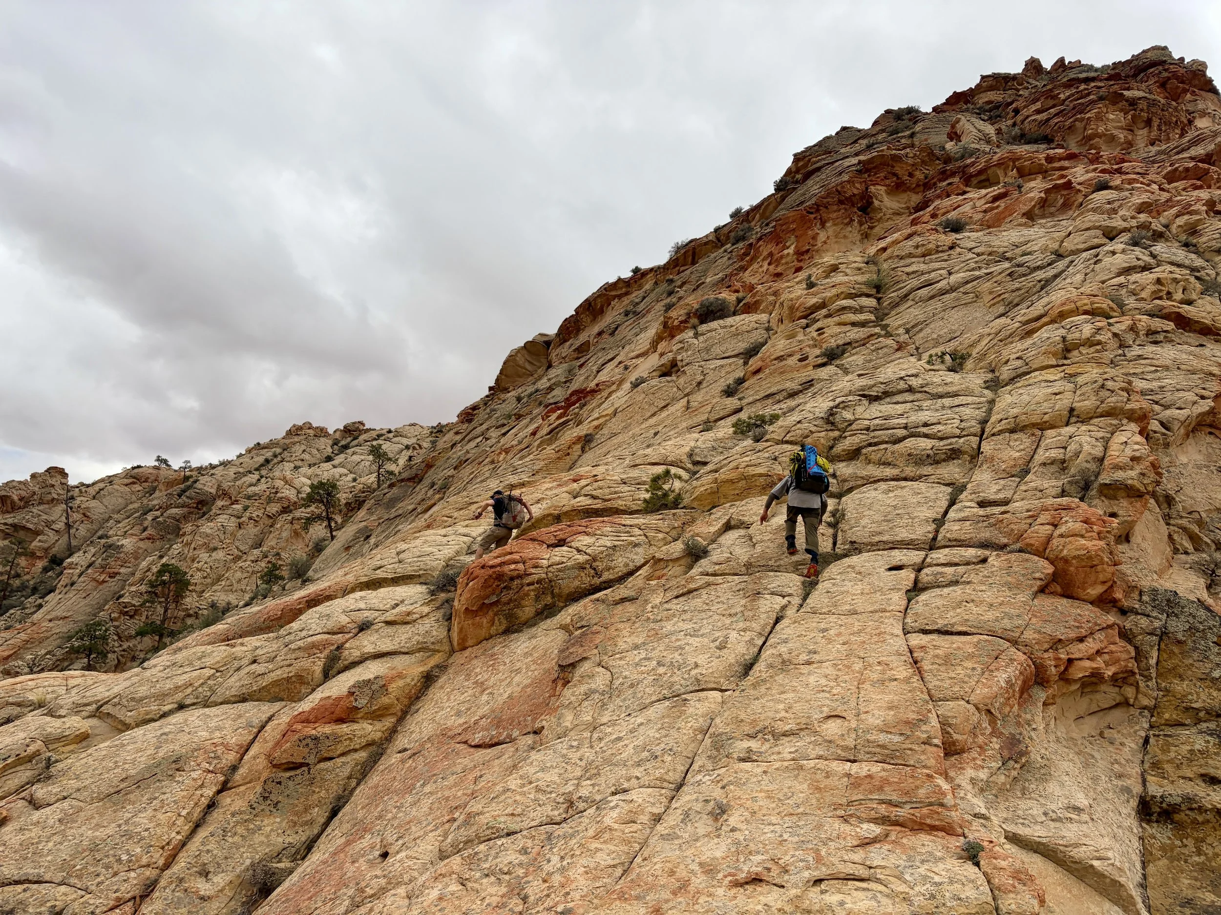
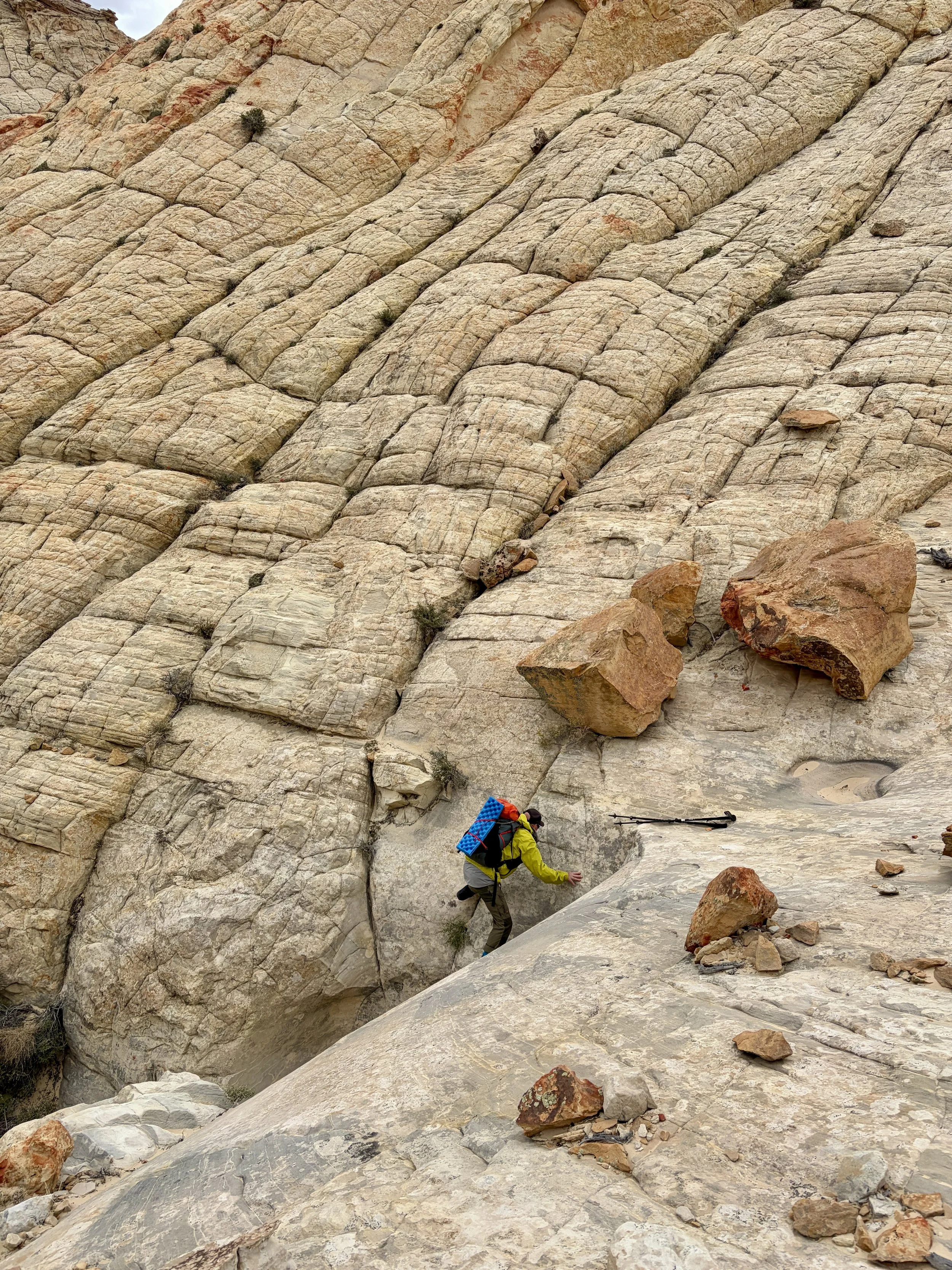
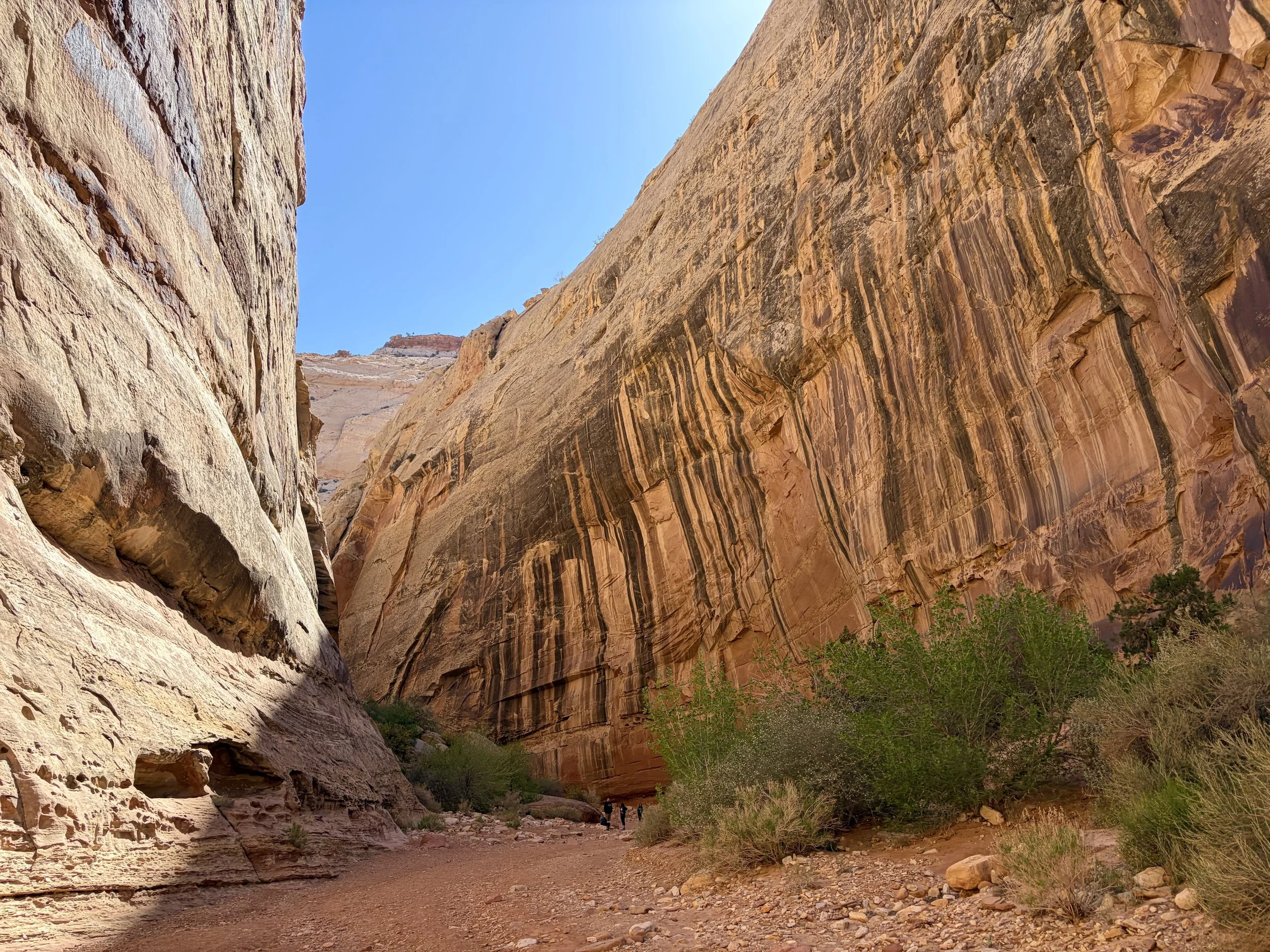
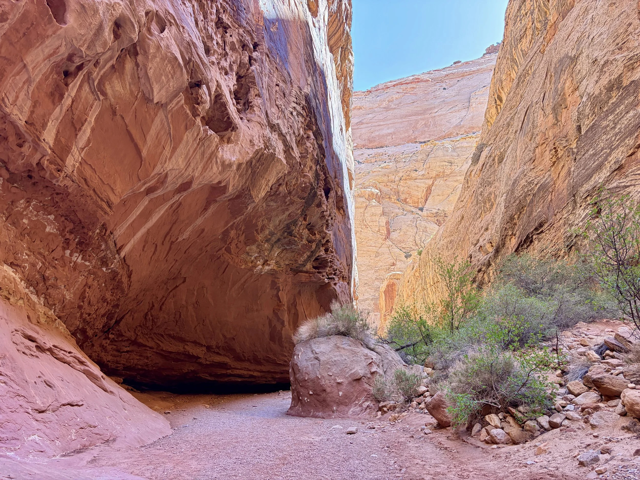
As we headed down this next canyon, we soon found ourselves in a slot canyon with chockstones to navigate. I’ve seen pictures of this slot full of water and also have seen pictures of it totally dry. It was totally dry for us. It was narrow and scrambly enough that we decided to pass our packs through this section. It was one of my favorite parts of the route. Once we got through the slot, we found a large pothole that looked like a donut that was full of water. We were expecting to see another pothole farther down the canyon so we decided to wait to fill our water up before we headed up onto another ridge where we’d likely make dry camp for the night. 1.5 miles later, we got to the spot where we were expecting a pothole and it was bone dry. Darn! Since we’d be exiting the canyon soon, we didn’t expect to find any more water that day and we didn’t have enough left for dry camping that night plus several miles of hiking the next morning. We took a gamble and lost. So we made the unhappy decision to walk back to the last donut pothole we had seen, 1.5 miles back up canyon. This 3 mile round trip detour ended up adding 2 hours of hiking to our day. With packs full of water, we continued along the route and gained the ridge where we hoped to find a campsite. It was an extremely windy afternoon, and we were having difficulty finding a site that wasn’t getting hit by 30 mph winds that was also flat. We ended up walking farther than we thought we would before we found a good enough site. We had once again hiked until early evening so we made dinner right when we got to camp and retired for the night after the very long day.
Day 2 stats: 9.6 miles (not including the extra 3 miles to get water), +2325 ft of elevation gain, -1754 ft of elevation loss

Day 3
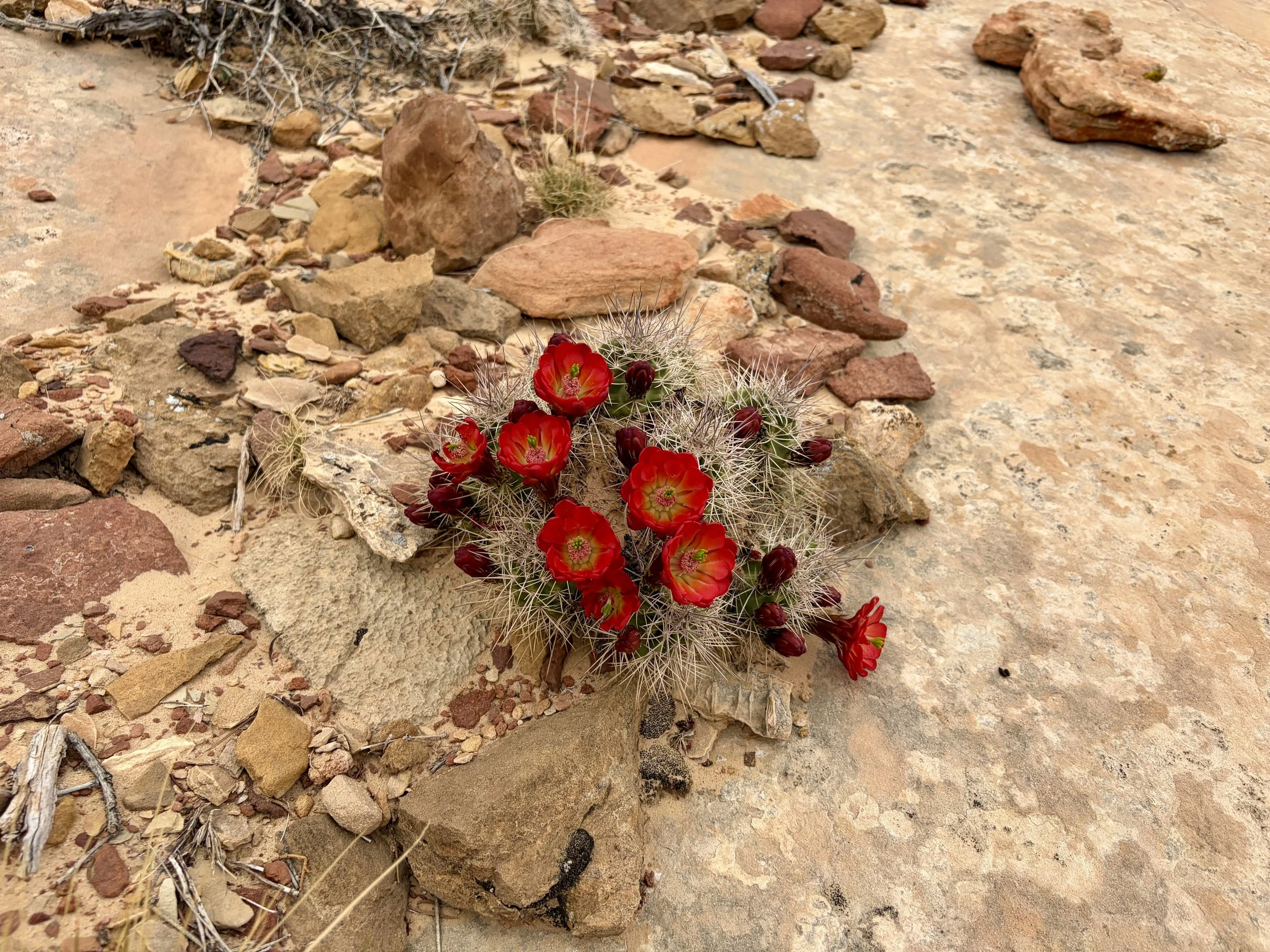
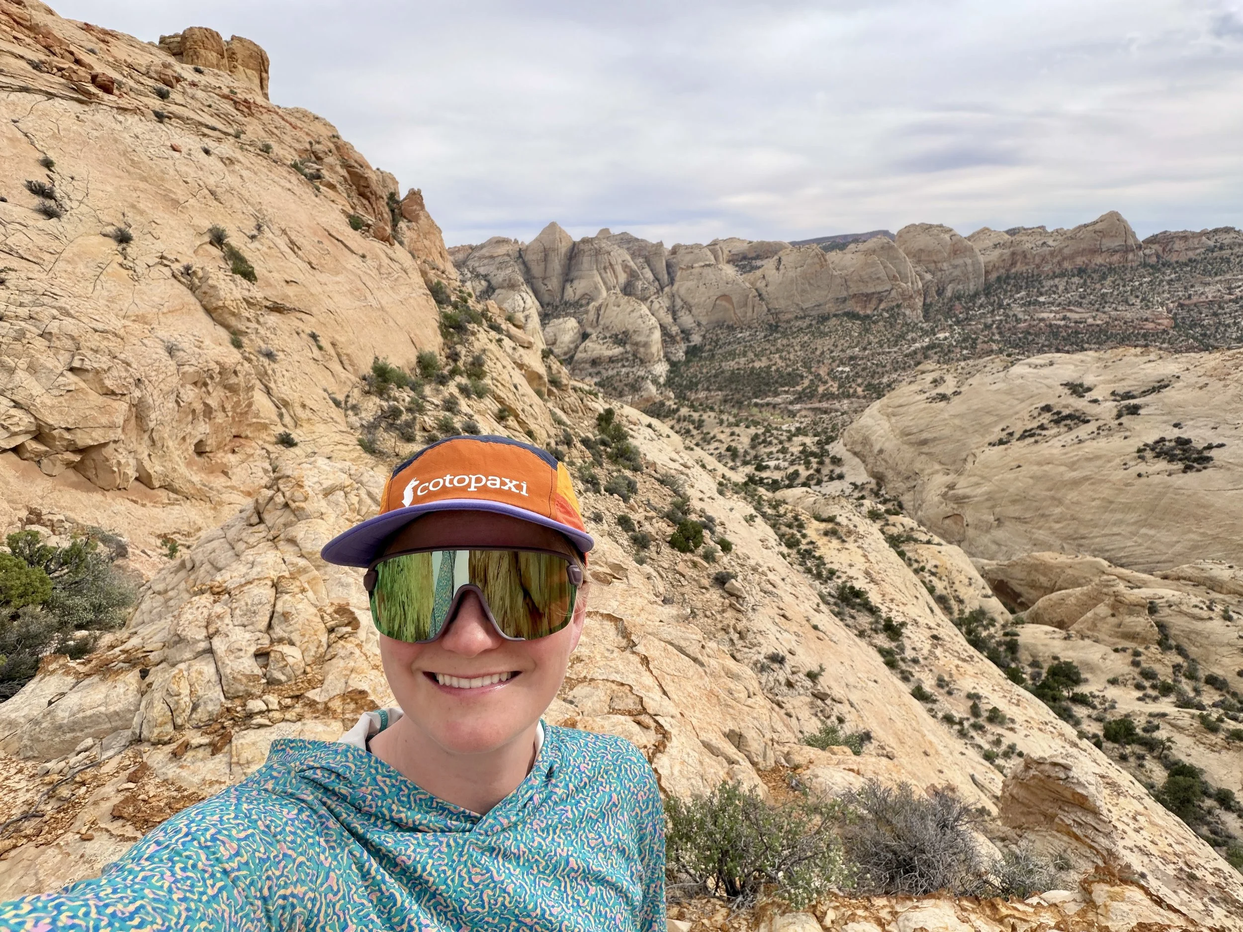
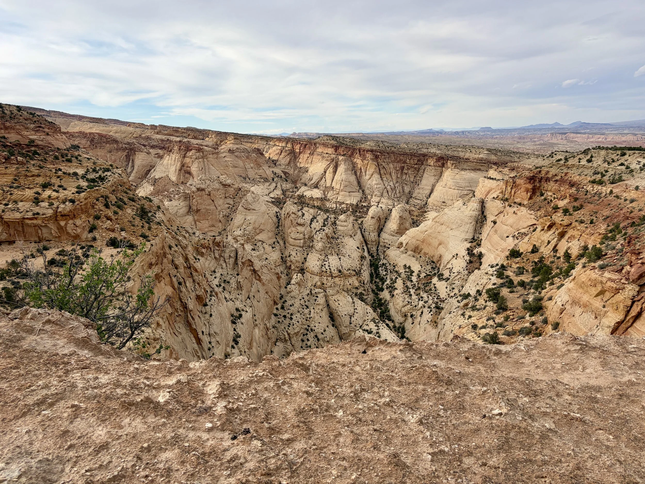
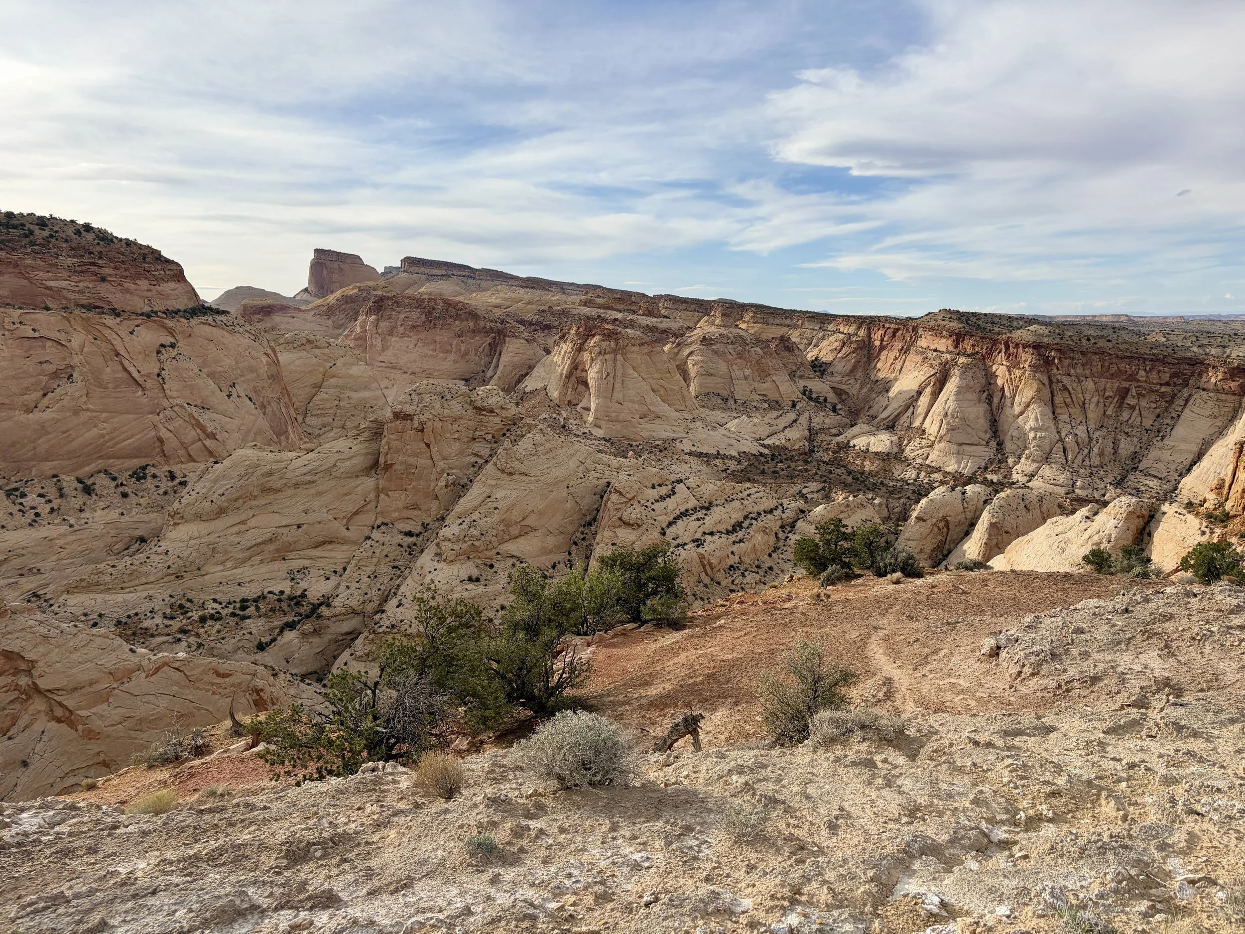
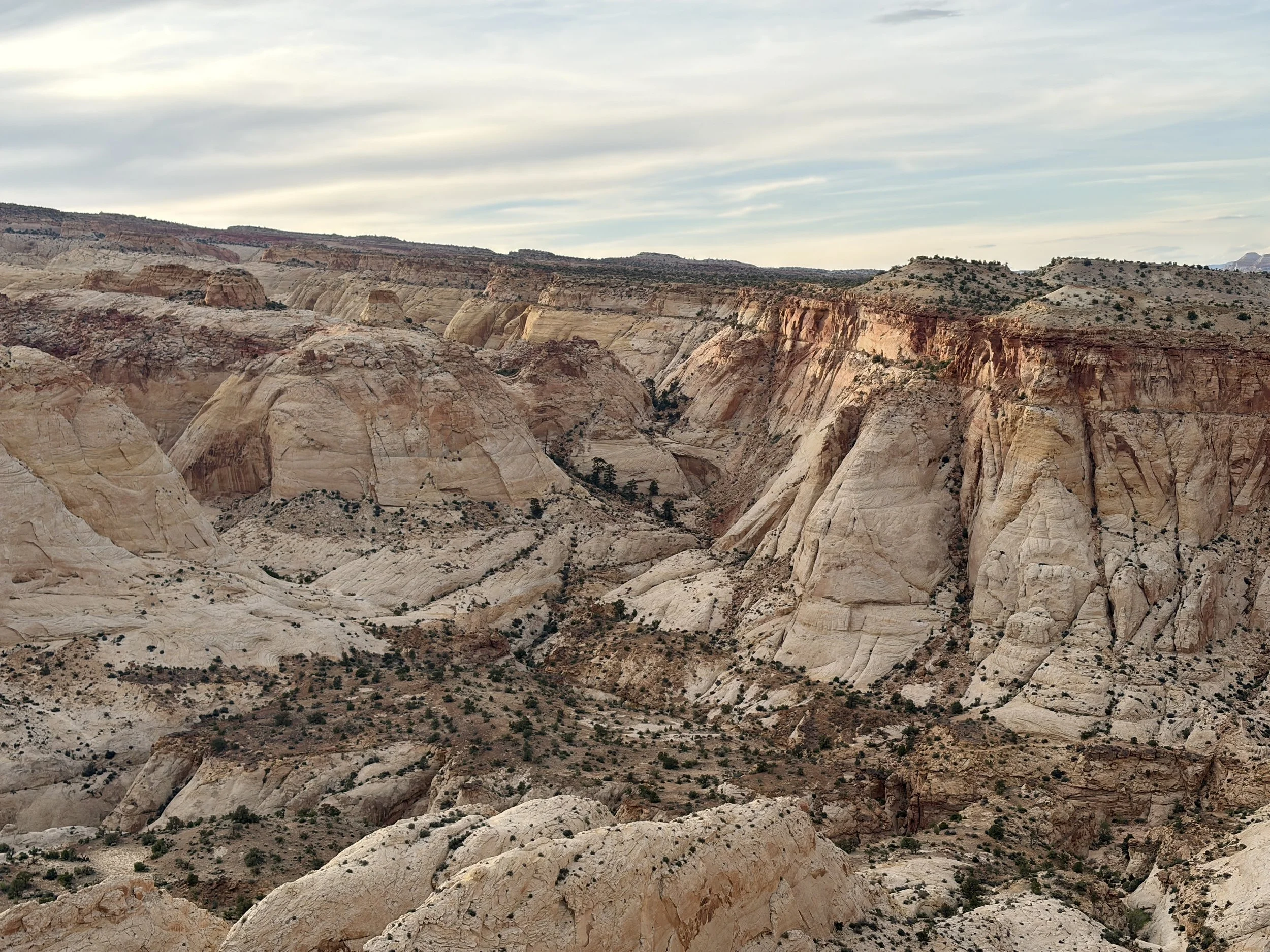
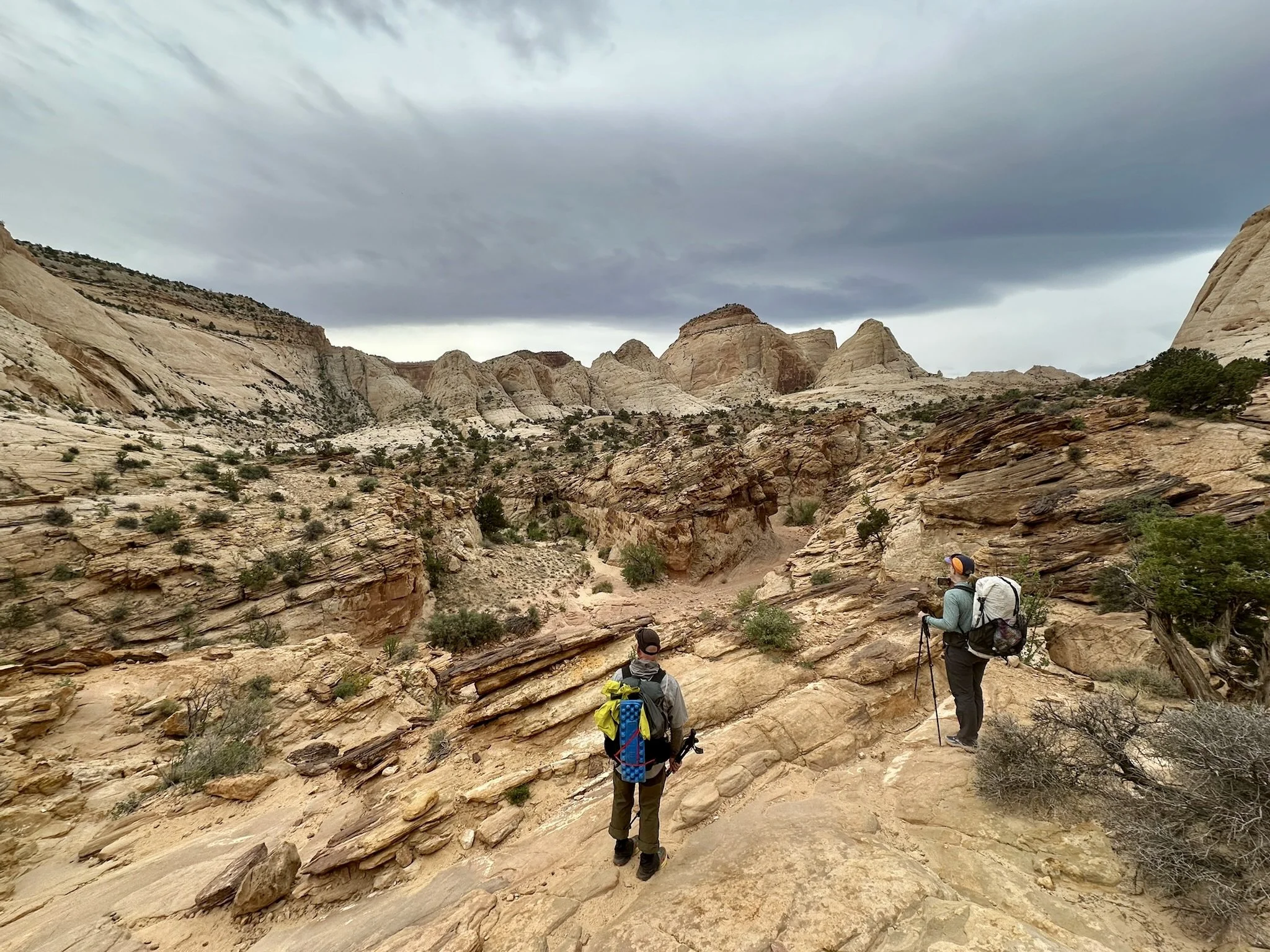
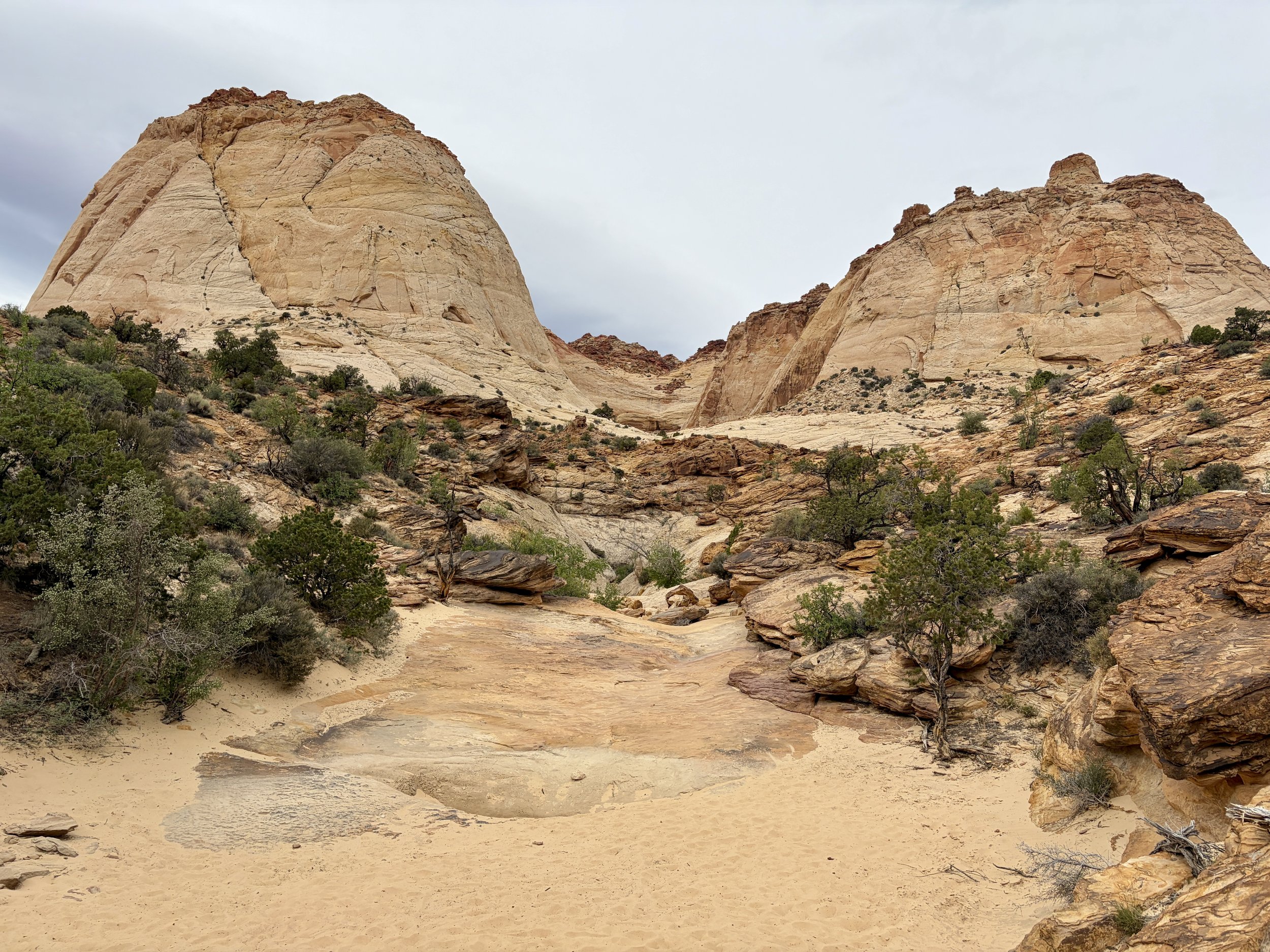
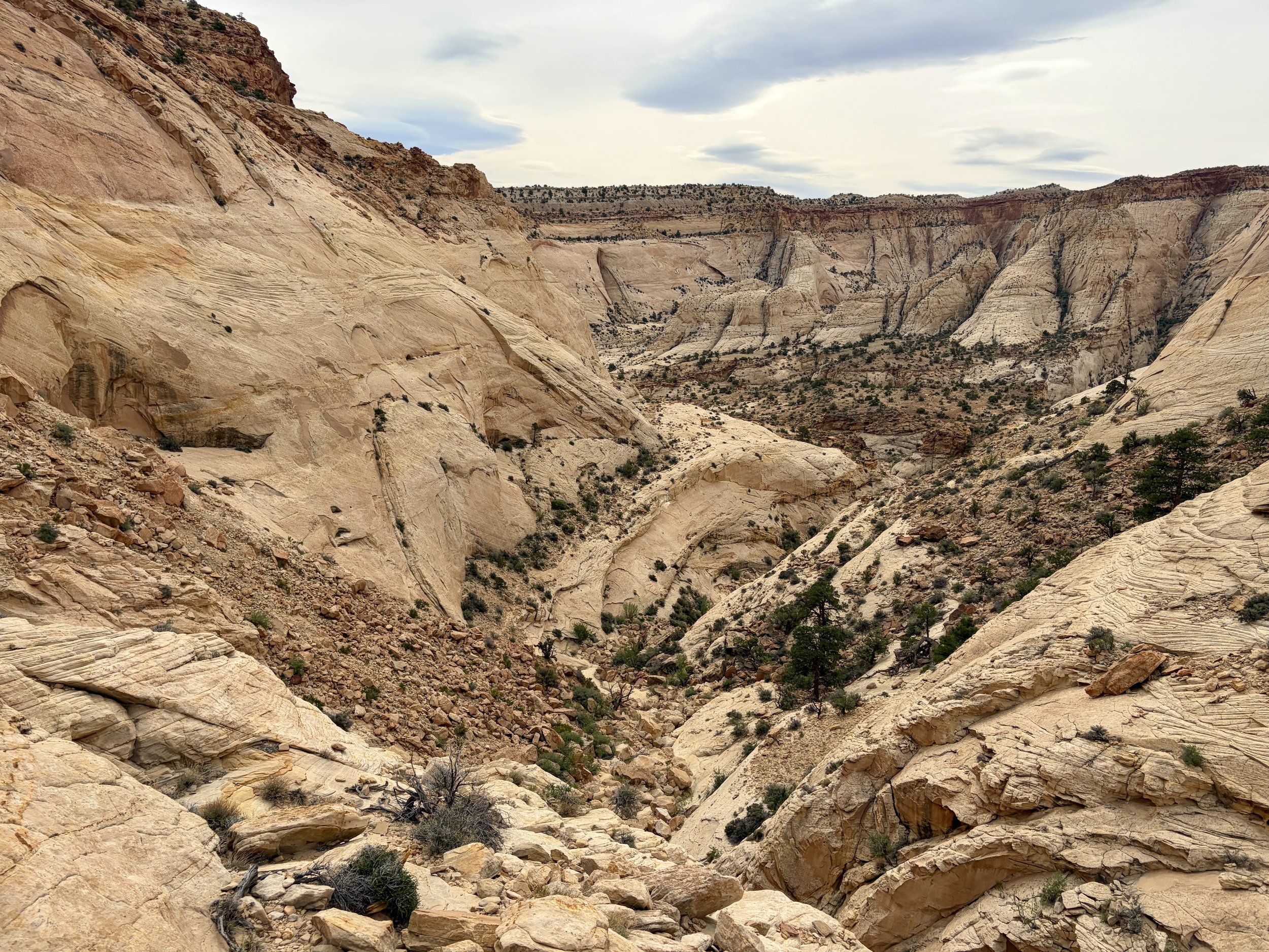
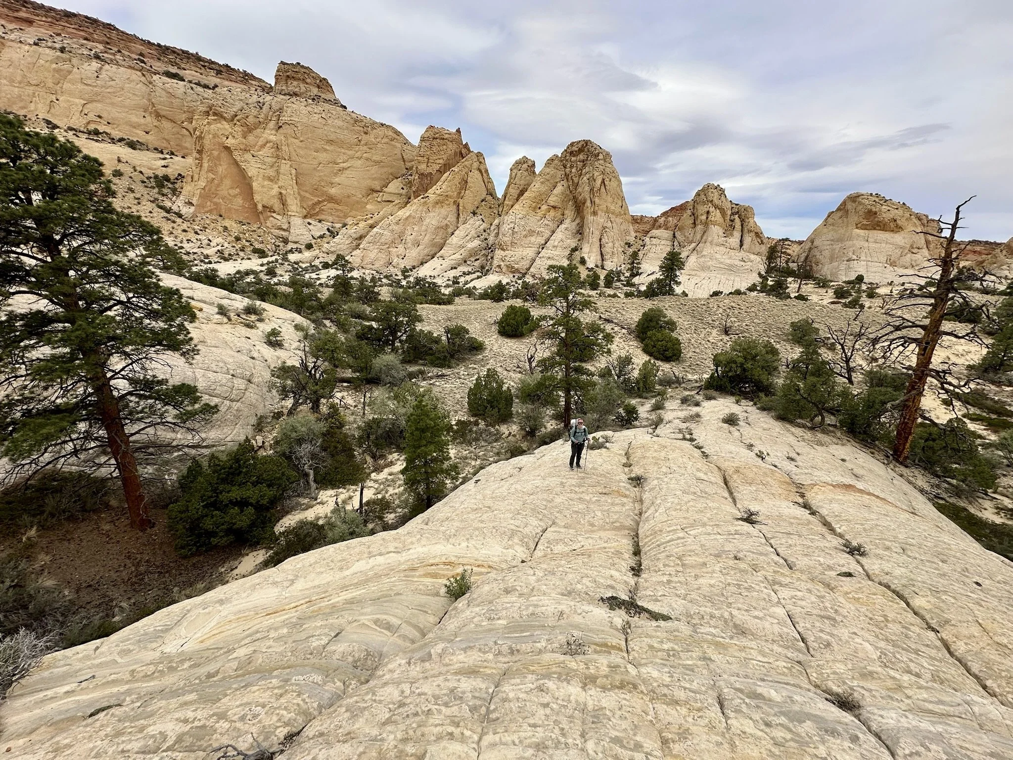
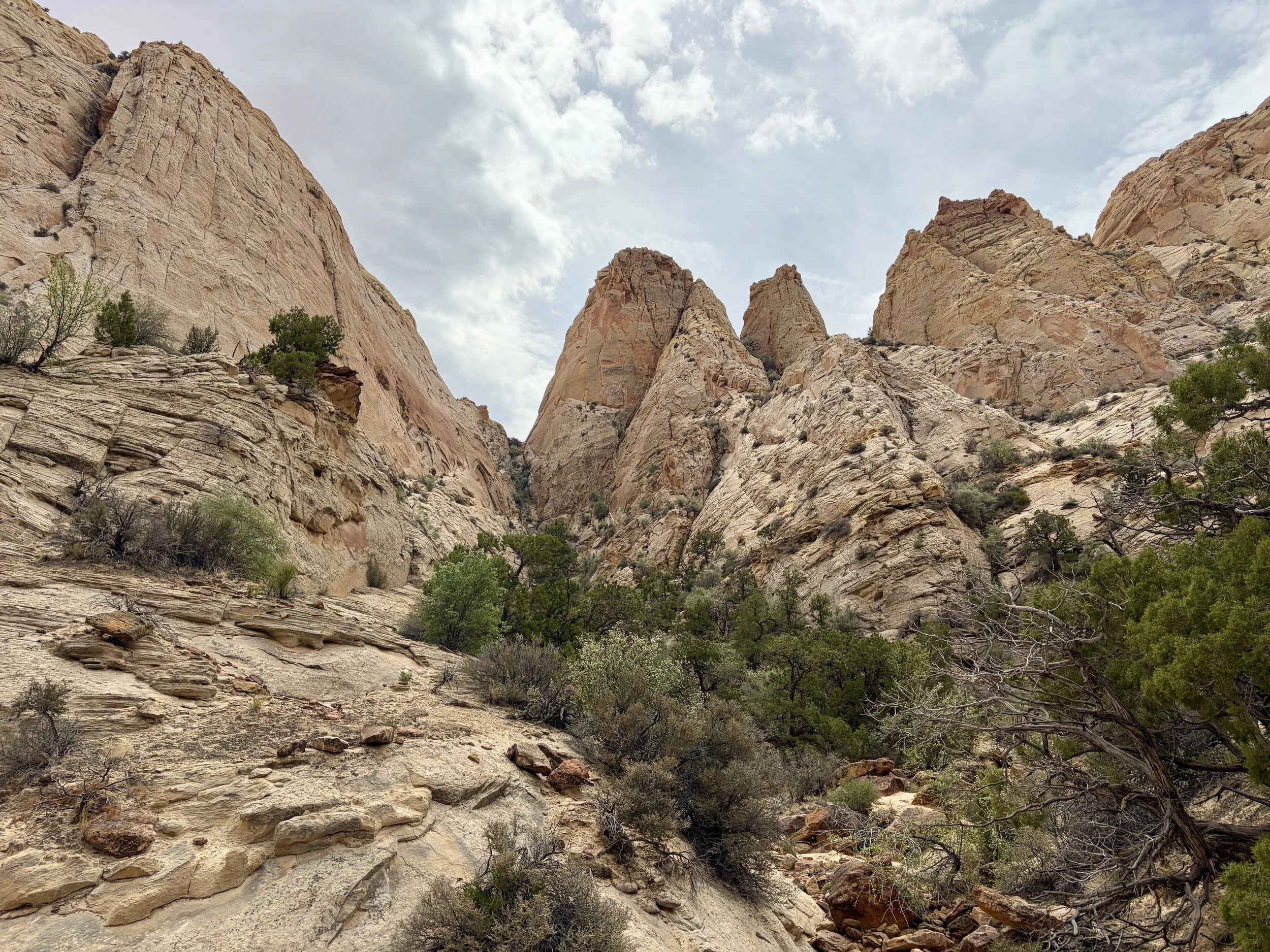
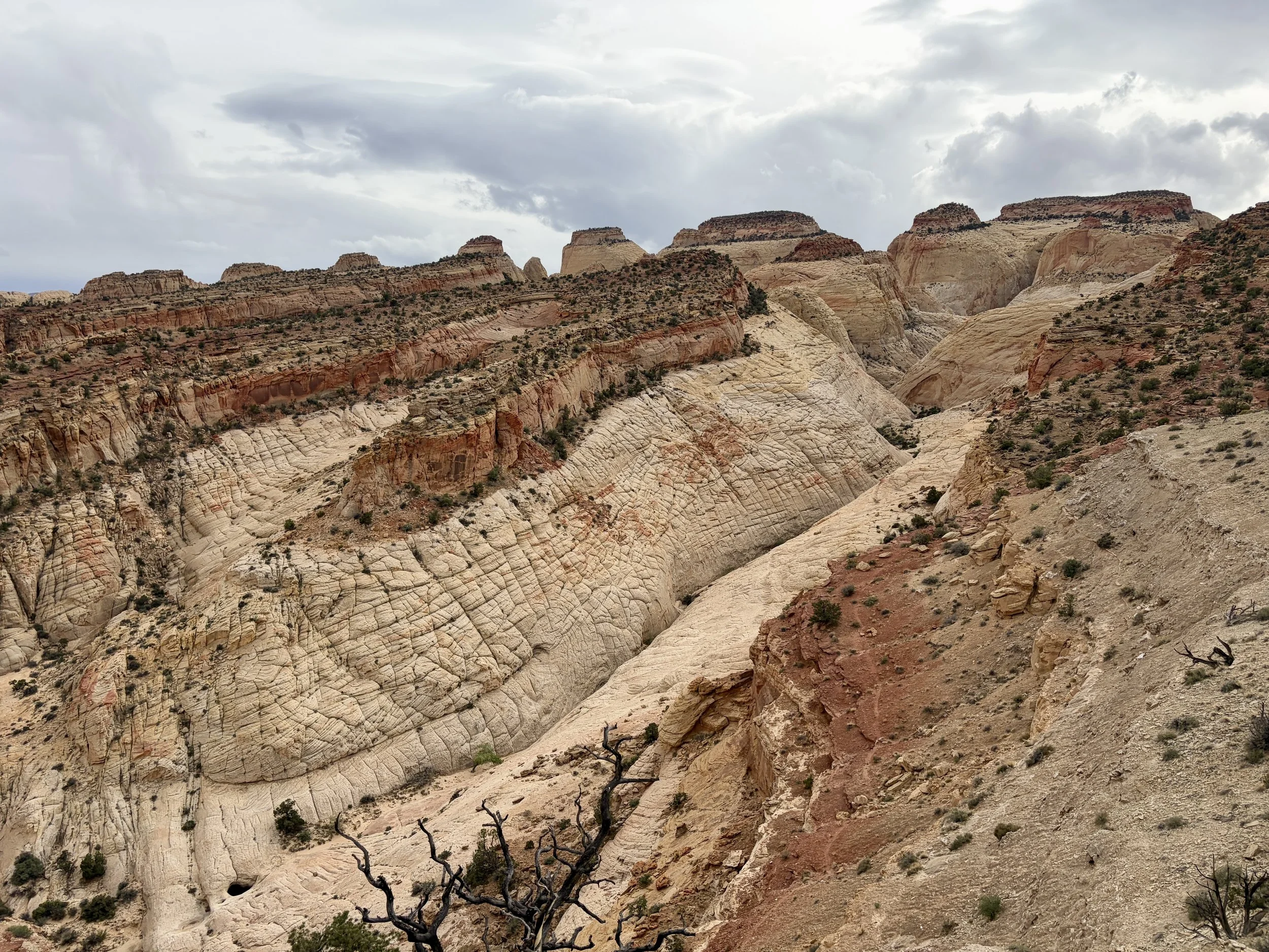
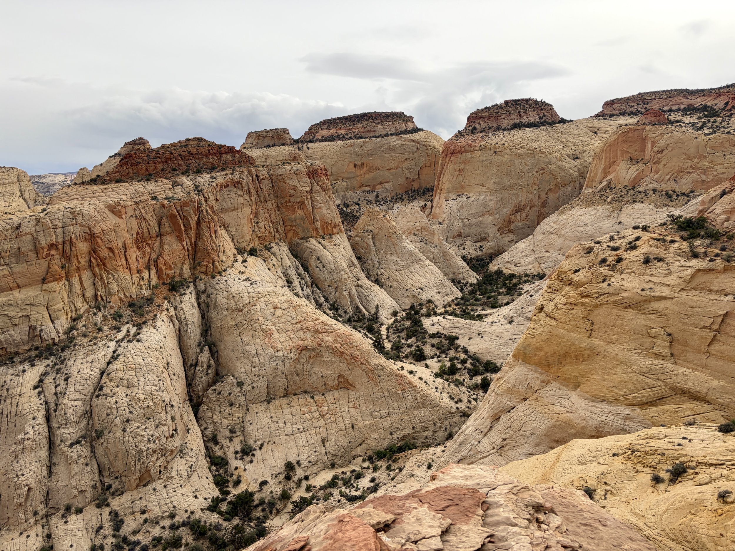
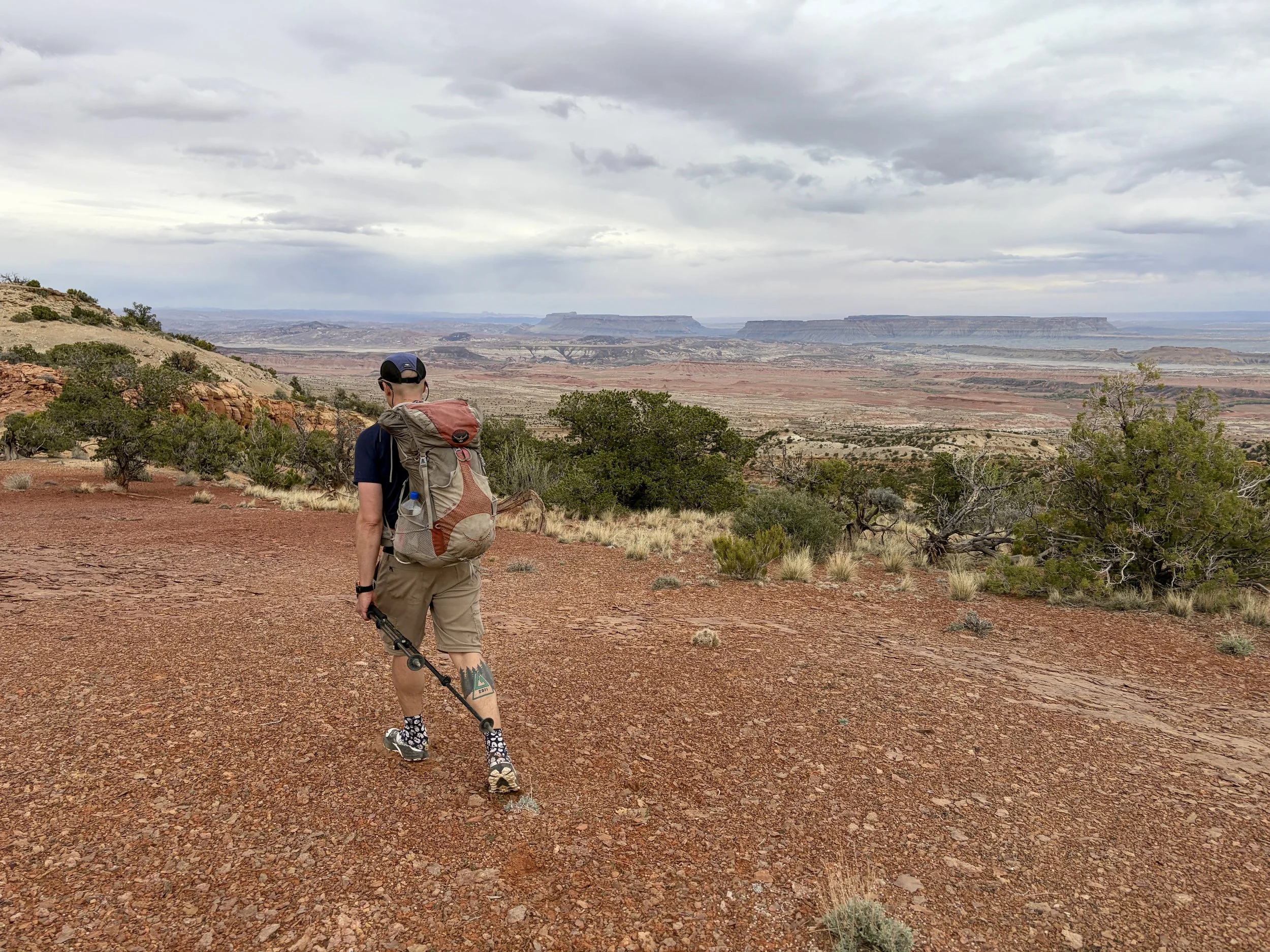
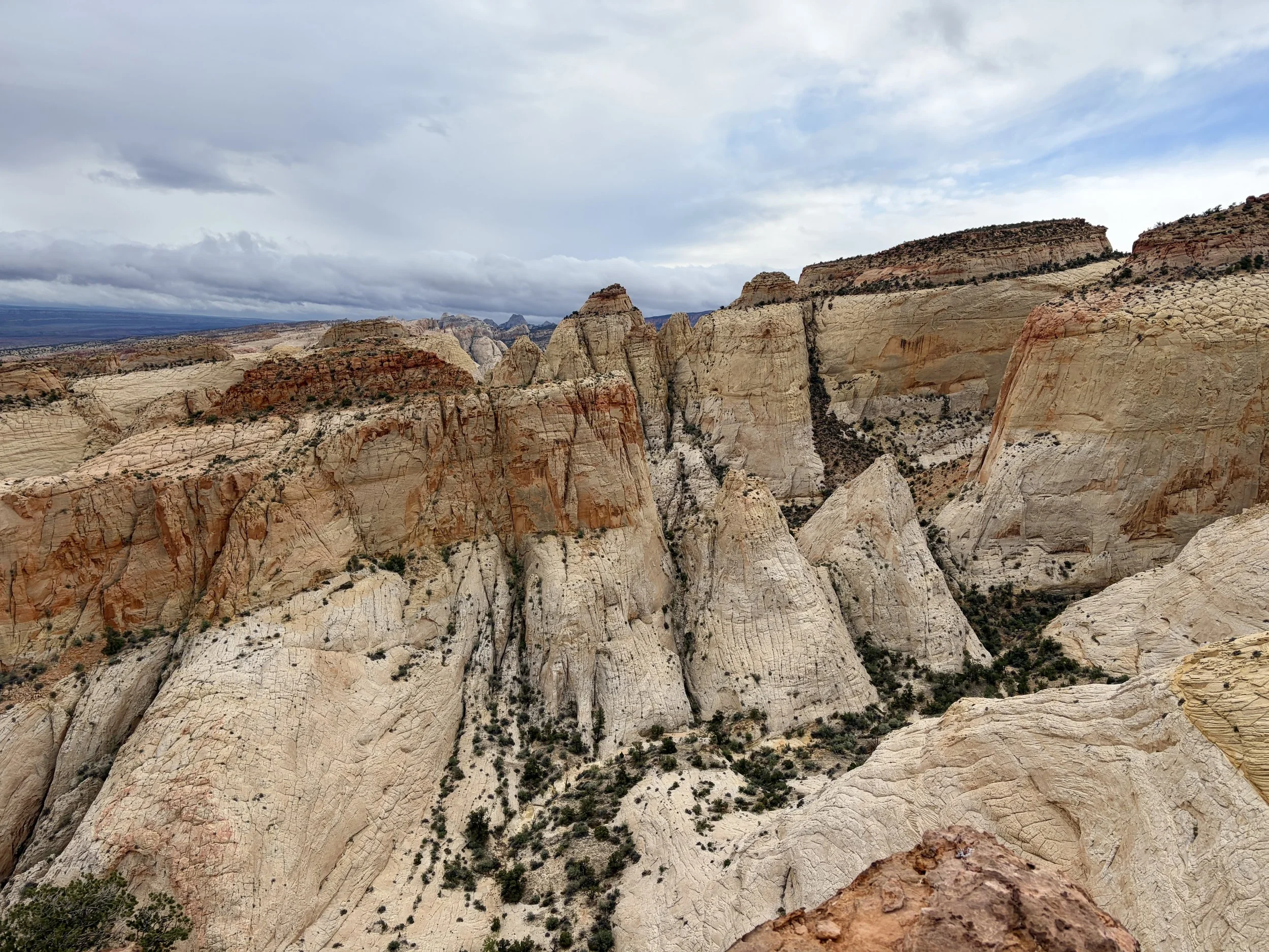
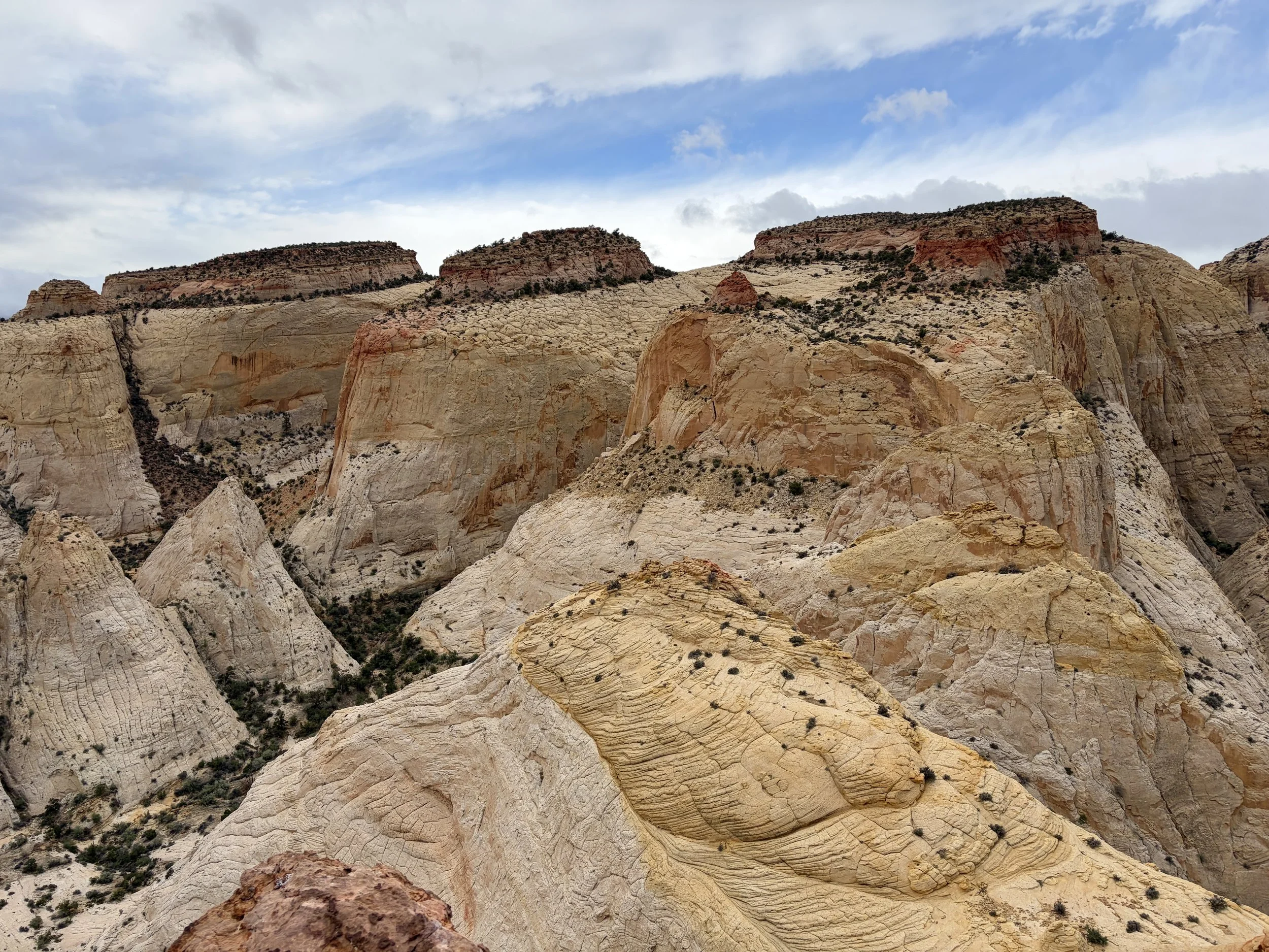
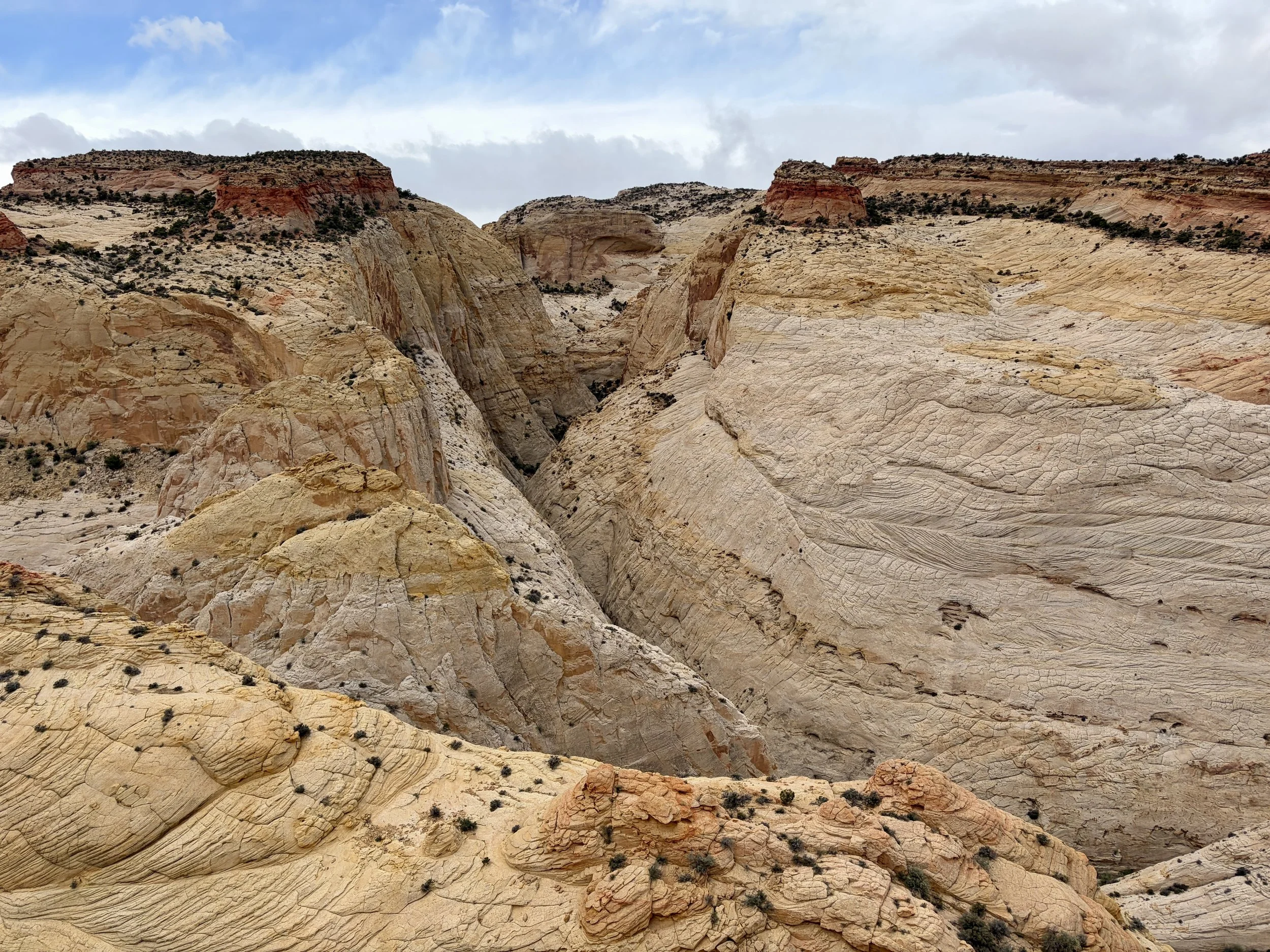
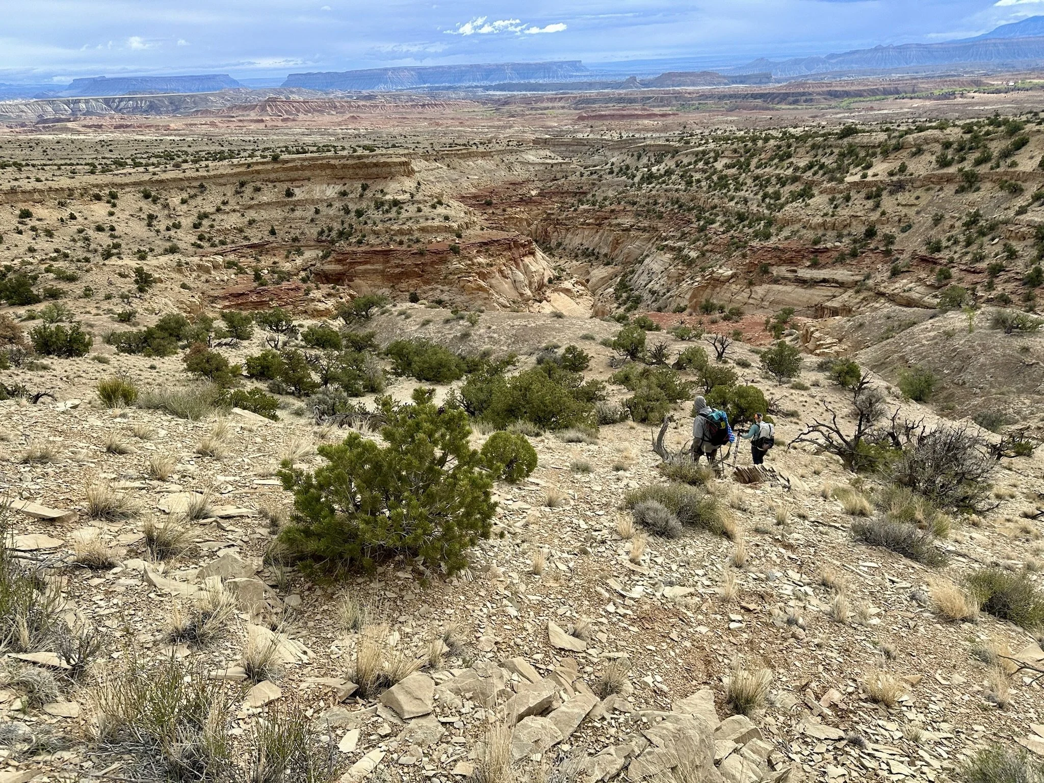
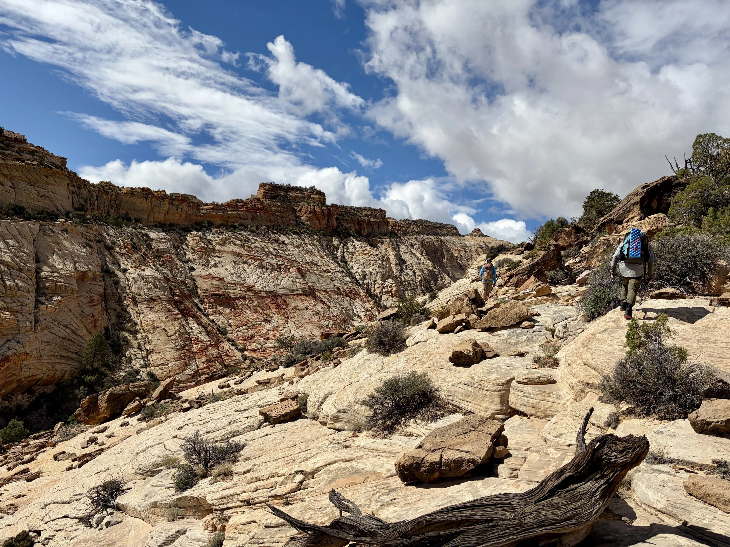
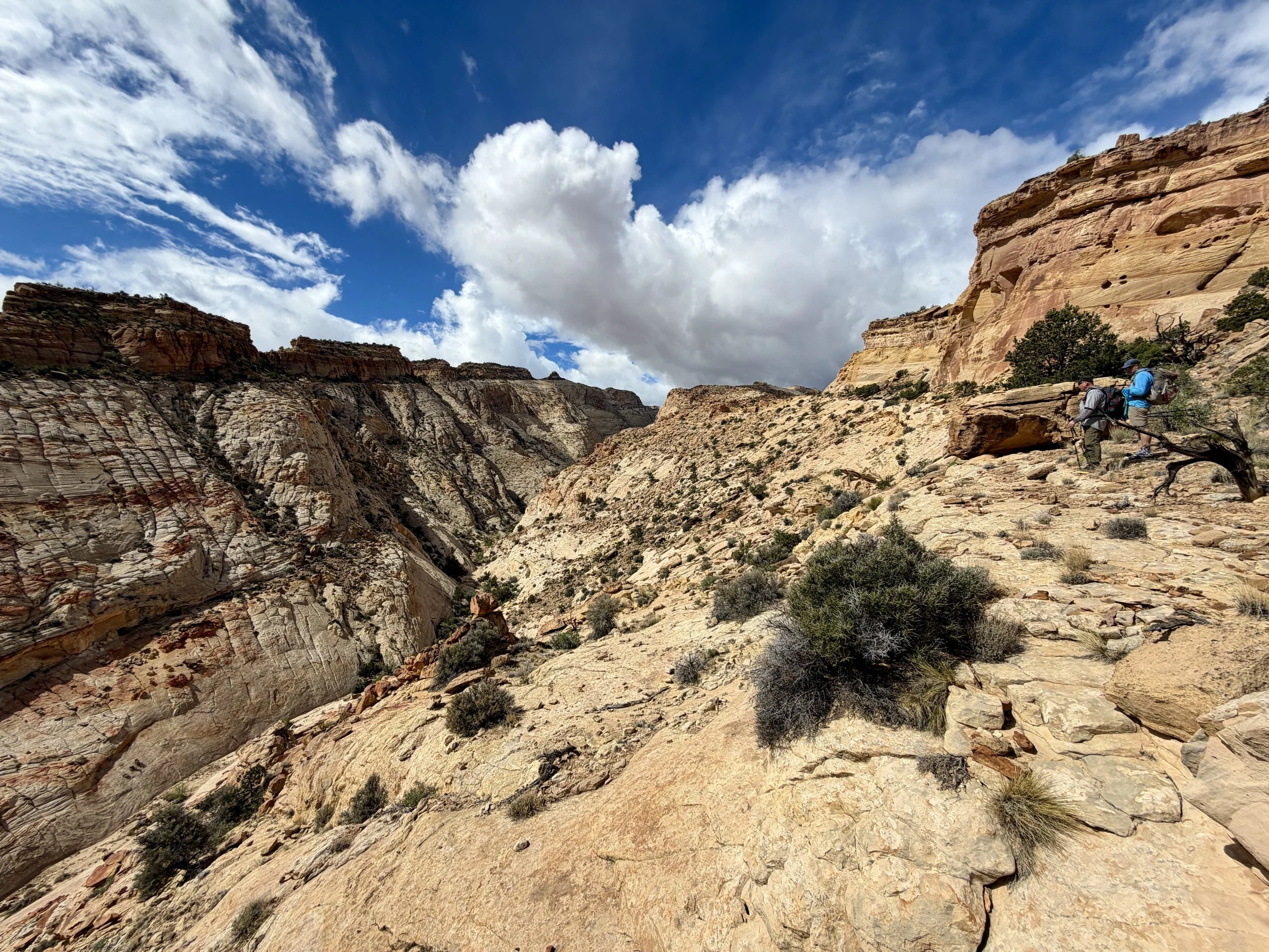
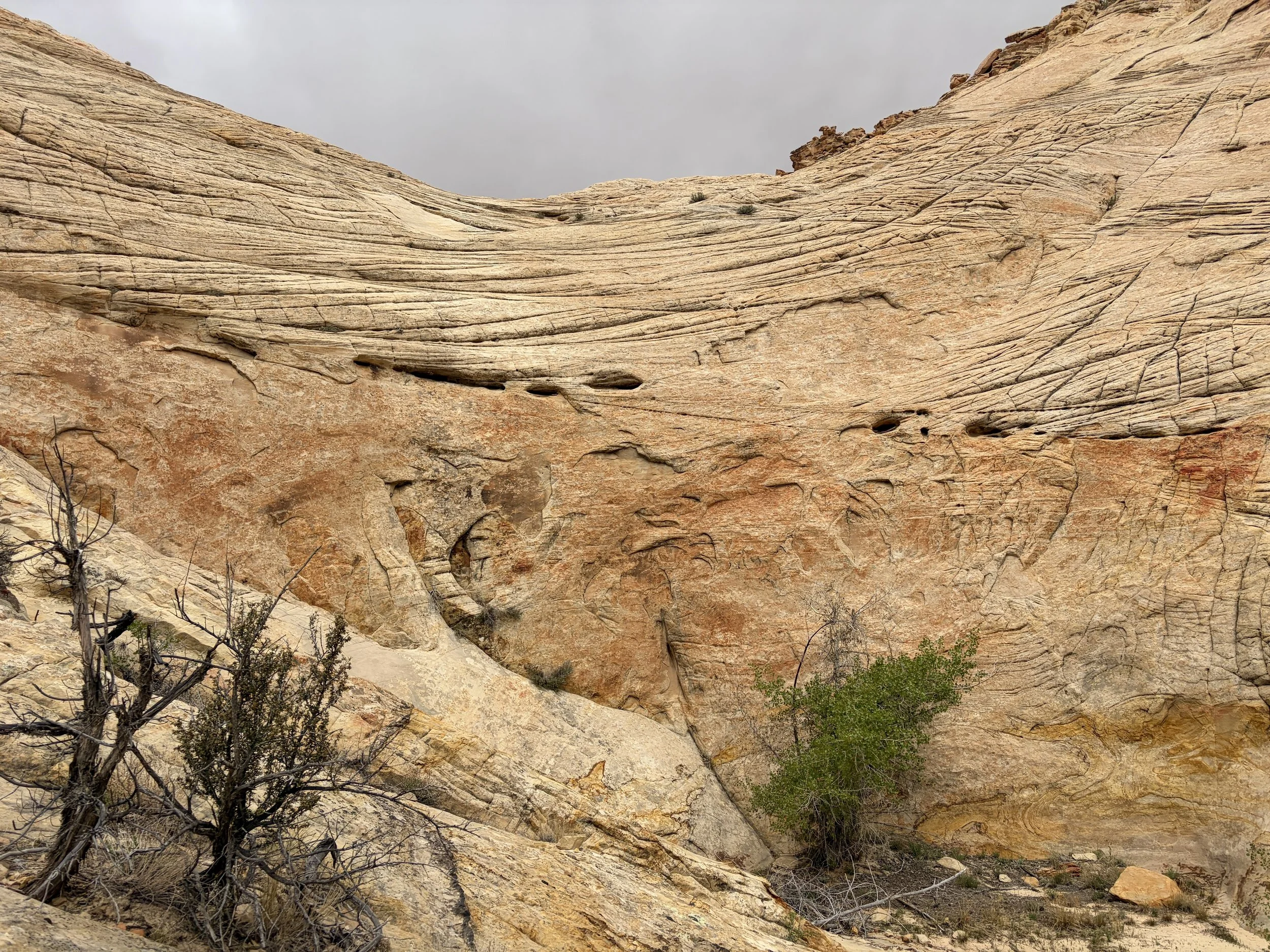
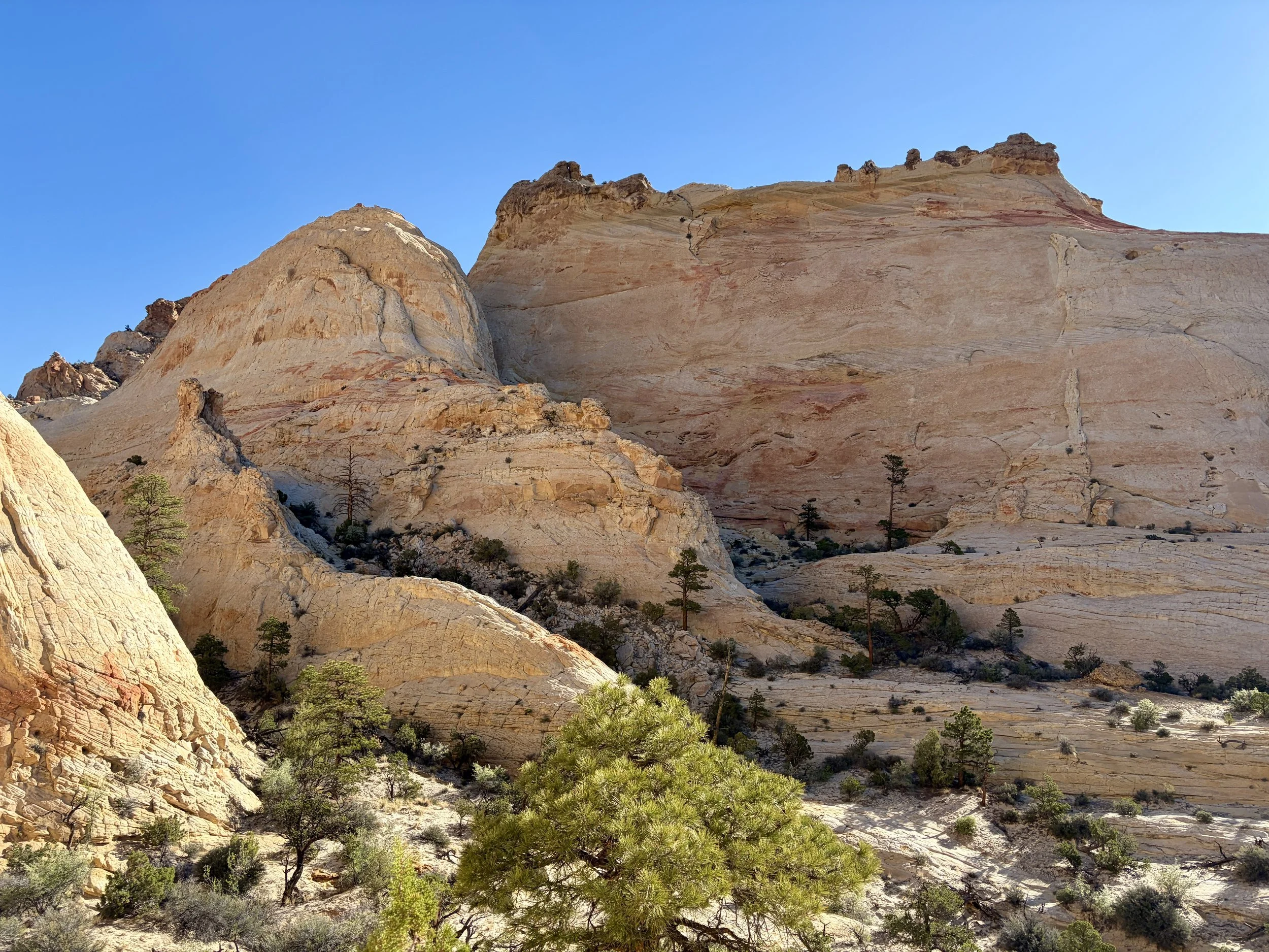
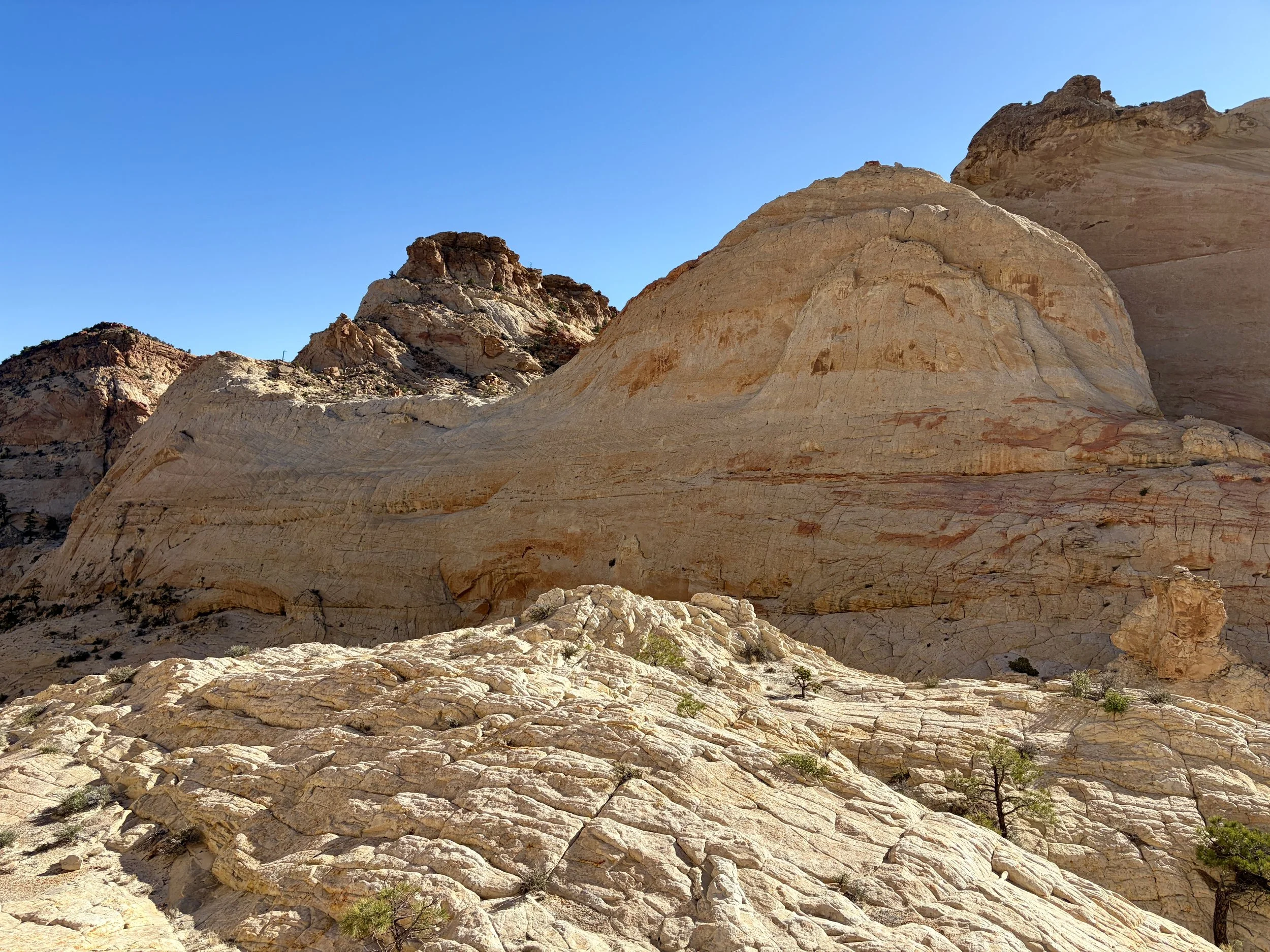
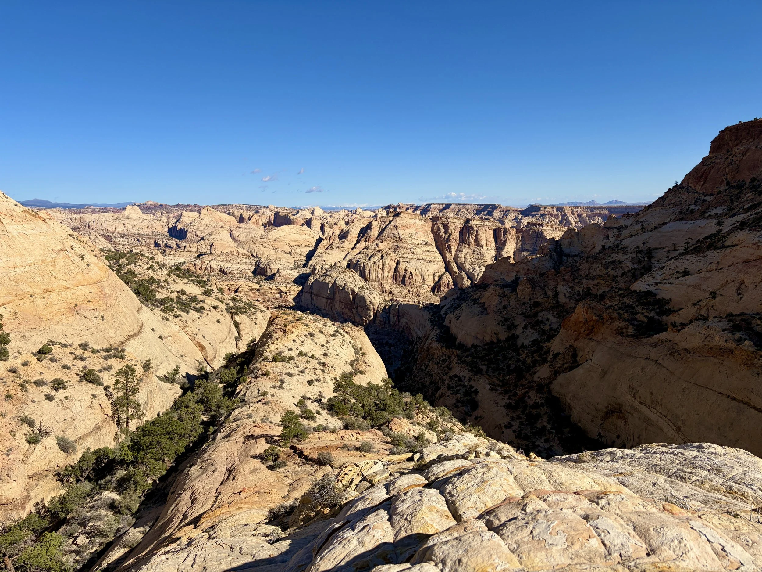
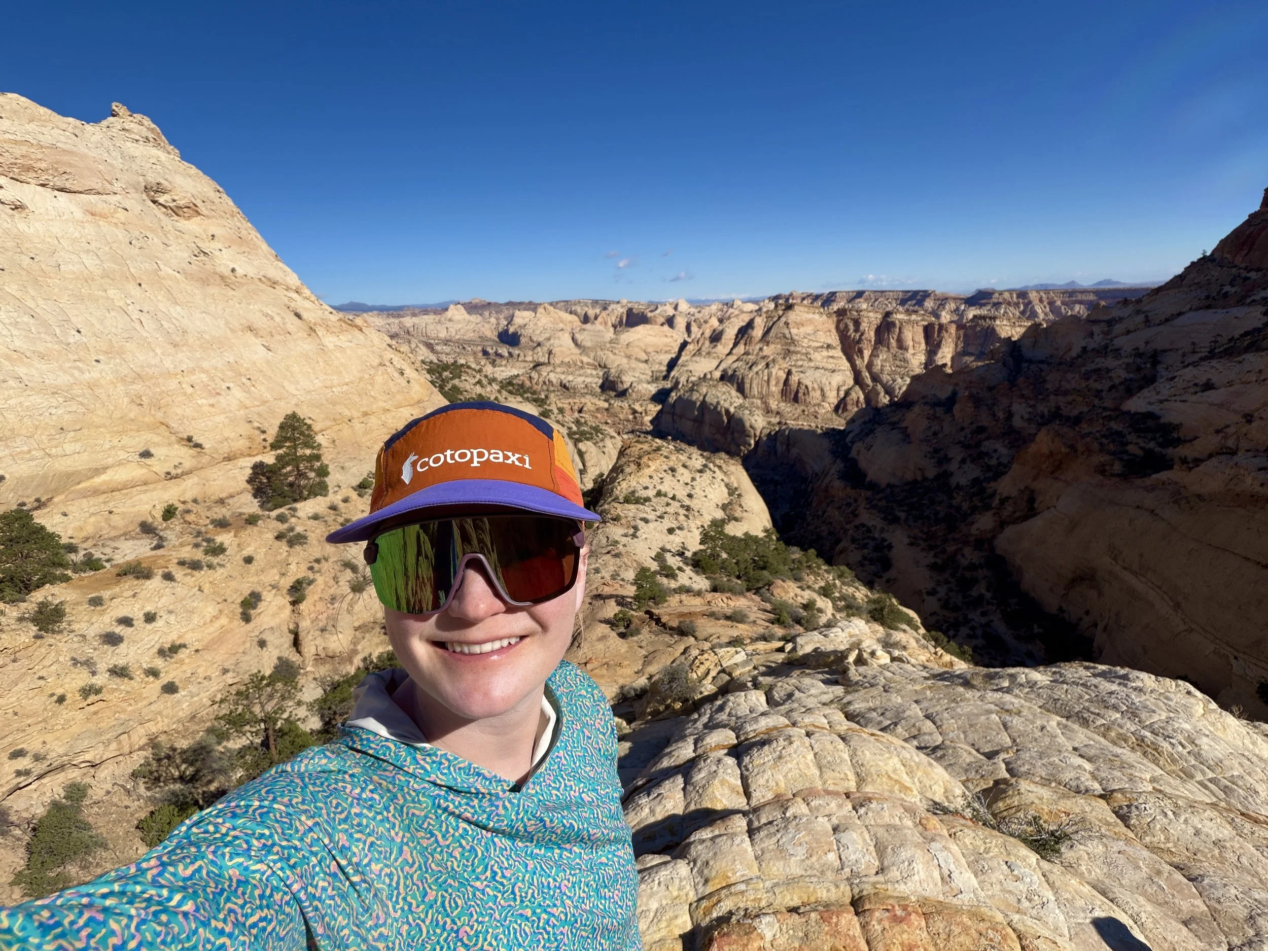
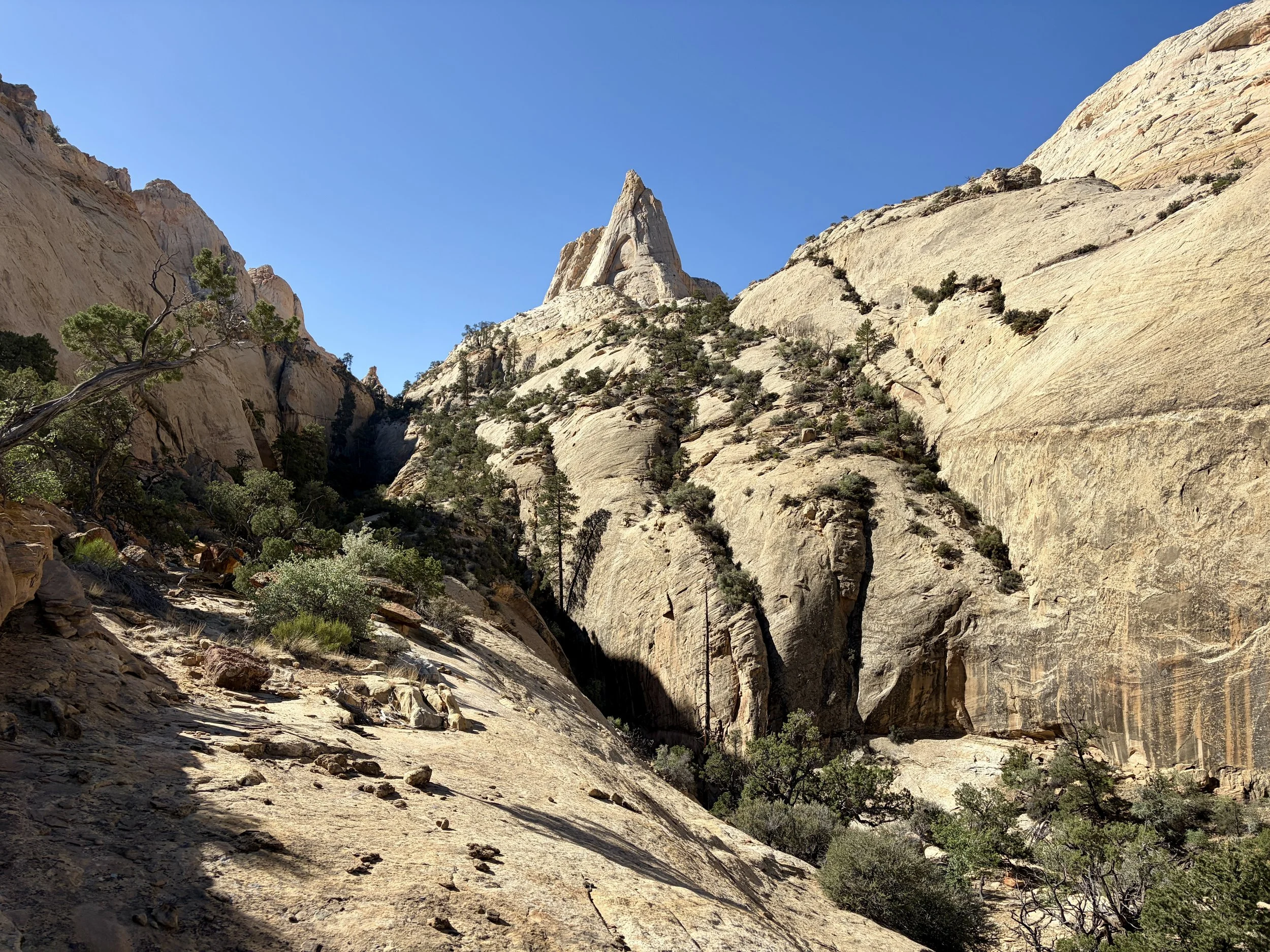
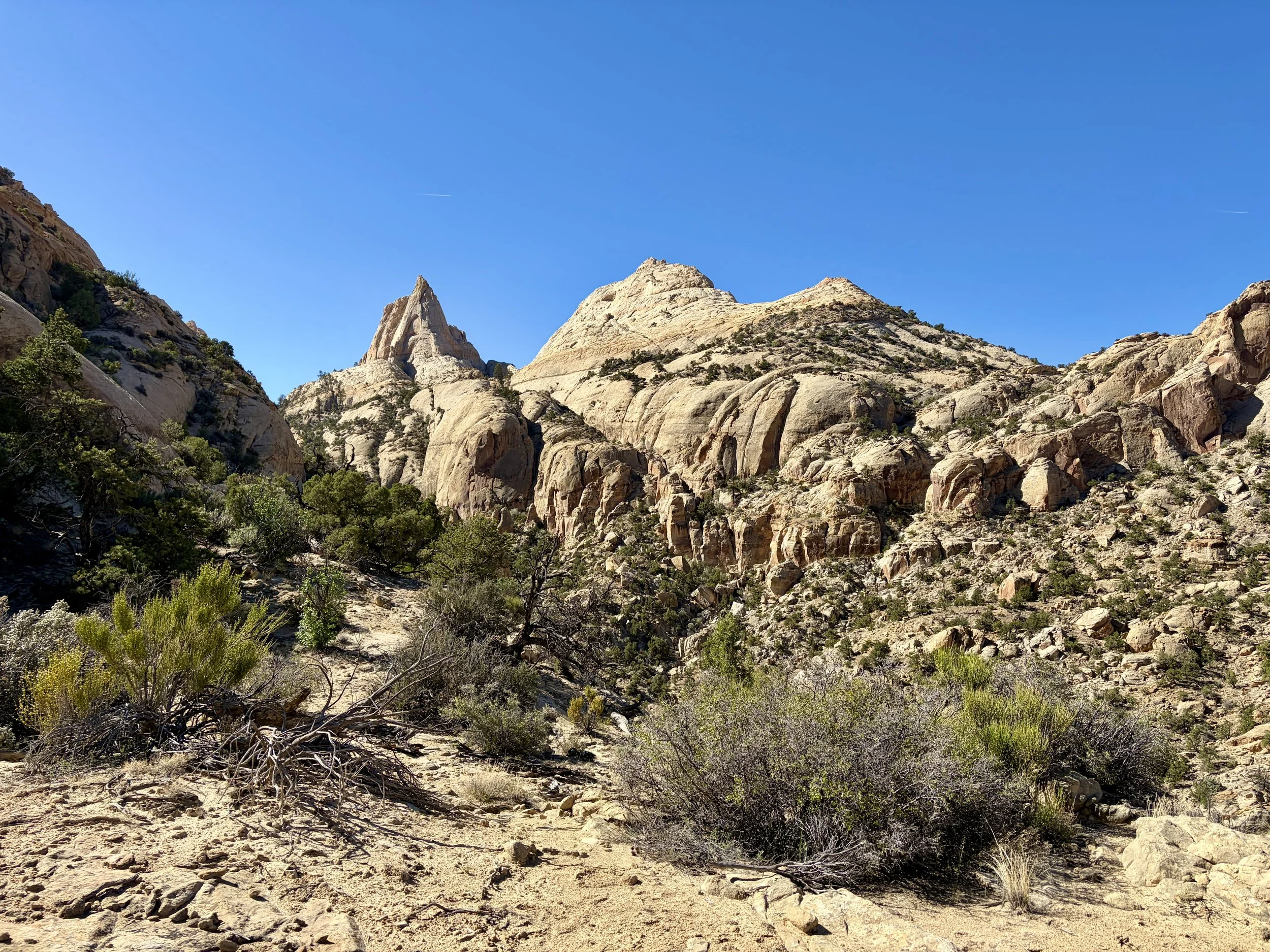
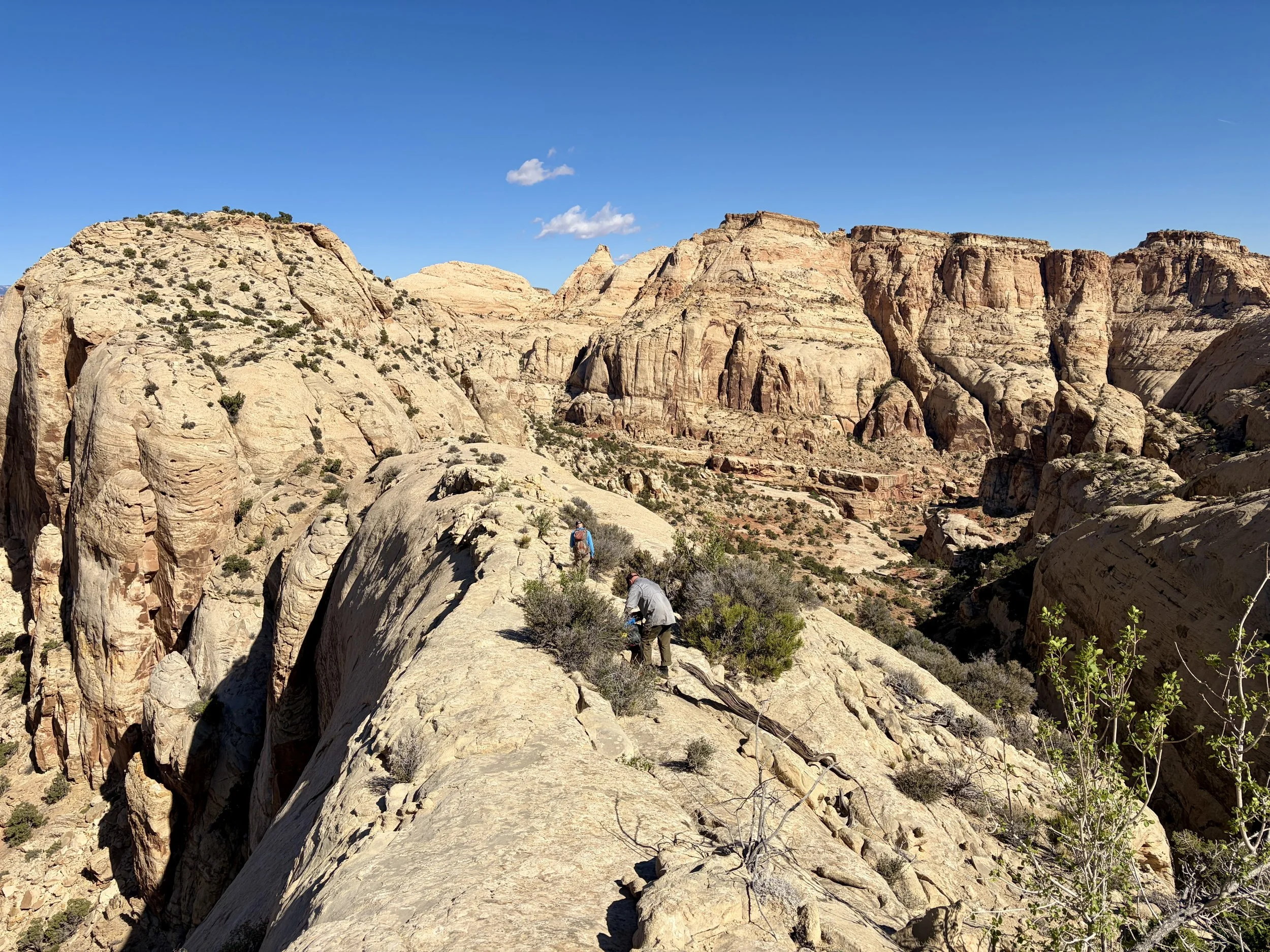
The following morning, we slept in a little later than the day before was we waited for the light rain to pass. We then had some of my favorite views of the trip. We did a short scramble from our campsite up to the top of this mesa that had some of the best views I’ve ever seen. These views made us forget what a slog the day before ended up being. Once we were ready to get moving, we headed back down a different ridge towards another canyon that we’d be hiking up that day.
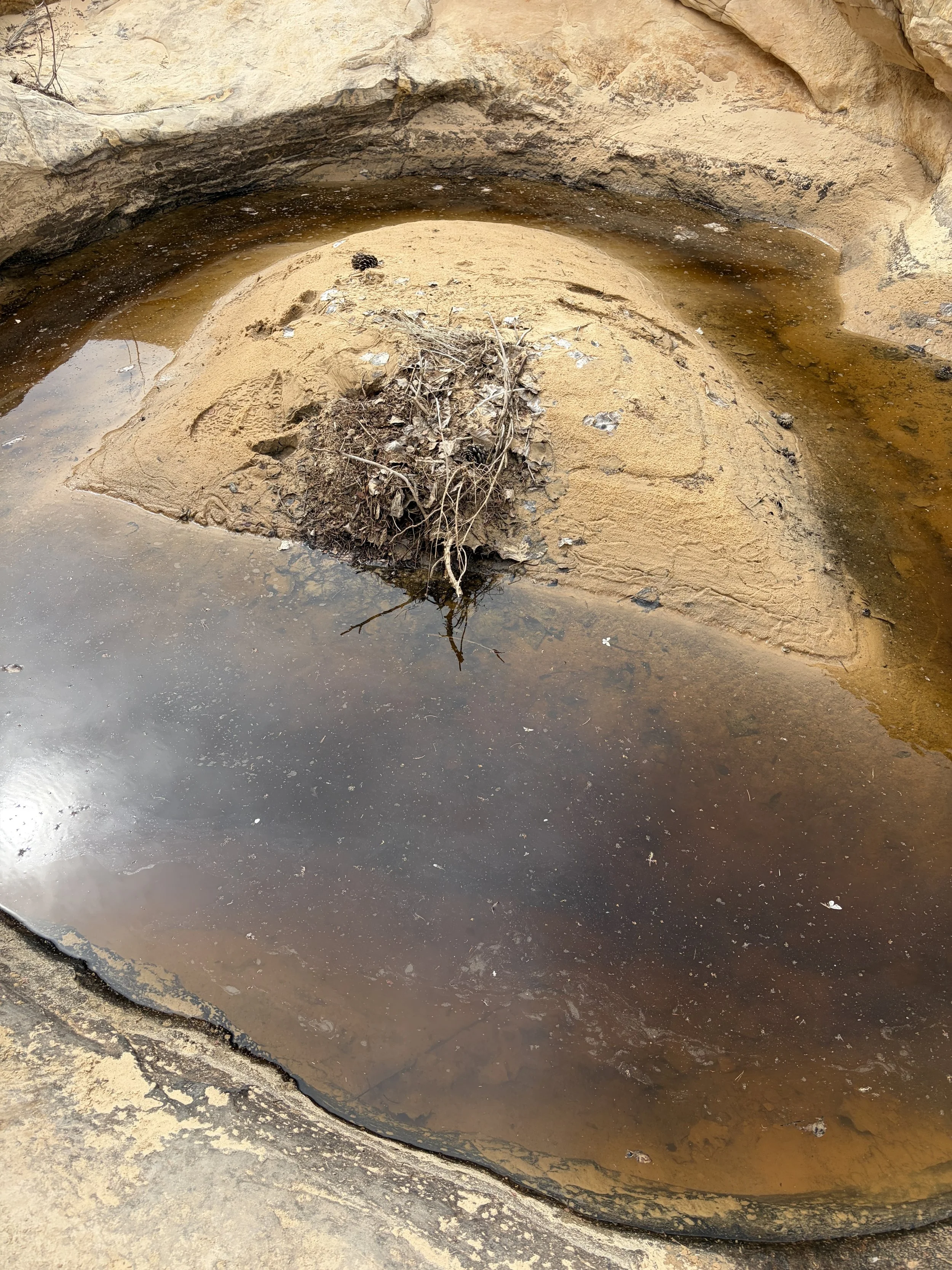
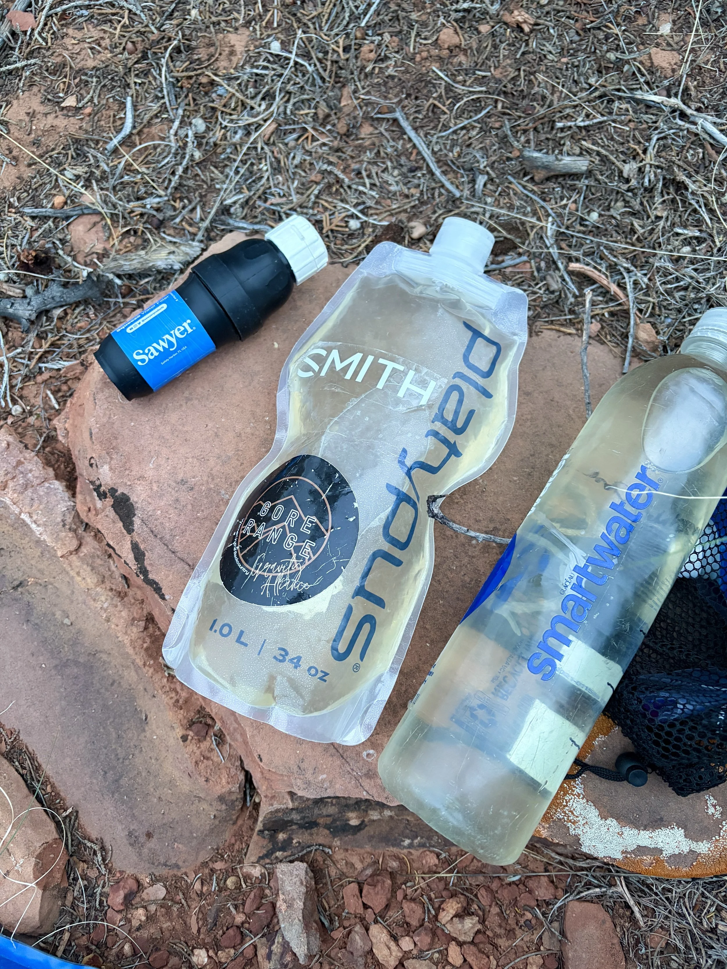
We thankfully found some potholes with water in them pretty quickly in this new canyon, which was a big relief. After seeing a few with water, we decided to wait to refill our water until later in the day so we weren’t carrying 5 liters of water each all day long. After we finished a long, dry section through slow moving terrain that day, we found ourselves at a pothole that we expected to have water, but didn’t. Anxiety set in again, considering the day we had yesterday. We kept walking and eventually came upon a small pothole with a little bit of water in it and quite a few dead bugs. The water was very brown. But it was water and we decided to fill up 5 liters each so we could get rid of our water anxiety and be prepared to dry camp again if needed.
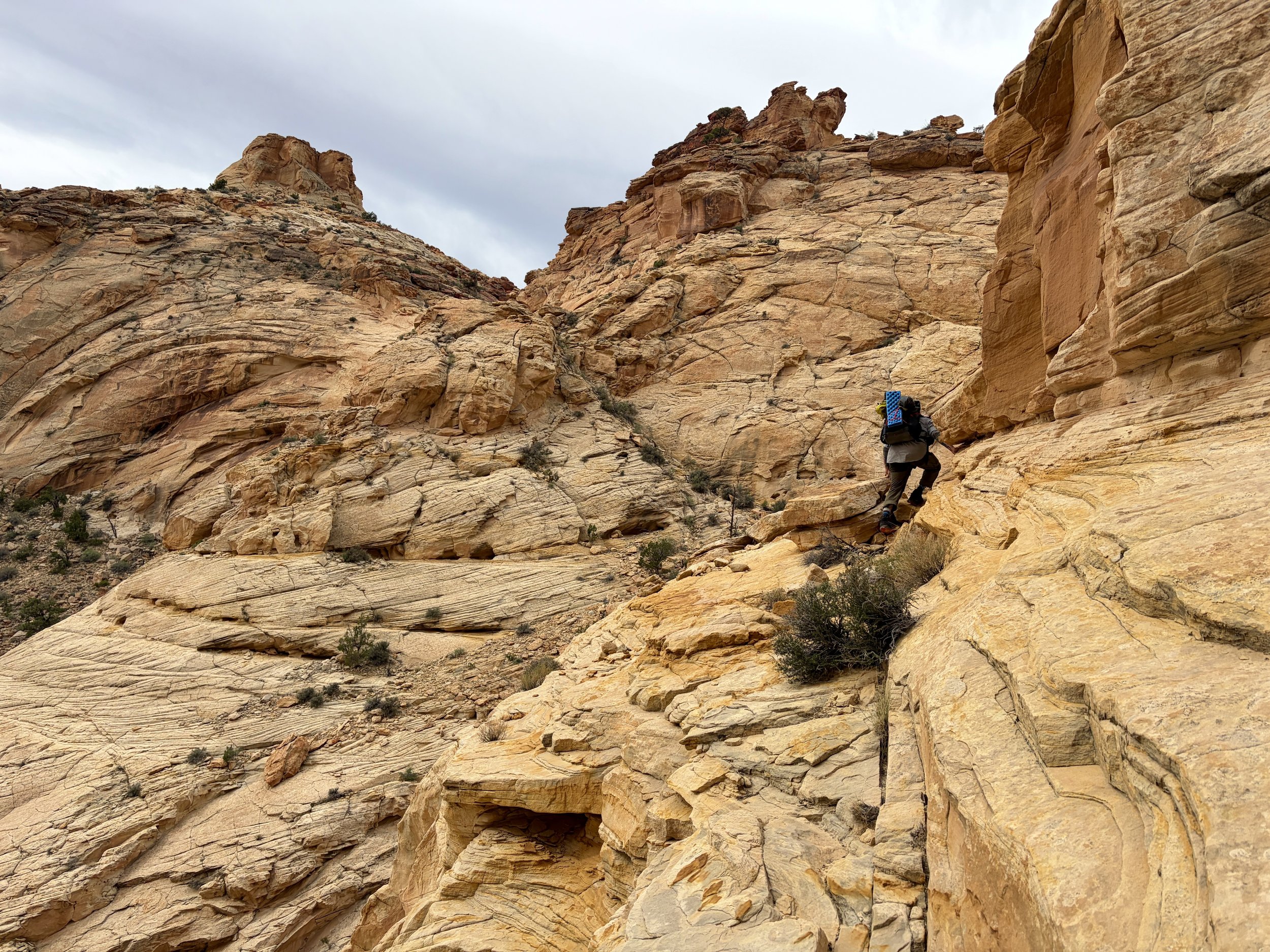
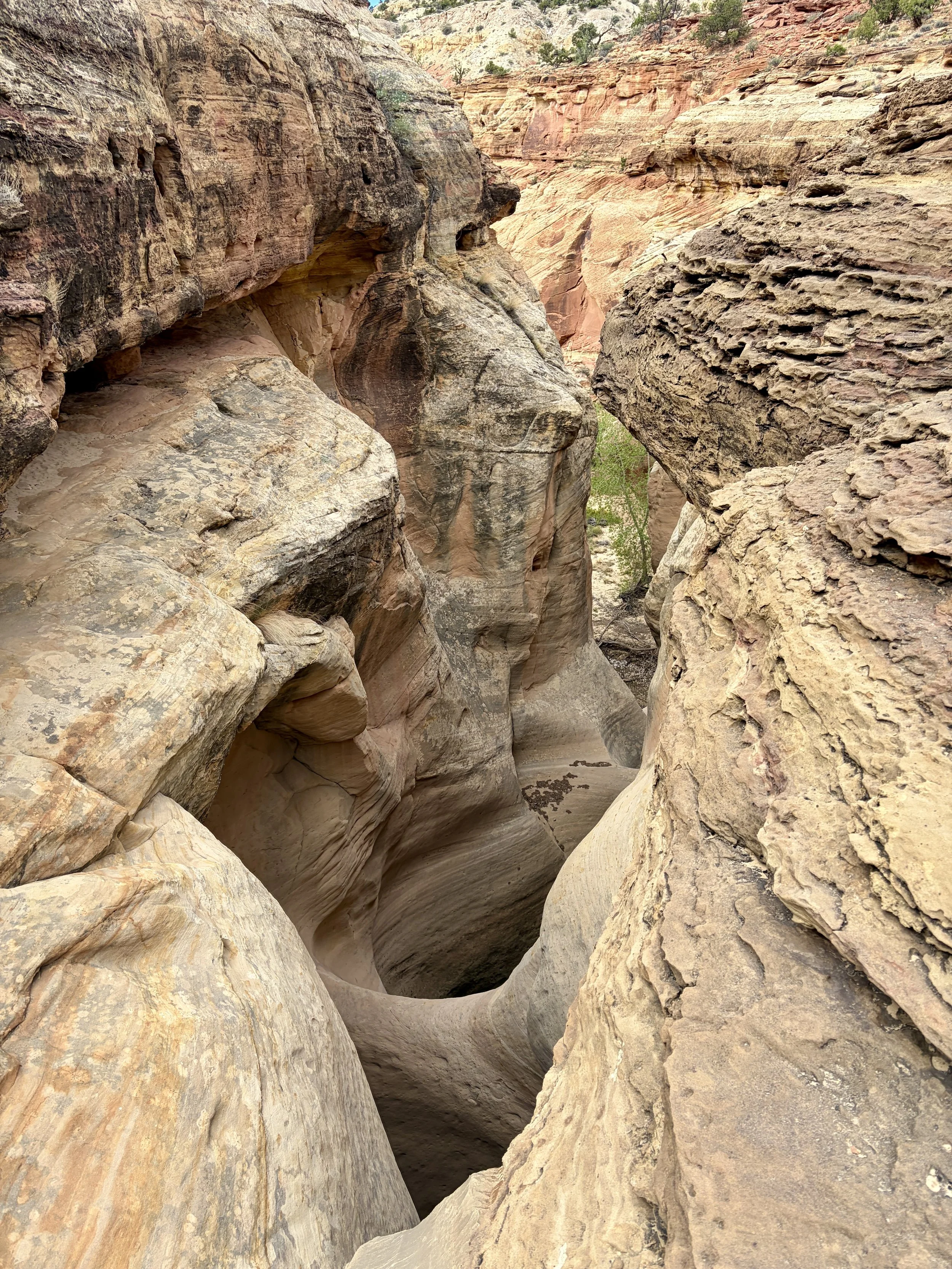
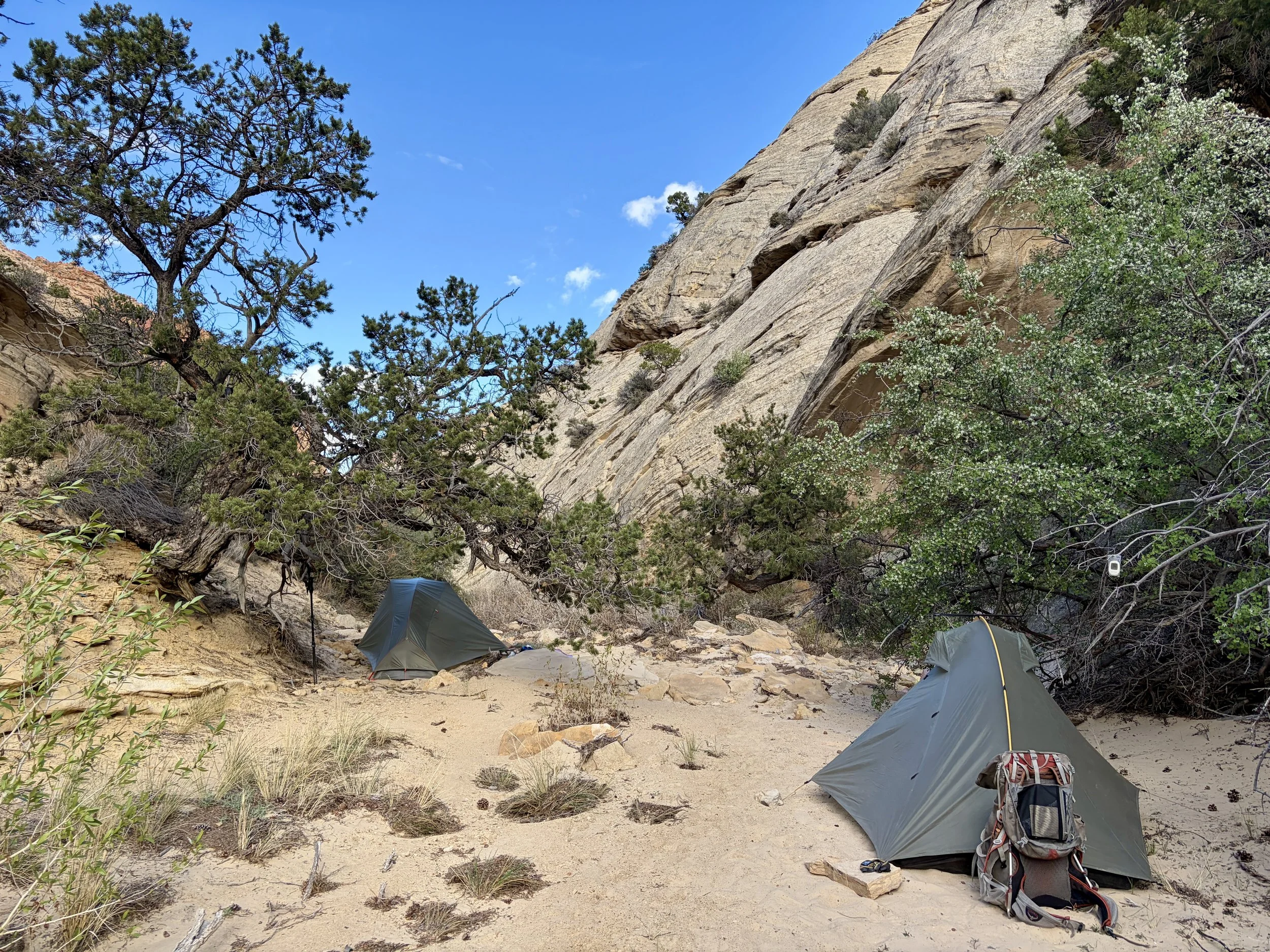
Soon after leaving this pothole, it started raining pretty hard for ~5 minutes, which was just long enough to make the slick rock live up to its name and be quite slippery. With a large dry fall feature coming up that had a very exposed traverse on slick rock to pass it, we decided to find an alternate route that would be safer for us to use considering the conditions. Thankfully, we did find one and made it to the other side of the drywall without any mishaps. We did find a large pothole of water here, which would end up being the last one we saw on the trip. We had a snack and drank a little extra water and then continued hiking. It was another windy afternoon and we set up camp in a semi-protected sand-bottomed canyon. It was the first night of the trip I didn’t listen to wind all night so I slept quite well.
Day 3 stats: 4.8 miles, +981 ft of elevation gain, -1357 ft of elevation loss


Day 4
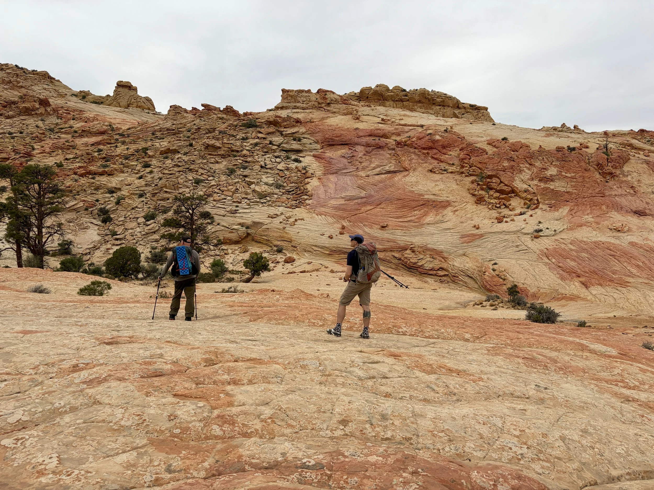
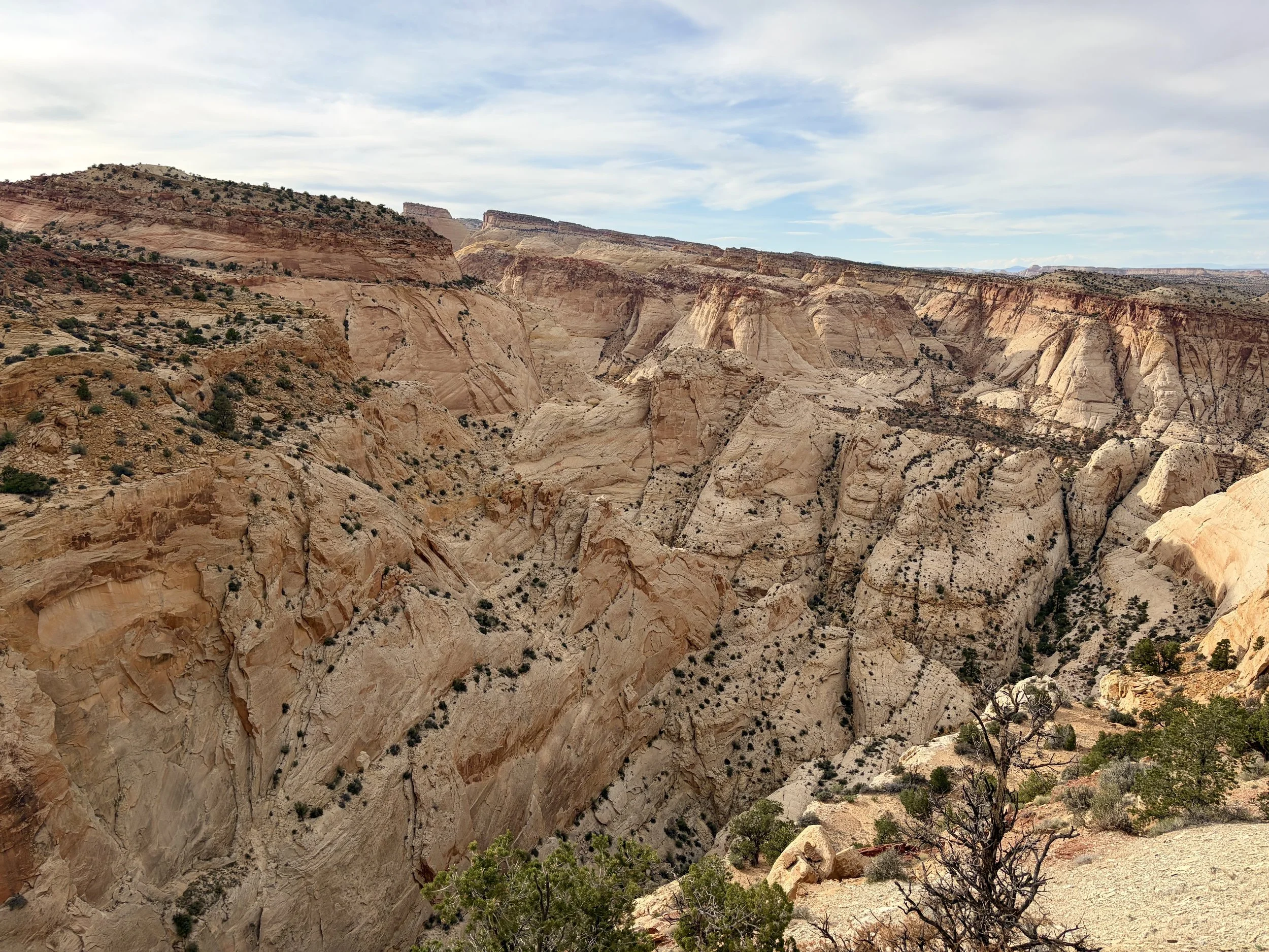
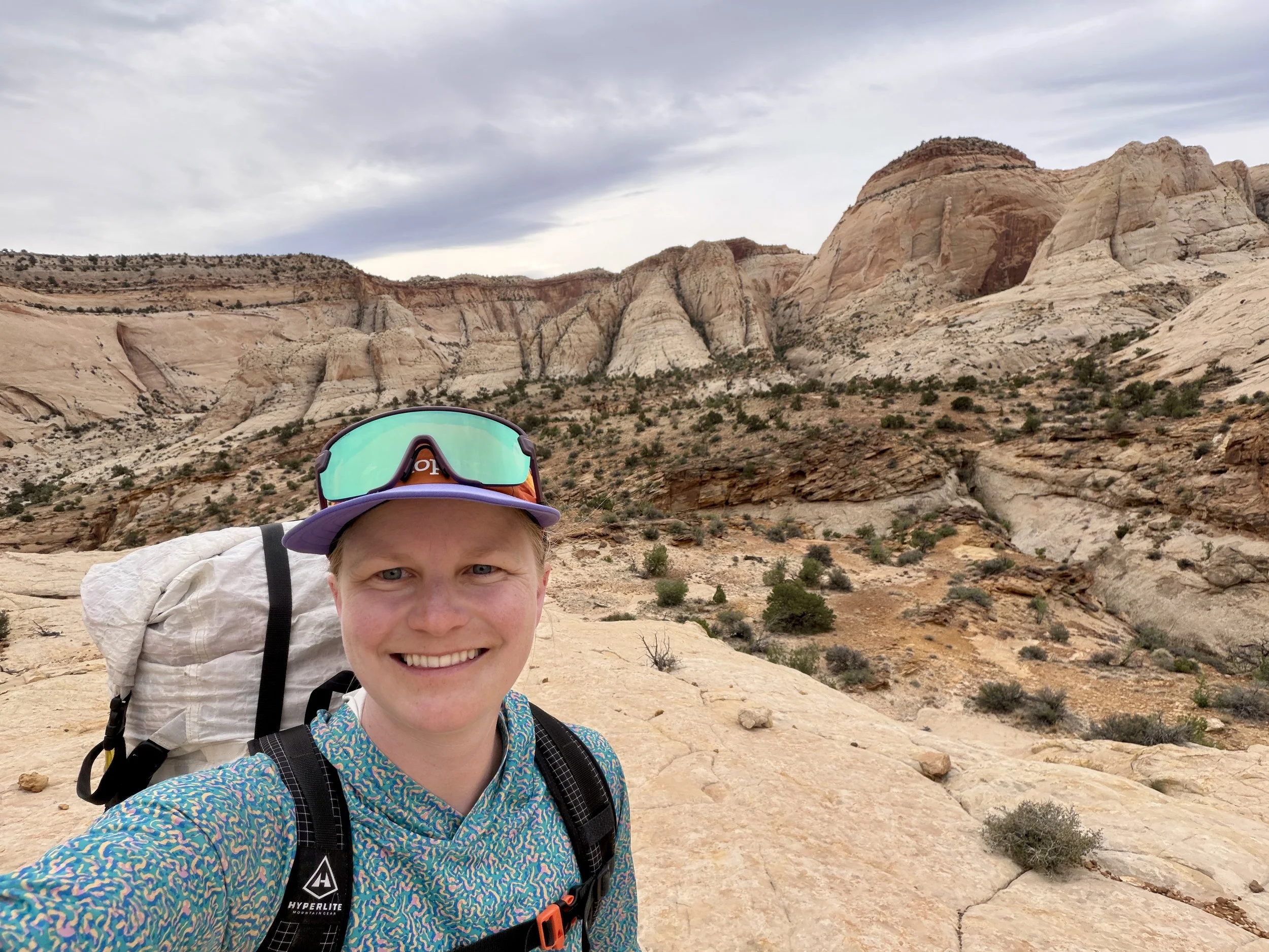
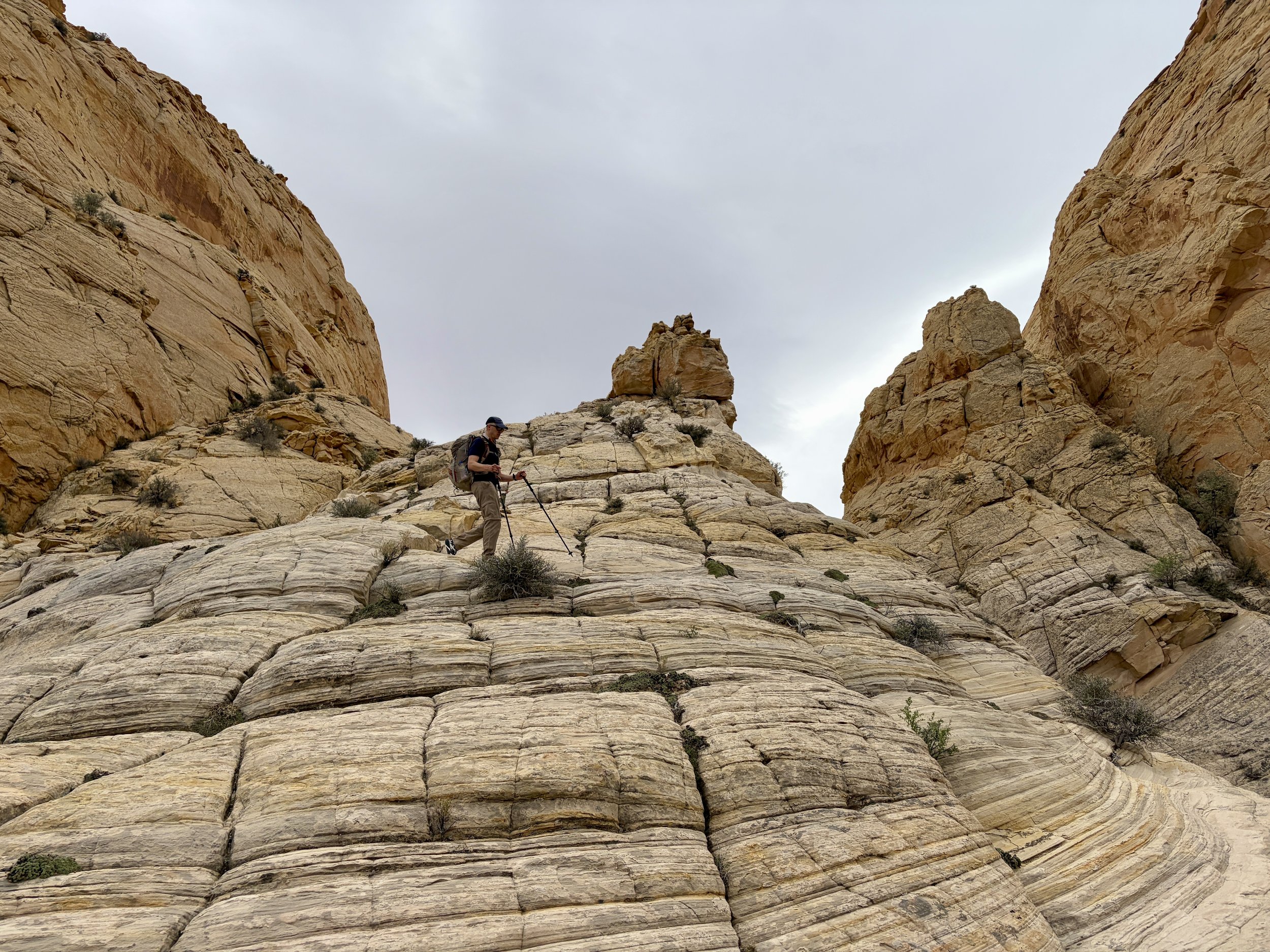
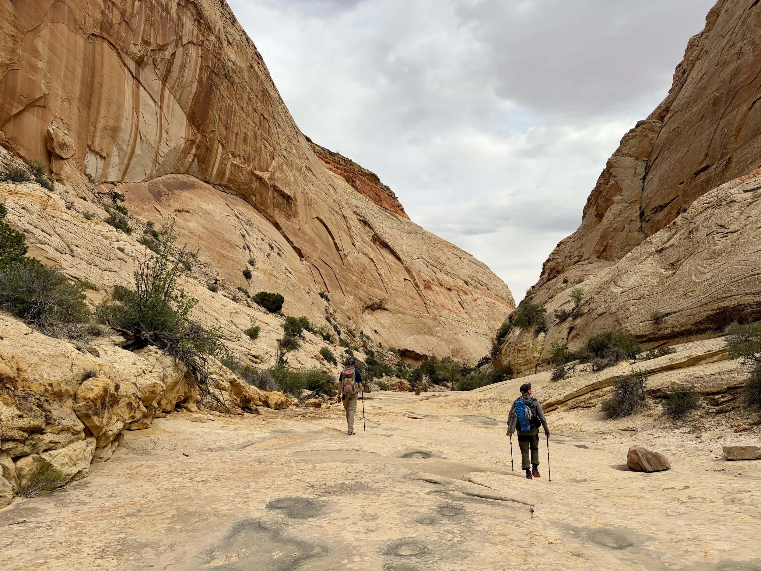
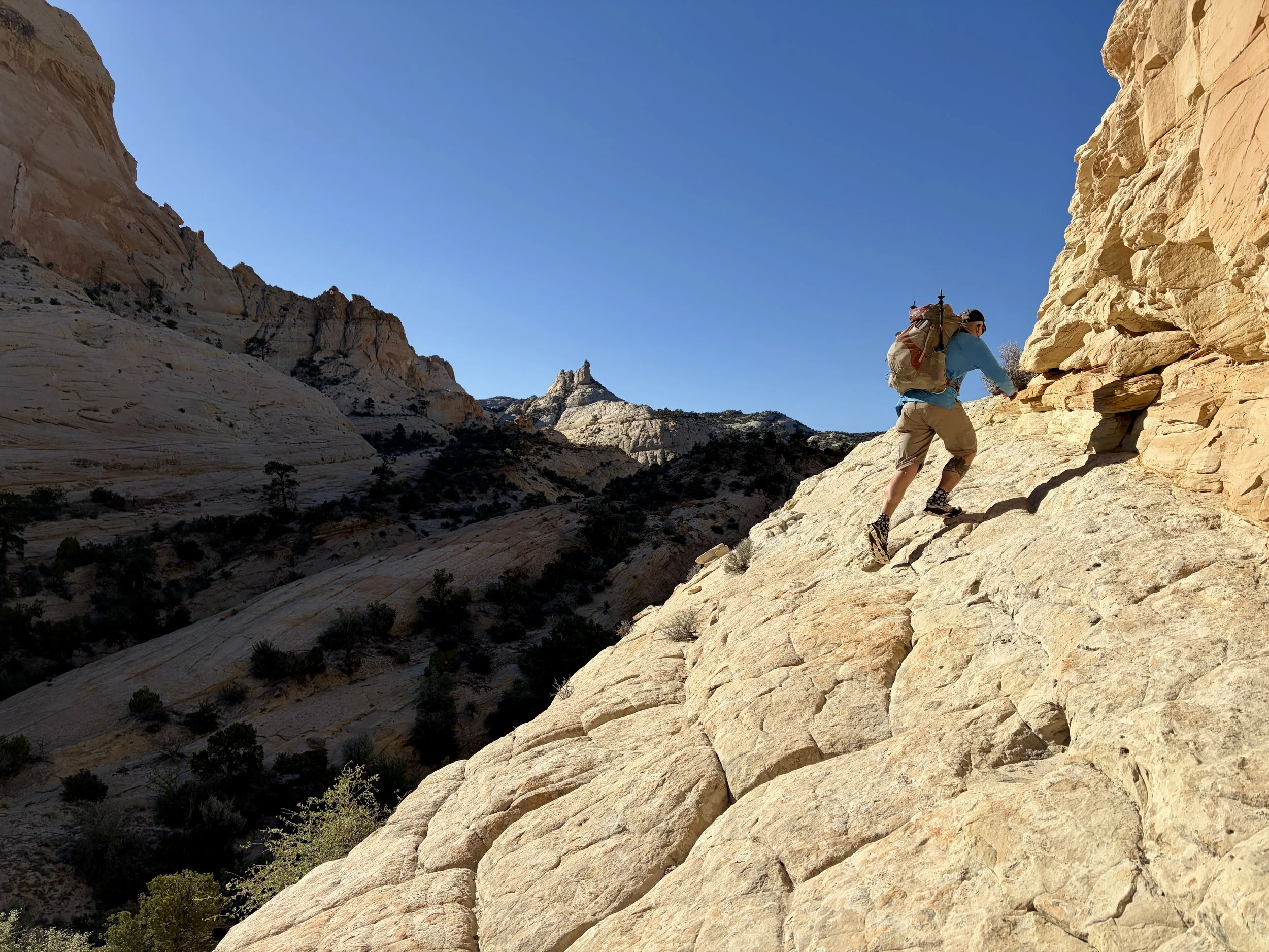
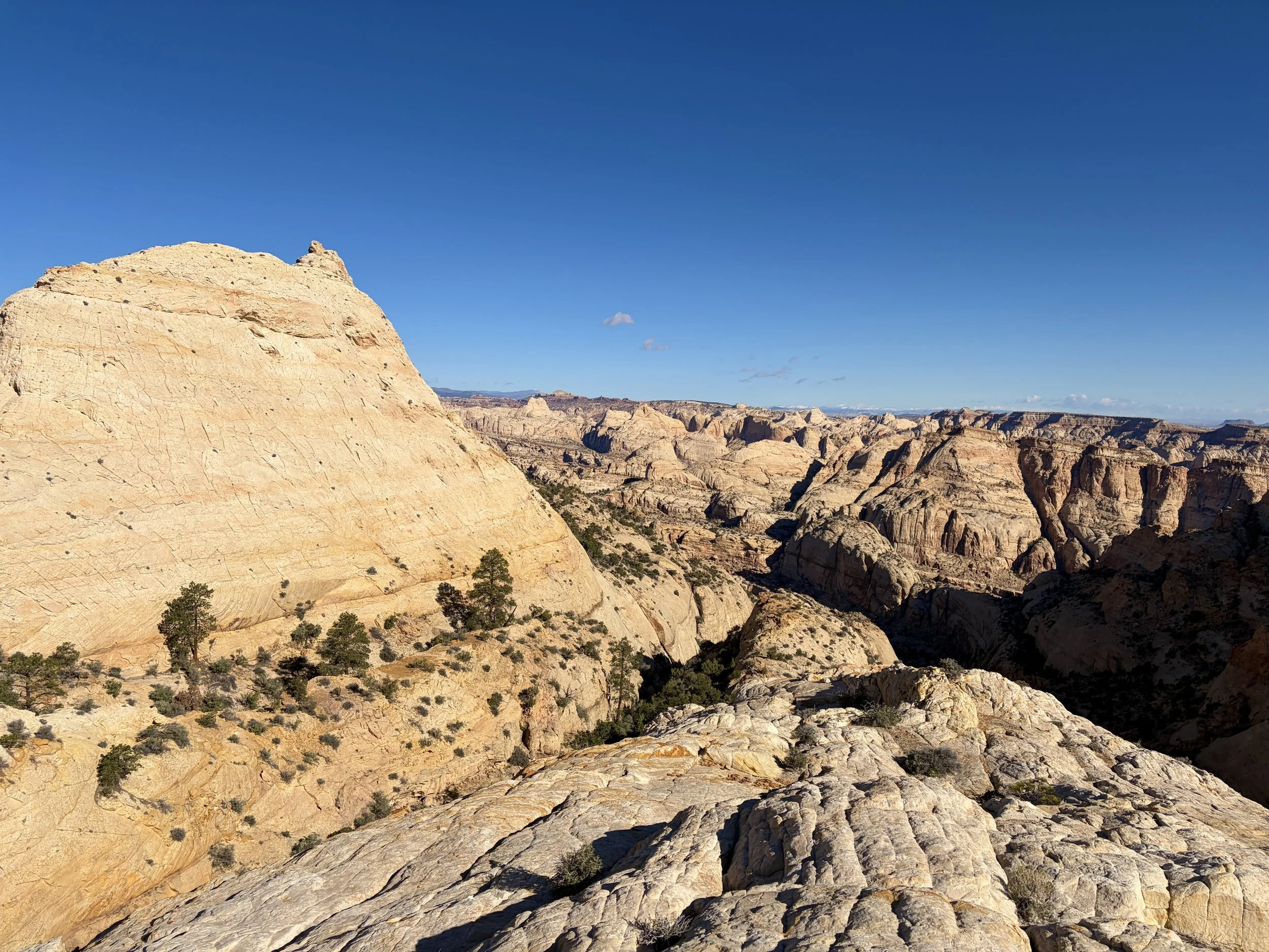
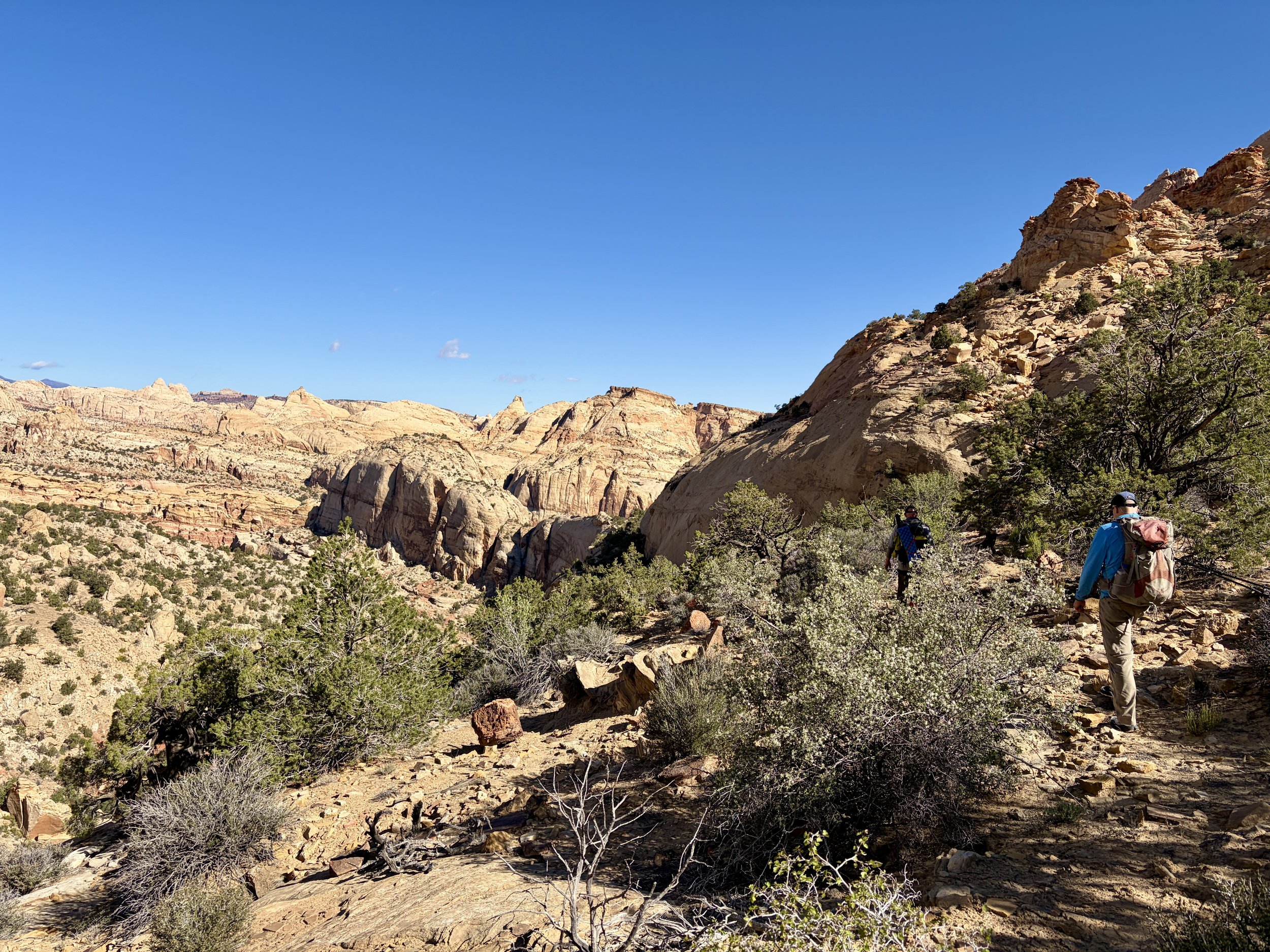
The following morning would be our final day. We headed up to the top of Bear Canyon and then walked along some slick rock ridges that had beautiful 360 degree views. We cautiously made our way down into the canyon that involved one slick rock section that was steeper than desired, but we managed to all get through it. As we made our way towards Grand Wash, we started to see the first people we’d seen in a few days. I wasn’t ready for the trip to end and would have loved to turn around and do the whole route again in the opposite direction. I guess I’ll have to save that for another time.
Day 4 stats: 4.5 miles, +405 ft of elevation gain, -1520 ft of elevation loss
Overall, this was definitely one of my favorite backpacking trips I have ever done. The views were absolutely incredible for 95% of the route and the solitude was unmatched. We moved through some terrain that I wouldn’t have believed we could go through if I were just sitting at home looking at a map, so thank you to the folks that spent all of the time discovering this traverse and made the information available. Capitol Reef is now one of my favorite National Parks, and I can’t wait to plan another trip in the park.
Total stats: 23 miles, +4644 ft of elevation gain, -5068 ft of elevation loss
Disclaimer: This website uses affiliate links, meaning: at no additional cost to you, I earn a small commission if you click-through and make a purchase. As an Amazon Associate I earn from qualifying purchases. I only feature products that I believe in and use myself. Your support means the world to me and allows me to host this website. Thank you!
Gear List
Map: Capitol Reef National Park Map
Compass: SUUNTO M-3 Compass
Emergency Communication Device: Garmin inReach Mini 2 *requires a subscription
First Aid Kit: Adventure Medical Kit *I have added items to this kit and would recommend tailoring a medical kit to your needs
Lighter: BIC Lighter
Emergency Blanket: SOL Emergency Blanket
Shell/Rain Jacket: REI Co-op XeroDry GTX Jacket
Headlamp: Black Diamond Equipment Spot
Multi Tool: Leatherman Squirt PS4 Multi Tool
Tent: Big Agnes Copper Spur UL
Tent Footprint: Big Agnes Footprint for Copper Spur UL
Backpack: Hyperlite Mountain Gear Junction 55
Water Filter: Sawyer Squeeze Water Filtration System
Stove: MSR PocketRocket 2 Ultralight Stove
Fuel: Jetboil Jetpower Fuel
Kettle: MSR Titan Ultralight Titanium Backpacking Kettle
Water Bottle: Platypus DuoLock SoftBottle Flexible Water Bottle
Spork: Sea to Summit Frontier Ultralight Long Handle Spork
WAG bags for human waste: Cleanwaste WAG bags
Sleeping Pad: Sea to Summit Ether Light XT
Pillow: Sea to Summit Aeros Premium Inflatable Travel Pillow
Sleeping Bag: Western Mountaineering Ultralite 20 Degree Sleeping Bag
Shirt: Patagonia Capilene Cool Daily Hoodie
Pants: Black Diamond Womens Alpine Light Pants
Socks: Darn Tough Hiker Micro Crew Midweight Sock with Cushion
Underwear: Smartwool Intraknit Hipster Bikini
Sunglasses: Smith Lowdown Slim 2
Cap: Coal 5 Panel Cap
Toothbrush: GUM Travel Toothbrush
Toothpaste: SuperBee Dentos Toothpaste Tablets
Hairbrush: Folding Hairbrush
Body Wipes: Pampers Sensitive Water Based Hypoallergenic and Unscented Baby Wipes
Trekking Poles: REI Co-op Flash Carbon Compact Trekking Poles
Camp shoes: Xero Shoes Women’s Z-trail Ev
Mug/cup: GSI Outdoors Infinity Backpacker Mug
Towel: REI Co-op Multi Towel Mini
Power Bank: Nitecore NB10000 Gen II Ultra-Slim Power Bank
Packing Cubes: Eagle Creek Packing Cubes
Chair: Helinox Chair Zero Ultralight Compact Camping Chair
Mosquito Head Net: Sea to Summit Ultra-Mesh Mosquito Head Net
Knife: LEATHERMAN Skeletool KBX Pocket Multitool with Knife and Bottle Opener